Tugunbulak, Uzbekistan
| 2023 | 2024 | 2025 |
Project: Silk Road High-elevation Urban Hubs (SR-Hubs)
Starting point and relevance
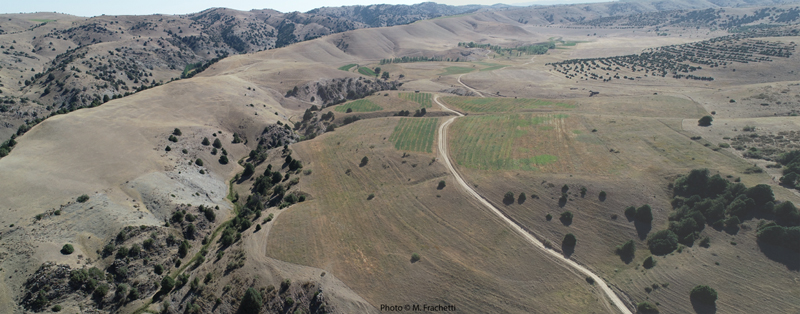
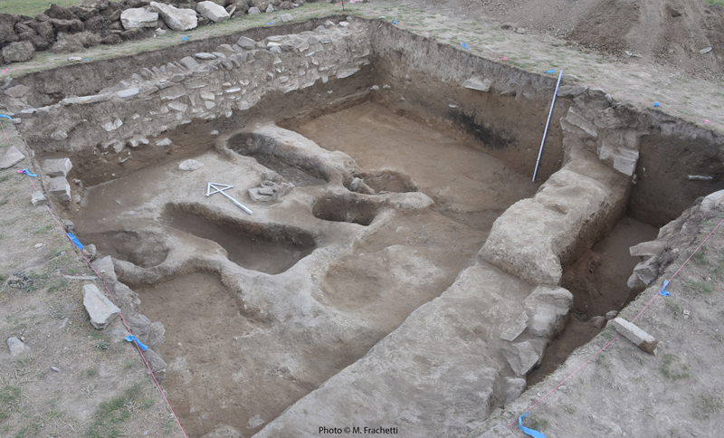
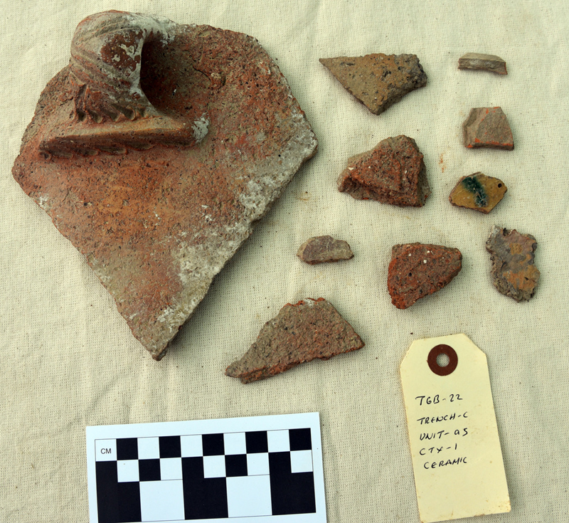
First discovered by our team in 2015, Tugunbulak is located at roughly 2000m elevation in the Malguzar mountain range, roughly 65km southeast of Jizzakh, Uzbekistan. Preliminary mapping and surface collections across the site documented abundant archaeological remains including ceramics and extensive wall foundations. Pilot fieldwork in 2022 used the region’s first drone lidar scanning to document the topographic surface of Tugunbulak in very high resolution, mapping the superficial layout of an extensive architectural zone including five massive fortifications (citadel castles) spanning over 50 hectares across an elevated ridgeline. Mapping and reconnaissance across the wider site area has identified additional structures and wall fortifications surrounding the urban core, as well as a series of outer wall lines that enclose a territory of roughly 150 hectares, associated with the city. In addition to mapping, pilot test excavations were conducted in the central architectural area and have verified the presence of stone/mudbrick walls and rammed earth (pakhsa) architectural fortifications on the central citadel mound, as well as production facilities with archaeological evidence for ceramic and/or metal industry. Initial radiocarbon dating of these contexts suggests an uninterrupted chronology of occupation of the urban center at Tugunbulak from the 6th c. CE to the 11th c. CE. These initial data suggest that this highland center was among the largest architectural constructions in highland Central Asia during the early medieval period, and opens many new questions about the economy, political organization, and connectivity among diverse populations throughout major transitions in Central Asian history.
Goals:
1) Document and map the archaeological extent and functional areas of Tugunbulak.
2) Document significant changes in architectural technology and principles of urban planning throughout the occupational history of the city.
3) Produce a refined chronology of construction, occupation, and abandonment of the city.
4) Map and describe in archaeological detail the site’s defensive infrastructure across the site area (e.g. walls, fortifications, and lookouts).
5) Assess the technologies and networks of economic production and consumption at Tugunbulak including subsistence related activities (farming, pastoralism, etc), material production (e.g. ceramics, metallurgy etc.), trade and commerce.
6) Document the water management system and impact of the city on local and regional hydrological system.
7) Assess the social-environmental feedbacks throughout the life of Tugunbulak, including impact on geomorphology, soil chemistry, forestry, and water regimes.
8) Contextualize the role of Tugunbulak in the wider economic and political geography of high-altitude towns (including the nearby site of Tashbulak), in the mountainous crossroads of Asia’s medieval Silk Routes (6th to 11th c. CE).
Partners:
Professor Michael Frachetti, SAIE laboratory, Department of Anthropology, Washington University in St. Louis
Dr. Farhod Maksudov, National Center of Archaeology (Uzbekistan Academy of Sciences)
Dr. Sanjot Mehendele, Tang Center for Silk Road Studies, University of California, Berkeley
Project website:
https://saielab.wustl.edu/all-projects/tugunbulak
| copyright by The Society for the Exploration
of EurAsia| E-mail
| Home
| ![]()