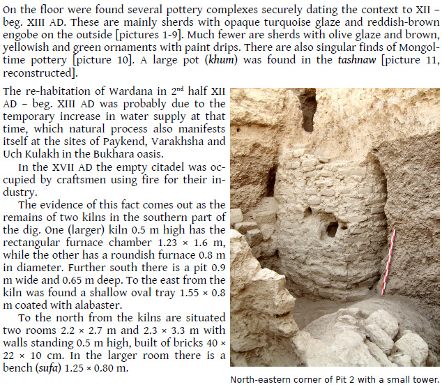
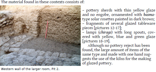
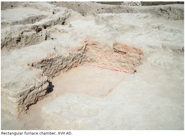
| |
Archaeological excavation of an ancient city in the Oasis of Bukhara
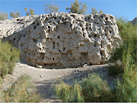
 The citadel of Vardanze. © A. Savchenko
 |
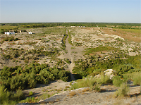
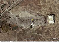 The site of Vardanze, the citadel is at the right. © Google
 |
The site of Vardanze was declared a World Heritage Site by the UNESCO World Heritage Commission as part of the transnational project "Silk Roads: Zarafshan-Karakum Corridor" on 17 September 2023.
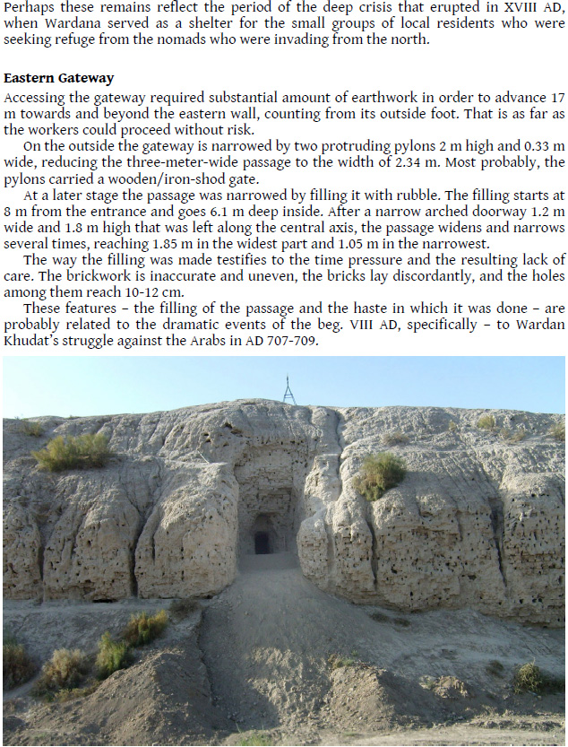
Starting point and Relevance
The archaeological site of Vardanze lies north of the city of Bukhara in Central Uzbekistan and once competed with it for supremacy in the area. As introduction, please refer to the following contribution On the history of the ancient town of Vardana and the Obavija Feud by the two leading archaeologists of this project, . T. Adylov, J. K. Mirzaahmedov. Vardanze has not been excavated so far and important findings can be expected.
Goals
To excavate a well preserved site located in an area of rich historical past reaching back to the times of the Hephtalites, the Turkish Qaghanates, Sogd and the Arabs.
Partner in Uzbekistan
Dr. . T. Adylov, Senior Research Fellow, Samarkand Institute of Archaeology
Dr. J. K. Mirzaahmedov, Leading Research Fellow, Samarkand Institute of Archaeology
Project team
Dr. J. K. Mirzaahmedov, Leading Research Fellow, Samarkand Institute of Archaeology, Project Leader
Dr. . T. Adylov, Senior Research Fellow, Samarkand Institute of Archaeology
Dr. Silvia Pozzi
Ilaria Vincenzi
On the history of the ancient town of Vardana and the Obavija Feud
. T. Adylov, J. K. Mirzaahmedov
Slightly abbreviated contribution from: Eran ud Aneran Webfestschrift Boris Marshak 2003
In the territory of the ancient irrigated land of Bukhara, at about 7 km in northeast direction from the provincial centre of afirkhan, lie the ruins of an ancient town called by the local people Kurgan-Vardanzeh. According to a subdivision common to other towns of its time, Vardanzeh was dominated by an ark-citadel with a lower town, the ahristan. At the present time only the rectangular-plan citadel is discernible. It extends in an east-west direction with an area of 0,5 ha and it is 15-16mts high. It is entirely surrounded by a moat that reaches 20 m in depth, obviously filled with water in antiquity. The ahristan is oriented along the north-south axis, south of the citadel. From the 19th to the beginning of 20th century it reached the apex of its importance while nowadays it appears isolated and mostly invaded by sand. For this reason the dimensions and shapes of the ahristan must be determined theoretically. It should be said that at a hidden level in the suburban part there is the rabad. As it is well-known, what is now the citadel, was until the 19th century a vast dwelling centre. Here was produced a kind of glazed ceramic very popular in the zone. This ceramic ware represents the last stage of the artistic development of Bukhara glazed ceramic ware of 18th-19th century, well-known even outside Bukhara. The decline of Vardanzeh is connected to the desertification of the periphery of the Bukhara Oasis. Such a process, already observed by E. K. Mejendorf at the beginning of 19th century (  , 1975, 85), resulted in a concentration of the people from the peripheric area to the centre of the Bukhara Oasis. During the 30's of 20th century Vardanzeh was abandoned and its inhabitants founded a new centre: Vardanzeh-Kukhna, 2 km south of the former. Vardanzeh-Kukhna still exists. , 1975, 85), resulted in a concentration of the people from the peripheric area to the centre of the Bukhara Oasis. During the 30's of 20th century Vardanzeh was abandoned and its inhabitants founded a new centre: Vardanzeh-Kukhna, 2 km south of the former. Vardanzeh-Kukhna still exists.
The citadel of Vardanzeh is one of the most well-known historical monuments of the region. Vardanzeh is mentioned often in the medieval written sources. In the Early Middle Ages it was the capital of a small but rich province whose governors were considered as important as the Lords of Bukhara, the Bukhar khudat. The celebrated medieval historian Narakhi (10th century), originally from the village of Narakh not far from Vabkand and author of the 'Tarikhi Bukhara' called this ancient town Vardana. With the same name it is mentioned in the works of Arab geographers of 10th century Al-Istakhri (Kitab al-Masalik va-l-Mamalik) and Tabari (Tarikhi al-Mulkba-l-Rasul). Another Arab geographer of 10th century al-Mukhaddasi (Akhsan at-Takhsim fi ma'rifat al-dalim) called this site Avarzana. Then, on other two Arab geographers, as-Sam'ani (12th century, Kitab al-Ansab) and Yakut al-Khamavi (13th century, Mu'jam al-Buldan) in their works reported both Vardana and Varzan ( , 1993, 63). The latter authors said also that in the Bukhara Oasis existed two sites with the same name Vardana or Varzan1 . Probably, Vardana should be considered the true name because it is reported more often in written sources and because the suffix '-zi' recurs in the names of modern localities. In Neopersian (Dari) it means 'place', 'zone'. The particle '-zi' is present in the names of ancient villages of the Bukhara region (for example Vaganzi, Isamzi, Paljanzi, etc.). So, the toponimous Vardanzi means 'the place of Vardana'. The etymology of this old name is unknown. , 1993, 63). The latter authors said also that in the Bukhara Oasis existed two sites with the same name Vardana or Varzan1 . Probably, Vardana should be considered the true name because it is reported more often in written sources and because the suffix '-zi' recurs in the names of modern localities. In Neopersian (Dari) it means 'place', 'zone'. The particle '-zi' is present in the names of ancient villages of the Bukhara region (for example Vaganzi, Isamzi, Paljanzi, etc.). So, the toponimous Vardanzi means 'the place of Vardana'. The etymology of this old name is unknown.
Vardana is recorded by Narakhi at length. In the XIIIth chapter of his History of Bukhara he reports an ancient legend about the foundation of this settlement which he considers a village. According to the legend, Vardana was founded by a Persian prince of the Sasanian dynasty called Shapur a son of the ah Khosrow. After quarrelling with his father, Shapur went to Bukhara where the local governor, the Bukhar khudat, received him with great honour. Shapur loved to hunt and the Bukhar khudat gave him the uncultivated land in the north of Bukhara where many wild animals lived. The prince ordered a great canal to be dig in this area, called in his honour apurkam. The simple people called it 'afurkam'. The new owner founded many villages along the canal, among which was Vardana. The latter was apur's residence and the centre of his feud 'Obavija' ( , 1991, 110-111). The prince and his successors, who, after a short time became kings, had the title of 'Vardan khudat'2 . Narakhi also mentions Vardana in the IV chapter of his book: according to his description Vardana was a great village with a huge stronghold which, in ancient times was the residence of the kings but in the days of the historian did not exist anymore. The founder of Vardana was Malik (king) ahpur (apur). Vardana was on the border with Turkestan3 and, consequently, it had a great strategic, trading and producing importance. Here existed a weekly bazaar and here was produced a kind of material called 'zandaniji' as precious as Chinese silk. Narakhi, then, said that Vardana was more ancient than Bukhara (, 1991, 98). , 1991, 110-111). The prince and his successors, who, after a short time became kings, had the title of 'Vardan khudat'2 . Narakhi also mentions Vardana in the IV chapter of his book: according to his description Vardana was a great village with a huge stronghold which, in ancient times was the residence of the kings but in the days of the historian did not exist anymore. The founder of Vardana was Malik (king) ahpur (apur). Vardana was on the border with Turkestan3 and, consequently, it had a great strategic, trading and producing importance. Here existed a weekly bazaar and here was produced a kind of material called 'zandaniji' as precious as Chinese silk. Narakhi, then, said that Vardana was more ancient than Bukhara (, 1991, 98).
The information of Narakhi is very interesting but controversial. In one part it is said that Vardana was probably founded by apur on the uncultivated land left by the lord of Bukhara, but in the preceding chapter that Vardana was older than Bukhara. Then, it is not clear if there existed a king called apur. It is well-known that during the Sasanian period there were two ah called Khosrow: Khosrow I Anoirwan (531-578) and Khosrow II (590-628). Other historical written sources do not say anything about a son of one of them called apur who escaped to Bukhara. It is not improbable that 'apur' is a name but a title4 . So, the name of this legendary prince, if ever existed, probably was not 'apur' and, consequently, the name 'apurkam' simply means 'the canal of the prince' 5 . This canal if it existed at all was recorded soon as 'afirkan'. Researches showed that this is not an artificial canal but one of the tributaries of Zerafan. The archaeologists proved that the villages along its banks existed in the first centuries B.C. On the surface of Vardanzi were found fragments of ceramic ware dated to 4th-5th century B.C. and even older. The cultivation of the region started long before the first Sasanian, Ardair I Papakan, was enthroned (approximately 226 A.D.). In our opinion, the legend of prince apur is only partly based on real facts but it is difficult to establish how it is really connected to the canal. Probably these events happened in the time of the Hephtalites (second half of 5th century- 60's of the 6th century). The huge Hephtalite state extended over a great part of Central Asia, Afghanistan, Pakistan and Northern India. It was a confederation of territories, more or less independent but linked to the central authorities through alliance agreements. The region of Bukhara was one of the most important feuds ( , 1998, 21). A king was at the head of this confederation but he had not absolute power over the governors. , 1998, 21). A king was at the head of this confederation but he had not absolute power over the governors.
There were several wars between Persia and the Hephtalite kingdom and the former was always defeated with the result that the Sasanians had to pay a regular tribute to the Hephtalites. Even the most powerful of the Sasanian ah -Khosrow I- had to pay tribute for a certain period, so it is not improbable that one of the Persian princes exiled by him found a perfect shelter among his father's strongest enemies. In this case his protector was the governor of Bukhara whose territory was situated close to the right bank of Jaykhun- Amudarja. This river was the borderline between Iran and the Hephtalite state. The governor of Bukhara received the prince for political reasons and later, according to an ancient aristocratic costume, they became relatives through the marriage of apur with one of the daughter of the Bukhar khudat. In this way the prince became a vassal of the lord of Bukhara and the land of Vardana was intended as the marriage settlement of the woman. Certainly this land had been cultivated since antiquity and Vardana already existed along the tributary river.
It is not improbable that in this period there were still some parts uncultivated where wild animals lived. It is worth noting that in the same period this territory had not such a strategic and economic importance. It was on the border between the cultivated lands and the steppes, often threatened and far away from the main trade routes. The fortified town of Vardana was outside of the Kampirak wall which surrounded the greater of the part of the Bukhara Oasis as a protection against nomad's attack6 .
This prince of whose existence it is not sure, lived with his wife in Vardana and protected the northern border of Bukhara. Probably he promoted the enlargement of the canal and the construction of smaller other ones in order to bring water to the fields and drinking water to the town and the villages. Maybe, it is for this reason that his name survived. So, the canal called 'Safara'- which, according to al-Istakhri, passed through Vardana- is this apurkam. Safara is a corruption of the name 'apur'7 .
To support this hypothesis we can report some facts obtained from the historical sources on the relations between Persians and the Hephtalites. The first fact is linked with the period of reign of the ah Peroz (459-484), the one who attacked the Hephtalites three times and every time was defeated. After the first war he was imprisoned but he was rescued by the Byzantine Basileus. After the second defeat he swore on his own life to pay a great tribute which he could not raise at once but in two years and he left his son Kavad as an hostage. The third incursion cost him his own life and his camp was captured together with his daughter who was taken as wife by the Hephtalite king Kun-khi ( , 1989, 250-251; , 1989, 250-251;  , 128-129)8 . The second fact is linked to the Mazdakite revolution which happened in Iran in 5th-6th century. The ah Kavad (488-531) tried to use disorders to suppress the great aristocratic families, the great landowners and the priests. The Persian aristocracy deposed Kavad and enthroned his brother in 496. Kavad escaped to the Hephtalite court where he had had friendly relations since his sister was married to their king. He knew that only the military Hephtalite power could support his return on the Sasanian throne. He also married the king's daughter, that is to say his niece. Kavad lived for three years among the Hephtalites and, after his requests, the king gave him a great army in order to conquer the throne of Iran in 499 ( , 128-129)8 . The second fact is linked to the Mazdakite revolution which happened in Iran in 5th-6th century. The ah Kavad (488-531) tried to use disorders to suppress the great aristocratic families, the great landowners and the priests. The Persian aristocracy deposed Kavad and enthroned his brother in 496. Kavad escaped to the Hephtalite court where he had had friendly relations since his sister was married to their king. He knew that only the military Hephtalite power could support his return on the Sasanian throne. He also married the king's daughter, that is to say his niece. Kavad lived for three years among the Hephtalites and, after his requests, the king gave him a great army in order to conquer the throne of Iran in 499 (  , 1940, 136). We do not know if the Hephtalite princess gave to Kavad any son. If he had existed he would have lived for sure at his grandfather's court for a certain period in order to allow the control of the Hephtalites over the Persian Empire. During the Middle Ages the custom of keeping hostages was a successful system to control aggression from the neighbouring countries. , 1940, 136). We do not know if the Hephtalite princess gave to Kavad any son. If he had existed he would have lived for sure at his grandfather's court for a certain period in order to allow the control of the Hephtalites over the Persian Empire. During the Middle Ages the custom of keeping hostages was a successful system to control aggression from the neighbouring countries.
So, we have the information about a long period of residence of Peroz and his son at the Hephtalite court. The first time Kavad was just a prince, the second time he was the exiled ah and a relative of the Hephtalite king. If it is correct to consider the residence of the Hephtalites as located in the region of Bukhara ( , 129), then our hypothesis could be considered likely and in apur of the legend could be recognized Kavad, while in the figure of the Khosrow of the legend could be recognized Peroz or his other son the usurper of Kavad9 . This is not improbable although also Khosrow I, son of Kavad, could be the considered the ah called in the legend apur. In the history of Persian-Hephtalite relations there was likely to have been some episode which agrees with this legend. , 129), then our hypothesis could be considered likely and in apur of the legend could be recognized Kavad, while in the figure of the Khosrow of the legend could be recognized Peroz or his other son the usurper of Kavad9 . This is not improbable although also Khosrow I, son of Kavad, could be the considered the ah called in the legend apur. In the history of Persian-Hephtalite relations there was likely to have been some episode which agrees with this legend.
|
|
|
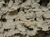
| Brick wall at the citadel. © A. Savchenko |
|
|
It is important to mention also the rest of the area of the feud belonging to the Vardan khudat, Obavija. In the territory of the modern region of afirkan there is some ancient village with its name ending in '-Uba'. The toponimous 'Obavija-Uba' comes probably from the Persian 'ab', water. The Hephtalites led by their king Ghatifar were defeated by the Turks in the region of Bukhara around 567-568 and their state was destroyed. Bukhara with other lands was incorporated into the Turk Qaghanate. The Kampirak wall lost its importance as the territory of the Bukhara Oasis now became an internal province of the Qaghanate. There was no reason anymore for its maintenance and the relationships between Turks and Sogdians were friendly. Many Sogdian feuds recognized nominally the Turkic power but were substantially independent and were allowed to have their own coinage and make pacts among themselves.
The territory of Western Sogd was divided into several feuds and three were dominant: Bukhara was the centre of one of these and its governors kept the title of Bukhar khudat. The second big centre was Ramitan. This ancient town is mentioned in Arab sources as the second capital of the region of Bukhara. There are some hints to consider the name of its governors as 'X-n-kkhudat' ('Khunukkhudat'? the real pronunciation and etymology of which are obscure). One of the 'Khunukkhudat' is mentioned in the History of Bukhara where he is linked to the renewal of the destroyed Varakha and another is mentioned as a governor who opposed to the advance of Qutayba ibn-Muslim (, 1998, 22-25). The two capitals were both situated along the Silk Road. The third feud was Obavija with the Vardan khudat as governor. According to Narakhi and Tabari the Vardan khudat were powerful governors and they could compete with the Bukhar khudat (, 1991, 111;  , 120-121). The reason of the flourishing of Obavija under the successors of apur was the new geopolitical reality. Obavija was situated on the border between the nomadic steppe and the territories along the Silk Road linking Bukhara and Samarkand, called 'ahrakh' ('Main branch')10 . In every period, the steppe under nomadic rule did not only import but also export along this segment of the Silk Road. The Turks had their interests in trading with the Sogdians. The Sogdian colonies were settled along the Silk Road. For this reason the Vardan khudat exploited the important position of Obavija. According to Tabari it is arguable that Obavija had its golden age in this period. , 120-121). The reason of the flourishing of Obavija under the successors of apur was the new geopolitical reality. Obavija was situated on the border between the nomadic steppe and the territories along the Silk Road linking Bukhara and Samarkand, called 'ahrakh' ('Main branch')10 . In every period, the steppe under nomadic rule did not only import but also export along this segment of the Silk Road. The Turks had their interests in trading with the Sogdians. The Sogdian colonies were settled along the Silk Road. For this reason the Vardan khudat exploited the important position of Obavija. According to Tabari it is arguable that Obavija had its golden age in this period.
In 706-7 the Arab general Qutayba ibn-Muslim crossed the Jaykhun and started the conquest of Sogd. In 712 the whole of Sogd, including Bukhara and Samarkand, was under Arab rule. The written sources record that the Vardana governor fiercely opposed the Arab advance. Tabari called him the king of all Bukhara (, 120-121) and Narakhi 'honoured king' ( , 1991, 111). Regarding this problem, it is said that after the surrendering of Taghod (son of Bidun and the illustrious queen 'Khatun')12 to Qutayba, the governor of Vardana proclaimed himself king of the whole Bukhara ( , 1991, 111). Regarding this problem, it is said that after the surrendering of Taghod (son of Bidun and the illustrious queen 'Khatun')12 to Qutayba, the governor of Vardana proclaimed himself king of the whole Bukhara ( , 1970, 279). Then, he continued the resistance to the conquerors as a king of all the people of this part of Sogd. As it is known, finally the Vardan khudat died and his feud was taken by the Arabs. Qutayba gave this domain to Tagod as a sign of his loyalty to the conquerors and Obavija ceased to exist as an independent feud. Vardana too lost its importance (, 1991, 111). Considering these facts, some scholars date the usurpation of the Vardan khudat to 707/8-709/10 (, 1970, 279; , 1970, 279). Then, he continued the resistance to the conquerors as a king of all the people of this part of Sogd. As it is known, finally the Vardan khudat died and his feud was taken by the Arabs. Qutayba gave this domain to Tagod as a sign of his loyalty to the conquerors and Obavija ceased to exist as an independent feud. Vardana too lost its importance (, 1991, 111). Considering these facts, some scholars date the usurpation of the Vardan khudat to 707/8-709/10 (, 1970, 279;  , 1989, 43). Developing these hypotheses, one can imagine in which circumstances the Vardan khudat proclaimed himself king of Bukhara. According to our opinion, the reason for this change of power are the previous events described in chapter XVIII of 'The History of Bukhara', where Narakhi says that in the Bukhar khudat palace a strong opinion existed concerning the honour of 'Khatun'. The father of Tagod was not the husband of Khatun but one of her bodyguards with whom she had an intimate relationship. As a result, a strong opposition was found in the court of Bukhara among the military class which wanted a noble and worthy person as a ruler. However, the queen who knew about the conspiracy prevented it. Later the expedition of Sa'id ibn-Osman -the representative of the Caliph in Khorasan (675/6)- Khatun included members of the aristocracy who opposed to her among the 80 hostages taken to Arabia by Sa'id. Later they all died heroically in the palace of Sa'id in Medina, after killing Sa'id himself ( , 1991, 116-118). , 1989, 43). Developing these hypotheses, one can imagine in which circumstances the Vardan khudat proclaimed himself king of Bukhara. According to our opinion, the reason for this change of power are the previous events described in chapter XVIII of 'The History of Bukhara', where Narakhi says that in the Bukhar khudat palace a strong opinion existed concerning the honour of 'Khatun'. The father of Tagod was not the husband of Khatun but one of her bodyguards with whom she had an intimate relationship. As a result, a strong opposition was found in the court of Bukhara among the military class which wanted a noble and worthy person as a ruler. However, the queen who knew about the conspiracy prevented it. Later the expedition of Sa'id ibn-Osman -the representative of the Caliph in Khorasan (675/6)- Khatun included members of the aristocracy who opposed to her among the 80 hostages taken to Arabia by Sa'id. Later they all died heroically in the palace of Sa'id in Medina, after killing Sa'id himself ( , 1991, 116-118).
After the death of the queen the struggle began again and there appeared several pretenders to the throne of Bukhara. The most powerful was the ruler of Obavija, who, during the period of Qutayba's incursions, was quarrelling with the Bukhar khudat. He considered himself as a descendant of the Sasanian house and so the legitimate and worth pretender to the throne of Bukhara. Tagod was young, inexperienced and compromised because of his friends with the Arabs. The Vardan khudat was undoubtedly supported by the local population and army. According to Tabari he even defeated the Arabs during their first battle and his prestige increased ( , 121). According to Narakhi, the Vardan khudat was originally from Turkestan. Qutayba was obliged to lead a long war against him and he pushed him many times out of the kingdom of Bukhara but the Vardan khudat escaped to his Turkish allies. Only after the Vardan khudat's death, Qutayba managed to give Bukhara to Tagod. Then, Qutayba defeated the other pretender and the decentralizing ambitions of the local aristocracy. As a result, Tagod accepted to conversion to Islam and his son was called Qutayba in honour of his patron ( , 1991, 93). , 121). According to Narakhi, the Vardan khudat was originally from Turkestan. Qutayba was obliged to lead a long war against him and he pushed him many times out of the kingdom of Bukhara but the Vardan khudat escaped to his Turkish allies. Only after the Vardan khudat's death, Qutayba managed to give Bukhara to Tagod. Then, Qutayba defeated the other pretender and the decentralizing ambitions of the local aristocracy. As a result, Tagod accepted to conversion to Islam and his son was called Qutayba in honour of his patron ( , 1991, 93).
In the beginning of the 80's of 7th century, during the suppression of the anti-Arabic rebellion under Mukanna, the opposition was renewed by strong nomadic elements. The inhabitants of Bukhara remained pagan and this was one of the reason why the representatives of the Baghdad Caliphs at Bukhara rebuilt the Kampirak wall. Once more, Vardana was outside it, as a border fort. At the end of 9th century, in the time of Emir Ismail as-Samani, the wall already had lost its military importance. Narakhi recorded one sentence of the Emir: 'While I am alive, I am the wall of Bukhara' ( , 1991, 112). Nevertheless, Vardana failed to restore its previous glory.
In the second half of 9th-10th century, several rustak appeared in the territory of former Obavija. According to Al-Istakhri in the territory of Bukhara there were 22 rustak, 15 of which were situated inside the Kampirak. Among the inside rustak is mentioned Arvan, where there was a canal with the same name ( , 1963, 163). Most likely, the centre of the rustak was situated in a place near to the town with the same name. If so it corresponds to a ruined old town situated approximately 7 km west of Vardanzeh. The local inhabitants call this place Jalvan. As Vardanzeh, it was inhabited also in the 19th century. In the Soviet period a new village called Jalvan appeared situated north of Vardanzeh where there was a canal called Jalvan. The canal was excavated in Soviet times so that its water could be used for cultivation of the northern territory. As for the place of old Jalvan, it was situated at the terminal part of the present day dry canal of Sultanabad which flows between afirkan and Pirmast. Modern Sultanabad corresponds to ancient Arvan. , 1963, 163). Most likely, the centre of the rustak was situated in a place near to the town with the same name. If so it corresponds to a ruined old town situated approximately 7 km west of Vardanzeh. The local inhabitants call this place Jalvan. As Vardanzeh, it was inhabited also in the 19th century. In the Soviet period a new village called Jalvan appeared situated north of Vardanzeh where there was a canal called Jalvan. The canal was excavated in Soviet times so that its water could be used for cultivation of the northern territory. As for the place of old Jalvan, it was situated at the terminal part of the present day dry canal of Sultanabad which flows between afirkan and Pirmast. Modern Sultanabad corresponds to ancient Arvan.
The other part of ancient Obavija including Vardana (on the right bank of afirkan) belonged to the external rustak. Among the 7 external rustak, Al-Istakhri recorded ah-Bal ('Gift of the king') (, 1963, 163). In the name we identify the legendary (or real?) gift of the Bukhar khudat (the king of the Hephtalites) to prince apur (Kavad?). It is necessary to mention that all the other external rustak are correctly identified around the Bukhara Oasis. So, the identification of the right bank of afirkan with the ah-Bal is certain. Naturally, the centre of the rustak was Vardana.
In conclusion, the rich history of this ancient town with its surrounding settlements entirely deserves the interest of the authorities and the scientific community, in order to sponsor a big scale archaeological investigation for the study of the site.
Bibliography
Notes

1) Another village with the same name exists nowadays. It is called Vardana-ajkhon, at c. 5 km east of Ramitan. In its north-east periphery there is the ancient corresponding town.
2) The title 'Vardan khudat' means litterally 'Lord of Vardana'. The ancient Iranian term 'khudah' ('khudat' according to Arab writings) means 'lord', 'governor', 'owner', etc. In the ancient period among the Iranians and the Turkish people it meant God (Allah). From the ancient Persian 'khudah' comes the Neopersian term 'khoja' (khujain) and the Russian ' ' (owner). ' (owner).
3) In Early and Late Middle Ages, Turkestan (the land of the Turks) meant South Russia, Kazakhstan, South Siberian steppes and also the desertic territory bordering the Central Asian oases. Just after the Middle Ages this term started to mean the whole of the geographic area of Central Asia.
4) In Middle Persian (Pahlavi) translation, 'apur' (more correctly 'ah-pur') means 'son of the king', 'prince'. It is correct to suppose that Middle Persian knew a wide diffusion arounf Bukhara since 6th-7th century together with Sogdian. This is confirmed by historical sources, archaeological finds and in modern languages the ancient hydro-toponym were kept until the present moment of time. Probably for this reason Neopersian completely ousted Sogdian language in its historical territory.
5) In ancient Iranian languages the term 'kan' meant 'to dig', 'place of the canalized waters', 'canal'. In the region of Bukhara, where it is possible to find many hydro-toponym ending in '-kan', it is possible often to observe the form 'kam' ('Kharamkam', 'Kami-Zar', Kami-Dajmun', 'Kalkanrud', 'Kalkan-Ata', etc.). During the 19th century, at Bukhara, the term 'kam' signified long main canal, while a small canal was called 'jui' (aryk) ( , 1962, 134). , 1962, 134).
6) The study of the written sources and the archaeological and cartographic investigations showed that the Kampirak wall was built in two phases. The first one is dated to the Hephtalite period (end of the 5th-middle of the 6th century). The second phase is dated to the period between 782 and 831 and it is described in the XV chapter of the History of Bukhara. Between the two phases there was a long period when the wall had no ADYLOV-MIRZAAHMEDOV - On the history of the ancient ... http://www.transoxiana.org/Eran/Articles/adylov_mirzaakh...

importance. The second phase wall presents signs of destruction. Both the first as the second phase were conceived for defence against the nomadic Turkish tribes ( ). ).
7) As it is well-known, Narakhi wrote his book in Arabic and in 11th century it was translated in Farsi by al-Kubavi, originary of Kuva (Ferghana). Nowadays it was preserved just the Persian version. Clearly, in the read and written Arab form, the name of the canal was 'afurkam', in accordance with the rules of Arab language and the local dialectal variations. Nevertheless, al-Kubavi does not simply 'adapt' automatically the arabized form of the canal but he reflects the adaptation according to the rules of literary Farsi (although he reflects the dialectal pronunciation as well). According to al-Istakhri, also his variant (without '-kam') was naturally arabized with more alterations. Possibly, the mistakes in the script were not due to the authors but to the copysts. In the place of 'in' they could have written 'sin' which, in Arab script is almost identical. Such mistakes in calligraphy were quite common among the Middle Ages copysts. As a result of such a phonetic corruption, 'apur' could have be transformed in 'Safar'.
8) Kunkhi (Gunkhaz) is the name attributed to him by the Byzantine historian Priscus. According to Ferdousi his name was Khunavaz and for Tabari Akhunvar. Possibly, the latter variant was not a name but a title ( , 1989, 251). , 1989, 251).
9) Among the ah of the Sasanian dynasty, Khosrow I was not only the most powerful but also the most famous. His predecessors and successors on the throne of Iran had this name not only in the literatury tradition but also in the representations of the Sasanian ah in the national monuments.
10) The constructions were built along the left bank of the Rudi-Zar canal (alias Nakhri-Zar, Rudi-arg, Nakhri-Bukhoro, Kharamkan) which during the ancient time was identified with the course of the lower reaches of Zerafan. Now this course is called ahrud.
11) In the ancient time the administrative and political borderlines were often fixed along a river, firstly because a river was a natural obstacle, secondly because it was a steady dividing line.
12) Narakhi called the queen just 'Khatun'. According to other historians her name was Kabaj-khatun (Tabari) and Khutak-khatun (?) (Kh-t-k-khatun) (Asam ibn-Kufi). Probably this name is actually a title ( , 1998, 24). , 1998, 24).
© The Authors
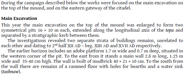
Excavations at Vardanze (Wardana)
Shafirqan District, Bukhara Region
August-September 2009
In August, 2009 the West Sogdian Archaeological Expedition 1
started investigations of the site of Vardanze, ancient Wardana, lying
on the northernmost border of the Bukhara oasis, at the southern edge
of the Qizil-Qum desert.
The principality of Wardana was one of the main centres of civilisation
in the oasis before the Arab invasion, competing in wealth and importance
with Bukhara itself. The course of historical events and a general description
of the site can be found here: http://www.transoxiana.org/
Buried under the sand in 1868 2 , Vardanze
has never received the same attention as other major sites in the Bukhara
oasis (Warakhsha, Ramitan, Paykend) 3.
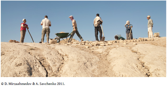
Recently, a topographical survey was made by the Italian archaeological
team who also laid a probing trench near the southern corner 4
of the main wall of the citadel. 5
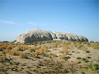
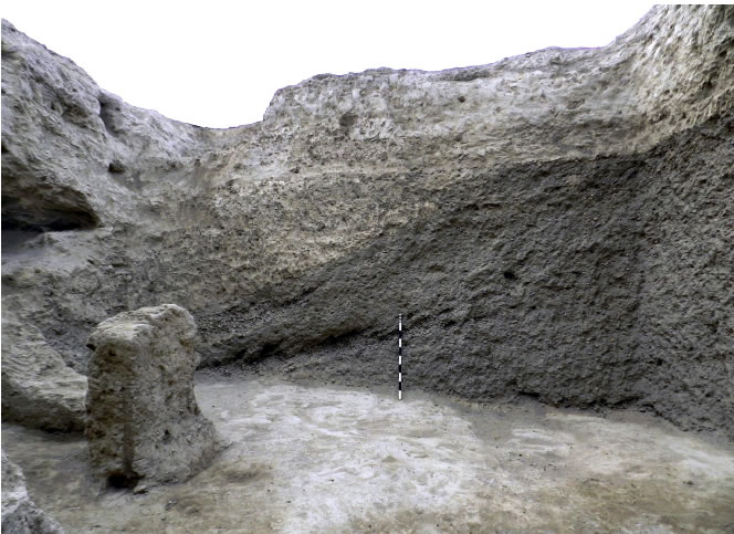
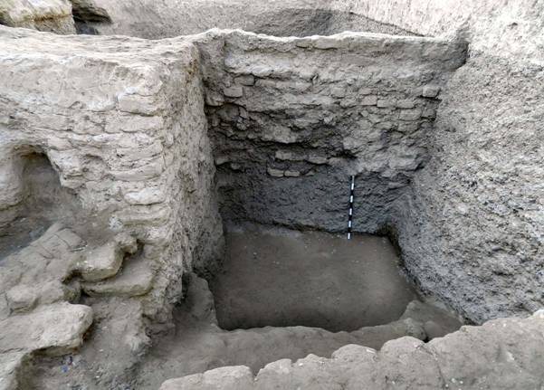
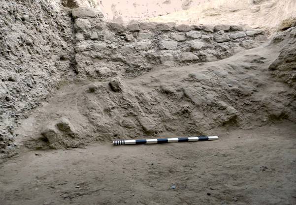
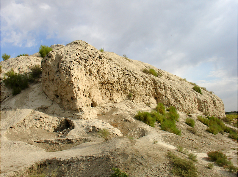 Plate 1: southern corner of the citadel
and the NE perimeter wall, ca. 15 m in height.
Plate 1: southern corner of the citadel
and the NE perimeter wall, ca. 15 m in height. |
|
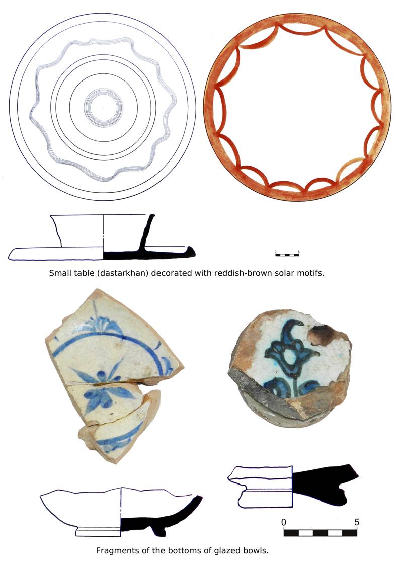
The array of the artefacts collected from the surface of the
site before the start of the excavations dated to the time spectrum
as wide as IX–XIX AD. Among those, the blue glazed pottery sherds
of XII–beg. XIII AD were the most numerous, next to them in frequency
of occurrence being the fragments of pottery with yellow and greenish
glaze characteristic for 1st half–mid XVIII AD.
Two separate trenches were laid as described below.
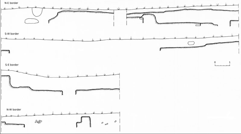
Trench 1
16×8 m, divided by a stratigraphic kerb 1 m wide into two equal
parts, lies in the centre of the flat top of the citadel, along its
S–E – N–W axis, slightly shifted to the N–W.
|
|
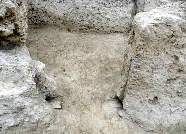
|
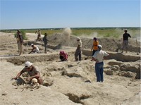
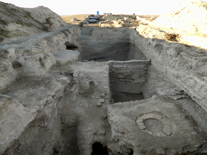
| Plate 2: Work in progress in the flat centre
of the citadel |
|
|
The excavations in this sector revealed a top stratum featuring the
remains of collapsed buildings covered with sand and loess. Along the
northern border of the trench, at 20-30 cm deep were found the remains
of a main wall 1,5-2 m wide, extending beyond the border of the trench.
Given the impressive dimensions, it can be safely assumed that this
main wall is part of the fortification of the site.
In the western part of the dig, at ca. 0,8-1 m were found some remains
of walls, benches (sufas), hearth pits, and rooms with poorly preserved
contours, laid with adobe and large sun-dried bricks.
The eastern part of the dig was full of alluvial sand and loess, and
can be assumed to be an open yard adjoining the architectural structures
to the west from it.
The finds gathered from the horizon uncovered by the excavations mainly
consist of glazed turquoise pottery sherds and fragments of non-glazed
pottery with red engobe. These features date the materials to the pre-Mongol
times.
From the debris in the western part of the dig were recovered several
pits and some small strata with pottery dating to the times of deep
social and economic stagnation in the 1st half of the XVIII AD as well
as several poorly preserved burials. The skeletons found there went
to pieces, and the numerous women’s decorations were scattered
all around. These burials interfered with the archaeological strata
of XII–beg. XIII AD, destroying them in several ways. The bricks
belonging to the earlier building period were taken off to edge the
graves which were shallow enough for the water to penetrate through
the holes dug by rodents.
The S–N orientation orientation of the burials, their poor order
and small depth (1-1,3 m) suggest a date in the Mongol times or soon
after that.
|
|
|
| Plate 3: central dig, western part in the foreground. |
|
|
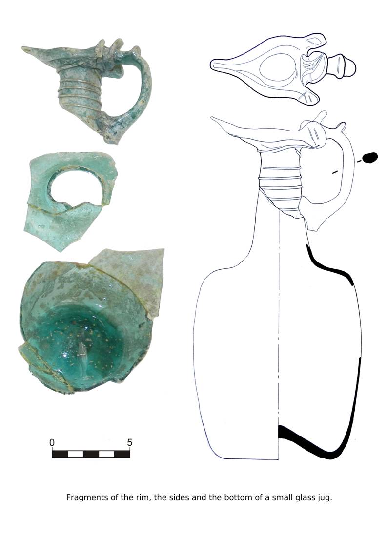
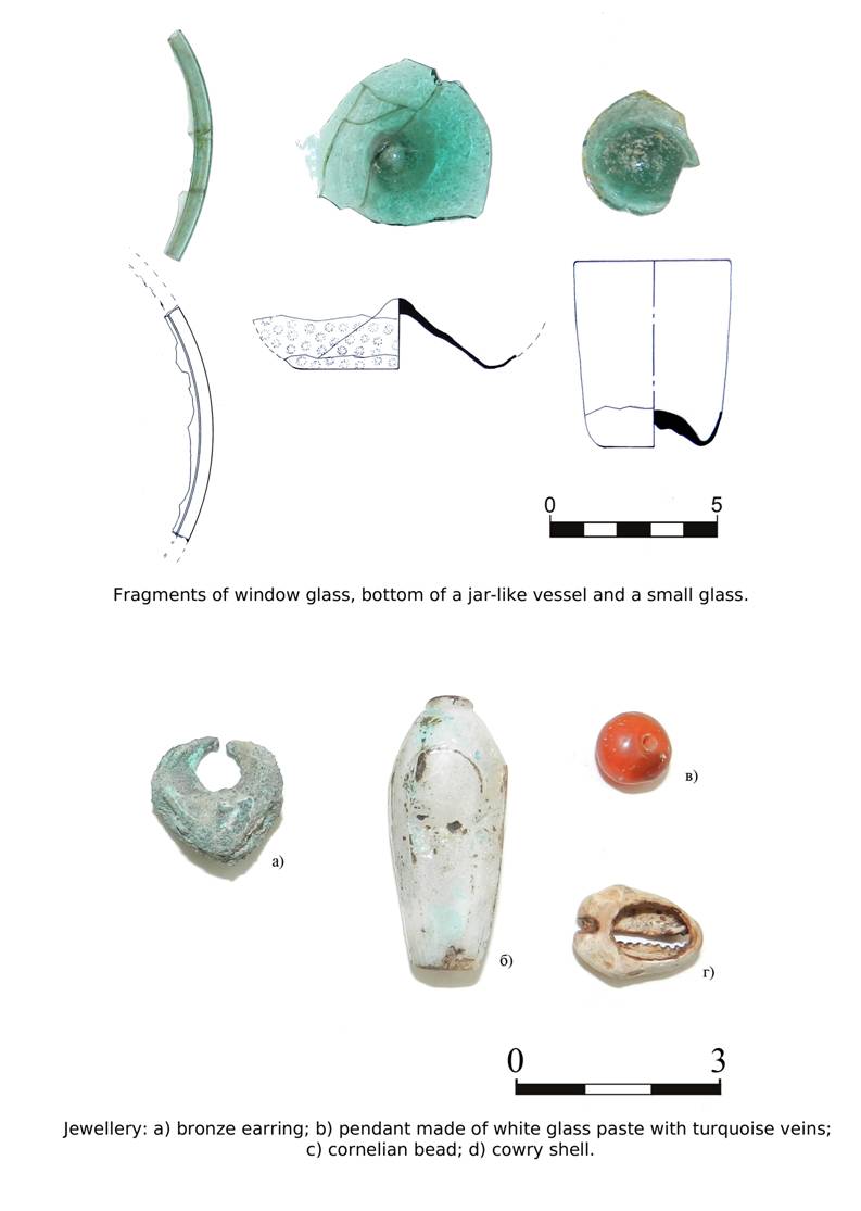
The finds from the central dig can be divided into two main categories:
pottery sherds testifying to its late squatter occupation, and a substantial
number of decorations from the female burials. The latter include beads
of various shapes made of glass of various colours: blue, dark blue,
black, yellowish, greenish, and turquoise, as well as of Cowries small
and large, cornelian, fruit stones, and bones.
One more group of decorations consists of bronze items: finger rings
of alike shapes and sizes, rod-like bracelets, fragments of earrings,
and small bells sewn upon women’s and child’s dress.
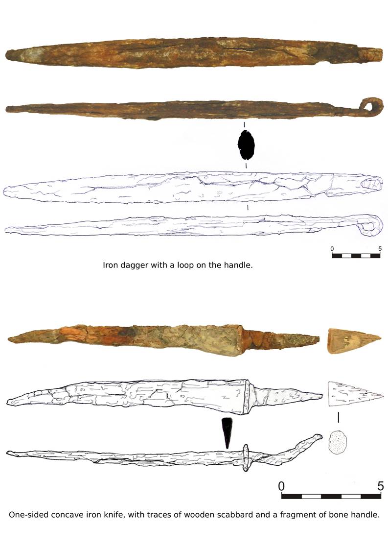
To the same stratum belongs the fragment of a bronze spoon and several
iron items probably coming from men’s burials – belt buckle,
finger ring, knife blade, etc.
It should be noted that among these decorations there were no items
made of precious metals or stones, which fact reveals the average, or
below average welfare of their owners. It is also noteworthy that a
traditional Muslim burial should not contain any women’s decorations
or men’s personal belongings. Perhaps we have here the evidence
of sedentarisation of the Turkic peoples who were less thorough in following
the rules of Islam, especially in the countryside where the masses of
the nomads were settling down.
It can therefore be argued that the site of Vardanze was in XII–beg.
XIII AD a rural settlement rather than an urban centre.
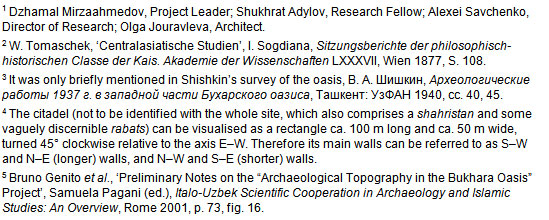
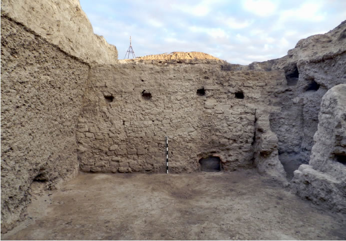
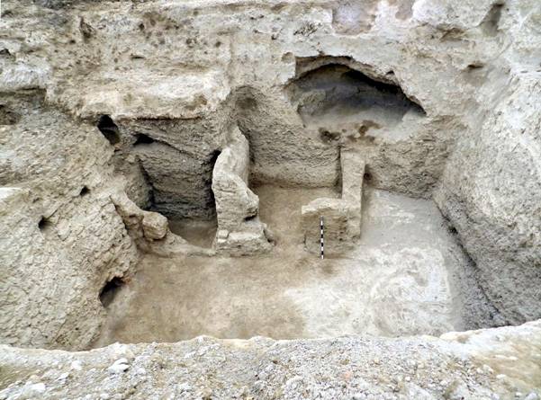
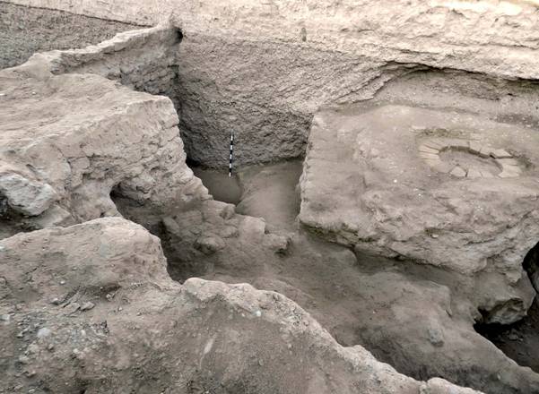
Trench 2 is situated in the western corner of the site,
by the junction of the N–W and S–W walls. Before the excavations
in this place was a large natural pit ca. 3,40 m deep, around which
were visible the remains of a main fortification wall with a breach
towards the north. It was natural to assume here a corner tower.
|
|
|
| Plate 4: western corner of the citadel before
the excavations. |
|
|
The top stratum in this sector appeared to be a debris of collapsed
constructions, fragments of sun-dried bricks and sand down to the depth
of 2,5 m. The pottery sherds from this stratum testified that from XII
AD to XIX AD the remains of the tower served as a shelter to random
occupants.
Lower down, at depth 5,8 m were revealed two parallel main walls built
of sun-dried brick with traces of plaster. Each wall is 1,9 m wide,
preserved up to 2,7 m of height. The space 2,6 m wide between the walls
was full of broken brick, crushed stone and sand, and contained fragments
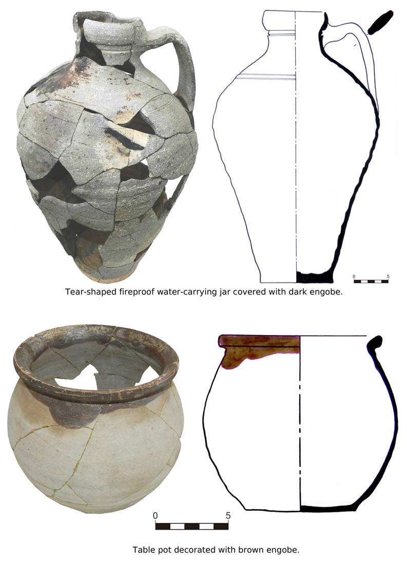
of thick-walled moulded pots, jugs and pitchers. Given the dark brown
and reddish engobe on the cheeks of the pots and the cuff-like shape
of the rim of one jar, the ceramic complex can be dated to V–VI
AD.
Such dating testifies to the fact that the two walls fringing the N–W
edge of the citadel are the remains of its earliest fortifications.
Filling the space between two walls with gravel is a building technique
which finds its parallel in the fortification of Ramitan and other Early
Mediaeval sites in the Bukhara oasis. Later on, probably near the time
of the Arab conquest, all walls were enforced by a jacket made of sun-dried
bricks 42 × 21 × 12 cm, as a result of which the initial
wall width of 6,4 m reached ca.11 m.
|
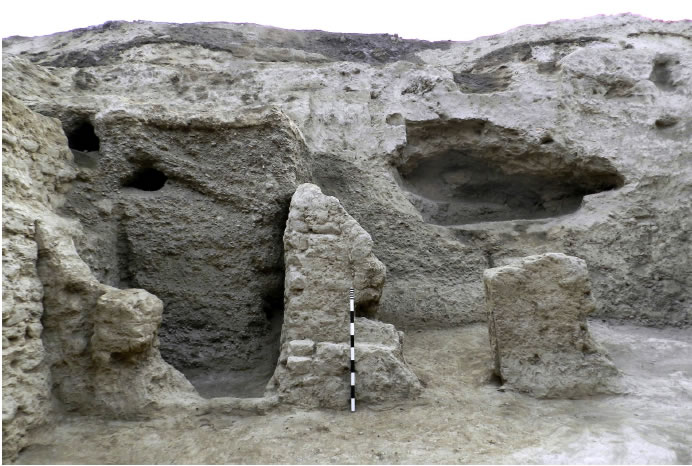
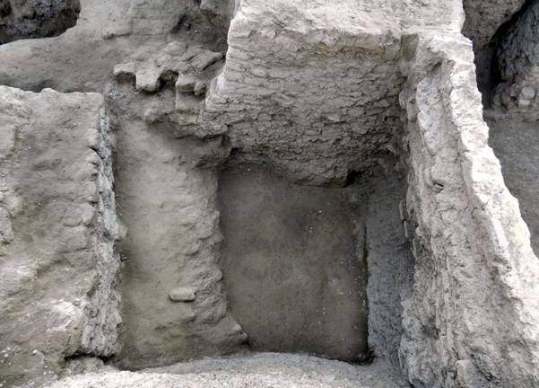
|
|
| Plate 5: brickwork of the outside jacket of
the main walls. |
|
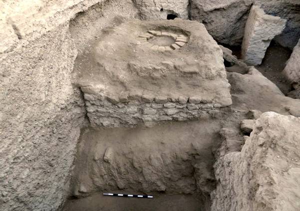
. |
Plate 6: excavated western corner of the citadel
The eastern side of the corridor formed by the two walls has two passages,
one in the N–E part (2,1 m high and 1,15 m wide), the other in
the S–W part (1,05 m high and 0,65 m wide). This last one was
probably made by the people hiding here during the times of troubles.
In the S–W the corridor inside the walls reaches the transversal
outside wall of the citadel, in the N–E it extends further, going
parallel to the outside N–W wall. For the safety reasons, the
investigations were stopped after 9 linear metres of the corridor were
uncovered.
To summarise, it can be stated that the end of the prosperity at Wardana
is associated with the Arab invasion. In IX–XI AD the citadel
was not regularly inhabited, and it is only in the period immediately
preceding the Mongol invasion that another occupational phase can be
traced. With the Mongols coming, the site must have been destroyed and
the citadel became a graveyard. At later times only squatter occupation
can be attested, with one large influx during the crisis that happened
in the 1st half of the XVIII AD when masses of people were
seeking refuge at places inaccessible for the nomads.
|
|
|
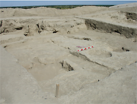
Plate 7: view of the shahristan from the top
of the citadel, facing SE. |
|
|
Plan for 2010
The excavations will be continued in the central part on top of the
citadel since it is assumed that the palace could have stood here.
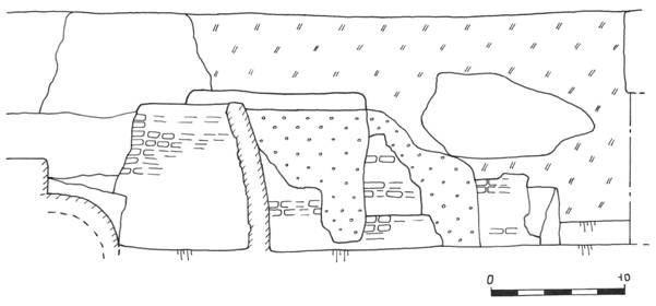
Cross-Section: Remains of the fortification system near
the foundation of the S-W tower.
Building structures and remains of a main fortification
wall in the central part of the citadel.
Building structures and remains of a main fortification
wall in the central part of the citadel.
Overview of finds and captions to sketches


Citadel of Wardana (Vardanze-tepa)
investigated by
Excavations Report, Autumn 2011
The site of Vardanze (anc. Wardana) is situated on the NE edge of the Bukhara
oasis, on the border with the nomadic steppe. In the times of the late Antiquity
and the Early Middle Ages the area was watered by one of the channels of the
R. Zarafshan, it was covered with vegetation and was abundant in game. In V– VI AD the site was the seat of the rulers of the NE part of the oasis, Wardan
Khudas. Until mid-XIX AD Vardanzeh was an important handicraft and trade
centre on the trade route connecting Central Asia through Kwarizm with the
Caucasus and Eastern Europe. The aridisation that started in XIX AD led to the collapse of economic and social life and complete desolation.
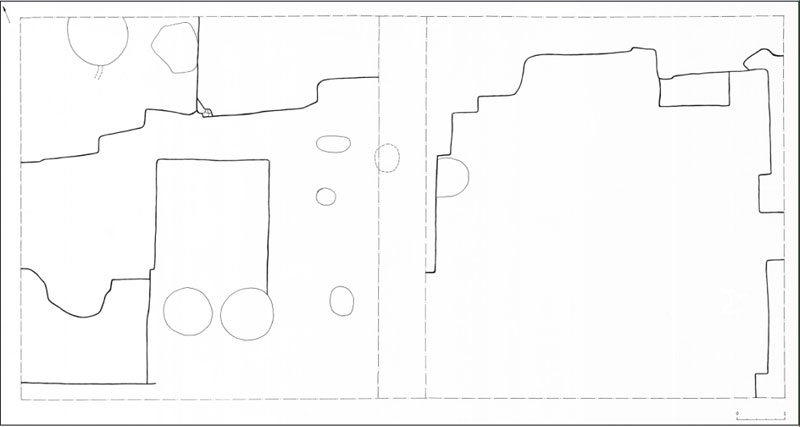
During this campaign all works were centred at the main excavation on the top
of the mound, extending the existing excavation in SW direction. The twometre-
wide stratigraphic kerb dividing the previous trenches 1 and 2 was
demolished, and the remains of a pre-Mongol building dating to the last occupa!
tional period of the citadel (end XII – beg. XIII AD) were removed.
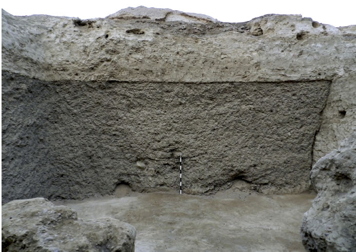
The next stratum consisted of poorly preserved remains of mudbrick walls
0.30–0.5 m high, standing on a massive adobe basis. Beneath the basis was
revealed a thick and sterile gravel bed marking the gap between the occupation
in IX–XI AD, and the revival of the citadel on the turn of XIII AD.
This last feature is paralleled by the same phenomena observed at the sites
of Paykend and Varakhsha, where it is explained by an influx of peasants from
the central parts of the oasis, trying to escape the increased tax burden under
the last Qarakhanids and the Khwarizm Shahs.
To this might be added the data of the primary sources, telling us about the
large-scale activities of the Khwarizm Shah Muhammad, who on the eve of the
clash of the Khwarizmian and the Mongol empires ordered to strengthen the
city walls countrywide in the end of the second decade of XIII AD.
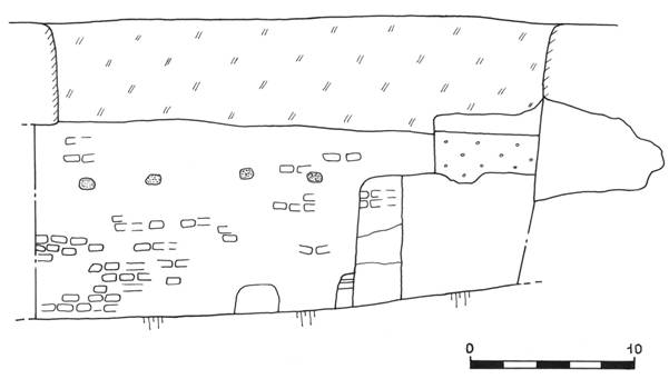
The excavation measuring 11 m E–W, 8 m N–S reached the depth of 5 m. A wall
3.05 m high divides it into two uneven parts, the eastern one 3"3 m and the
western one 6"6 m. The wall made of sun-dried bricks 42"25"11 cm is
oriented N–S, and goes beyond the excavation's edge. At 2.15 m from the floor
level there are four oval pockets for the roof beams, 20 cm in diameter and 20
cm deep.
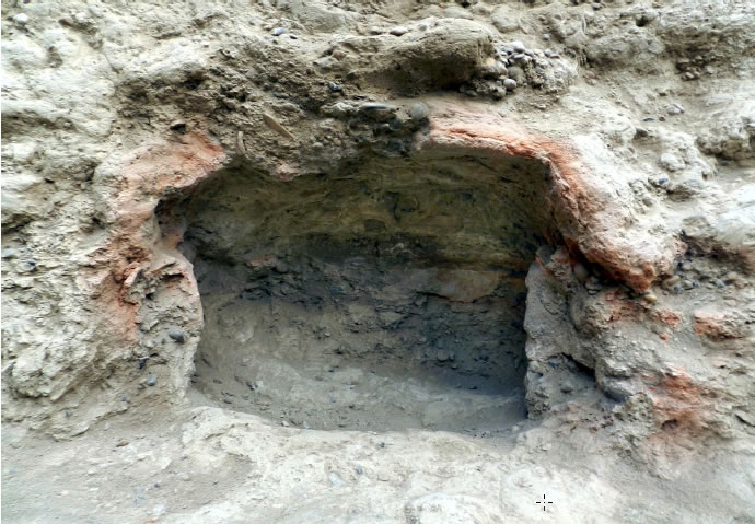
In the southern part of the wall, at the floor level were revealed the remains
of a rectangular hearth with a semicircular top, 0.7 m wide and inserted 0.45 m
deep into the wall.
Beneath the gravel bed mentioned above were found the remains of two
rooms built of sun-dried bricks 32"22"11 cm and having their doorways to the north. Both rooms are extended to the south and go beyond the edge of the
excavation. Room 1 is 1.95 m wide with the western wall standing 2 m high and
the eastern wall 1.55 m high. Room 2 is 2.3 m wide, with the walls 1.05 m and
1.85 m respectively.
The SW corner showed the remains of a large cesspit 3.1 m wide, going
down from the level of the 2nd half XII – beg. XIII AD. The pit was filled with
ashes testifying to a big fire in the beginning of XIII AD, and with fragments of
glazed and non-glazed pottery, metal- and glasswork badly damaged with fire.
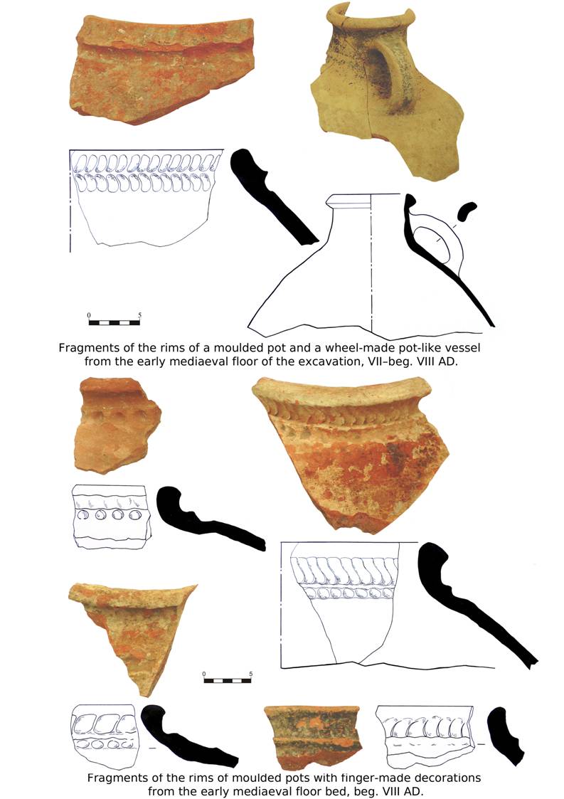
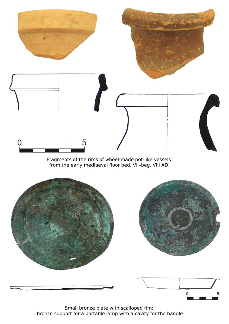
The material found on the early mediaeval floor consisted of fragments of
moulded pots with characteristic finger-made decorations, and a large wheelmade
pot with black engobe on the rim. These finds securely date the floor to
VII – beg. VIII AD.
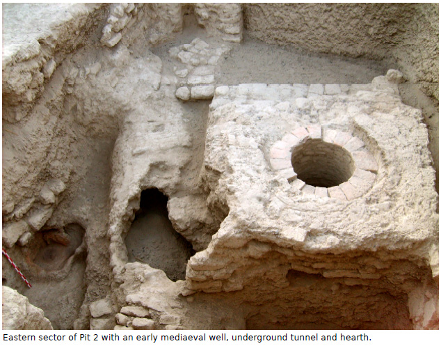
The most interesting architectural detail revealed was an underground
tunnel going N–S and intersecting with the previously discovered tunnel
oriented E–W. The tunnel declines to the north and continues under the floor
towards the main gate of the citadel.
Thus it can be observed that, some time after the death of Wardan Khuda
and the destruction of the citadel, another occupational phase begins. It is
marked with rebuilt walls, construction of underground tunnels, raising the well
level, erection of a tower-like building, etc.
Initially this had been the citadel's courtyard with the remains of buildings
in its southern sector and a well in the middle of the courtyard.
Exploring this particular context was particularly diffcult because of the
struggle through the gravel filling, with three or four grade levels of removing
the earth from the depth of ca. 5 m.
General view of the excavation facing west.
Western part of the excavation. Lateral wall with beam pockets and hearth.
Western part of the excavation. Hearth on the eastern wall at floor level.
Western part of the excavation. Northern wall with gravel bed.
Western part of the excavation. Western wall with loess filling.
Southern wall with the remains of two rooms and a cesspit.
Western part of the excavation. Two rooms and a cesspit in the southern sector.
Western part of the excavation. Doorpost at the entrance into Room 2.
Eastern part of the excavation facing west.
Eastern part of the excavation. Northern wall with filling.
Eastern part of the excavation. Southern wall with the turn of the wall.
Raised platform of the well and the underground tunnel going N–S.
Eastern part of the excavation. Well platform and underground tunnel.
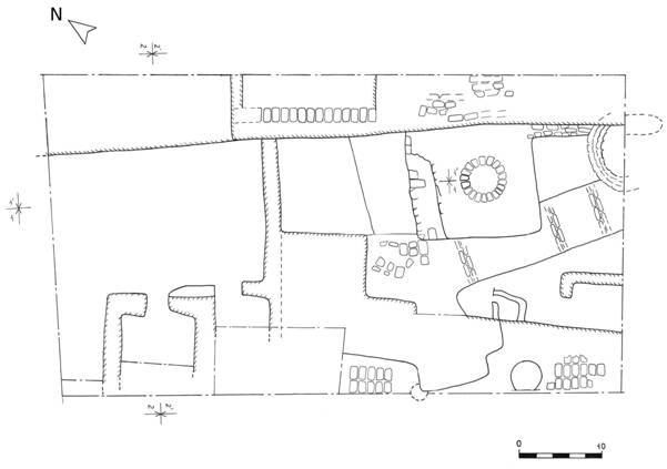
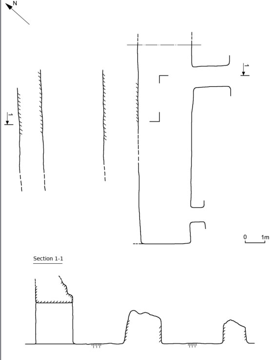
Ground plan of the excavation in 2011.
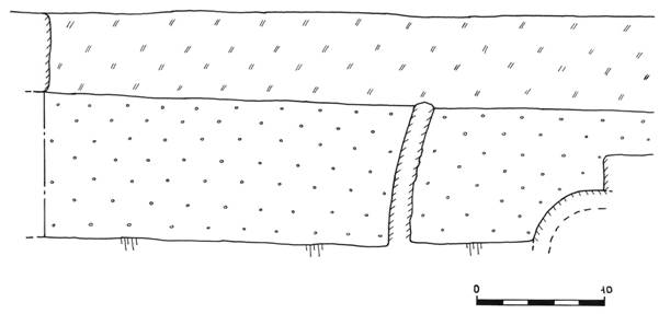
Section 1–1
Section 1'–1'
Section 2–2
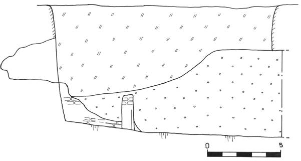
Section 2'–2'
|
|
|
|
|
|
|
The Society for the Exploration of EurAsia
REPORT ON THE FOURTH ARCHAEOLOGICAL EXCAVATION AT VARDANZE (ANCIENT VARDĀNA),
BY THE WEST SOGDIAN ARCHAEOLOGICAL EXPEDITION
(2012)
The Society for the
Exploration of EurAsia
REPORT
ON THE FOURTH ARCHAEOLOGICAL EXCAVATION AT VARDANZE (ANCIENT VARDĀNA),
BY
THE WEST SOGDIAN ARCHAEOLOGICAL EXPEDITION
(2012)

Silvia Pozzi
With contributions by J. Mirzaahmedov,
Sh. Adylov
and the drawings by S.
Mirzaahmedov and M. Sultanova
January 2013
Preliminary remarks
The
archaeological investigations at the citadel of Vardanze (ancient Vardāna),
capital of a small
Early Mediaeval principality located on the
borderline of the Bukhara oasis, were carried out between September, 29 and
November, 5, 2012. The main objective of this campaign was an extensive
investigation of the building phase immediately subsequent to the one excavated
in 2011. For this purpose the fieldwork
focused on the area north of the previously excavated sectors (trenches 1-2),
where three contiguous trenches (named trench 3, 4, 5) were laid one by
one without separating partitions. In addition, Trench 2, where the
upper strata had been investigated in the past years, was deepened and several
architectural structures were completely exposed at the total area of 532 m2. Besides the excavation, a further objective of the 2012 field season was to
update the topographic maps, showing both old and new trenches.
Note
All the
excavated stratigraphic units (walls, floors, layers, fillings, etc.) were
registered with the abbreviation SU (stratigraphic unit) and assigned specific
numbers. However, in this report the walls are indicated without the
abbreviation in order to facilitate the reading. The dimensions of the walls,
when given, appear in this order: thickness, length, and preserved height (H).
Excavation
Monumental defensive
system
The
most intriguing architectural feature discovered this year is a monumental wall
system enclosing the northern side of the residential area (Figg. 2, 4).
At the present state of excavation it consists of two parallel walls running
along the longitudinal axis of the tepa (E–W). The external wall is 191,
2.7 m thick, the widest wall found so far, and it is built of large mudbricks
(43×26×12 cm). Its southern face is still well plastered and has been excavated
up to a length of 10 m (Figg. 11, 12). The upper side of the wall lowers
towards the north, following the eroded profile of the tepa. The
northern extension of trench 5, which was aimed at investigating the width of
this wall, revealed several layers of rammed heart (pakhsa). The layers of pakhsa
(each layer is 14 cm thick), which alternate irregularly with rows of mudbricks,
have been found only on the northern face of the wall. The pakhsa seems to
extend to the limits of the citadel, but the structure is disturbed by a wide
rubbish dump (SU 199) filled with fragments of fired bricks, a grave (SU 202)
and a hole (SU 203) containing fragments of glazed pottery (18th-19th centuries AD).
South
of wall 191, at the distance of 4 m, there is wall 29, which is 1.30 m thick.
Both walls run parallel to each other for 35 m (Fig. 10). This wall,
found at 10-15 cm beneath the surface, is built of mudbricks measuring 42×25×12
cm and it is intersected by two later graves (SU 127-128) in its western section.
Its southern side represents the limit of the dwelling area. It was exposed for
its entire length and height, down to the floor levels (-2.60, -2.90 m). The
northern side was partially exposed, so it is unclear whether the space between
the two parallel walls had been used as a corridor. The western part, belonging
to trench 5, was excavated down to one metre from the top of the wall but no associated
floors were found. The only rammed earth floor found (SU 137, -2.65 m) is
located north of wall 29, close to the eastern edge of the excavation field.
Three fragments of oinochoe-like juglet rims, dating to 7th-8th cent. AD, were found on
this floor. A mudbrick structure (SU 147) leaning on the northern face of wall
29 probably belongs to this context as well (Fig. 7). The masonry is
clearly visible, but the limits of the structure that slopes down northwards
remain unclear. Further investigation could demonstrate if this is a wall
reinforcement. The remaining area north of wall 29, excavated only to a depth
of 20 cm, has several rows of aligned mudbricks laid against the same wall (Fig.
8). There are several holes cut through these mudbricks (for storage
jars?), as well as cesspits (badrab) and water sinks (tashnau). An
isolated human skull was also found, buried several centimetres under the
surface. The jugs and the jars found in situ (on the spot) demonstrate
that this area was in use during the 12th century, although a
greenish glazed dish and a turquoise lamp (chirag) dating to the 18th century show some sporadic occupation in later periods.
Corridors EW and NS
The
dwelling area situated to the south from the perimeter wall 29 is divided into
two different but related sectors (eastern sector and western sector),
whose internal circulation is defined by a T-shaped system of corridors. The NS
corridor, 2 m wide and 4.5 m long, forms the proper division between the two
sectors and contains a bench (sufa) abutted to the eastern wall 64 (Fig.
9). Proceeding northward, this corridor intersects the EW corridor, while to
the south it opened probably into a big hall or a courtyard located to the east
of wall 64. The EW corridor (1.20 m wide) runs parallel to wall 29 and it has been
presently unearthed for a length of 22.5 m (Fig.
10). This corridor was originally connecting the two sectors, but was later
obstructed by two walls (131, 206). In particular, wall 131 (4.8 m long) was
built on the junction between the two corridors, closing the passage. At the
same time the NS corridor was narrowed by the building of two walls (62 and
174) abutted to wall 66. Thus, the function of the spaces was modified and
rooms 6 and 8 remained isolated. It is probable that from the beginning of the
8th century AD room 8 was definitely abandoned until its re-use in
the 12th century.
Eastern sector
Room 4
The room
measures 1.50x 3.80 m and the perimeter wall 29 constitutes its northern limit
(Fig. 13). The eastern wall (27) (4.3x0.43, H: 1.10 m) presents a
particular texture called ‘combined brickwork’ (mudbricks and pakhsa), frequent in the Early Medieval structures (Fig. 14).
In this case the masonry is made by rows of headers (mudbrick size: 40x23x9 cm)
separated one from another by layers of pakhsa 6-9 cm thick. The western wall
(26), measuring 3.8x0.43, H: 0.80 m, was built with the same technique, and presents
a more eroded surface, especially in its southern part. A round hole (Ø: 10
cm), probably built to provide ventilation, pierces the masonry in the upper
part. The massive wall 53 (60x110, H: 50 cm) connected to wall 26, represents
the southern limit of the room, where there is also an entrance. The cleaning
of a partially preserved mudbrick floor (SU 55, -2.50 m) revealed the presence
of pottery fragments dating to the 7th-8th centuries AD
and of a schist millstone scattered in correspondence of the entrance. Another
wall (165) was detected under wall 53, demonstrating the existence of a
previous building phase. This wall was found also under room 9 and to the east of
wall 27 (Fig. 15). We can suppose therefore that in a previous phase
rooms 4 and 9 formed a large room, enclosed to the south by wall 165, to the
west by wall 113 and to the east by wall 74.
Room 9
The room
measures 2.5x3.80 m and it is enclosed to the north by perimeter wall 29 (Fig.
16) together with adjacent room 4. The western limit is represented by wall
113 (1.40x3.70, H: 110 m), the east by wall 26 and the southern border by the
massive wall 78 (1x2.5, H: 0.80 m, mudbrick size: 37x24x9 cm), now entirely
removed from its original location. No associated floor levels have been found.
The removal of wall 78 revealed the presence of wall 165 and traces of a floor
associated to the same context (SU 138, -3.20 m), and preserved only where
bordering wall 113. It seems that this room had no obvious access.
In order to
reach the thick layer of fluvial pebbles and sand already detected last year in
trench 1, we proceeded with the removal of a layer of compact soil (SU 79)
found under floor SU 138 and under walls 26, 113, 156. As expected, this layer
covered a pebble layer (SU 82, -3.69 m) levelling the surface before the new
walls were built. On closer inspection, the pebble layer proved to be formed by
two similar strata. The first one (15 cm thick) contained only a few pebbles while
in the second stratum the pebbles were abundant. The provenance of the pebbles
is unknown but the large quantity suggests the presence of an ancient river
located nearby. The pebbles were laid beginning on the northern side, as demonstrated
by the inclination of the layer visible in the western section of trench 1
(2011 excavation). The deepening of room 9 allowed the exact identification of
the northern limit of the pebble layer, represented by wall 81 (Fig. 17).
The recovery of this wall is particularly important since it represents the
deepest and the most ancient architectural feature uncovered this year. In fact,
it is probably contemporary to the architectural structures unearthed in 2011
and dating to the 4th-5th century AD (see the
conclusions).
Room 8
This wide room
measures 4x3.70 m and it is enclosed to the north by the perimeter wall 29 (Fig.
18). To the east it is delimited by wall 113, to the south by wall 60
(4x0.8, H: 1.40 m) and to the west by wall 104 (2.90x0.95, H: 1.5 m). The
entrance is located on the west side and leads directly to the EW corridor. The
room was fully excavated, exposing two floor levels. The upper one (SU 120,
-2.80 m) is characterized by traces of fire, charcoals and by a rectangular
mudbrick structure (SU 125, 0.90x1, H: 0.25 m) located in the north-eastern
corner of the room. The lower floor (SU 135, -3.10 m), only partially
preserved, was found just in the central and eastern parts of the room. A small
probing trench opened in the south-western corner of the room revealed the
presence of a pebbles-and-sand layer similar to the one already detected in
room 9, confirming a matching stratigraphic sequence.
After the
abandonment of the room, which occurred probably in the 8th century,
another occupational phase dating to the 12th century was recognized.
The room, still delimited by the same walls, was converted apparently into an
open space. A U-shaped mudbrick bench (SU 110-112) was detected along the
western, northern and eastern walls whilst the central space of the room was
occupied by a trapezoidal mudbrick structure (SU 101) measuring 110x150x180 cm.
The stratigraphic sequence of this occupational phase is complicated by the
presence of several fire places, pit holes and two drains of significant
dimensions and dated to the 12th-13th centuries.
Room 7
The excavation
of this area (Fig. 19), initially interpreted as a room, was very
problematic because of a very disturbed stratigraphy. This space (3x3.80 m) is
delimited on the east by wall 104, on the north by wall 106 (1.20x5.15, H: 1.22
m) and on the west by wall 64 (1x8.50, H: 1.20 m). On the south, where we
expected to find the continuation of wall 60, we identified only a few aligned
mudbricks, not enough to confirm the existence of the wall. Moreover, the
presence of the EW corridor to the north from room 7 reinforced our hypothesis
according to which this area could be part of a wider hall located east of wall
64.
Under a layer close
to the surface (SU 80) and containing many ceramic fragments, two deep pit holes
of irregular form (SU 100, 108) were excavated. The pit holes filled almost the
whole room and destroyed the surrounding walls in several points. A remarkable amount
of ceramic fragments and jewellery, mixed with soft soil and pebbles (debris?)
were found inside the pit holes. A precise identification of the shapes of the
holes has been proven difficult by the softness of the soil contained in both
the fillings and it is not excluded a contamination of the materials. Under the
holes there was a compact layer of soil (SU 117) containing several small finds
and a copper coin. The deepening of this layer revealed the foundations of
walls 64, 104 and 106. These walls were built on foundations (SU 123-124-217) made
of compact clay and built directly on a pebbles-and-sand layer (SU 122), similar
to the pebble layers already recognized under rooms 8 and 9. The foundations are
not present in clay walls of this kind and the walls are usually built directly
on top of the natural soil. We can therefore assume that the construction of
foundations depended on the presence of pebbles layers in the walls and was aimed
to offer a more stable support to the later walls. No floor level has been
identified in this room.
A similar
stratigraphy was detected in the EW corridor situated to the north of this
area. A deep pit hole (SU 99) containing ceramic fragments and small objects
was identified in the corridor. The underlying layer of compact soil (SU 118)
contained several small finds as well, including a chalcedony seal.
Western sector
Room 6
The room
measures 2.70x2.6 m and it is enclosed by walls 66 (7.9x1.20, H: 1.3 m), 67
(5.2x1.2, H: 1.5 m), 69 (13.3x1, H: 1.4 m) and 68 (3.5x1.30, H:1.77 m) (Fig.
20). The entrance is located on the northern side and opens into the EW
corridor. Wall 211 was built at a later date against the western wall. The room
contains a mudbrick bench (0.57 m wide, H: 0.25) only partially preserved.
Rooms 10-11-12
Room 12 measures
3.80x4 m and is enclosed by walls 68, 69, 181 (3.8x0.9, H: 1.30 m) and 182
(4.5x1.10, H: 1 m) (Fig. 21). The clearance of the related earthen floor
SU 194 (-3.25 m) revealed a substantial quantity of big pebbles (10 cm long)
laid in the north-eastern corner of the room. Contrary to the layers uncovered
in the eastern sector, here the pebbles are not mixed with sand and they
abut an earthen structure (197) found under the floor SU 194 as well. Further
researches could reveal the exact nature of these features.
In a subsequent
building phase the room was filled with a layer of compact soil (SU 193), on top
of which it was built partition wall 183 (0.40x3.90, H: 0.5 m). This wall was
made by rows of headers (mudbrick measure: 40x23x9 cm), some of them not well
distinct because of the erosion of the lateral surfaces. Three round holes (Ø:
6 cm) characterize the upper part of the wall and were used probably for
ventilation or for hanging foodstuff. Wall 183 divided the previous room 12
into two smaller rooms, labelled respectively 10 (1.80x3.90 m) and 11
(3.80x1.80 m) and featuring flattened floors SU 178 and SU 189. The second
floor, showing traces of fire, was laid on a layer of compact soil (SU 195)
containing fragments of moulded khum with dark slip (6th-7th century AD). The entrance to these rooms were not found but we hypothesize the
presence of a passage in the eastern part of wall 69, where it is visible a
sort of pit hole, still not investigated.
In the following
building phase, other two walls (188-190) were built in room 11, narrowing the
surface furthermore (3x1.60 m). The mudbrick wall 188 (5x1.1, m) was built on
the previous partition wall, 183, and on wall 182, while wall 190 (1.10x0.40,
H: 0.09 m), made with only one row of headers, was built between walls 188 and
68. During this phase wall 68 was plastered again (plaster is 10 cm thick). It
is noteworthy the presence of an iron arrowhead dating to the beginning of the
8th century, discovered under wall 188. The last occupational phase
is represented by a round cesspit (SU 180, Ø:1 m, H: 1.2) cutting the wall 183.
The filling is made of a compact layer of greenish soil, which contained
several fragments of a wheel-made khum dating to the 12th century
AD. One fragment carries an incised inscription in Arabic (recognized the
letter –ah).
Courtyard
The
investigation of the area to the south from rooms 4-12 revealed a wide-open
space or a courtyard, probably leading to the entrance of the palace. This area
was delimited on the west by wall 218 (3x1.2, H: 0.36 m), on the north by the
walls 216 (1.37x0.60 m, H: 0.7 m) and 182, while on the east it was enclosed
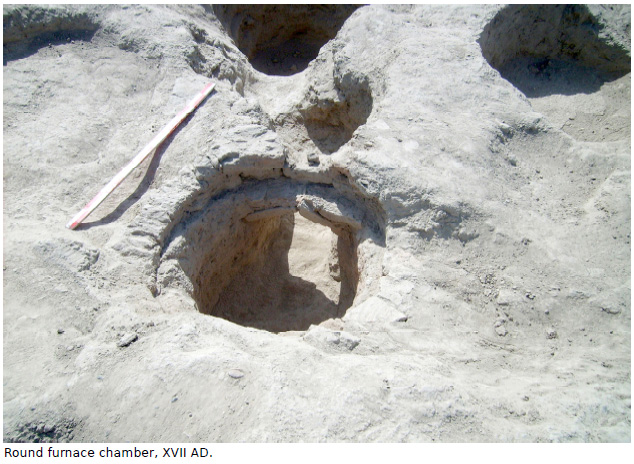
by wall 66. The 17th century furnace uncovered in 2010 and abutted to
wall 182 has not been removed yet. The southern side reaches the limits of the excavation.
A related compacted floor (SU 185, -3.00) was identified on the surface
delimited by the walls. The presence of wavy gaps (2-3 cm wide) on the western
part of the floor remains unclear (channels made by the streaming of pluvial
water?) (Fig. 22).
Upper levels
As already
mentioned, the upper levels investigated during the 2012 campaign refer to an
occupational phase dating to the 12th-13th centuries AD.
The main evidences consist of ashy areas, pit holes, cesspits (badrab)
and drains (tashnau) made by one or more inverted jars buried into the
ground (Figg. 23, Pls. 14, 17). These features were often grouped close
to each other, demonstrating the preference for specific areas. The absence of
relevant architectural remains suggests that the pre-existent structures were
re-used with limited new building activity.
Several burials
were also found in different areas of the excavated trenches. Two of them,
clearly identified as Muslim graves thanks to the northward orientation, were
built excavating an oval subterranean chamber into the ground (Fig. 24).
Another type of burial, found on the same year, consists of oval holes 30-40 cm
deep, very simple, unadorned and probably produced very quickly. The graves
intersect the levels dating to the 12th-13th centuries,
suggesting that the citadel became a graveyard at a late period. Currently
there are not enough elements to propose a more precise dating considering also
the absence of grave goods.
Finds
During the 2012
campaign we selected a total of 167 finds to be catalogued, among them
potsherds and small finds in bronze, iron, glass, bone and stone. Each find was
recorded in an inventory and both photographed and drawn. The ceramic finds,
mostly fragmented, can be divided into two chronological groups: the Early
Medieval pottery (6th-8th centuries AD) and the Medieval
pottery (12th-beg. 13th centuries AD). Since the citadel
was not inhabited between the 9th and the 11th centuries,
accordingly no ceramic vessels belonging to this intermediate period were
found, except for a few fragments of glazed lamps dating to the 9th-
10th centuries AD. Some later vessels dated to the 18th-19th centuries were recorded as well.
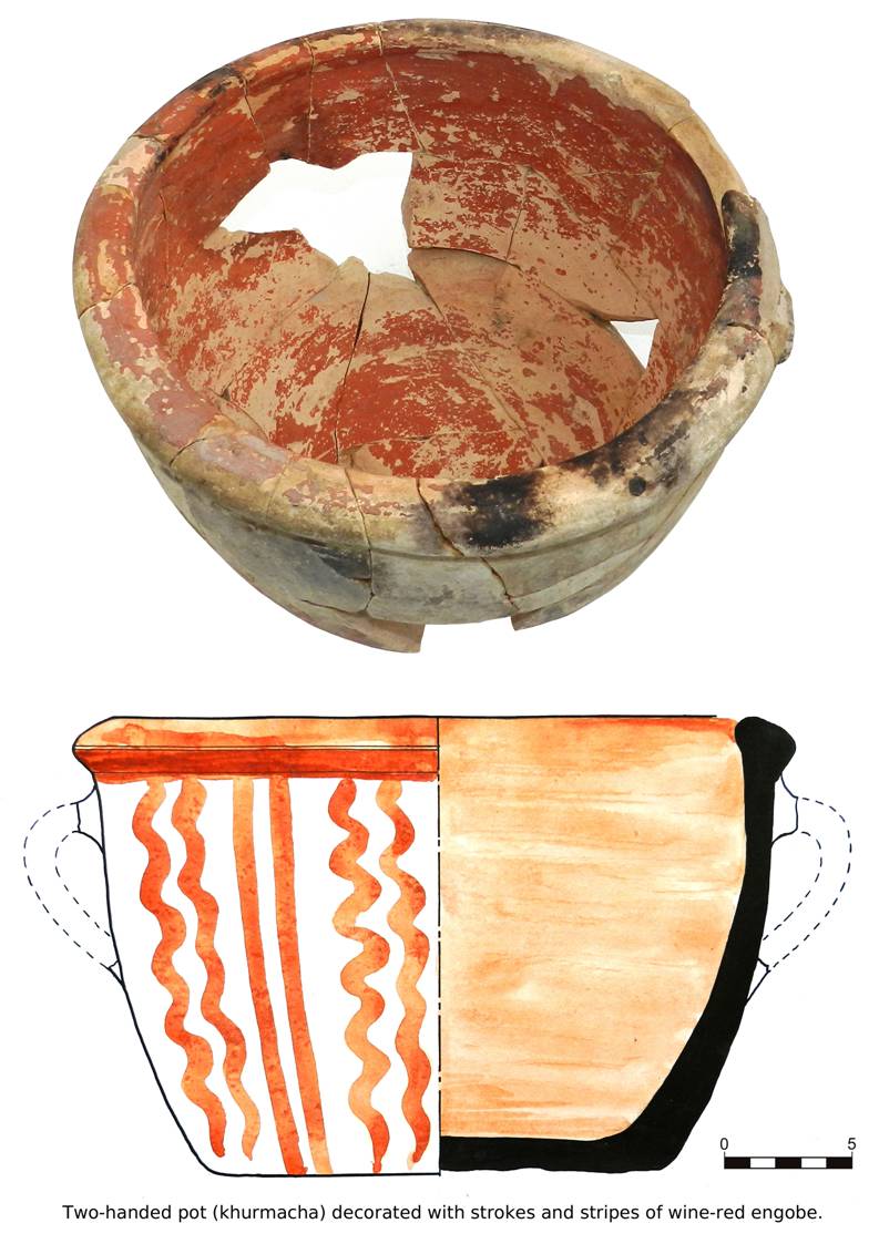
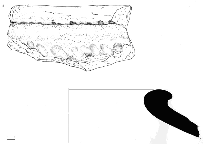
Among the Early
Medieval pottery, mostly found in the layers formed following the abandonment
of the citadel, two distinct groups were identified. The most ancient group is
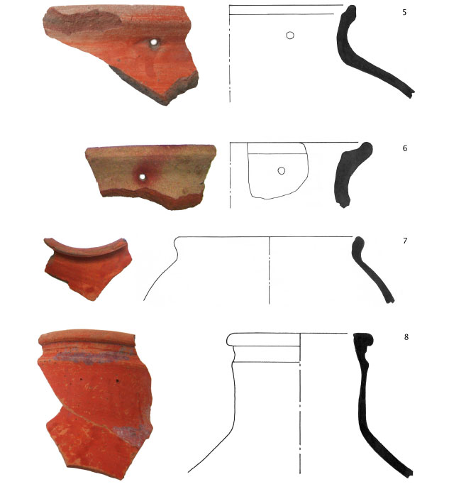
dated to the beginning of the 6th- first half of the 7th centuries AD, while the second group dates to the second half of the 7th-
beginning of the 8th centuries AD. The first group does not show
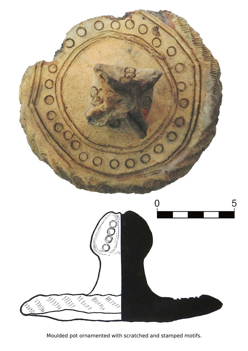
evidence of many types of vessels: it consists mainly of large moulded jars
(khum) used for storage purposes (Pl. 1). After analysing the fragments,
we propose that these rough vessels were formed by an ovoidal body and that
they were often cooked only partially (as suggested by the variable colour,
reddish-greenish). In some cases, the external surface presents a white slip on
which a red or black slip is applied forming irregular streaks along the body.
The rims are barely protruding and the necks, not pronounced, are usually
decorated with one or two rows of finger marks (straight or oblique). These
decorations are typical of the Kaunchi pottery,
in particular with the production of the 4th-5th centuries
AD. The nomadic culture of Kaunchi was widespread in the Sir Darya area since
the 2nd -1th centuries BC and survived until the 7th century AD influencing the ceramic production of the neighbouring regions such
as the Bukhara oasis, where the pottery of this type is called of ‘Kizil Kir’
type.
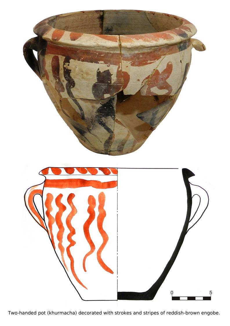
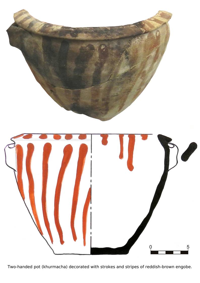
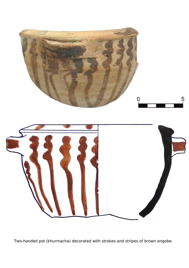
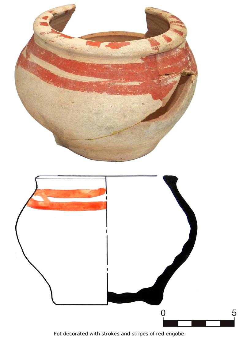
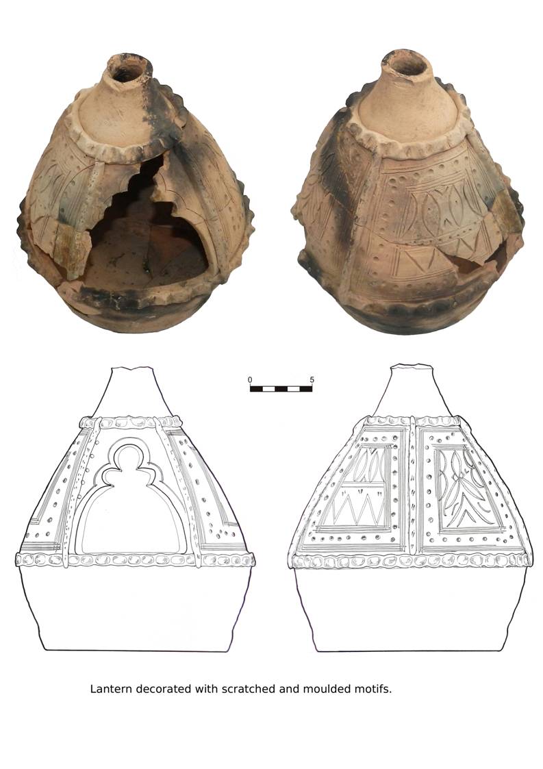
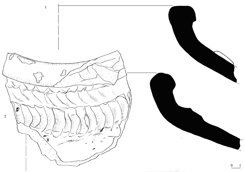
The second Early
Medieval complex (second half of the 7th- beginning of the 8th centuries AD) presents a more diversified range of shapes, among them large
and small khums, pots, jugs used for household purposes, cups, basins and
goblets (Pl. 6). Many of the larger khums were prepared on a
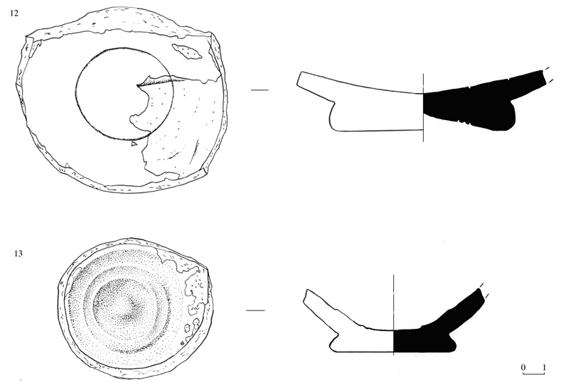
potter’s wheel and the rims present rounded or triangular sections (Pl. 2).
The necks, more pronounced than in the preceding pottery, are decorated by
finger impressions and elongated incisions, slightly oblique. In
the smaller vessels the external surface is often covered with a white-yellow
slip and it is decorated with a red slip forming irregular streaks along the
body (Pls. 3-5). The dominant decoration of the small jars, however,
consists in rows of wavy lines (pointed or rounded) incised with a sharp stick,
a well-known motif widespread also in other contemporary Sogdian centres. In
two exemplars of small jars, the rim presents an inset for the lid and the neck
is pierced probably for hanging. Another type of decoration, typical of the
small jars with an reverted globular rim, consists in small oblique dots and
wavy lines incised on the sharp edge between the neck and the shoulder (Pl.
5).
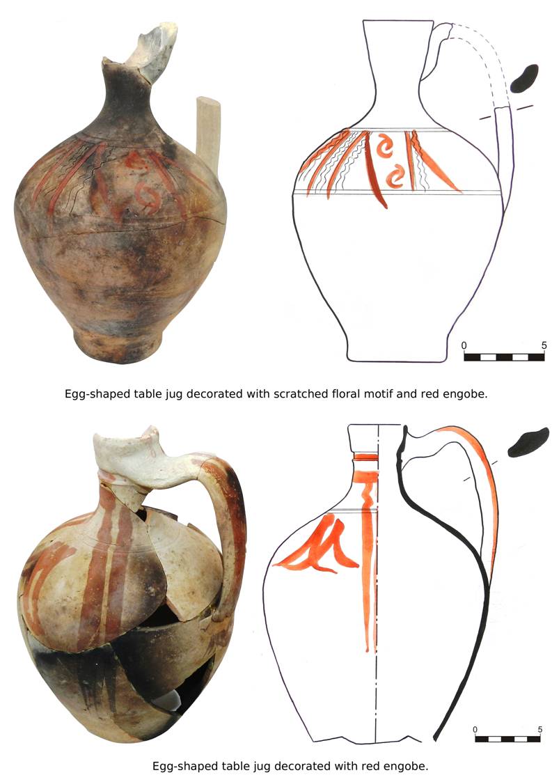
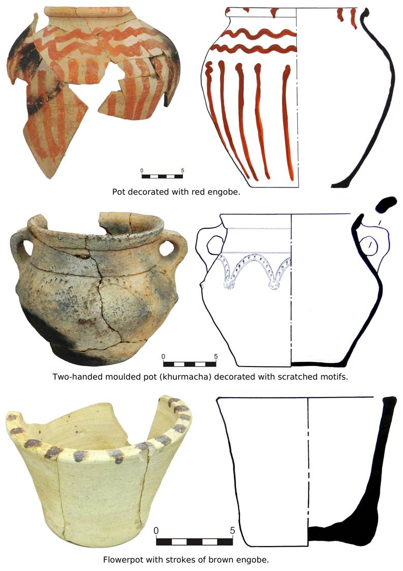
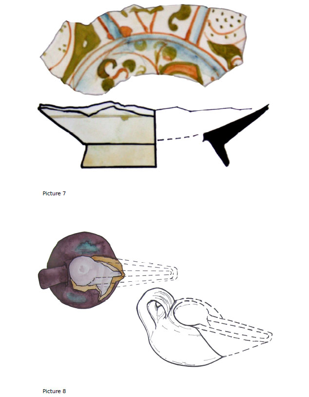
Several examples
of jugs were recovered this year. The jugs may or may not have a handle and
they are usually made with a pale reddish clay, covered with a white slip (Pl.
7). The beak (Ø: 11-14 cm ca) presents a straight rim with rectangular
section, slightly concave on the external side. In one exemplar, a petal-like
ornament decorates the bottom part of the handle and of the spout located under
the neck (Pl. 8). It is probable that this particular decoration,
unknown before, represents a peculiar local motif. Lastly, the discovery of
some fragments of ‘oinochoe-like’ juglets deserves to be mentioned. The juglets
were found all outside perimeter wall 29 (Pl. 9). These vessels are made
of a light red-orange clay and they are decorated with a fine white-red slip.
To conclude, we
can recognize two different trends in the local pottery production between the
6th and the 8th centuries AD. The first one is based on
the classic Sogdian tradition and it presents close analogies with the
contemporary complexes of the whole Sogd. The second type of production,
technically inferior, was influenced by the Kaunchi culture, as shown by the
recurrent ornamental features. If we compare the local Early Medieval pottery
with the production of the other settlements and villages in the Western Sogd, we
can see a more intense influence of the Kaunchi in the vessels of Vardāna.
It is not surprising, since Vardāna was situated on the borderline between
the sedentary area and the steppe, a territory under the control of the nomadic
populations.
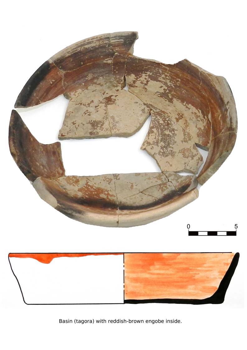
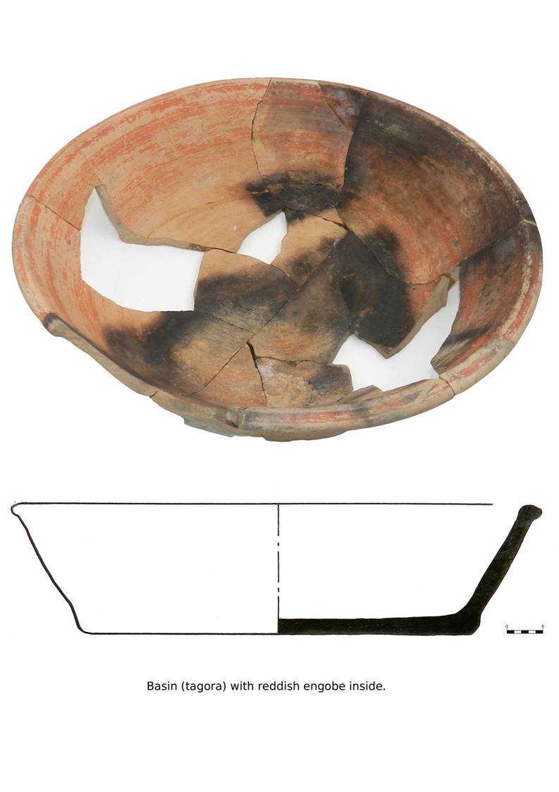
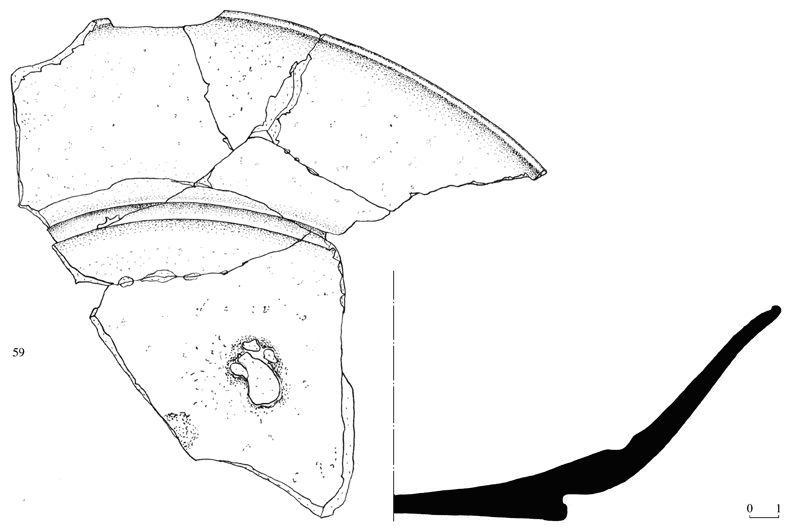
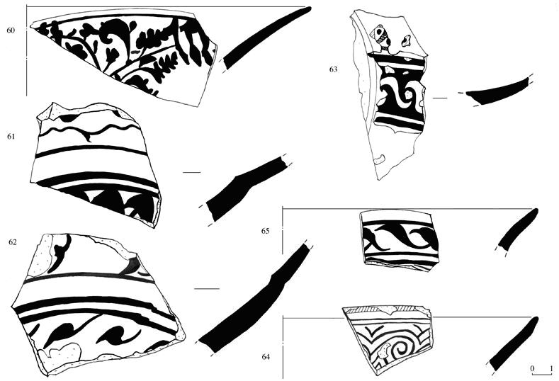
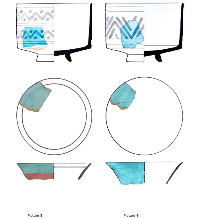
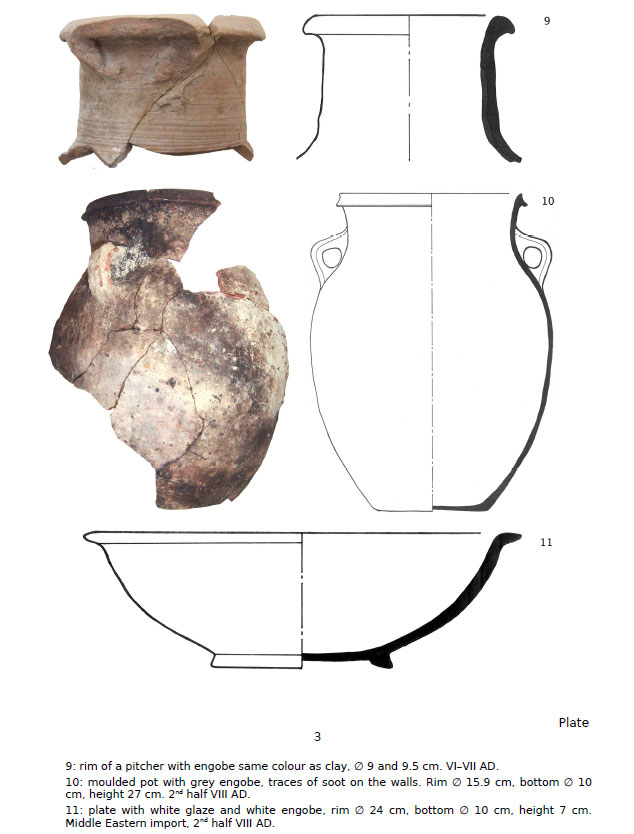
The
chronological complex of ceramics dating to the 12th century AD is
represented mostly by large khums and jugs found superimposed in canalization
systems (tashnau). The khums are wheel-made and present an ovoid body
often covered with a white slip (Pl. 13). The rim of the larger khums
(Ø: 25 cm) is usually straight while in the smaller vessels it presents an
inset for the lid or an external groove, probably used for functional purposes
(to tie a fabric used as lid?) (Pl. 15, inv. 127-152). The rims are
usually not decorated, or otherwise they present a simple ribbon motif. Incised
or stamped decorations are generally concentrated on the shoulder, in form of
concentric lines or wavy motifs. The latter design, still in use since the
Early Medieval period, is then more stylized and approaches comb-like patterns
(Pls. 14-16). Continuity in production can be recognized also in the red
slip applied to the body to form irregular streaks, which remains in use in the
later period.
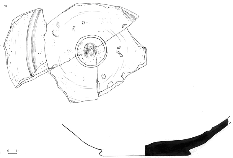
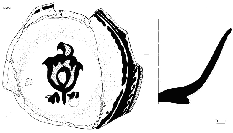
A large
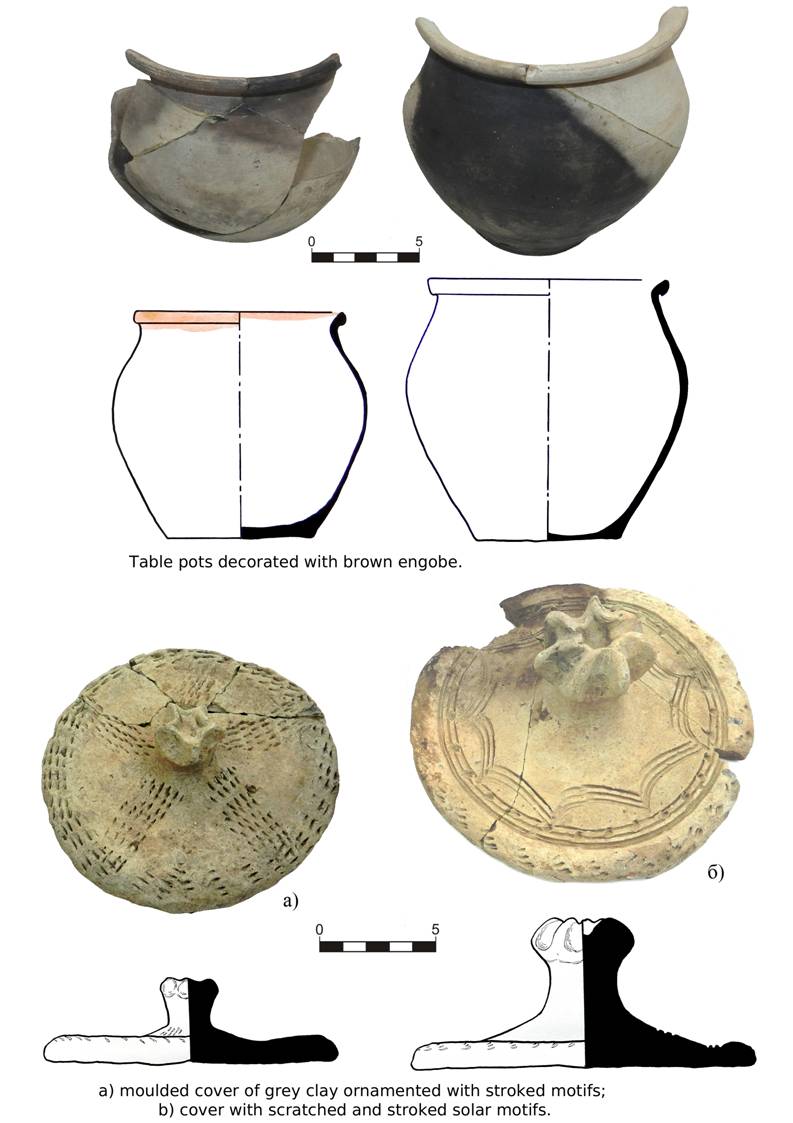
assemblage of lids (Ø: 32-34 cm), mostly wheel-made and used to cover the
jars, has been found (Pl. 18-20). Some of the lids are covered with a
white slip and the surface is decorated with incisions or stamped decorations.
The incised decorations are mainly geometric and stylized, showing similarities
with the motifs on the storage vessels. Among the stamped decorations are both
geometric and elegant vegetal motifs. All the lids date to the 12th century AD, except for a fragment showing an incised tree-motif (Pl. 18,
inv. 18). This lid could be earlier, as suggested by some ceramics from
Paykend, which are characterized by a similar motif called the ‘tree-of life’. It is
interesting to note that this decoration is also very common on the ossuaries
from Sogd and the neighbouring regions.
A large
assemblage of cooking pots has been found inside pit hole SU 100 (room 7).
Most of the vessels are wheel-made and do not carry any decoration (Pl. 11).
The clay contains small inclusions and the predominant colour is grey. The rim
shards (Ø: 13-20 cm) can be divided into four general groups even if they are
irregular: inverted rims with an elongated section (Pl. 11, inv. 95, 103,
104); reverted rims with round section (Pl. 11, inv. 97, 99, 100);
reverted rims with an inset for the lid (Pl. 11, inv. 96, 107); reverted
rims with a flattened upper part (Pl. 11; inv. 98, 105, 106). A
particular inverted rim with vertical body has also been found (Pl. 11, inv.
101).
A varied ceramic
assemblage dating to the 12th century –beginning of the 13th century AD was discovered in the large pit hole SU 23 during the 2011 campaign,
but some vessels were reconstructed and then catalogued only this year. The
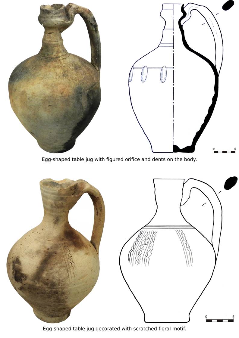
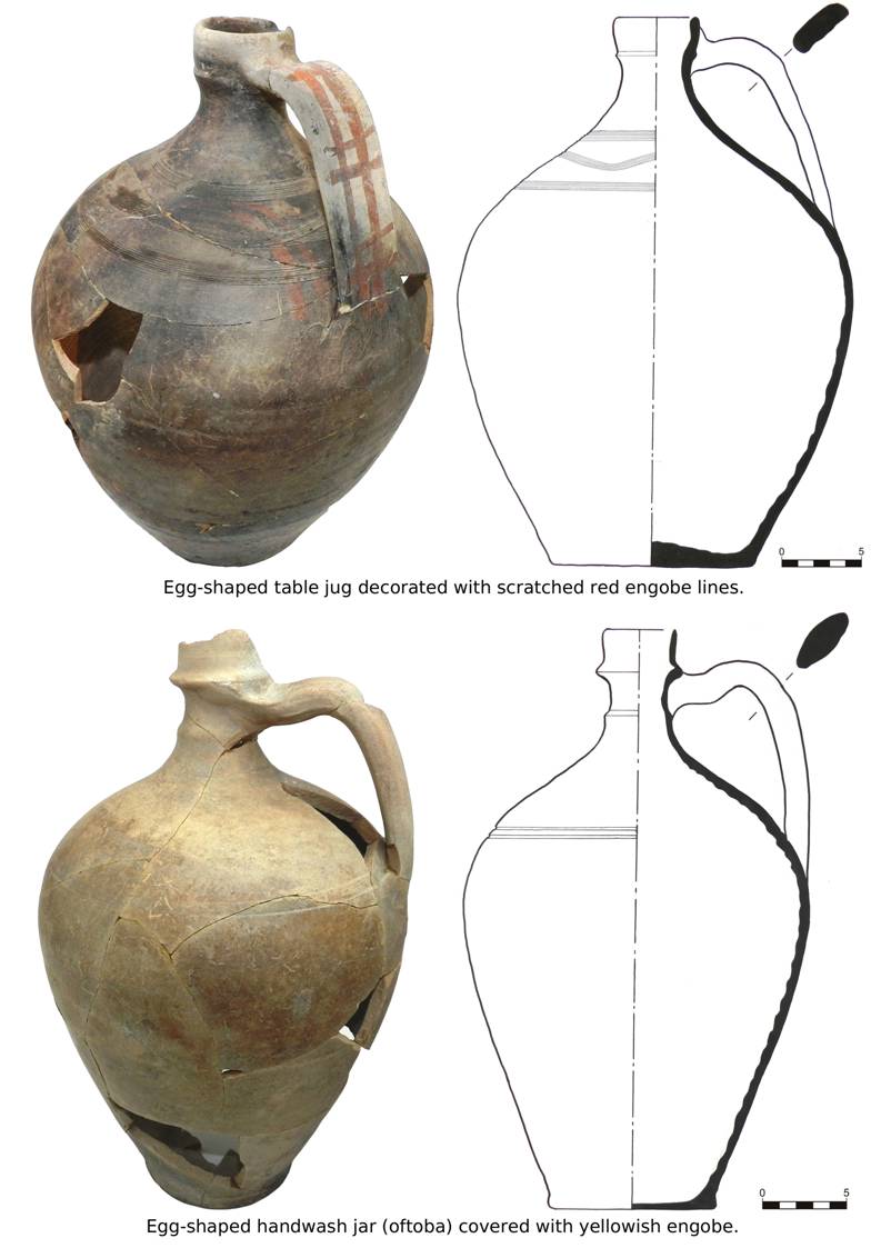
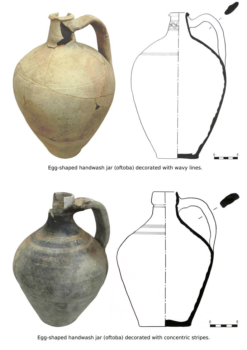
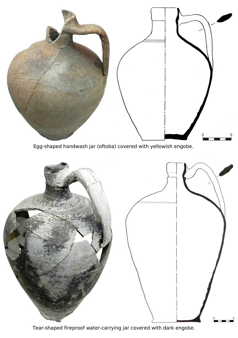
assemblage contained mostly egg-shaped juglets with funnel-like rim, but there
is also an ovoid jar, two small table pots decorated with thin incisions, a
cooking pot and a lid (Pls. 25-28). All the fragments present traces of
a later fire that interested only the material found in the pit hole (see 2011
report).
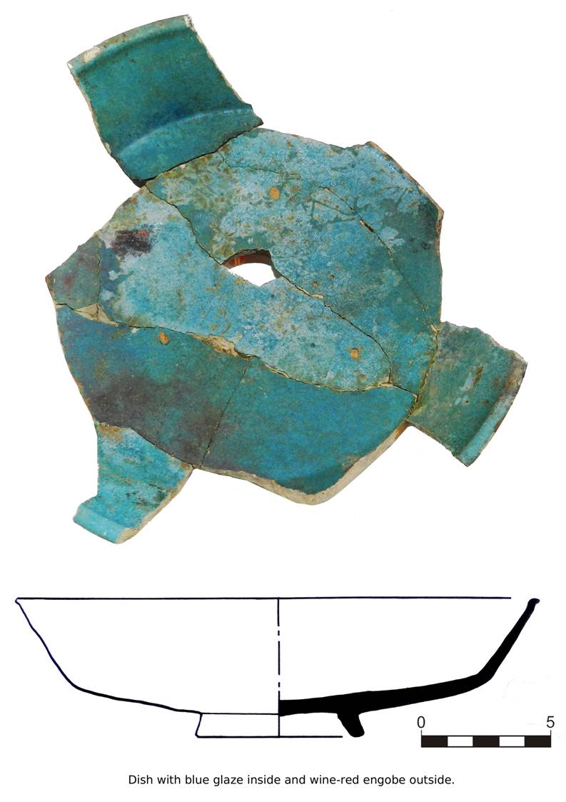
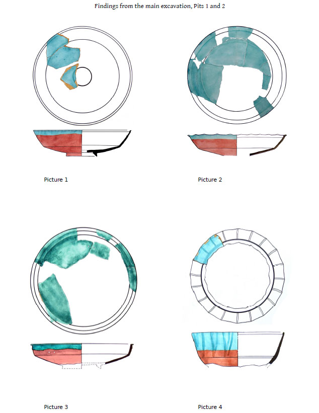
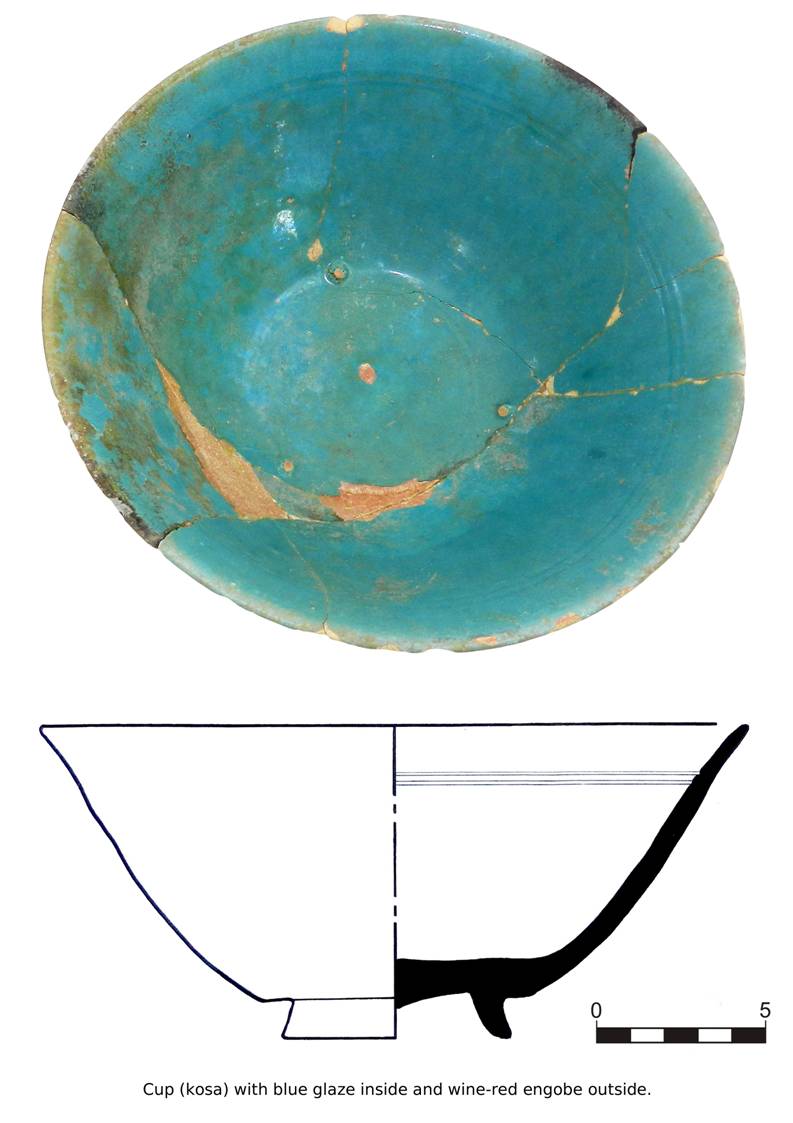
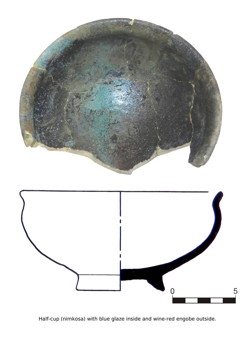
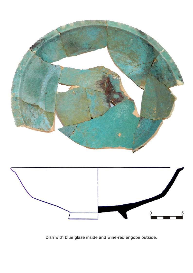
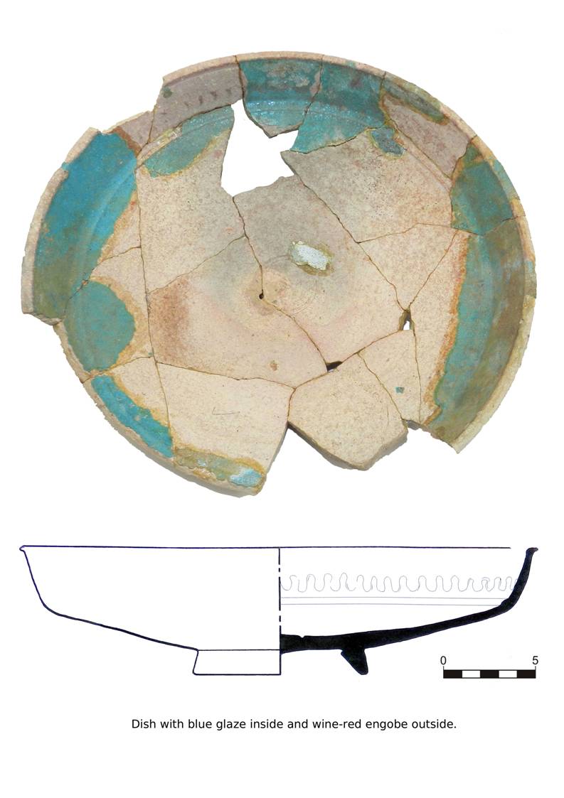
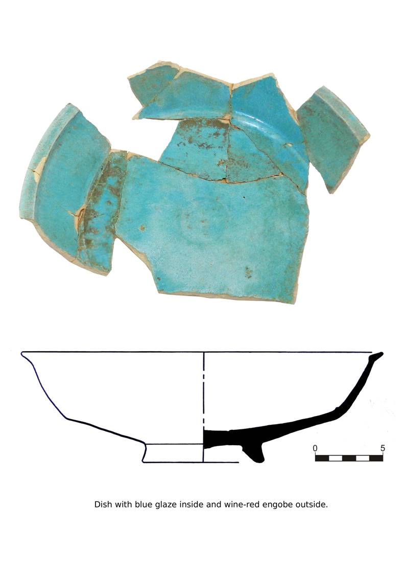
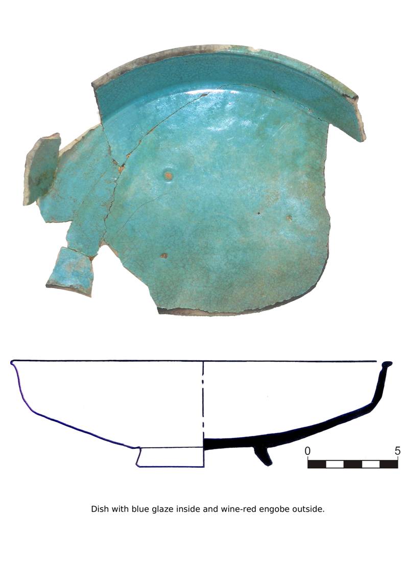
The glazed
pottery dating to the 12th century AD consists of a few fragments of
turquoise plates, a small fragment of a lamp and a fragment of a whitish plate
decorated with radial motif (Pls. 21-24). The pottery dating to the 18th-19th AD centuries includes a glazed greenish plate decorated with scratched stylized
motifs, a yellowish plate decorated with brownish ‘zangir’ motifs, a
glazed turquoise lamp, a small glazed yellowish plate and a pale brownish cup,
decorated with stylized motifs.
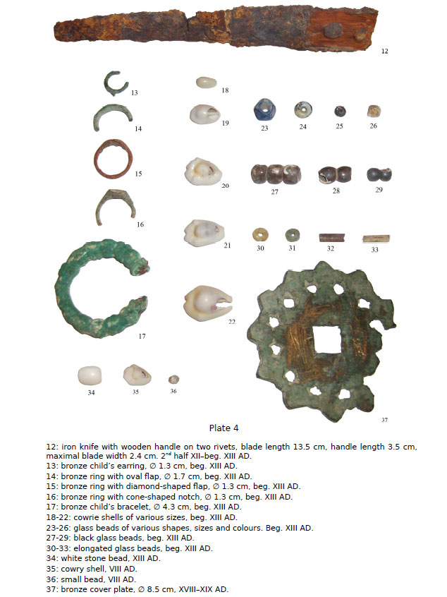
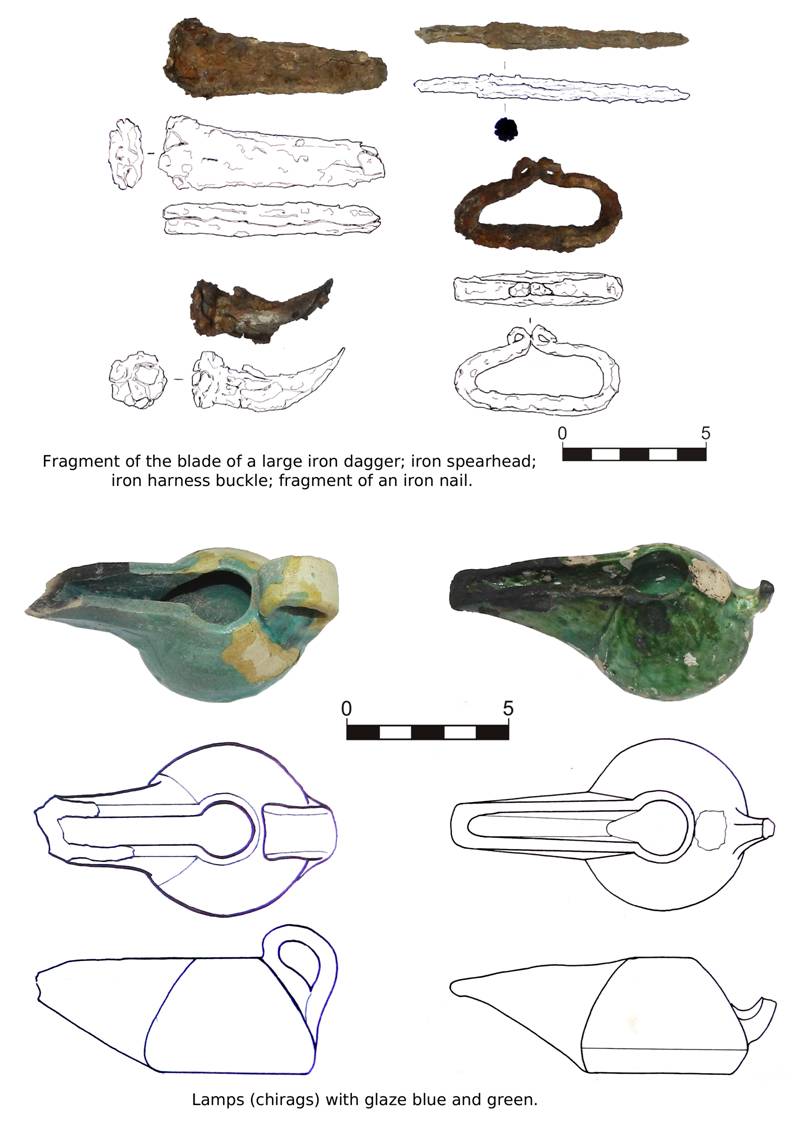
A conspicuous
assemblage of metal artefacts was found this year and it includes iron weapons,
bronze ornaments and a copper coin (Pls. 29-31). Among the weapons are a
sickle of uncertain dating (12th century?) and an arrowhead dated
to the beginning of the 8th century AD. A copper coin pertaining to
the ‘Asbar series’ was discovered in room 7 under the layers formed following
the abandonment of the site and it is of great importance for dating the
structures. Slightly scyphate, on the obverse it is still discernible the
portrait of the king, unusually facing left, while on the reverse it is
represented a stylized fire altar on the Bukharan tamgha. The
Sogdian legend usually present on these coins identifies the king as Asbar, probably a local Bukharan ruler whose kingdom has
not been recognized yet. These coins were often used in the Bukhara oasis as
small change for the silver Bukhar-Khudah drachmas and they are probably dated
to the 6th-first half of the 7th centuries AD.
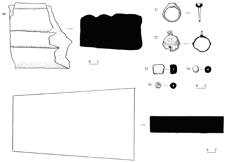
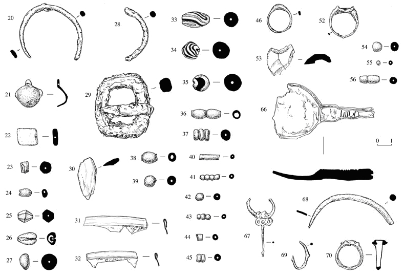
The set of
unearthed bronze ornaments is very varied and includes several rings (signet
rings or with gemstone insets), bracelets and bells (Pls. 29-31). The
dating of these artefacts is controversial and complicated by the recurrence of
the forms and the decorations through the centuries. However, after comparing
the artefacts with those from Penjikent,
we can suggest a probable dating of some finds. The decorated bracelet (inv.
77) could be dated to the end of the 7th century, the circular
earrings (inv. 115-116) to the first half of the 8th century,
while the earring decorated with a rolled surface (inv. 163) is probable
dated to the end of the 8th century. The bells (inv.
61, 69, 71, 79) are very similar to the ones found at Penjikent and are
dated to the end of the 7th - 8th centuries AD. For the
remaining bronze artefacts we do not have comparative material available and
therefore our suggested dating is based considering the dates of other dated
finds found in the same stratigraphic contexts (8th century or 12th century AD). Similarly, glass past beads and cowry shells, probably employed as
ornaments in bracelets, necklaces or to adorn female dresses (Pl.
32), are dated in the same manner with uncertainty.
The bone
artefacts unearthed this year, three in total, consist of a round button
decorated with circular stamped motifs and two objects of unknown use, found in
separated contexts and probably dated to the 8th century AD (Pl.
33). The tubular object (inv. 135),
probably in ivory, is of significant interest. It is perforated in the central
part and the shape is troncoconical. The smoothed surface presents incised
parallel lines and probably this find is the central part of a larger object,
composed at least by three pieces, as suggested by the recesses on the edges.
Among the glass
finds, we wish to mention some fragments of green pots and the rim of a pale
blue cup, probably dated to the 12th century AD (Pl.
34). It is also worth mentioning the discovery of several fragments of
glasses used in stained glass windows and dating to the 12th century as well. In the Medieval period, the
stained glasses were often used especially in religious buildings. They were
made by circular glasses hold together by strips of gypsum. In the wealthiest
buildings, each glass could differ in colour from the others, while the glasses
found in Vardanze are all green, slightly different only in the hue.
The last category
of artefacts consists of two chalcedony finds: a broken signet ring with oval
flap (8th century AD?) and a seal dating to the Sasanian period, which is being
studied separately.
Conservation activities
Partial back-filling of
the excavated trenches
The Uzbek rules
on the conservation of archaeological sites require the partial back-filling of
the excavated trenches at the end of every campaign of excavation. In the 2012
fieldwork this activity was carried out on the last day of the excavations,
using the soil coming from the spoil heaps located near the trenches.
Particular attention was given to the top of the walls and to the floors, which
were protected with 10-20 cm of soil (Fig. 26).
Metal finds
The significant
amount of bronze and iron artefacts found during this field season has
requested the services of a specialized conservator who cleaned the artefacts
from the rust and recomposed the broken finds. His work allowed to reveal the
details of each object, as it has been the case of the previously unreadable
Asbar coin (Fig. 25).
Diagnostic survey
An accurate
visual analysis of the external walls of the citadel was carried out in order
to register the current deterioration patterns of the masonry. The
monitoring of the structures needs to be carried out every year and it could
represent a helpful activity for conservation purposes. We have recorded the
main signs of deterioration found on the walls of the citadel. These can be
summarized as follows (Figg. 27-28):
Erosion:
the surface of the walls manifests a general erosion, mainly due to the
rainwater washing. The original top is missing in most walls or it has been
transformed in a hard crust of amorphous clay. This fact has caused in some
cases the loss of the original vertical profile of the walls. On the southern
wall and in the central part of the northern wall the erosion interests in
particular the top, as testified by the marked sloping of the top surface into
the sides. On the remaining walls, the erosion is evident especially at the
base, characterized by frequent coving (undercutting). Missing mudbricks and
exposed brickwork are commonplace as well. Accumulations of debris all around
the citadel demonstrates the progressive deterioration of the architectural
structures.
Water channels:
several vertical cracks (gullies) due to the rain flow are present in
particular on the eastern and northern walls. We suggest that in origin some of
them could have been architectural elements of the wall surface (flutings?),
especially the deepest channels (0.20 m wide and 1 m deep).
Collapse of
architectural structures: the erosion produced
by weathering contributes to the progressive weakening and to the consequent
structural failure of the architectural structures, as it has happened in the
south-western corner of the citadel, where a consistent portion of wall has
collapsed recently. The masonry on the north-western corner of the citadel is
completely exposed as well and the architectural components well visible.
Animal, insects and
human damage: Many holes of small and large
dimensions (10-30 cm wide), caused by insects and birds, are widespread
particularly on the eastern, northern and western walls. Artificial damage has
been recognised as well and it is mainly due to habits of the local visitors.
They often prefer to climb the citadel walking through a wide water channel
located in the south-eastern corner, rather than use the stepped access,
aggravating the erosion of the structures.
Conclusions
The
2012 archaeological investigations at the citadel of Vardanze (ancient
Vardāna) exposed a vast dwelling area, probably part of the last residence
of the Vardān Khudah. The area, divided into two sectors by a T-shaped
system of corridors, is delimited on the north by two monumental walls, the
external and thicker one forming the proper fortification. Seven rooms of
different dimensions were unearthed along the internal monumental wall. Their
functional interpretation, still unclear, suggest their use as service units of
the palace rather than as royal quarters. The
architectural structures date to the 6th–8th centuries
AD, a date produced from the analysis of the building techniques employed as
well as the ceramic and numismatic artefacts found. This
long occupation is characterized by at least two building phases, as demonstrated
by the traces of reconstruction that changed only slightly the initial layout
probably at the beginning of the 8th century AD. The rooms are built
on top of a previous architectural phase,
probably dated to the 4th-5th centuries AD, and are separated from it by an interlayer of fluvial pebbles and
sand 3 m thick. It means that the buildings of the Early Medieval phase were
not constructed modifying the pre-existent structures, as it happened in other
centres of the Bukhara oasis. The leading authority, probably identifiable with Vardān Khudah, preferred to follow another building plan consisting in the intentional
burying of the ancient buildings and elevating the new structures of the
citadel on top of them.
The
archaeological data points to an interruption of the inhabitation in the
citadel between the 9th and the 11th century AD. During
that time the citadel was frequented only sporadically. The effective
occupation resumed only in the 12th century AD, as testified by the
re-arrangement of some rooms previously abandoned and the re-conversion of
specific areas, now used for functional purposes (storage areas, baths,
toilets, rubbish dumps). It is probable that this occupational phase lasted
until the 13th century; thereafter the citadel was used only
sporadically as graveyard until recent times.
In conclusion,
we suggest that the development of Vardāna in the Early Medieval period is
in line with the events occurred in the Bukhara oasis, characterized at that
time by a widespread building activity.
From the 5th century AD onward, in fact, we assist at the foundation
of new towns and at the re-organization of the ancient castles, implementing
the defensive systems and sometimes transforming the nearby villages into
proper cities (shahristan). The archaeological results confirm both the
antiquity of Vardāna and the persistence of its importance throughout the
centuries, at least until the 8th century AD. This dating is
supported by the Medieval chronicles, among those stands
out the ‘Tarikh-i Bukhara’ (tr. ‘The history of Bukhara’), compiled by
Naršakhī.
According to the local historian, in the Early Medieval period Vardāna was
the capital of the small Obavija principate, led by the Vardān
Khudāh. Such was the prestige that one of its sovereigns is mentioned as
an opponent of the Bukhār Khudāh, even
usurping his throne for a short time. Naršakhī informs us also of
the prolonged resistance of the last ruler of Vardāna after the conquest
of the region by the Arabs, in year 709 AD. This last fact would explain the
occupation of the citadel until the 8th century AD, as well as the
abandonment occurred in the same century.
The local
ceramic tradition seems to confirm that this was a frontier settlement. Here
the classic Sogdian style coexists with a foreign influence identifiable as the
Kaunchi culture style. The foreign influences are mostly evident in the pottery
of the 6th-7th centuries AD, but they have been detected
also in vessels produced in the following centuries. The commercial vocation
attributed to this place by the Medieval chronicles may
explain the peculiar nature of the local pottery, which mixes different
cultural styles, suggesting that the inhabitants of Vardāna often hosted
foreign visitors, and these were not always hostile and instead they were often
commercial partners.
Bibliography
BARTHOLD,
W. (1968), Turkestan down to the Mongol invasion, London.
BELENITSKI,
A. M., MARŠAK., B. I, RASPOPOVA, V. I (1981), ‘Sogdiiskii gorod v nachale
Srednix vekov’, Sovetskaja Archeologija, 2, pp. 94-109.
BELENITSKI,
A. M., BENTOVIČ, I. B., BOL’ŠAKOV, O. G. (1973), Srednevekovyj gorodov
Srednej Azii, Leningrad.
BRYKINA,
G. A. (ed.) (1999), Srednjaja Azija i Dal’nyi Vostok v epochu srednevekov’ja,
Moskva.
DAVIDOVICH,
E. A. (1953), ‘Svetnoe akonnoe steklo XV v iz Samarkanda’, Trudi
Sredneasiatskogo Gasudarstvennogo Universiteta (Archeologija Srednie Azii),
Novaya seriya, vip. XLIX, Gumanitarnie Nauki, 6, Tashkent, pp. 143-160.
FILANOVIČ,
M.I. (1983), Kul’tura drevnebukarskogo oazisa III-VI vv. N. E., Tashkent.
FODDE,
E., WATANABE, K., FUJII, Y. (2007), ‘Preservation of Earthen Sites in Remote Areas: the Buddhist Monastery
of Ajina Tepa, Tajikistan’, Tim Williams (ed.), Conservation and
Management of Archaeological Sites, vol. 9 n. 4, London, pp. 194-218.
FRYE, R. N. (1954), The History of Bukhara,
Translated from a Persian Abridgment of the Arabic Original by Narshakhī,
Cambridge (Mass.)
GRENET, F. (1996), 'Crise et sortie de crise en
Bactriane-Sogdiane aux IV-V siecle: de l'heritage antique a l'adoption de
modeles sassanides', Convegno internazionale sul tema: La Persia e l'Asia
Centrale da Alessandro al X secolo, Roma, pp. 367-390.
ISAKOV,
A. I (1977), Citadel drevenego Penjikenta, Dushambe.
LEVINA,
L. M. (1971), Keramika Nizhnei i srednei Syrdar’i, v I tys. n. e.,
Moskva.
LO
MUZIO, C. (2009), ‘Note archeologiche sull’oasi di Bukhara’, C. Silvi Antonini,
Dj. K. Mirzaachmedov (eds.), Gli Scavi di Uch Kulakh (Oasi di Bukhara),
Rapporto Preliminare, 1997-2007, Pisa-Roma, pp. 17-40.
MUKHAMEJANOV,
A.R., ADYLOV, SH., MIRZAAHMEDOV, J.K., SEMENOV, G.L. (1988), Gorodishe
Paykend, k probleme izuchenia Srednevekovogo goroda Sredni Azii, Tashkent.
MUKHAMEJANOV,
A. R., MIRZAACHMEDOV, J. K., ADYLOV, S. (1983), ‘Keramika nižnich sloev
Bukhary’, IMKU, 17, Tashkent, pp. 81-97.
NIL’SEN,
V. A. (1966), Stanovlenie feodal’noj architektury Srednej Azii (V-VIII vv.),
Tashkent.
RASPOPOVA, V. I (1980), Metalliceskie
izdelia rannesrednevekovogo Sogda, Leningrad.
RASPOPOVA, V. I. (1999), Metalliceskie
isdelia iz Pendjikenta, S. Peterbug.
RASPOPOVA, V. I., ŠIŠKINA, G.V. (1999),
‘Sogd’, G. A. Brykina (ed.), Srednjaja Azija i Dal’nyi Vostok v epochu
srednevekov’ja, Moskva, pp. 50-77.
SAVCHENKO, A. (2010), Excavation
at Vardanze (Wardana), Excavation Report, August-September 2009. Available
at http://www.exploration-eurasia.com/EurAsia/inhalt_english/frameset_projekt_0.html
SAVCHENKO, A. (2011), Citadel
of Wardana (Vardanze-tepa), Excavations Report, July-August 2010. Available
at http://www.exploration-eurasia.com/EurAsia/inhalt_english/frameset_projekt_0.html
SAVCHENKO,
A. (2012), Citadel of Wardana (Vardanze-tepa), Excavations Report, Autumn
2011. Available at http://www.exploration-eurasia.com/EurAsia/inhalt_english/frameset_projekt_0.html
SEMENOV,
G. L., MIRZAAHMEDOV, D. K. (2005), Raskopki v Paykende v 2004 g., Material’i
Bukharskoi Archeologhiceskoi Expedizii (MBAE), v. VI, Sankt-Peterburg.
SEMENOV,
G. L., MIRZAAHMEDOV, D. K. (2006), Otchot o raskopkax v Paykende v 2005 g., Material’i Bukharskoi Archeologhiceskoi Expedizii (MBAE), v. VII,
Sankt-Peterburg.
SEMENOV,
G. L., MIRZAAHMEDOV, D. K. (2007), Otchot o raskopkax v Paykende v 2006 g., Material’i Bukharskoi Archeologhiceskoi Expedizii (MBAE), v. VIII,
Sankt-Peterburg.
SILVI
ANTONINI et al. (2010), ‘Gli scavi di Uch Kulakh (Uzbekistan). Campagne
2008-2009’, F. Serra (ed.), Rivista degli Studi Orientali, vol. LXXXII,
2009, Pisa-Roma, pp. 59-95.
SILVI
ANTONINI, C. (2009), ‘La ceramica e altri reperti’, C. Silvi Antonini, Dj. K.
Mirzaachmedov (eds.), Gli Scavi di Uch Kulakh (Oasi di Bukhara), Rapporto
preliminare, 1997-2007, Pisa-Roma, pp.137-164.
TORGOEV,
A. I, MIRZAAHMEDOV, D. K. (2011), Otchot o raskopkax v Paykende v 2009-2010
g., Material’i Bukharskoi Archeologhiceskoi Expedizii (MBAE), v. XI,
Sankt-Peterburg.
ZEJMAL’,
E.V. (1994), ‘The circulation of coins in Central Asia during the Early
Medieval period’, B. A. Litvinskii, C. Altman Bromberg (eds.), Bulletin of
Asia Institute, ‘The Archaeology & Art of Central Asia, Studies from the
Former Soviet Union’, vol. 8, pp. 254-267.
Figures
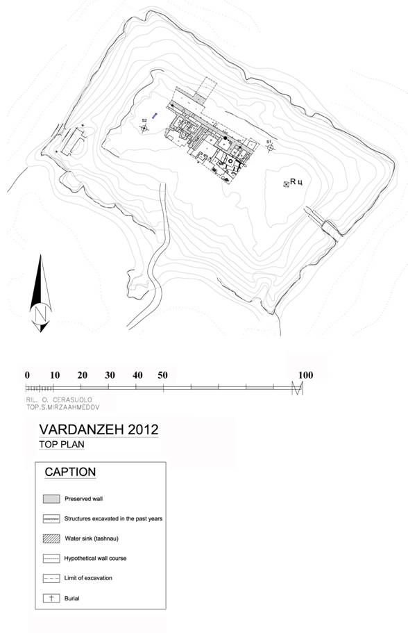
Fig. 1 Plan
of the citadel of Vardanze.
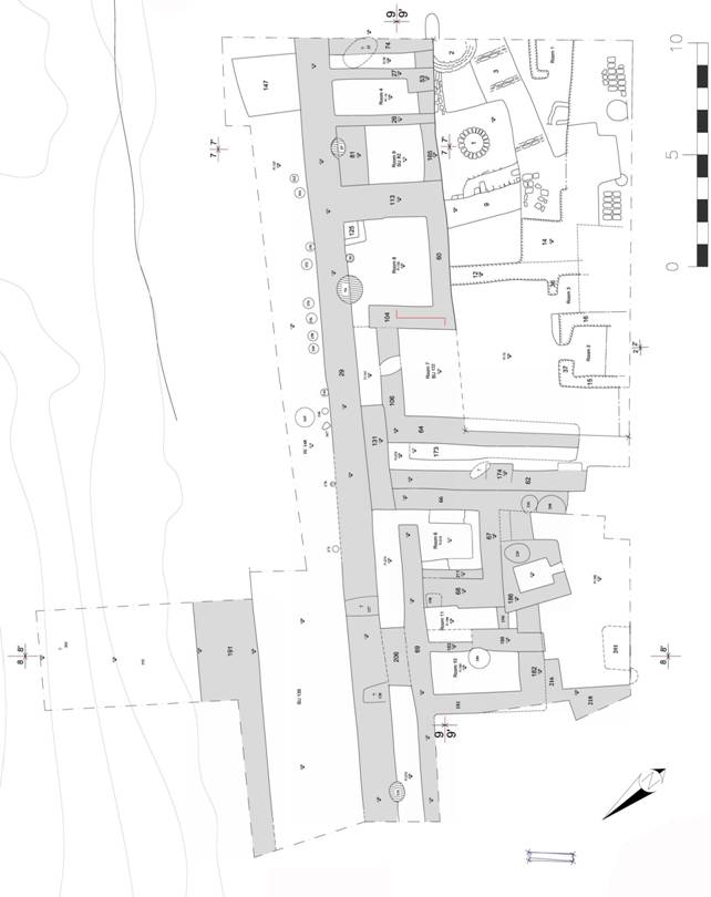
Fig. 2 Vardanze
citadel, plan of the 2012 excavation.
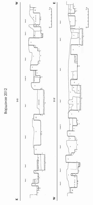
Fig.
3 Sections
East-West 9-9 and 91-91. (26) mudbrick wall; (27)
mudbrick wall; (29) mudbrick wall; (49) cut for pit hole used for water sink;
(53) mudbrick structure; (60) mudbrick wall; (61) filling of soil; (62)
mudbrick wall; (64) mudbrick wall; (66) mudbrick wall; (67) mudbrick wall; (68)
mudbrick wall; (69) mudbrick wall (74) mudbrick wall; (76) trodden floor; (79)
layer of soil; (81) mudbrick wall; (82) layer of pebble and sand; (94) cut of
pit hole used for water sink; (106) mudbrick wall; (113) mudbrick wall; (122)
layer of pebble and sand; (123-124) layer of compact clay, used as foundation
of walls 104-106; (125) rectangular mudbrick structure; (130) trodden floor;
(147) mudbrick structure; (165) mudbrick wall; (173) bench; (174) mudbrick
partition wall; (175) bench; (181) mudbrick wall; (182) mudbrick wall; (183) mudbrick
wall; (193) layer of soil; (194) trodden floor; (196) layer of pebbles; (197)
layer compact soil; (204) mudbrick wall; (211) mudbrick wall (2nd phase of wall 68); (212) trodden floor; (215) trodden floor; (217) layer of
compact clay, used as foundation of wall 64.

Fig.
4 Sections
North-South 8-8 and 81-81. (29) mudbrick wall; (69)
mudbrick wall; (135) filling; (180) cut of pit hole; (181) mudbrick wall; (183)
partition mudbrick wall; (182) mudbrick wall; (185) trodden floor; (186)
furnace (188) mudbrick wall; (191)mudbrick monumental wall; (192) layer
containing adobe rows; (193) layer of soil; (194) trodden floor; (201) cut of
pit hole; (206) mudbrick wall plug; (213) trodden floor; (216) mudbrick wall;
(218) mudbrick wall.
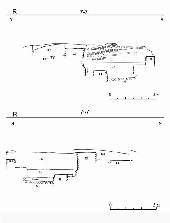
Fig.
5 Sections
North-South 7-7 and 71-71. (26) Mudbrick wall; (29)
Mudbrick wall; (79) layer of soil; (81) mudbrick wall; (82) layer of pebble and
sand; (113) mudbrick wall; (137) trodden floor; (147) mudbrick structure; (148)
layer containing aligned mudbricks; (165) mudbrick wall.
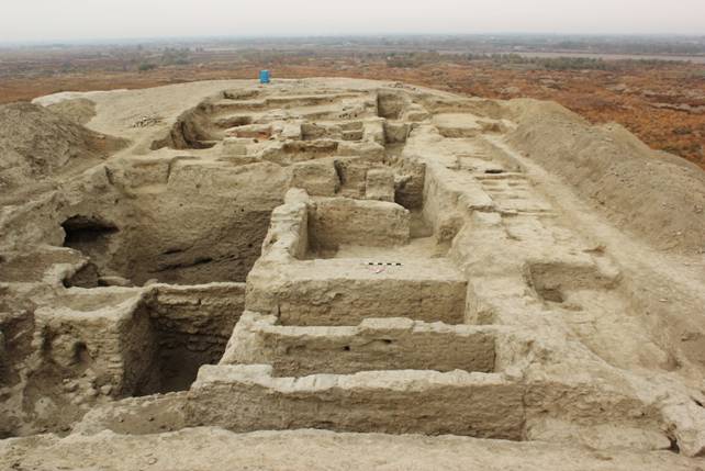
Fig. 6 General view of the excavation (view from east side).
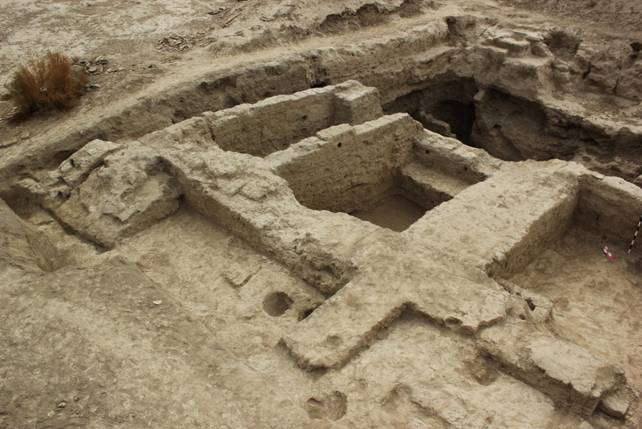
Fig.
7 From left to right:
rooms 4, 9 and 8, delimited on the northern side by wall 29 (view from the north-western
side).
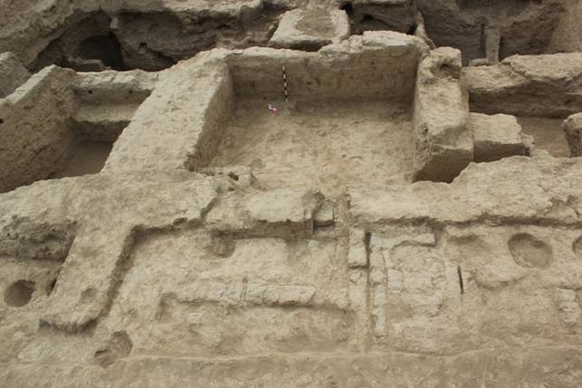
Fig.
8 Room 8, delimited on its northern side by wall 29. In the foreground there are
the remaining of aligned mudbricks layers, cut by 12th century pit
holes (view from the northern side).
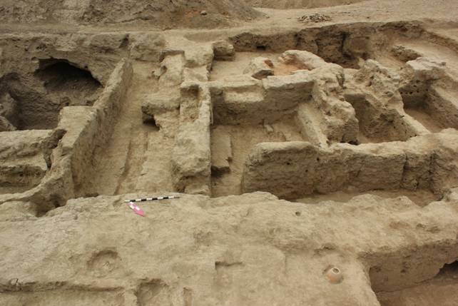
Fig. 9 General view of the NS corridor and of the western
sector of the palace (view from the northern side).
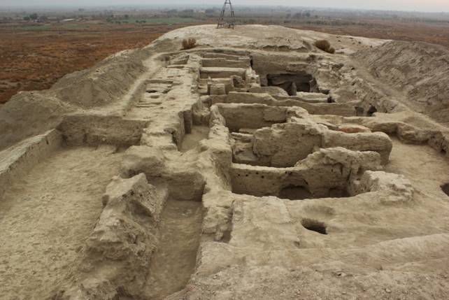
Fig.
10 General view of the excavation. From left to right: the perimeter fence wall
191, wall 29 and the internal corridor (view from the western side).
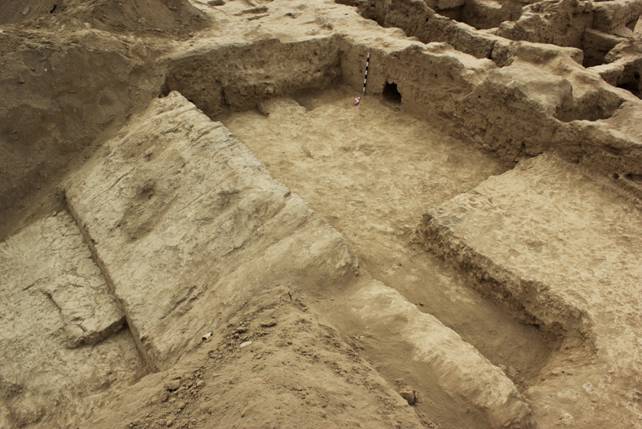
Fig. 11 Monumental walls 191 and 29 (view from the north-western
side).
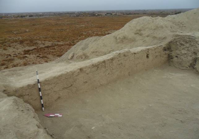
Fig. 12 Monumental wall 191 (view from the south-western
side)
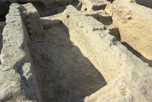
Fig. 13 Room 4 (view from the northern side)
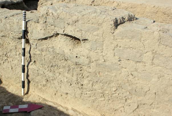
Fig. 14 Room 4: wall 26, particular of ‘combined’
brickwork.
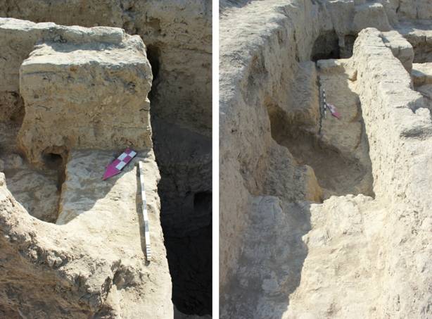
Fig.
15 Room
4: wall 165, under structure 153 (view from the west side); on the right: wall
74, under the eastern limit of the excavation (view from the northern side).
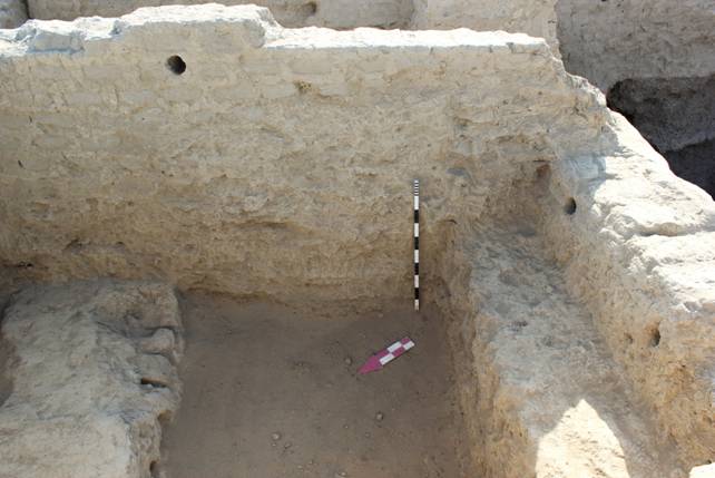
Fig. 16 Room 9, wall 26 (view from the western side).
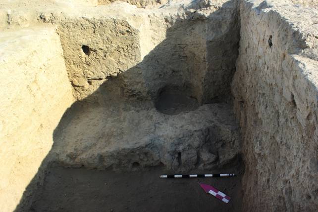
Fig.
17 Room 9: wall 29 cut by the circular pit hole used for the canalization system
(tashnau); wall 81 is in the foreground (view from the southern sid
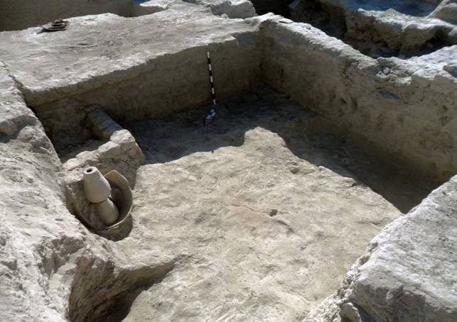
Fig. 18 Room 8: drain SU 89 (view from the north-western
side).
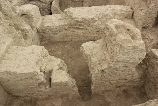
Fig. 19 Room 7 and part of the EW
corridor (view from the northern side).
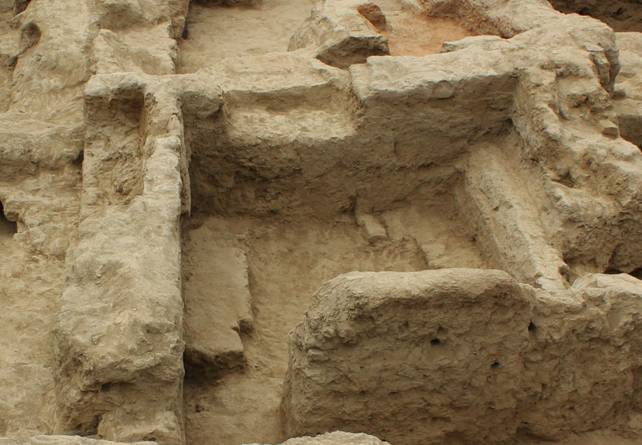
Fig. 20 Room 4 (view from the northern side).
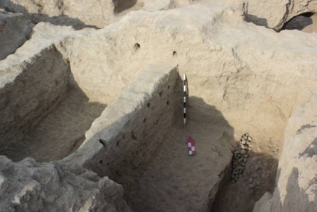
Fig.
21 Rooms 10 and 11. On the right side it is visible the layer of pebbles found
under floor 194 (view from the southern side).
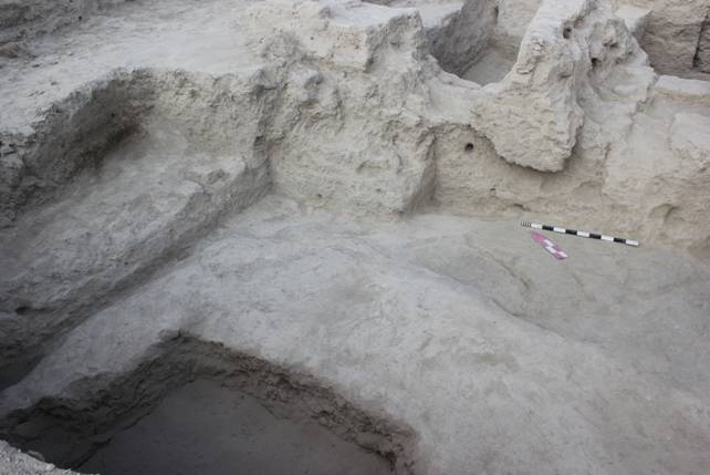
Fig.
22 Western sector, courtyard. Compacted floor SU 185 cut by the pit hole SU 201
(view from the southern side).
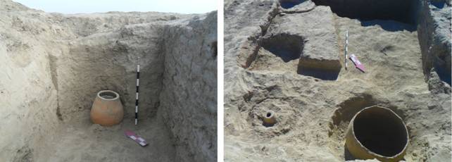
Fig. 23 From left to right: room 9, drain SU 48; room 8, drains
SU 89 and SU 95.
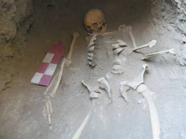 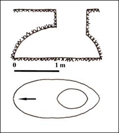
Fig. 24 Grave SU 32, in the eastern part of the excavation.
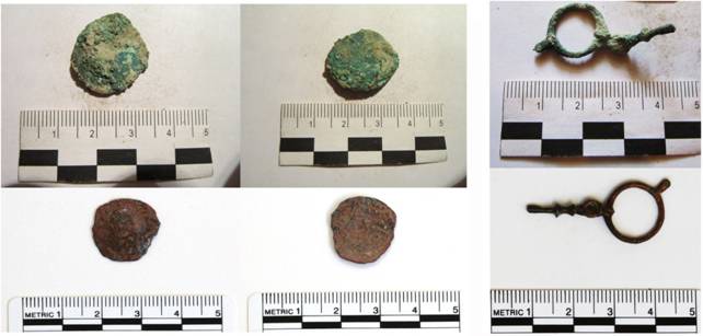
Fig.
25 Asbar copper coin (inv. n° 60) and bronze earring (inv. n° 116) before and
after conservation.
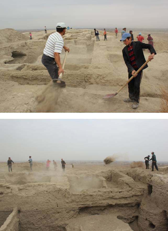
Fig. 26 Partial back-filling of the excavated trenches at
the end of the excavation.
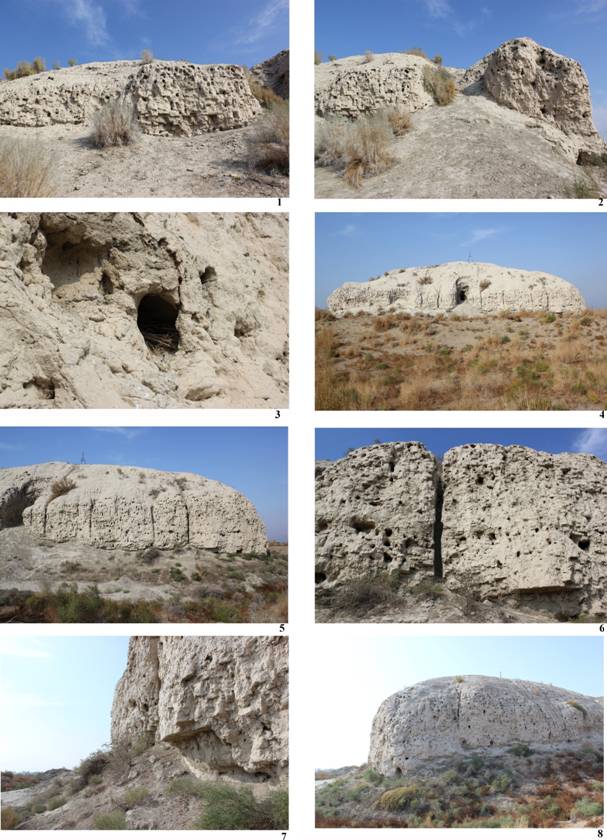
Fig.
27 Left to right, top to
bottom: (1)
Southern wall: exposed mudbrick texture; (2) southern wall: erosion due to the passage
of local people; (3) eastern wall: particular of a bird nest; (4) eastern wall:
general view; (5) eastern wall: missing mudbricks; (6) eastern wall: particular
of the cracks; (7) eastern wall: erosion at the base of the structure (coving);
(8) northern wall: general view.
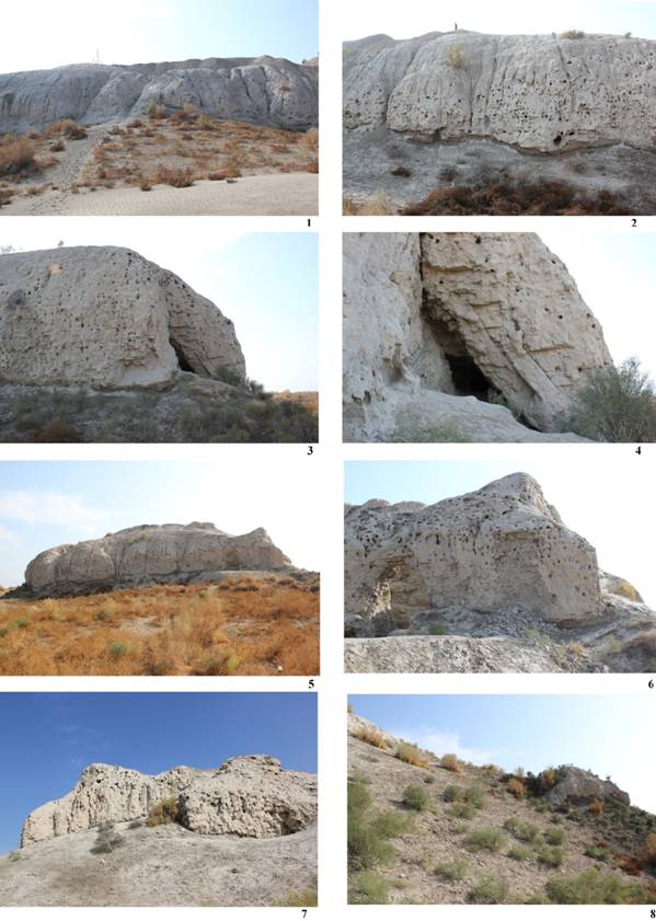
Fig.
28 Left
to right, top to bottom: (1) Northern wall: central sloping; (2) northern wall:
gullies, bird nests and missing brickwork at the base of the architectural
structure; (3) north-western corner: missing mudbricks and coving; (4) north
western corner: particular of the architectural components; (5) western wall:
general view; (6) south-western corner: collapse of the wall; (7) southern
wall: exposed brickwork; (8) entrance tower: erosion of the surface.
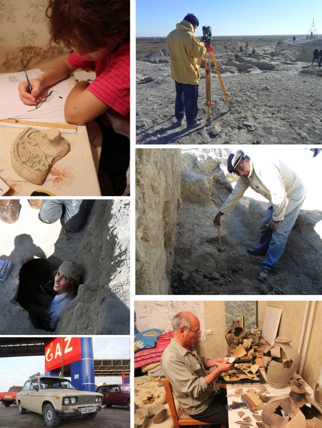
Fig. 29 Research staff at work.
Fig. 30 Team workers.
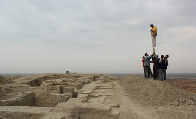
Fig. 31 Our topographer shooting the final pictures.
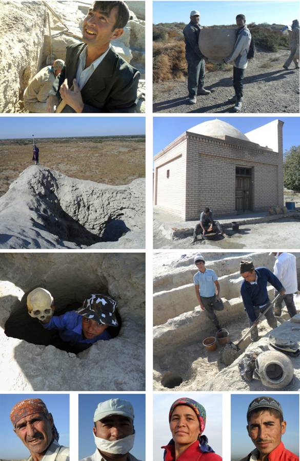
Fig. 32 Our
field assistants at work.
Plates
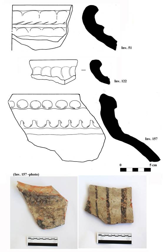
Plate
1 Fragments of moulded jars (khum) decorated with rows of finger marks and
black slip painted on the surface. (6th-7th centuries AD)
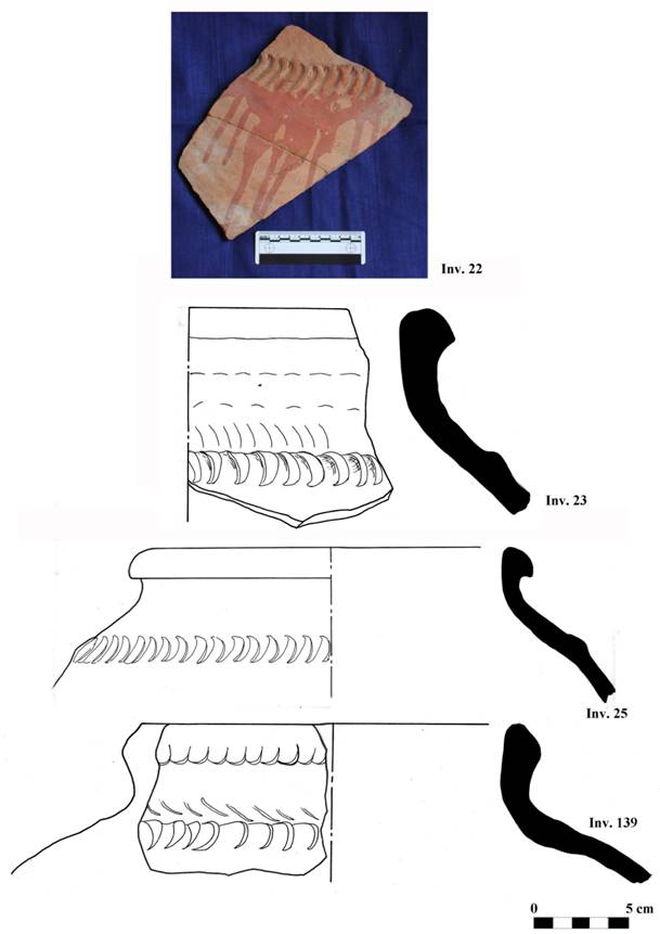
Plate 2 Fragments of moulded
jars (khum) decorated with finger marks impressions and elongated
motifs. The fragment 22 shows also decoration obtained with a red slip on the
shoulder. (7th- 8th centuries AD)
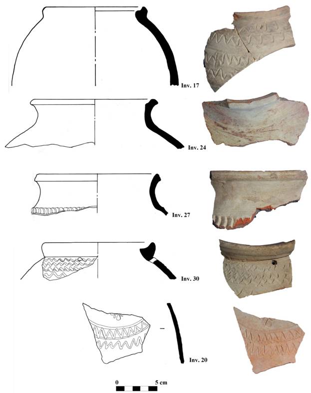
Plate 3 Fragments of small
jars (khum-cha). Typical decoration consisting of wavy lines (pointed or
rounded) incised on the shoulder. (7th-8th centuries AD)
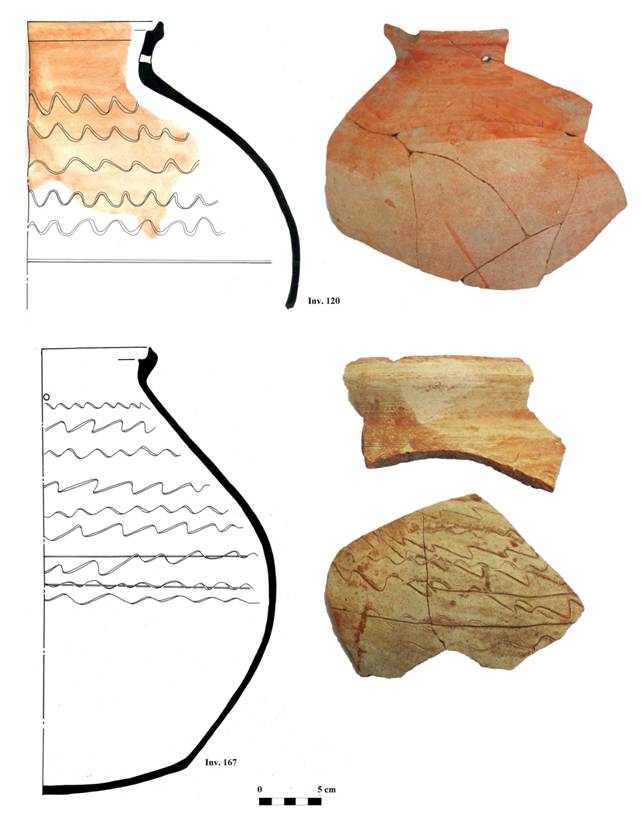
Plate 4 Fragments of small
jars (khum-cha). Typical decoration consisting of wavy lines (pointed or
rounded) incised on the shoulder and red slip on the surface. (7th-8th centuries AD)
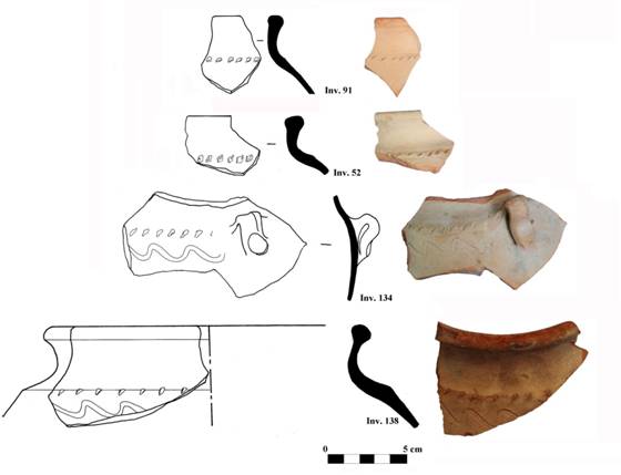
Plate 5 Fragments of small
jars (khum-cha). Typical decoration consisting in wavy lines and dotted
motifs incised on the shoulder. (7th-8th centuries AD)
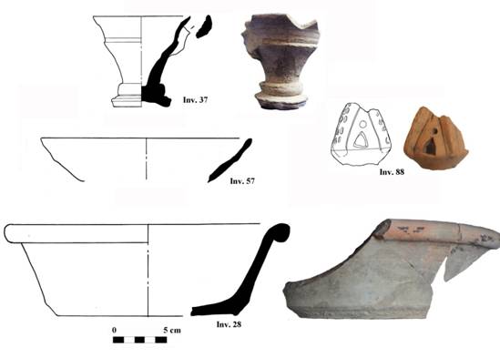
Plate 6 (37)Wheel-made
goblet; (57)fragment of wheel-made bowl; (88)fragment of unknown ceramic object
(handle?); (28) fragment of small basin (tagora) decorated with black
slip. (7th-8th centuries AD)
Plate
7 Fragments of wheel-made storage jus (7th-8th centuries
AD).
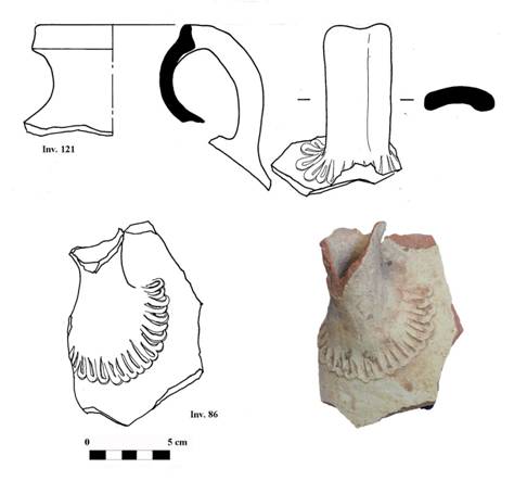
Plate
8 Fragments of decorated jug with spout, probably belonging to the same vessel (7th-8th centuries AD).
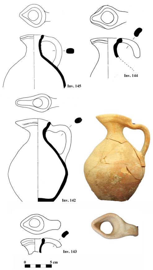
Plate 9 Fragments of oinochoe-like juglets. (7th-8th centuries AD)
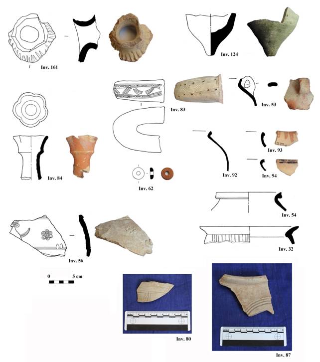
Plate 10 (161) Fragment of
decorated spout, belonging to a juglet; (124) bottom part of a mercury bowl (sim-op);
(84) fragment of flower-like spout, belonging to a juglet; (83) fragment of
decorated handle; (53) fragment of moulded handle; (62) ceramic spindle-whorl;
(92) rim of globular storage pot; (93) rim of small pot decorated with red
slip; (94) rim of small pot decorated with black slip; (56) fragment of jug
decorated with appliquéd motifs; (54-32) rims of cooking pots; (80) fragment of
small pot decorated with incised lines; (87) rim of a small jar. (12th century AD)
Plate 11 Fragments of cooking pots. (12th century AD)
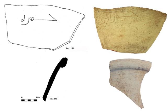
Plate 12 (151) Fragment of
wheel-made khum showing Arabic inscription; (165) fragment of basin (tagora).
(12th century AD)
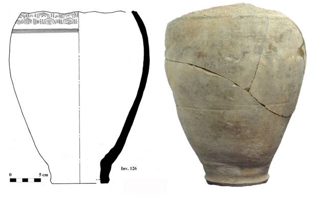
Plate 13 Egg-shaped khum,
found deposed upside down on the ground; it was used as drain (tashnau).
Geometric stamped motifs on the shoulder. (12th century AD)
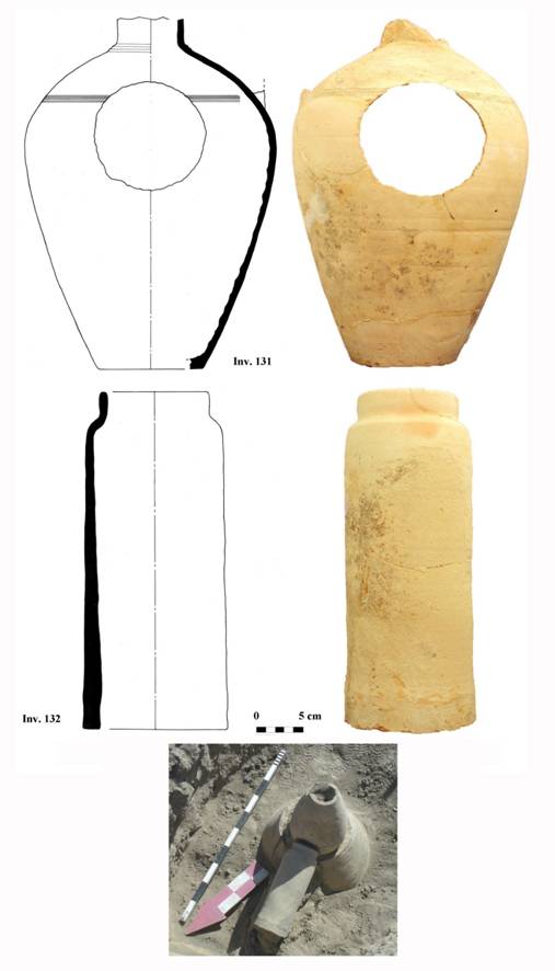
Plate
14 (131) Egg-shaped jug; (132) cylindrical tube (kubura), both used as drains
(tashnau). (12th century AD).
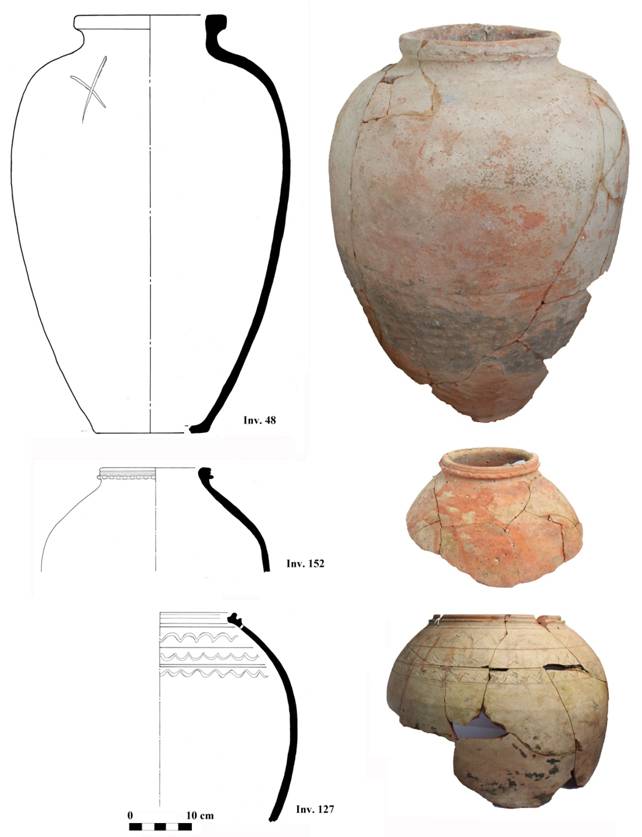
Plate
15 Big jars (khum) found upside down on the ground and used as drains (tashnau).
The jars 152-127 present traces of a red slip. (12th century AD)
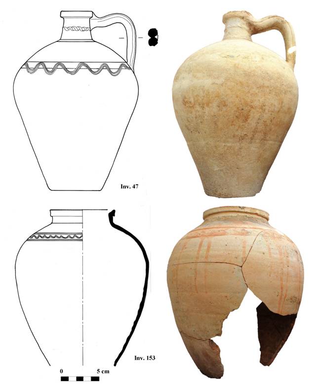
Plate
16 (47) Egg-shaped jug decorated with incised wavy lines and a string-like motif
on the neck; (153) egg-shaped jar (khum) decorated with incised wavy
lines and red slip. Both found upside down on the ground and used as drains (tashnau).
(12th century AD)
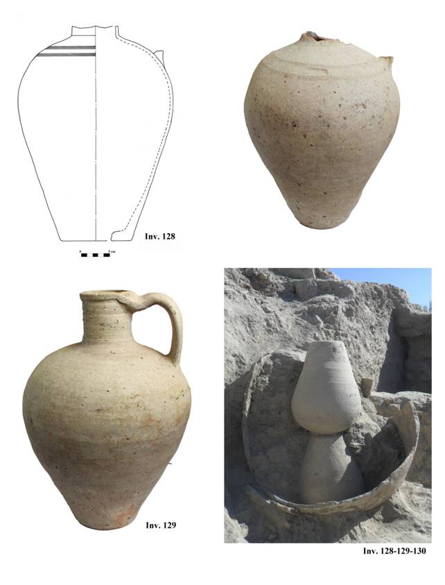
Pl.
17 (128-129) Egg-shaped jugs, used as drain; (130) large jar used as drain. (12th century AD)
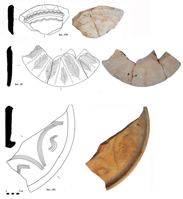
Plate 18 (150) Fragment of lid
decorated with incised wavy lines and finger marks impressions on the rim; (18)
fragment of lid decorated with tree-like motif; (156) fragment of lid decorated
with wavy lines forming semi-circular motifs. (12th century AD,
except for inv. 18, probably earlier)
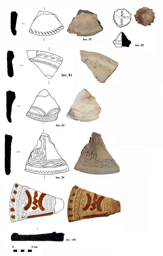
Plate
19 Fragments of lids and of a handle of a lid, all decorated with incised and
stamped motives. Fragment 158 also has a red slip decoration. (12th century AD).
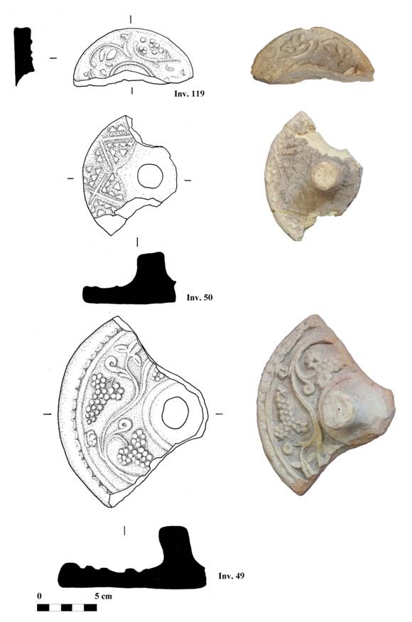
Plate 20 (119) Fragment of lid
decorated with stamped vegetal motifs; (50) fragment of lid decorated with
stamped geometric motifs; (49) fragment of lid decorated with stamped vegetal
motif (grape). (12th century AD)
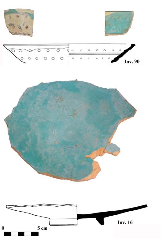
Plate
21 (90) Fragment of turquoise glazed bowl, decorated with dotted impressions on
the backside; (16) fragments of turquoise glazed plate, decorated with
concentric decoration in the central part. (12th century AD)
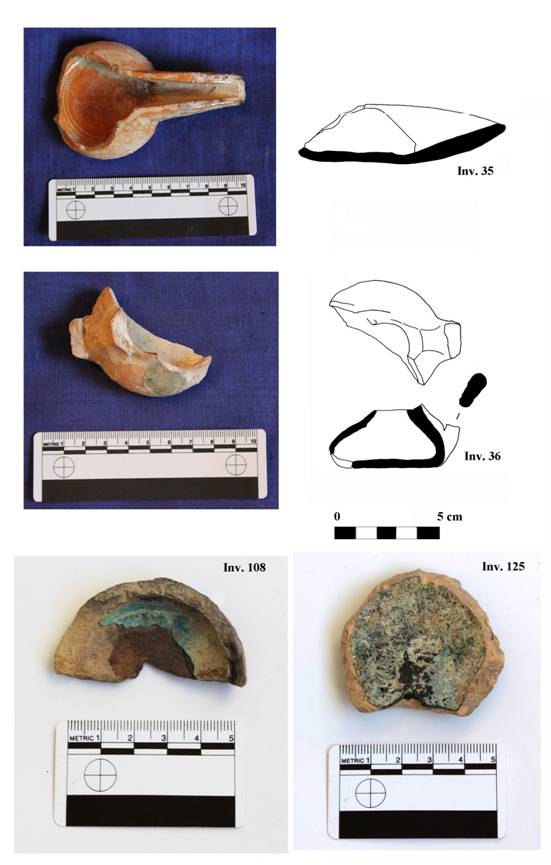
Plate
22 (35) Fragment of whitish glazed lamp (chirag) (10th century
AD); (36) fragment of greenish glazed lamp (9th-10th centuries AD); (108) fragment of turquoise glazed lamp (12th century
AD); (125) fragment of dark greenish glazed lamp (9th-10th centuries AD).
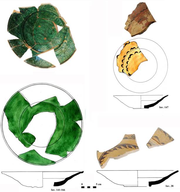
Plate
23 (141-166) Fragments of greenish glazed plate, decorated with scratched stylized
floral motifs (18th century AD); (147) fragment of a plate with
red-brownish slip and black ‘zangir’ motifs, without glazing (18th century AD); (38) fragments of yellowish glazed plate, decorated with ‘zangir’
and foiled motifs (18th century AD).
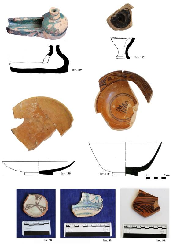
Plate
24 (149) Turquoise glazed lamp (chirag) (18th century AD); (162)
fragment of pipe (chilum), containing charcoal inside (19th century AD); 159) fragments of glazed plate ( (18th century AD);
(160) fragments of light-brownish glazed cup, decorated with stylized motifs
(18th century AD); (58) fragment of whitish glazed cup, decorated
with radial tree-foil motif (12th century AD); (89) fragment of
whitish glazed plate, decorated with turquoise radial motifs (13th-14th centuries AD); (148) fragment of brownish glazed plate, decorated with painted
‘zangir’ and net motifs. (18th century AD)
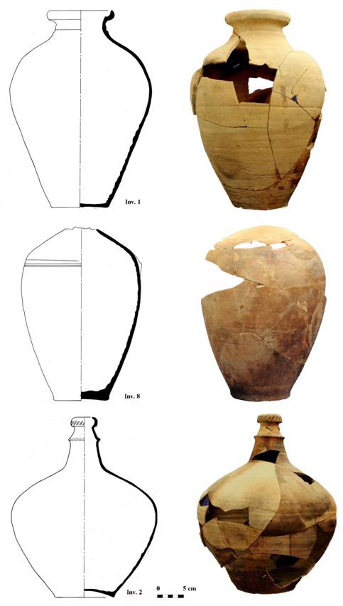
Plate
25 (1) Egg-shaped jar; (8) egg-shaped juglet, decorated with concentric lines
incised on the shoulder; (2) tear-shaped jug, decorated with cordon-like motif
on the neck. (12th-beg. 13th centuries AD)
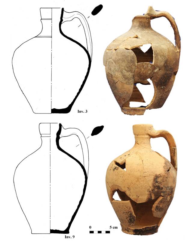
Plate
26 (3) Egg-shaped juglet, decorated with concentric lines incised under the neck
(9) egg-shaped juglet. (12th-beg. 13th centuries AD)
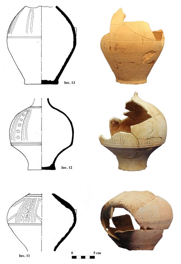
Plate
27 (13) Bottom part of an egg-shaped juglet, decorated with incised vertical motifs;
(12) small pot, decorated with incised vertical motifs and floral decorations;
(11) small pot, presenting vertical and oblique decorations. (12th-beg.
13th centuries AD)
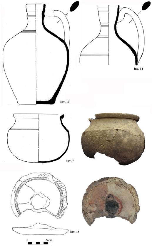
Plate
28 (10-14) egg-shaped juglet; (7) globular cooking pot; (15) fragment of moulded
lid, decorated with stamped and incised motifs. (12th-beg. 13th centuries AD).
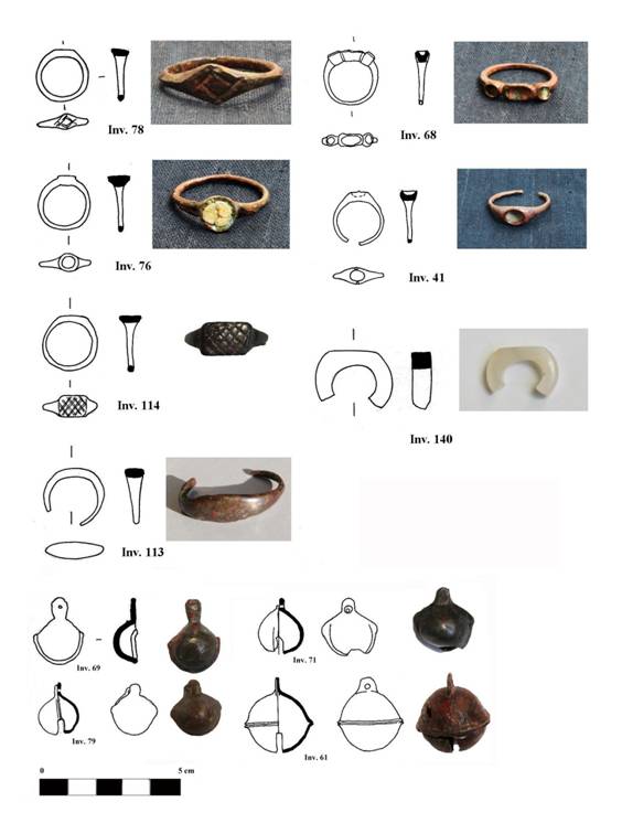
Plate
29 (78)
bronze signet ring with crossed marks on the rhomboidal flap (end of 7th-
beg. 8th centuries AD?); (68) bronze ring with three gemstone insets
(12th century?); (76) bronze ring with circular inset containing
glass past (8th century?); (41) bronze ring with oval gemstone inset
(12th century?); (114) bronze signet ring with rectangular flap
presenting crossed marks (first half of 8th century?); (113) bronze signet
ring (first half of 8th century AD?); (140) chalcedony ring (8th century?); (79) bronze bell (end of 7th – beg. of 8th centuries AD); (69, 71, 79, 61) bronze bells (8th century AD?).
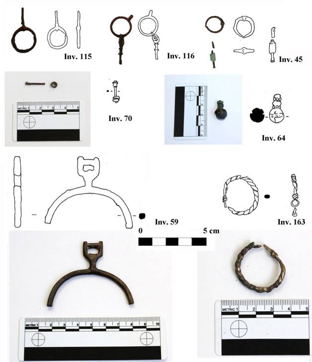
Plate 30 (115-116) bronze
earrings (first half of 8th century AD);(45) bronze earring (8th century?); (70) bronze earring (undated); (64) bronze pendant? (8th century AD?); (59) bronze ornament? (8th century AD?); (163) bronze
earring (end of 8th century AD).
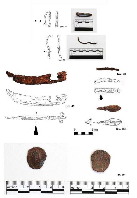
Plate
31 (77-39) Bronze bracelets (end of 7th- beg. 8th centuries
AD); (46) iron sickle (12th century AD?); (40) fragment of iron
knife? (undated); (154) iron arrowhead (beg. of 8th century AD);
(60) Asbar copper coin (first half 6th- beg. 7th centuries
AD).
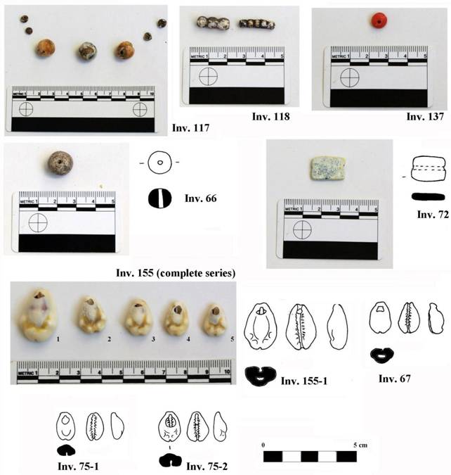
Plate 32 (117-118, 66, 72)
glass beads (8th century AD?); (137) coral bead (8th century
AD?); (155, 67, 75) cowry shells (8th century AD?).
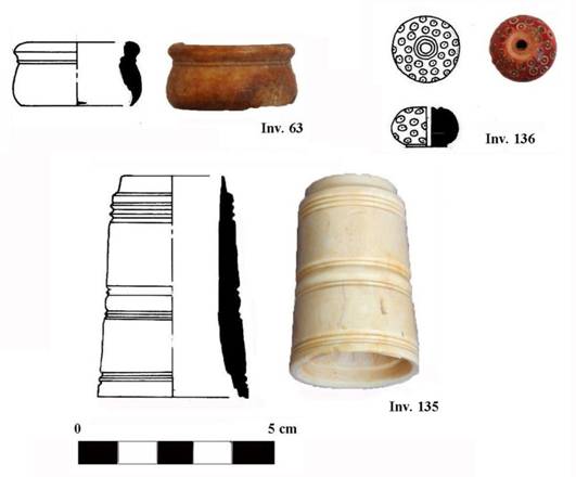
Plate
33 (63) bone artefact (unknown use) of pot-like shape, perforated inside (8th century AD?); (136) bone bead, decorated with impressed circular motifs (8th century AD?); (135) tubular artefact in ivory (unknown use), perforated in the
internal part (8th century AD?).
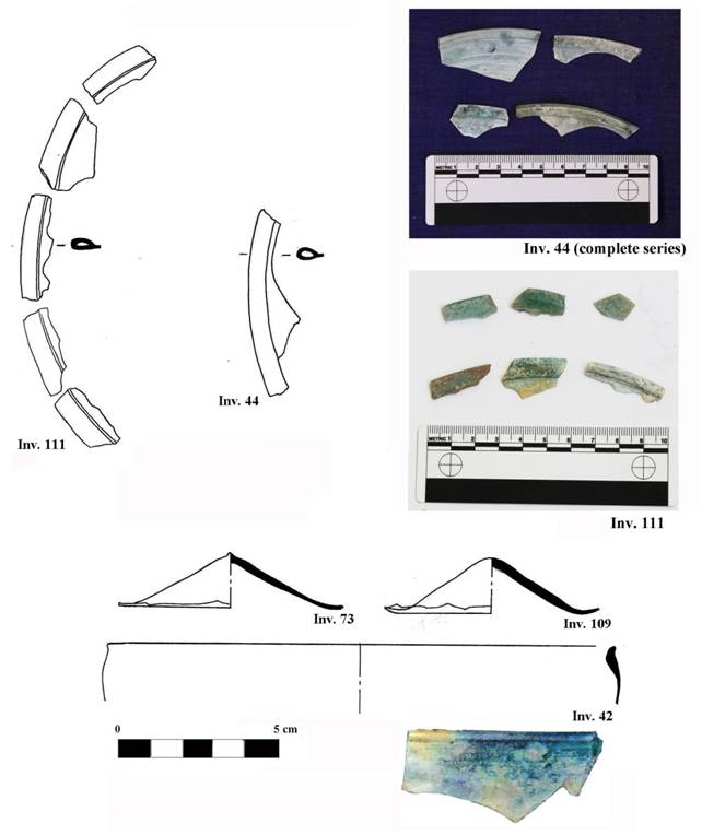
Plate 34 (111-44) Fragments of
pale greenish window glasses (12th century AD?); (73-109) bottom
part of glass pots, light turquoise (12th century AD?); (12) rim of
glass cup, bluish colour (12th century AD?).
Cf. Belenitski et alii 1981:
94-109; Muchamedjanov et alii 1988: 158-162.
Torgoev, Mirzaachmedov 2011: 28, fig. 95.
Zejmal’ 1994:
247, fig. 2.
Preliminary report
on the 2013 field work at Vardanzeh
This preliminary report aims at presenting the results of the fifth archaeological excavation on the site of Vardanzeh (ancient Vardāna). The activities, carried out between October, 7 and November, 12, 2013, were mainly focused on the citadel and have enlarged the excavated area on north, west and east sides, for a total surface of 466 m squared. A probing trench measuring 42 m squared was also laid in the lower city, starting the first archaeological investigation inside the perimeter walls of the shahristan. The research staff was composed of four archaeologists: Šukrat T. Adylov, Džamal K. Mirzaachmedov, Maxuma I. Niyazova and Silvia Pozzi. We employed 14 workers for the field work activities and a conservator for cleaning and restoring the metal artefacts. This year the architect Siroj Mirzaachmedov, in charge of the topography of the site, also realized detailed sections of the whole tepe. The architect Munira Sultanova drew a selection of artefacts, among them pottery, metal finds, glasses and ornaments in stone and shells.
Excavation
The new architectural structures and rooms that emerged during the field work contributed to define the layout of the early medieval palace located on top of the citadel. The corridor that encircles the northern side of the residential area (labelled ‘northern corridor’) and its delimiting walls were further excavated up to a length of 49 m, leading to the identification of the north-western corner of the palace. Except for a small passage that led southwards into a perpendicular corridor (labelled ‘western corridor’), the northern corridor was blind. The width of the western corridor, 3.80 m, is identical to that of the northern corridor. The excavation of the northern corridor down to the foundations cleared up that in the early medieval period the corridor was an empty space, without any passage leading into the dwelling area. During the late 8th century AD the palace was abandoned and the corridor was filled with several deposits of clay of different compaction, probably originated by the collapse of the adjacent walls. A different situation was detected as far as the western corridor is concerned, where two building phases, both dated to the early medieval period (5th-8th centuries AD), were identified.
The excavation led in the dwelling area (proper palace) was localized both to the east and to the west from the previously excavated trenches. In the west, the longitudinal corridor was further investigated, evidencing that it turned southwards. To the south from this corridor, two rooms (labelled ‘rooms 16 and 17’) were unearthed. The first one is a squared room with sufa, while the second, also characterized by sufa,is a transit area that led to the so-called ‘courtyard’ identified last year. Another room (labelled ‘room 23’) was found in the eastern area of the palace, to the south from wall 29. A thick deposit of fired clay containing ashes and charcoals was laid all over this room and yielded several fragments of pottery, dated to the 5th beginning of the 7th centuries AD. The complex of unearthed pottery was very rich and comprehended, among others, several sherds of khum, decorated pots, spindle whorls and a lid with zoomorphic handle. Some fragments of early medieval glass vessels and an iron arrowhead were also found in it. Interestingly, the rammed floor exposed beneath this deposit was characterized by three hollows filled with grey ashes. The largest one, of rectangular shape, measured 1.20x1.40 m and was encircled by a course of mudbricks. Some mudbricks were found on the lower level, together with several artefacts. Other two elongated hollows, east-west oriented, were found to the south and to the north from the rectangular hollow. At the present state of our research, the exact use of these features is difficult to assert. The assemblage of storage pottery and the traces of ashes could point to some activity associated with the preparation of food. On the other hand, the remarkable thickness of the fired deposit, found in a circumscribed space, as well as the still indecipherable hollows, do not exclude other interpretations. Room 9 was also further excavated in order to investigate the massive wall 81 identified last year and associated with a preceding building phase, probably dated to the 4th-5th centuries AD. The thick deposit of gravels and sand that separated the two building phases was further excavated, exposing wall 81 to a height of 2 m. A part some pockets of clay, the deposit was uniform in composition and did not contain any artefact. However, its removal revealed the presence on wall 81 of three aligned pockets, probably used to support wooden beams.
It seems most likely that the abandonment of the palace took place around mid or the late 8th century AD. Traces of a re-occupation of the citadel in the 10th century AD are attested in the south-western part of the excavated area, where a large dumping hole containing glazed and non-glazed pottery was found. This is the first statement of an occupation of the citadel during that period. A more documented and consistent occupation occurred in the 12th century AD. At that time the northern corridor, filled with the ruins of the delimiting walls, was partitioned in six contiguous rooms. Nearly all the rooms presented drainage systems (tashnau), cesspits (badrab) or pit holes. It appears likely that in the following centuries the whole area was definitely abandoned, becoming a favourite location for burials. Several graves were found all over the citadel and a marble gravestone still in situ represents an important spot of devotional activities by the local people. The archaeological investigation carried out in proximity of this gravestone, that is probably dated to the 16th century AD, revealed the presence of three burials containing wooden coffins, a typology which had never been recorded on the site until that time. As a rule, Muslim cemeteries in Bukhara oasis were erected around the tombs of religious personalities. Seen as the proximity of the burials to the gravestone, we would willingly infer they were intentionally realized close to the gravestone.
Besides the excavation led on top of the citadel, it is worthy to mention the investigations in the lower city (shahristan). A trench (labelled S-1) measuring 9.5x4 m was laid along the eastern perimeter wall of the lower city. Two contiguous rooms (labelled ‘northern and southern rooms’) which can be broadly dated to the beginning of the 20th century AD were unearthed under a superficial deposit of eolic sand. The removal of this occupational phase put in light some poor structures built on a thick deposit of pebbles and sand and dated to the end of the 19th -beginning of the 20th centuries AD. The western face of the perimeter wall was unearthed, its preserved height was about 1.80 m. The wall was highly damaged especially in the southern part, where the exposed masonry evidenced several missing mudbricks. The external face of this wall was exposed as well to a height of 1.70 m. The sloping wall, very eroded, was probably coated with superposed layers clay, as suggested by the different consistence of the building material.
Finds
During the 2013 campaign we selected a total of 270 finds to be catalogued, among them potsherds and small finds in bronze, iron, glass, stone and leather. The ceramic finds can be divided into two broad chronological groups: the early medieval pottery (5th-8th centuries AD) and the medieval pottery (10th-12th centuries AD). For the first time we dispose of a conspicuous group of pottery (glazed and non-glazed) dated to the 10th century AD, a period for which no concrete traces of occupation of the citadel had been detected before. Some later vessels found in the shahristan and dated to the end of the 19th -beginning of the 20th centuries AD were recorded as well.
The majority of the early medieval pottery is dated to the 7th-8th centuries AD and only a small group dates to the earlier period (5th-7th centuries AD). The pottery dated to the 7th-8th centuries AD presents a rich variety of shapes and uses, ranging from the table to the storage vessels. The predominant class is that of the jars (khum), of different dimensions and executed in several styles, followed by the jugs, mainly used for storage purposes. One of the most attested types of jars is that of the large khums decorated with finger marks impressions. Another very common type of storage vessel is constituted by the globular jars, made on the potter’s wheel and decorated with incised wavy lines. The jugs are divided into two groups, according to the diameter of the rim. Jugs characterized by large rims (Ø: 12-15 cm), with and without handle, were used to store both liquid and solid contents, while jugs characterized by narrower rims (Ø: 8-11 cm) were mainly used to store liquids. Two complete pitchers characterized by an ‘oinochoe-like’ rim and a pitcher with a small spout located under the neck were also found. Among the vessels used to storage liquids, a special mention goes to the flasks, found in two specimens. Other common vessels are dishes, bowls, cups, pots and lids. As already evidenced in the pottery found last year, we are in presence of two distinctive styles of production. Formal traits referred to the classic Sogdian tradition are attested in particular in the table vessels, while the large storage vessels evidence analogies with the ‘Kizil Kir’ production, genetically dependent from Kaunchi. Vessels belonging to the first group are technically superior, even though the pottery of the second seem to present more elements of originality. At the present state of our research, we can assume that the two trends are well balanced and in some cases they originated vessels which testify an original fusion of the two cultural tendencies.
The ceramic assemblage dating to the 10th century AD comprehends glazed ware, cooking pots, lids of various shape, a basin (tagora) and a large ceramic tray (dastarkhan). The complex of glazed ware presents a diversified range of shapes, among them lamps, dishes, cups and a jug. Table vessels are usually covered with white slip and the internal surface is decorated with epigraphic or floral motifs painted in red and brown colours, glazed with a transparent coat. The complex of lids includes a varied assemblage of shapes, all wheel made. Two typologies are frequently attested: the first one has a concave shape, topped with a small handle of globular or mushroom-like shape and a protruding stopper on the back side. A second typology is represented by the bell-shaped lids, usually provided with a button-like handle.
The pottery dated to the 12th century AD is also very varied and consists of storage, table and cooking vessels, lids, glazed vessels and lamps (chirag). A varied assemblage of trunk conic pots with slightly convex sides (khurmacha) was found. A distinctive feature of these vessels, usually executed in pale red ware or covered with a false white slip, is the painted decoration, consisting in vertical stripes of red slip. Two kinds of jug were found: large vessels, used to store or boil water, and table vessels. Table juglets, usually executed in fine clay of pale colour (gray or yellow), are thin walled. Several specimens present elongated handle, a vertical or a funnel-like rim and have a narrow neck. Fragments of lids of large dimensions (Ø: 30-40 cm) with a central hole were also found. The glazed pottery includes table vessels and lamps (chirags). Turquoise dishes and white dishes decorated with stylized floral motifs of brown, yellow and green colours are frequently attested. Green glazing is also widespread in dishes and lamps.
A conspicuous assemblage of small finds dating to different periods was found. The largest class is constituted by glass artefacts, dated from the late 8th century AD to the 12th century AD. The unearthed fragments belong both to circular windows (Ø: 15-19 cm) of pale green colour and to small vessels, of white or green colour. Among the fragments of vessels, mostly covered with white patina, there are several down parts of cups, walls, handles and some decorated rims. The metal finds uncovered this year include iron and bronze artefacts as well as six copper coins. Except for the artefacts found in the shahristan, all the metal finds were cleaned and recomposed by our conservator, when possible. As the majority of the iron finds was very fragmented, it was difficult to ascertain their exact function and dating. Among them, it is worth mentioning the discovery of an iron arrowhead probably dated to the 5-7th century AD. As far as the bronze artefacts are concerned, the most beautiful is a fragmented vessel for cosmetics. The other bronze finds consist of a bracelet for children, of tubular shape, a tweezers decorated with impressed dots and a rectangular plaque decorated with two studs. The copper coins unearthed this year are six in total, two of them found in the shahristan. The first one, erratic, is a Bukharan production labelled ‘Bukhara mednaja moneta’ and probably dates to the 1917, while the second, found in trench S-1, is illegible. Among the coins found in the citadel, only one is illegibl, while the others pertains to the Asbar series, in use from the 5th to the 8th centuries AD, to the Samanid period (9th-10th centuries AD) and to the Kharakanid period (11th-12th centuries AD).
The set of unearthed ornaments comprehends four cowry shells beads, a small bead made of glass paste and a turquoise globular bead. A small dome-shaped carnelian, probably part of a bezel, was also found. A special attention is deserved to the spindle whorls, mostly found in the same stratigraphic context and dated to the 5th-7th centuries AD. All of them have a trunk conic shape which differs in the treatment of the lateral sides. The last category of artefacts described consists in the stone finds: a block of grey stone carved in parallelepiped shape, found together with the fired spindle whorls, and an ovoid pestle made in orange stone, smoothed on one side.
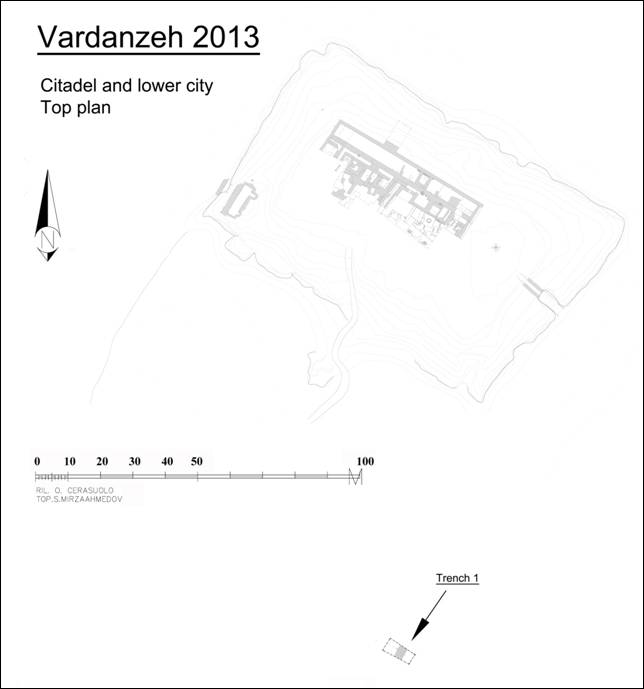
Fig. 1 Vardanzeh, top plan of the excavated structures.
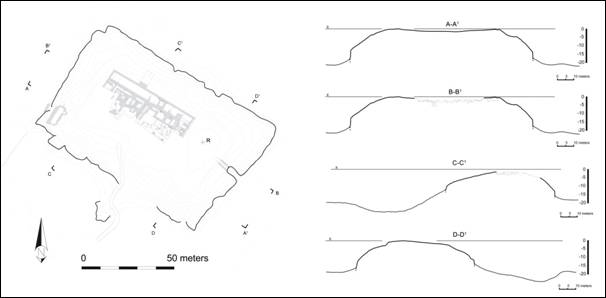
Fig. 2 Vardanzeh, plan and sections of the citadel.
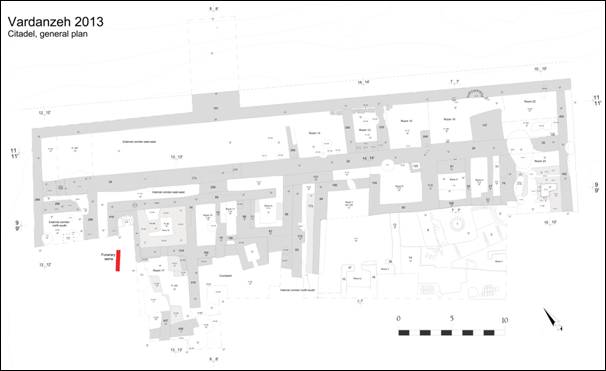
Fig. 3 Vardanzeh, plan of the citadel.
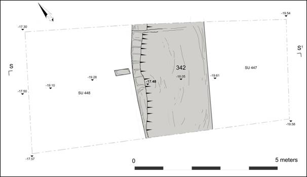
Fig. 4 Vardanzeh, plan of trench S-1 in the lower city.
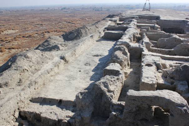
Fig. 5 Vardanzeh, citadel. Northern corridor and internal corridor (view from west).
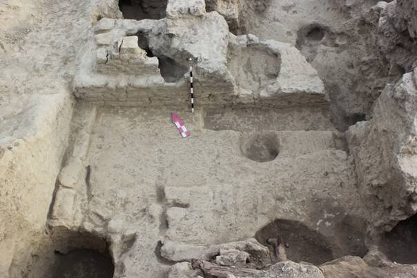
Fig. 6 Vardanzeh, citadel. Western (external) corridor (view from south).
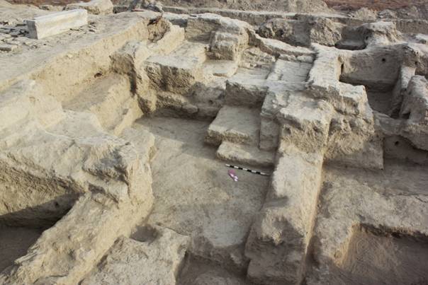
Fig. 7 Vardanzeh, citadel. Rooms 16 and 17 (view from south).
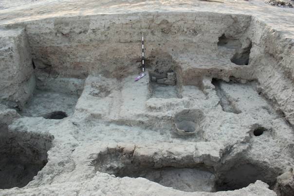
Fig. 8 Vardanzeh, citadel. Room 23 (view from west).
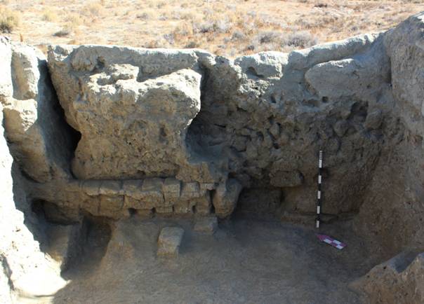
Fig. 9 Vardanzeh, lower city. Perimeter wall (view from west).
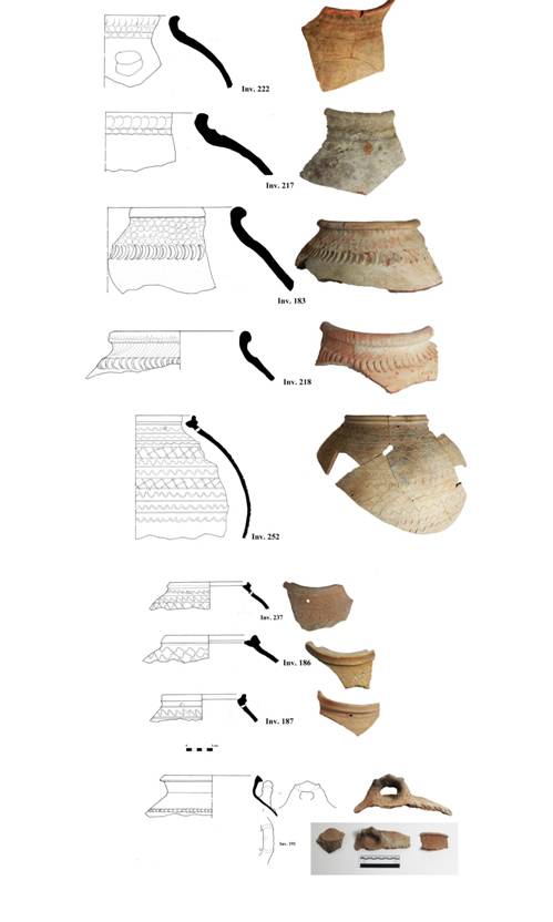
Fig. 10 Pottery dated to the 5th-8th centuries AD: jars decorated with finger marks impressions (183, 217, 218, 222), jars decorated with rows of wavy lines (186, 187, 237, 252), moulded cooking pot (191).
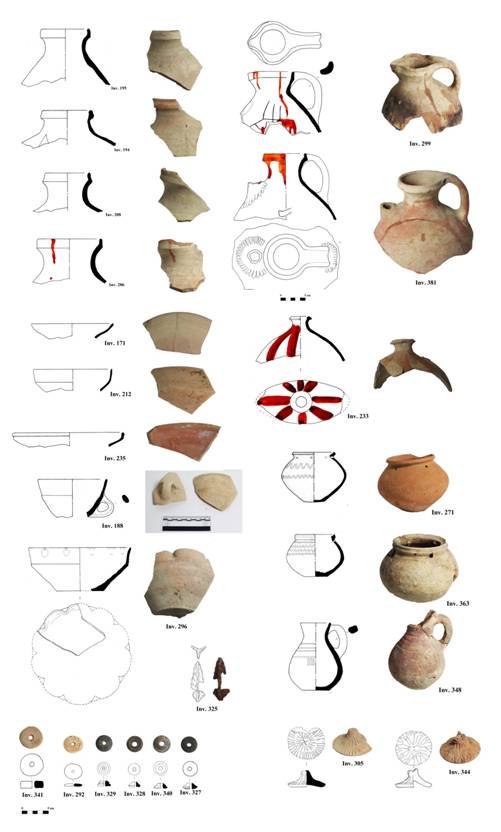
Fig. 11 Early medieval pottery: jugs (194, 195, 206, 208, 299, 381), bowls (171, 212, 296, 235), cup (188), lids (305, 344), flask (233), small pots (271, 348, 363), spindle whorls (292, 327-329, 340, 341), iron arrow head (325).
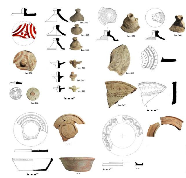
Fig. 12 Pottery dated to the 10th -12th centuries AD: painted lid (270), bell-shaped lids (382, 383, 385), concave lids (388-390), lids decorated with stamped and incised motifs (266, 309, 330, 360, 367), basin (361), ceramic tray (362), lid with central hole (306).
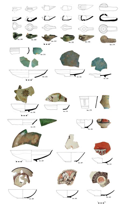
Fig. 13 Glazed pottery dated to the 10th-12th centuries AD.
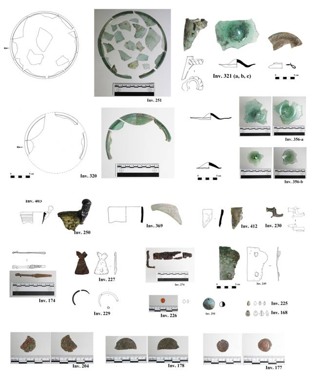
Fig. 14 Window glasses (251, 320), down parts of glass vessels (321 b-c, 356 a-b), rims of glass vessels (230, 250, 321 a, 369, 412), bronze tweezers (174), iron plaque (227), bronze bracelet for children (229), iron lock system? (274), bronze plaque (249), carnelian bead (226), turquoise bead (293), cowry shell beads (168, 225), Samanid copper coin (204), Kharakhanid copper coin (178), Asbar copper coin (177).
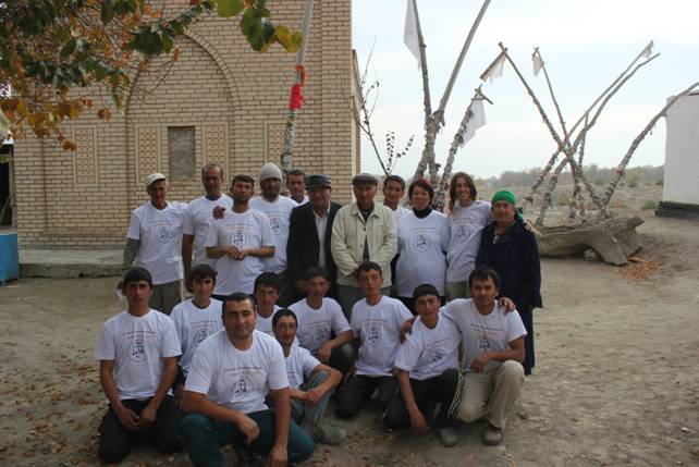
Fig. 15 Team workers.
Fieldwork 2014 at Vardanzeh
Due to unfortunate circumstances no fieldwork could be undertaken in 2014.
The next fieldwork is scheduled for spring 2015.
PRELIMINARY REPORT
ON THE 2015 FIELD WORK AT VARDANZEH
Introduction
The sixth archaeological excavation on the site of Vardanzeh (ancient Vardāna) was carried out between
March, 30 and May, 3, 2015. The activities focused on the citadel and have enlarged the excavated area on
west and east sides, for a total surface of 224 m squared (FIG. 1). The research staff was composed of three
archaeologists: Silvia Pozzi, Džamal K. Mirzaachmedov and Šukrat T. Adylov. Siroj Mirzaachmedov
updated the topography of the site while Munira Sultanova drew a selection of artefacts, for a total of 398
finds among pottery (345) and small finds (53).
As already evidenced in the past years of excavation, a palace dated to the early medieval period (ca. 5°-8°
centuries AD) was unearthed on the top of the citadel (FIG. 2). The palace (henceforth defined ‘early
medieval palace’) had a rectangular plan and was characterized by massive perimeter walls that were
detected, up to now, only on the northern and western sides. Along these sides the perimeter walls delimited
wide corridors probably used by the guards for the surveillance of the palace. One of the main purposes of
the 2015 excavation was to continue the investigation of the perimeter walls as well as of the related
corridors. A second objective of the 2015 campaign was to increase our knowledge of the internal layout of
the palace, in particular the eastern sector, in order to provide a better definition of the occupational phases.
Excavation
Trench 9 measured 5x5 m and was located in the eastern part of the citadel, in correspondence of the
northern corridor of the ‘early medieval palace’. Several holes, fireplaces and drainage system made of
superimposed ceramic vessels (tashnau) would attest a sporadic occupation of this area in later times and in
some cases have cut the underlying mural structures. A room (labelled room 24) characterized by sufà on
three sides was found at an altitude of -2.40 m (FIG. 7). Pottery fragments found in the filling of the room
would suggest a dating to the 10th-12th centuries AD, despite of the presence of several fragments of early
medieval jars (khum), probably re-used in later period.
Trench 10 was located in the western part of the citadel in correspondence of the western corridor of the
‘early medieval palace’. As already evidenced in the past years of excavation, the western part of the citadel
was assiduously used as cemetery probably for the attractive presence of the carved gravestone, ascribable to
a Muslim saint (see report 2013). Three burials characterized by wooden coffins were identified in this area.
One of them, north-south oriented, contained several fragments of baked bricks, wood and the rests of at
least five individuals. The ceramic fragments collected inside the burial would date this feature to the 18°
century AD, even though the grave was probably re-used, as suggested by the destroyed rests of the wooden
coffin and the scattered bones. A previous phase of occupation is inferred by several holes identified in the
western part of the trench after the removal of a deposit of friable clay. Rests of a pavement made by three
layers of baked bricks were found in the north-western part of the trench and covered the drainage system
that served to collect the draining waters of a bath place. The underlying occupational phase was found at an
altitude of -1.65 m and is represented by wall 448, north-south oriented. This structure covered perimeter
wall 269 and was located in the central part of the corridor of the ‘early medieval palace’, now in state of
abandon. During a previous constructive phase the corridor of the palace was still in use, as attested by the
presence of wall 299, detected along the eastern limit of excavation, and by partition wall 435, east-west
oriented. In the oldest phase of occupation of the corridor, partition wall 435 was absent and a mudbrick
floor was detected at an altitude of -3.64 m (FIG. 8).
Trench 11 was laid in the eastern part of the citadel, in correspondence of the internal area of the ‘early
medieval palace’. Some features would attest an occupation of this area as graveyard and rubbish dump. We
refer in particular to a burial identified in the central part of the trench, to some holes and to a drainage
system tashnau located in the northeast corner of the trench. The underlying occupational phase is
represented by room 25, used as bath area as attested by three individual baths places made in baked bricks
(alt. ca. – 1.92/2.10 m) (FIG. 3). The first bath (Bath 1), badly preserved, was located in the eastern part of
the room. The bath had a squared plan and the floor, probably made with baked bricks, was not preserved.
The drainage system tashnau was made of two stacked ceramic pipes inserted into the broken neck of an
ovoid jug (FIGS. 9, 21). Two overlapping fireplaces tandirs were found outside the north-western corner of
the bath and they were possibly used to heat the water used to bath. A better-preserved bath (Bath 2), smaller
than the previous one, was found to the west from Bath 1. The floor consisted of seven baked bricks, two of
them perforated in order to allow the discharge of water. The underlying drainage system made up of a jug
positioned on an upturned basin and some fragments of pottery were found inside the filling of the hole
realized to insert the drainage system. A third bath (Bath 3), also well preserved, was localized in the western
part of the room. Squared baked bricks positioned on edge delimited the floor and also in this case the central
bricks had been perforated to allow the drainage of water. The removal of the bricks revealed two underlying
drainage systems, suggesting for this bath two phases of use. During the most recent phase the drainage
system was made of two superimposed ovoid jugs. The cut realized to insert these vessels had damaged the
most ancient pipeline, found slightly northward. We can assume that room 25 could be dated to the 9th-11th
centuries AD, as attested by a Bukhar Khudah dirham (type al-Mahdi) found in the layer of clay that filled
the corridor of Bath 3.
The clearing of mudbrick and baked bricks structures of room 25 evidenced that the room was raised up on a
compact deposit of clay of reddish colour, characterized by fragments of charcoals and mudbricks. This layer
covered a more friable deposit of clay of dark brown colour that filled two contiguous rooms (labelled rooms
26 and 27), both delimited on north by wall 29 (FIGS. 4, 10). The peculiarity of these rooms was the presence
of wooden beams preserved thanks to the fire that interested this area. The beams presented a rectangularshaped
section (ca. 15x10 cm) and the majority were found on the floors still in situ, both along the partition
walls and in the middle area of the rooms. Despite the difficulties in ascertain the exact function of these
features, it is not excluded they were part of some timber frame construction used to create small partitions
inside the rooms. Most probably these rooms were used as storage area, as attested by several jars (khum)
found in situ, buried on the floors for some centimetres. A large quantity of pottery, organic burnt material
(straw baskets, cotton fabric, fibre of cotton), bronze and iron tools, bone spindle whorls and millstones were
found on the floors of rooms 26-27 and inside the layer of filling of the rooms. It has to be pointed out that in
2013 an AMS 14C analysis was executed on a sample of charcoal picked up from the fireplace of room 23,
also covered by a dark deposit of clay similar to the one that filled rooms 26 and 27. The calibrated dating
indicates a chronological framework between the 410 AD (95,4%) 610 AD, even though the typologies of
vessels unearthed in these rooms are usually dated to the end of 7th beginning of the 8th centuries AD.
Trench 12 was located in the eastern part of the citadel, in correspondence of the internal area of the ‘early
medieval palace’. The most recent human activities identified in this trench would suggest a discontinuous
occupation of the citadel, as attested by several features (fireplaces and holes) found under a superficial layer
of sand. Two drainage systems tashnau dating to the medieval period were also identified in the southern
part of the trench while a third drainage system, already detected in 2013 in the north eastern corner of the
trench, was completely excavated. A previous constructive phase also referred to the medieval period is
represented by a badly preserved mud-brick structure located in the middle area of the trench. An earlier
phase of occupation was identified at an altitude of ca. 3.15 m. Several walls belonged to this phase, the most
important one is massive wall 555, north south oriented, detected in the western part of the trench. An east
west oriented partition wall (526) was identified in the northern part of the trench and was built on wall 555.
Wall 526 constituted the southern limit of room 23 and was cut in the eastern part by a drainage system.
Other three walls (534, 551, 577) probably belonged to the same phase but they were found in a badly state
of preservation. During the oldest constructive phase detected in this trench only wall 555 was present. The
excavation revealed that this wall was built on a deposit compact clay 0.50 m thick, badly preserved in the
southern part of the trench (FIG. 11) A layer of pebbles and sand was identified under the compact deposit of
clay and corresponded to the deposit of pebbles and sand that covered an earlier constructive phase, already
attested in other trenches during the previous years of excavation.
Trench 13 measured 4x4 m and was laid in the central area of the citadel in order to establish the whole
chronological sequence of occupation of the citadel itself. The uppermost excavated layer corresponded to
rammed floor 13 already identified in 2011 at an altitude of -6.65 m under a layer of pebbles and sand 3 m
thick. Its removal revealed that the floor was realized on a very compact deposit of clay characterized by
aligned mudbricks of yellow colour, localized in particular in the north-western part of the trench. The
underlying deposits of clay, of very hard compaction, contained sporadic mudbricks and few fragments of
pottery, mostly modelled jars and bowls covered with red slip (FIG. 18). An irregular hole that proceeded
under the limit of excavation was identified in the north-eastern corner of the trench. The excavation of this
deposit stopped at an altitude of -9.76 m and we plan to complete it next year (FIG. 5).
Trench 14 measured 5x4 m and was located in the eastern part of the citadel, in correspondence of the
northern corridor of the ‘early medieval palace’. As attested in the other excavated trenches, some holes
identified in different places of the trench would suggest a later use of this area as rubbish dump. Four walls
(623, 624, 628, 629) were identified to the north from wall 29 and enclosed a small bath area characterized
by two phases of construction, as attested by two different drainage systems tashnau (FIG. 12). The bath
could be dated between the 9th and the 11th centuries AD, as suggested by an Abbasid copper fulus and a
Bukhar Khudah dirham (type al-Madhi) found inside the masonry of wall 638. To the south from wall 29
another structure made of squared baked brick was identified. Possibly the rests refer to a bath that was only
partially excavated since it continued under the southern limit of excavation.
Trench 15 measured 21x2 m and was laid at the base of the eastern external wall of the citadel, immediately
to the south from the eastern gate, in order to investigate the foundation of the wall and the ditch that
surrounded the citadel itself (FIG. 6). A superficial deposit of sandy clay was spread all over the trench and
contained several fragments of mudbricks that would attest the progressive collapse of the external
brickwork of the main wall. A more compact deposit of sand was found under this layer and consisted in the
stratification of thin layers of eolic sand. The removal of this deposit evidenced that the external wall of the
citadel was built on a basement made of compact clay that extended eastwards for five meters. The
basement, four meters high, was characterized by an inclined profile that ended at an altitude of -20.35 m. A
slightly flat surface could attest the presence of a rammed floor, also confirmed by a fireplace found at the
end of the basement. The floor gently sloped eastward and was exposed down to an altitude of -23.28 m. We
didn’t continue the excavation downward because both sections were very friable and the working conditions
not safe.
Pottery study
Up to now pottery unearthed at Vardanzeh has been studied and dated trough the comparison with wellknown
productions of Sogdiana as Paykend, Afrasiab, Pendjikent and other small local sites. Nevertheless,
several traits registered on our potsherds often did not fit with any of these productions, evidencing the limits
of a chronological attribution inferred only on the base of the ‘external’ chronologies, albeit authoritative.
The consequent difficulty in shaping a precise chronological horizon of the excavated structures led us to
deepen our pottery analysis by using a systematic and multi-layered approach that aims to establish a more
solid chronological framework. During the last fieldwork we set up a specific study of the pottery focussed
on the analysis of the fabrics associated with a typological study of the shapes. The potsherd collected during
the 2015 fieldwork amounted to 413 diagnostic potsherds and 2186 un-diagnostic potsherd, for a total of
2599 analysed fragments. Descriptions, photos and drawings of all the diagnostic fragments were stored in a
Diagnostic pottery database. Among the diagnostic potsherds, seventy-eight fragments were registered in
the Inventory of significant pottery. This significant material comprehends complete vessels (both entire and
archaeologically complete vessels), new typological shapes and any other ceramic potsherd that present
relevant features, such as a specific decorative motif or incised signs (tamghas). The analysis of the
functional classes within the diagnostic pottery revealed that the most frequent class is the storage ware
(51%), followed by the table ware (25%) and the by the cooking ware (17%). On the site we found also
pottery used as canalization (3%) and oil lamps (3%), while only 1% was referred to glazed pottery.
The most interesting complex of pottery unearthed this year was found in rooms 26 and 27, certainly dated to
the early medieval period (6th-8th centuries AD). This complex comprehends storage and table wares as well
as some modelled cooking wares. Many typologies were already known from the previous years of
excavation while others are completely new. The majority of the specimens were blackened and very fragile
as they were found in the deposit that contained the burnt wooden rests. The storage wares comprehend jars
of different dimensions, pots, flasks and jugs, all made on potter’s wheel. The predominant class is
represented by the jars decorated with elongated finger marks impression and splashes of red slip on the
surface (FIG. 13). Several specimens were found in situ, confirming that they were usually buried for some
centimetres on the floors. A relevant feature attested on some of these jars is the presence of incised signs
(tamgha/nishan) (FIG. 14). Another common typology is the jar decorated with incised wavy lines (FIG. 15).
The same splashed decoration used on the jars is also attested on large jugs with a handle that are
characterized by incised signs (tamgha) on the lower part of the vessels and on the shoulder. Table ware
repertoire is also very rich and comprehends bowls, jugs, pitchers, pots and filters made on a potter’s wheel
(FIG. 16). In some cases the lower part of the body is cuts with a knife, producing a rough petal-like motif
that is a distinctive mark of the early medieval production of Sogdiana. Cooking wares are also of great
interest since all specimens are modelled using rough clay that contained straw and flat black stones of large
size (FIG. 17).
The repertoire of pottery dated to the medieval period (9th-12th centuries AD) is also rich and comprehends
both newly and already attested shapes. Few fragments of glazed pottery were found this year and they
mainly consist in dishes and bowls of turquoise colour dating to the 12th century AD. New typologies include
table and storage jugs, jars and cooking vessels (FIGS. 19-23). Pottery specifically made for canalization was
also found and is represented by two cylindrical pipelines marked on the external surface by grooves (FIG.
21) and by two cylindrical pipelines with plain surface (FIG. 23, N. 539-1). Another interesting category of
cooking wares that deserves special attention is represented by the ovens (tandir). These vessels, made on a
potter’s wheel, have a dome-like shape and are positioned upturned, with the rim on the floor and the open
base on top (FIG. 23). Usually they are executed in a porous fabric of pink colour that contained a lot of
straw. The upper part of the rim is flattened to allow the standing position and the internal surface is marked
by rough grooves, both horizontal and vertical executed, in order to facilitate the adherence of the bread.
Artefacts
A varied assemblage of artefacts was found this year and includes metal finds, glass artefacts, some
millstones, terracotta, shell, bone and organic finds, for a total of seventy-one inventoried artefacts. When
necessary, the artefact were cleaned, restored and consolidated by Dilmurod Kholov, a conservator employed
at the Museum of Ark in Bukhara. Anvar Kh. Atakhodjaev, an expert of numismatic employed at the
Institute of Archaeology of Academy of Science in Samarkand was in charge of the numismatic consultation.
Several bronze and iron artefacts were found this year, together with five coins. Some of them are certainly
dated to the early medieval period since they were found on the floors of rooms 26-27. As far as the bronze
finds are concerned, we refer in particular to the rim of a cup, to a fragmented flat rectangular tool, to a round
bell, to a ring and to a decorated plaque (FIG. 24). Two bronze objects found in different stratigraphic
contexts are a circular earring, a fragment of vessel decorated with a modelled ribbon and a small spout
probably belonging to an usmadon.
The iron artefacts are more numerous even though in most cases very corroded and of difficult interpretation
(FIG. 25). Several specimens dated to the early medieval period were found on the floors of room 26-27 and
during the cleaning of room 23. Three are clearly knives or blames of knives (inv. 482, 493, 506) while two
of them are probably nails. An interesting artefact found in this stratigraphic context is an entangled chain.
Even though it was not possible to unravel the chain, some circular links were still well visible.
A small assemblage of glass finds was unearthed this year and comprehends glassware and a disk-like
window (FIG. 26). The most ancient item, probably dating to the early medieval period, is a broad-necked
vessel of yellow-white colour, decorated with a glass thread-roller on the neck (inv. 489-a-b). Fragments of
vessels dating to the 12th century AD were also found. In particular we refer to two concave vessel bases of
pale green colour (jugs or carafes?) (inv. 443-455) and to a circular flat foot of a stem glass (wineglass?) of
turquoise colour (inv. 460). Other two interesting artefacts are a fragment of jug that presented a twisted
wick-like overlay on the neck (inv. 454) and a small handle (inv. 459). All artefacts present a superficial
corrosion.
Two categories of stone artefacts were found and they refer to small finds and to several fragments of schist
millstones. Among the small finds (FIG. 27) there is a disk-shaped spindle whorl of withe colour (inv. 467)
and a rhomboidal bead made in jet (lignite), a dark gemstone that has an organic origin (inv. 451). As far as
the millstones are concerned (FIG. 28), three of them (inv. 508, 509, 510) were found in room 27 and are
thus dated to the early medieval period. One millstone found complete (inv. 508) measured 52 centimetres in
diameter and was 3.5 centimetres thick. The surface was rough and it was probably used as upper millstones
since a small hole for inserting the handle was visible near the circular edge.
Nine bone spindle whorls (FIG. 27, inv. 441, 452, 473, 474, 475, 491, 494, 495, 496) were found in rooms
26-27, completely blackened by the fire that interested this area during the early medieval period. Similar
spindle whorls were also found in 2013 during the excavation of room 23, dating to the early medieval
period as well, but at that time they were interpreted as terracotta spindle whorls because of the black colour.
All finds but one have a trunk conic shape that differs in the treatment of the lateral sides. A disk shape bead
made in bone (inv. 485) and a cowry shell bead were also found (inv. 487). Only two artefacts in terracotta
(FIG. 27) were found this year and they consist in a bell-shaped spindle whorl (inv. 448) and a quadrangular
bead of pink colour (inv. 476). The last artefact is securely dated to the early medieval period.
During the excavation in rooms 26-27 several types of organic material (wood, row cotton, cotton fabric,
straw) were found completely burnt (FIG. 29). We were able to collect only few fragments of each typology
of material since the remains were very fragile at the moment of excavation. The analysis of a large piece of
soft burnt material (inv. 470) revealed we were in presence of row cotton, possibly part of padding. Some
fragments of cotton fabric (inv. 504) were attached to the padding and were inventoried separately. The
fragments consisted in the assemblage of several layers of cloth characterized by plain weave. The remains
of straw artefacts manufactured according with the straw plaiting represent another category of organic
material (inv. 471-472). The rests were worked in different ways (rolled, plaited) and during the excavation
we noticed that a large fragment of straw enveloped a ceramic pot characterized by convex base. Most
probably they were part of a straw basket used to hang the pot.
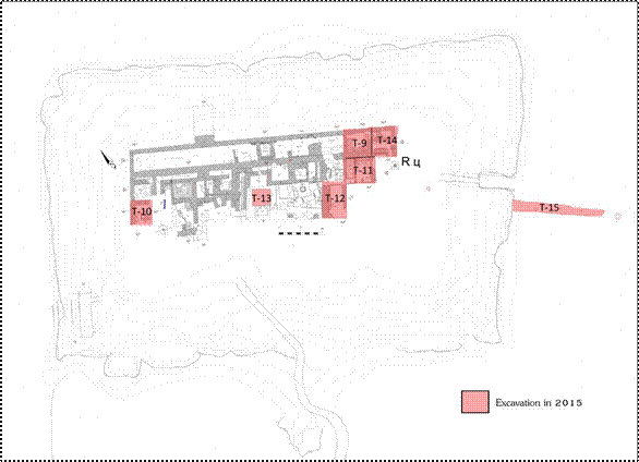
FIG. 1 Vardanzeh, general plan of the citadel and trenches excavated in 2015 (topography Mirzaachmedov on Cerasuolo general plan).
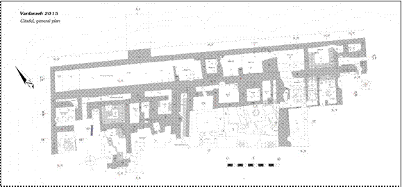
FIG. 2 Vardanzeh, particular of the general plan (Mirzaachmedov).
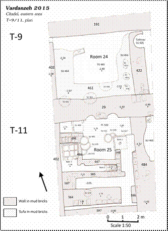
FIG. 3 Vardanzeh, plan of rooms 24-25 during the medieval period (Mirzaachmedov).
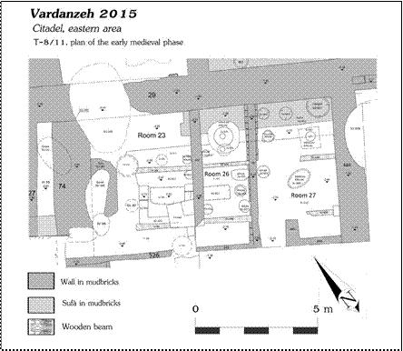
FIG. 4 Vardanzeh, plan of rooms 23, 26 and 27 during the early medieval period.
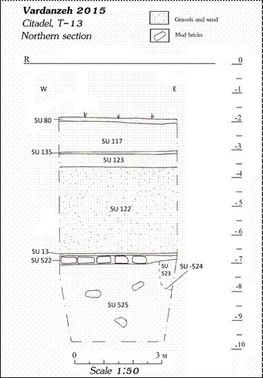
FIG. 5 Vardanzeh, central area of the citadel (T-13), north section.
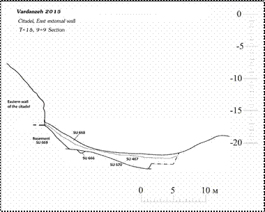
FIG. 6 Vardanzeh, T-15, plan of north section.
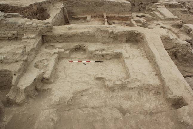
FIG. 7 Trench 9: room 25 (view from north).
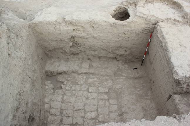
FIG. 8 Trench 10: early medieval corridor, floor 558 (top view).
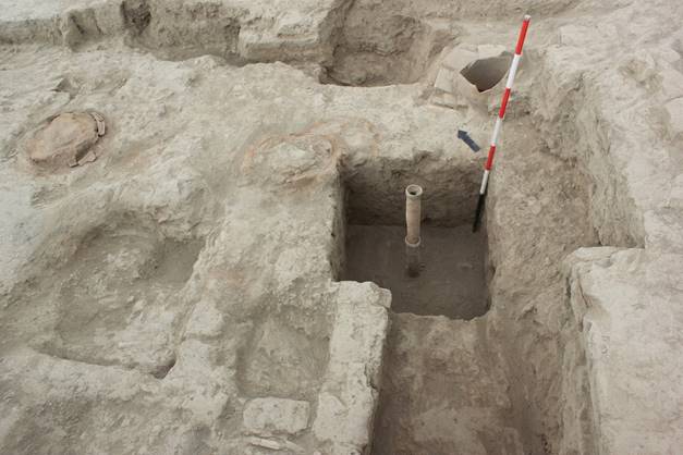
FIG. 9 Trench 11, room 25, upper part of drainage system of bath 1 (view from south).
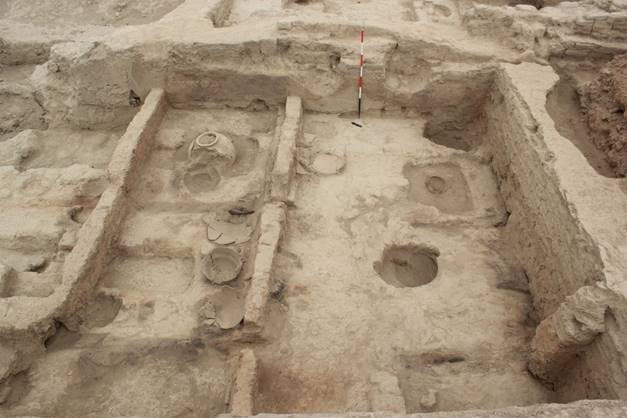
FIG. 10 Trench 11: rooms 26 and 27 (view from south)
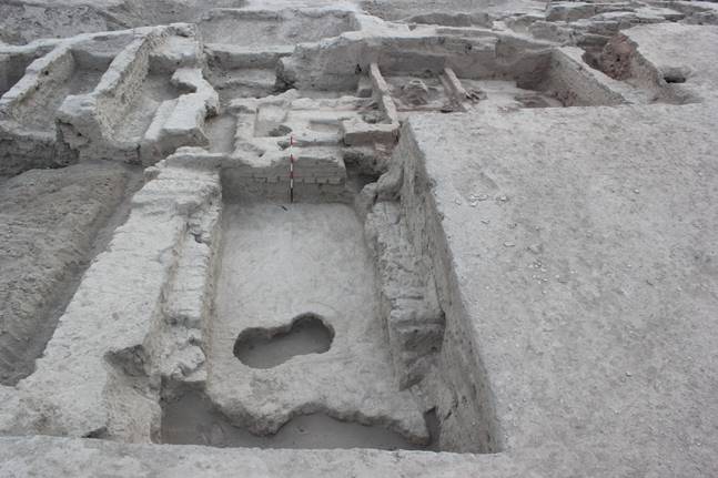
FIG. 11 Trench 12: wall 555 (on left) and partition wall 526 on the background (view from south).
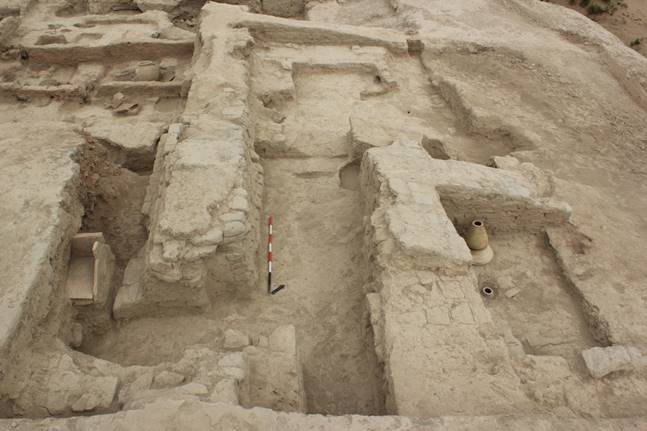
FIG. 12 Trench 14: general view from east.
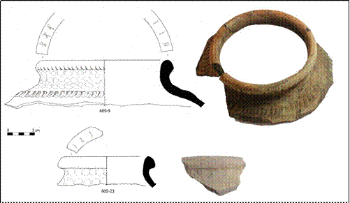
FIG. 13 Trench 11 (rooms 26-27):jars decorated with finger marks impressions and notches on the rim (605-9, 605-23).
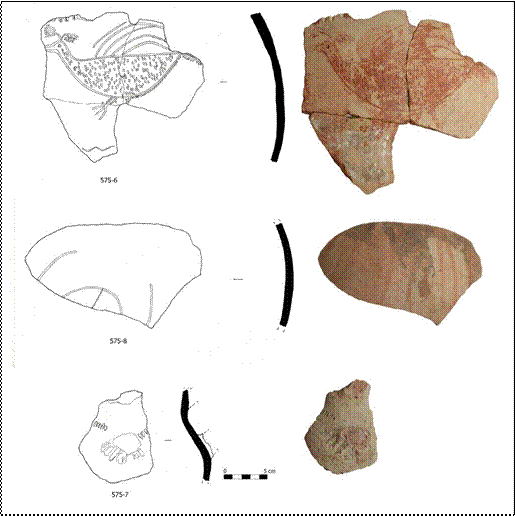
FIG. 14 Trench 11: jar decorated with incised bird (575-6), jar decorated with incised sign (tamgha) (575-8), small pot (575-7).
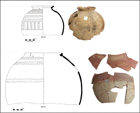
FIG. 15 Trench 11 (rooms 26-27): jars decorated with incised wavy lines (605-28, 605-55).
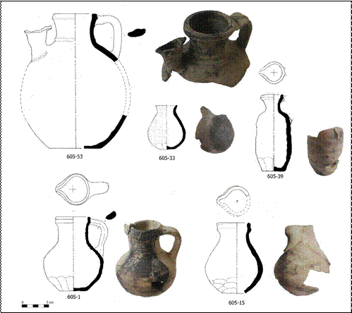
FIG. 16 Trench 11 (rooms 26-27): table jug (605-53), table juglets with moulded spout (605-
1, 605-15, 605-39), small pot (605-33).
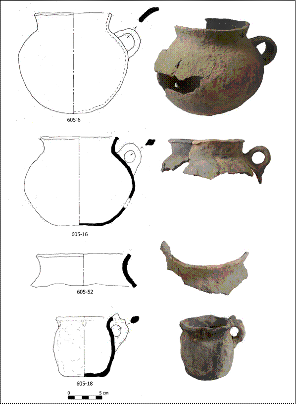
FIG. 17 Trench 11 (rooms 26-27): modelled cooking pots (605-6, 605-16, 605-52), modelled cooking cup (605-18).
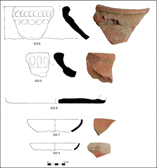
FIG. 18 Trench 13: jars decorated with finger marks impressions (522-5, 522-6), base of jar (522-8), bowls with red slip (522-4, 522-7).
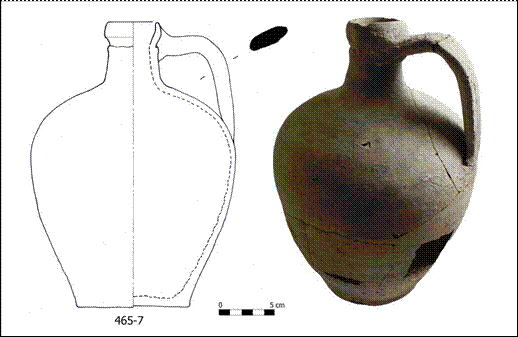
FIG. 19 Trench 9: jug used for boiling water (465-7).
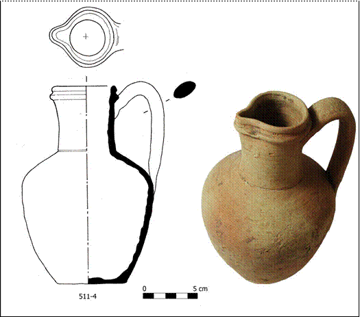
FIG. 20 Trench 11: juglet with moulded spout (511-4).
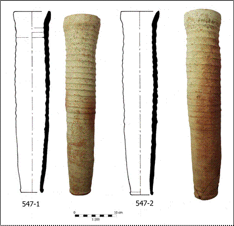
FIG. 21 Trench 11: pipelines (kubura) (547-1, 547-2).
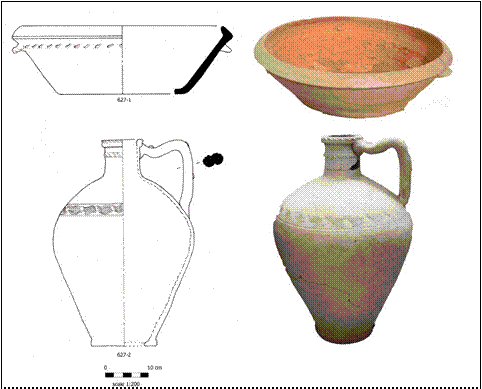
FIG. 22 Trench 14: basin (tagora) re-used in drainage system (627-1), storage jug re-used as drainage system (627-2).
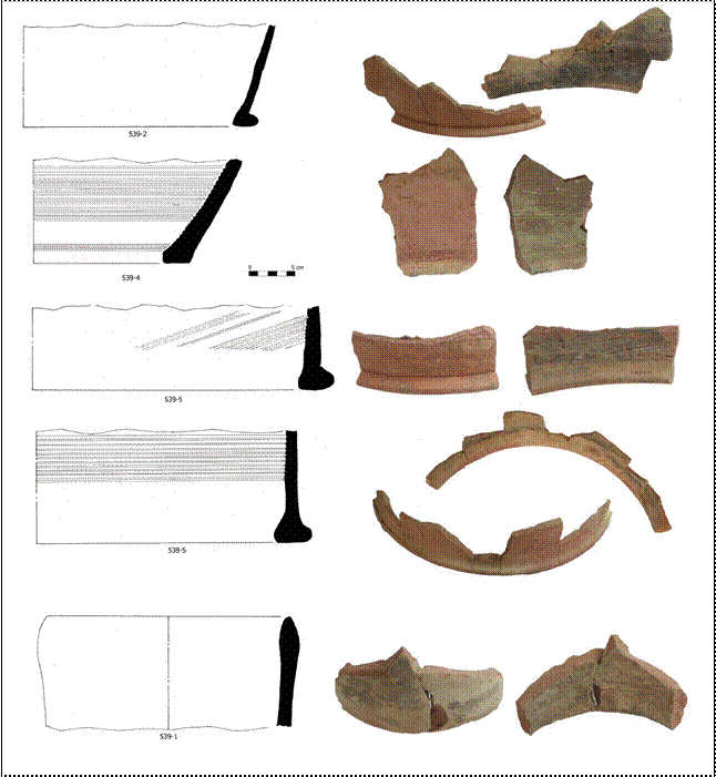
FIG. 23 Trench 11: ovens (tandir) (539-2, 539-3, 539-4, 539- 5), pipeline (kubura) (539-1).
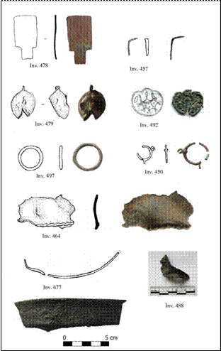
FIG. 24 Bronze finds: flat tool (inv. 478), bell (inv. 479), fragment of vessels (inv. 464, 477), decorated plaque (inv. 492), circular earring (inv. 450), fragment of spout (inv. 488), unknown object (inv. 457).
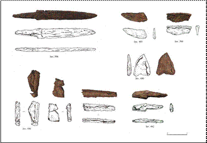
FIG. 25 Iron finds: knife (inv. 506), tips of blame (inv. 440, 493), part of blames (inv. 444, 482, 500).
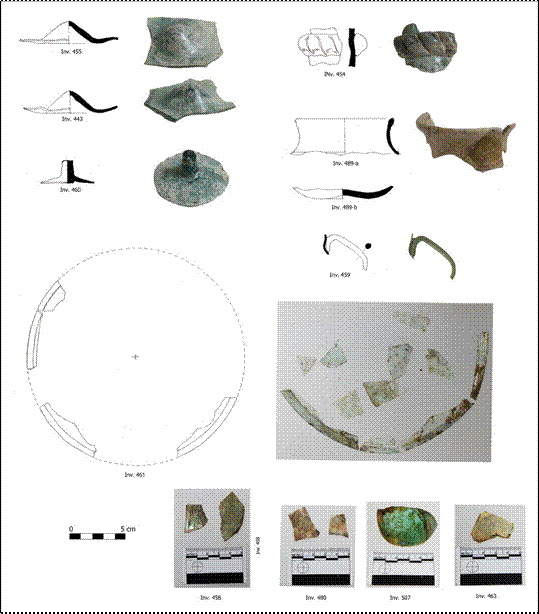
FIG. 26 Glass artefacts: bases of glass vessels (inv. 443, 455, 507), base of stem glass (inv. 460), neck of jug (inv. 454), rim and base of glass pot (inv. 489-a, b), handle of juglet (inv. 459), rim of vessel (inv. 458), fragments of vessels (inv. 463, 480), circular window (inv. 461).
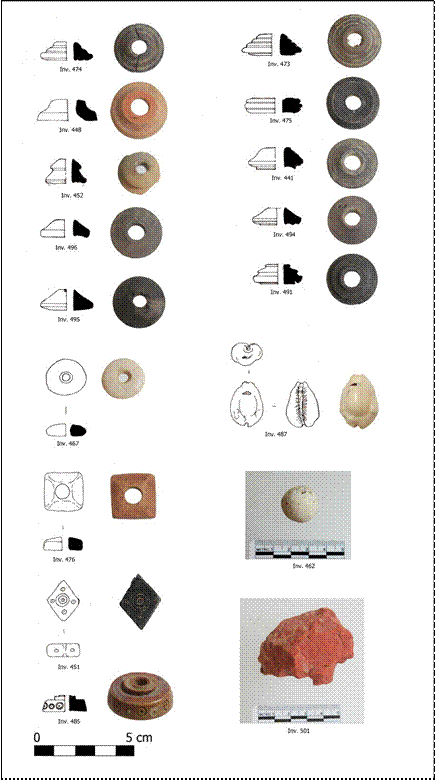
FIG. 27 Small finds: bone spindle whorls (inv. 441, 452, 473, 474, 475, 491, 494,
495, 496), terracotta spindle whorl (inv. 448), stone spindle whorl (inv. 467), terracotta bead (inv. 476), jet (lignite) bead (inv. 451), bone button (inv. 485), cowry shell bead (inv. 487), ball of gypsum (inv. 462), piece of ochre (inv. 501).
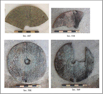
FIG. 28 Millstones (inv. 447, 508, 509, 510).
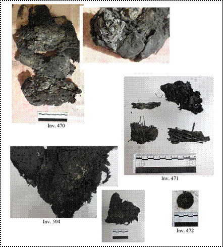
FIG. 29 Organic burnt material: cotton padding (inv. 470), cotton cloth (inv. 504), fragments of basket straw (inv. 471-472). |
|
PRELIMINARY REPORT
ON THE 2016 FIELD WORK AT VARDANZEH
(report as pdf download here)
The seventh archaeological excavation on the site of Vardanzeh (ancient Vardāna) was carried out between March, 28 and April, 30, 2016. The activities focused on the citadel and have enlarged the excavated area on west, east and south sides, for a total surface of 220 m squared, plus 87 m squared of investigation led in previous excavated trenches (FIG. 1-2). The research staff was composed of three archaeologists: Silvia Pozzi, Džamal K. Mirzaachmedov and Šukrat T. Adylov. Siroj Mirzaachmedov updated the topography of the site while Munira Sultanova drew a selection of artefacts, for a total of 580 finds among pottery (505) and small finds (75).
Excavation
Trenches 4 -6, already investigated in 2012, are located in the western sector of the palace. The decision to re-open the investigation of this area is due to the necessity of a better understating of the chronology of the two mud brick structures (SSU 206, 131) that at one point in time obstructed the northern segment of the side-corridor. Mud brick structure SU 206 measured 2.70x1 m and its removal evidenced that his part of corridor was obstructed not earlier than the 9th century AD. Mud brick structure SU 131 measured 4.70x1.20 meters and closed the junction between the NS oriented corridor and the EW oriented corridor. The removal of this structure evidenced that it was made of two distinct parts (SSU 707-708). Structure SU 707, north- south oriented, measured 1.30x0.90 m and is the most ancient. Mud brick structure SU 708 measured 3.70x1 m was built against structure SU 707, closing the possibility to reach the central part of the palace trough the NS oriented side corridor. The removal of this structure put in light rammed floor 711 at an altitude of -3.19
m. The analysis of the pottery fragments detected in SU 708 and on floor 711 would date these features between the 5th and the 6th centuries AD.
Trench 13 is a probing trench opened in 2015 that aimed to shape the stratigraphic sequence of the citadel. For security reasons the initial area of the trench (4x4 m) was reduced to 1.20x2.10 m. A very compact deposit of clay (SU 743) was excavated down to an altitude of -10.85 m. This deposit contained sparse layers of mud bricks measuring 45x25x11 cm and yielded some fragments of pottery. Most of these fragments belong to storage jars decorated with splashed brown lines but some fragments of red slipped cups probably
dating to the 5th century AD were also detected. This deposit could be interpreted as part of the platform built
to support the ancient building structures found beneath the layer of pebbles and sand.
Trench 16 was located in the eastern part of the citadel, and initially it measured 5.5 x 1.70 m. Traces of occupation dating to the 12th are attested by the presence of wall 484 and of two drainage systems (SSU 677- 725) of type tashanu. The early medieval occupation dating to the 7th-8th centuries AD was detected under a deposit of clay that contained several traces of burnt material (SU 713) and is represented by room 27. A rammed floor (732) that contained several traces of burnt wooden beams was detected at an altitude of -2.86m. Four holes (SSU -736, -737, -738, -745) that sustained large jars were detected in the northern part of the room. The jars positioned in these holes, very fragmented, were found still in situ together with several other fragments of pottery. The removal of most of the features related to room 27 revealed the presence of an underlying room (labelled room 31) that probably occupied a wide part of the eastern sector of the palace. At the present state of our knowledge, we can assume that this room had two sufa (SSU 367, 735) and four WE oriented platforms made of mud bricks (SSU 751, 775, 776, 779) located in the central area of the room. The platforms, each ca. 1.70 m wide, were made by an external row of stretchers (40x23x10/43x24x10 cm) separated each other by ca. 15 cm of mud plaster, while the inner brick work consisted in three parallel rows of headers (FIG. 3). Although the use of these platforms is still unclear, we can assume that at one moment they had some function in the building of the later rooms 23, 26, 27. Interestingly, the wooden beams found burnt in those rooms were positioned exactly above the central part of the platforms. Another room (labelled room 32) was discovered beneath mud brick platforms SSU 751-775 at an altitude of ca. –3.36 m, where we detected rammed floor 839, related to the most ancient level of occupation of the early medieval palace. The room was delimited on north by wall 29, on east by wall 827 (alt. – 3.10 m) and on west by wall 882 (only the eastern face was exposed). A sufa (SU 840), NS oriented, was built against wall 827. Badly preserved traces of mural paintings (SU 780) were detected in two different parts of the southern face of wall 29 and a small fragment was identified on wall 827 as well. Most probably, the paintings decorated at least two sides of room 32 and also another room that should have been existed to the west from room 32 (not excavated yet). The paintings were realized on a mud plaster ca. 2 cm thick (SU 778) and at a certain point in time (ca.
7th-8th centuries AD), when the rooms 23, 26 and 27 were created, they were hidden by the construction of
sufa SU 735 and by a new mud plaster 3 cm thick (SU 779). The fire that occurred in rooms 23, 26 and 27 burned mud plaster SU 779 and contributed to a further damage of the paintings. At the present state of our research, we have some knowledge only on the colors used in the paintings (white, red black, blue). Two fragments of paintings labelled 780-1 (72x57 cm) and 780-2 (33x29) were consolidated on site and removed (FIG. 7).
Trench 17 was located to the south from T-11 and measured 4x4 m. A sporadic occupation of this area was detected at an altitude of ca. -1.10 m under a superficial deposit of friable sandy clay (SU 673). It consisted of a rammed floor (680) where two fireplaces (SSU 681, 682) were found, one of them (SU 682) contained a
cooking pot archaeologically complete. Four holes (SSU 703, 709, 720, 722) were also identified in this area. The underlying level of occupation that can be dated to the second half of the 12th century AD is probably related to the use of this area for the personal care, as suggested by a drainage system of tashnau type (SU
761). A room (labelled room 33) dating to the early medieval period was detected at an altitude of ca. -2.90 m (floor 753) to the south from rooms 26-27, under a deposit of clay of red colour (SU 747). The room was connected to room 27 through a passage delimited by walls 768 and 759 (alt. -2.64 m). Another partition wall (760 alt. -2.68 m) was detected to the west from wall 759. Rammed floor 753 was cut by five low holes realized to maintain in standing position large storage jars. The excavation of floor 753 and of wall 760, as well as the partial removal of partition walls 256-759 put in light a previous building phase that consisted in a large room (room 31) characterized by mud brick platforms, detected also in T-8-11-16.
Trench 18 measured 8x7 m and was laid in the SE corner of the citadel in order to detect the SE corner of the early medieval palace. A sporadic use of this area in the 12th century AD is attested by the presence of five holes (SSU 705, 714, 716, 750, 884) localized under a superficial layer of sandy clay (SU 679, alt. -1.50 m). A rammed floor (693) and some features that suggest a slightly earlier exploitation of this area for the
personal care were detected at an altitude of -1.80 m. A floor made of seven fired bricks (694, 0.0.69x70, alt.
-1.83 m) was found at an altitude of -1.83 m and four fireplaces (SSU 684, 686, 688, 699) were found to the east from the bath (FIG. 5). The eastern perimeter corridor of the early medieval palace was detected at an altitude of -3.10 m (floor 873) under a deposit of compact clay (SU 867) that contained a lot of broken mud bricks. The corridor was delimited on east by wall 831 and on west by wall 868 (only partially exposed), while on south it was delimited by perimeter wall 701. A passage detected on wall 868 suggested that the corridor turned westward.
Trench 19 was laid in the NE part of the citadel and measured 7x19 m. The excavation aimed to detect the NE corner of the early medieval palace and to increase our knowledge on the layout of the medieval structures excavated last year to the north from wall 29. A level of occupation related to the bath area identified last year in T-14 was detected to the north from wall 29 (alt. -0.65 m) at an altitude of ca. -1.35 m. Some structures were detected under a deposit of compact clay (SU 729) and two sub-phases can be
distinguished, as already hypothesized last year by the recovery of two different drainage systems. Three rooms (29, 30, 34) dating to the early medieval period (7th-8th centuries AD) were detected under the above- mentioned medieval phase. These rooms were built inside the northern corridor of surveillance of the palace delimited by walls 29 and 191, evidencing that at one point in time the eastern part of this corridor, originally
empty, was partitioned in several spaces. Room 29 (4x3.30 m), located in the easternmost part of the corridor, was delimited by on north by perimeter wall 191, on south by wall 29, on west by wall 800 (4.10x0.80 m, alt. -1.32 m) and on east by perimeter wall 831 (FIG. 94). The room had sufa on north, west and south sides (SSU 841, 844, 845, each 0.35 m high and 0.90 m wide), while in the eastern side a mud brick structure (SU 821) measuring 1x0.90 m was found. A rammed floor (850) was detected at an altitude of -2.50 m. The room was filled with deposit of clay SU 822 that contained broken mud bricks and a lot of
pottery and iron tools dating to the 7th-8th centuries. Room 30 (4.10x3.10 m), located to the west from room
29, was delimited on north by wall 191, on south by wall 29, on east by wall 800 and on west by wall 843 (4x0.90 m). The room had 0.80 m wide sufa on four sides (SSU 846, 847, 848, 849, alt. -1.98 m) and a rammed floor (858) was detected at an altitude of ca. – 2.10 m. The room was filled with a compact deposit of clay and broken mud bricks (SU 734 =781) that yielded a lot of pottery and iron tools dating to the 7th-8th century AD. Room 34 (7x4.10 m) was located to the west from room 30 and it was delimited on north by wall 191, on south by wall 29, on west by wall 422 and on east by wall 843. Differently to rooms 29 and 30, this room had no sufa and was excavated down to an altitude of – 2.50 m (FIG. 4).
Trench 20 measured 6.5x4 m and was laid in the western part of the citadel in order to investigate the different phases of occupation of the western perimeter corridor of the early medieval palace. A large hole (SU 798, d: 2.50, H: 2.28 m) identified in the southern part of the trench would suggest that in the 12th century AD this area was used as rubbish dump. A more consistent phase of occupation dating to the 12th century AD as well was detected at an altitude of -1.25 m. It consisted of a NS oriented wall made of mud bricks detected in the W part of the trench (756) and of another mud brick wall (772, alt. -1.30 m) identified in the eastern part of the trench. A rammed floor (755) related to walls 757 and 772 was detected at an
altitude of -1.25 m and covered another ancient floor made of mud bricks (771), detected at an altitude of -
1.40 m. The western perimeter corridor of the early medieval palace, delimited by walls 269 and 299, was detected at an altitude of -3.20 m (rammed floor 856) under a deposit of clay (SU 784) that contained pottery dating to early medieval period and some fragments of iron. During this phase the corridor was partitioned by an east-west oriented wall (855, 0.25x2.20 m, alt. -1.33 m) and an obstructed passage (SU 882) 0.80 m wide, was detected on wall 269, immediately to the south from wall 855. A more ancient mud brick floor (SU 861) was detected at an altitude of -3.58 m under a deposit of sandy clay (SU 857) (FIG. 6).
Trench 21 was opened to the south from T-11/16 and measured 4x5 m. The presence of drainage systems of type ‘tashnau’ and of several holes often reused through the centuries have complicated a lot the excavation of this area and the chronological attribution of the upper levels of occupation. The pottery fragments detected in two holes (SSU 803-825) would suggest that from the 12th to the 18th century AD this area was used as rubbish dump. Between the 10th and the 12th centuries AD this area was probably used for the personal care, as attested by the presence of six drainage systems. The prolonged use of this area for this specific purpose is inferred by the overlapping of the drainage systems and is also confirmed by the remake
of the walls that delimited this area. A room (labelled room 35) dating to the early medieval period and coeval to rooms 27 and 33 was discovered under a very compact deposit of clay of difficult comprehension (SU 869). The room is delimited on north by wall 644 and on west by wall 768, while the remaining limits are still unclear. Traces of a rammed floor (884) were detected at an altitude of ca. -2.90 m. The partial removal of floor 884 put in light the remains of mud brick platforms 776 and 779 that belonged to previous building phase (room 31). Both platforms were badly preserved and damaged by later drainage systems and holes.
Pottery study
During the last fieldwork we continued the pottery study started last year, increasing our knowledge of the fabrics associated with the typological study of the shapes. The list of fabrics elaborated last year allowed us a fast data entry of the new potsherd. The potsherds collected during the 2016 fieldwork amounted to 623 diagnostic and 4522 un-diagnostic potsherds, for a total of 5145 analyzed fragments. Descriptions, photos and drawings of the diagnostic potsherds were stored in the Diagnostic pottery database. The diagnostic potsherds include fragments of rims, bases, functional parts, but also archeologically complete vessels and walls decorated with incised signs (tamga/nishan). The predominant fabrics among the diagnostic fragments recorded this year are the families numbered as 1, 5 and 6. The analysis of the functional classes within the diagnostic pottery unearthed this year revealed that the most frequent class is the storage ware (48%), followed by the tableware (30%) and the cooking ware (13%). We found also storage pottery re-used as pipeline in drainage systems (2%), some fragments of specific ceramic pipelines (less than 1 %), oil lamps (less than 1 %) and pottery used for other purposes (mousetrap) (less than 1 %). The 7% of the potsherds referred to glazed ware and they were found in particular in T-17/21.
Early medieval pottery
The majority of the pottery complex dating to the 7th-8th centuries AD was unearthed in the deposits that filled rooms 29, 30 and 34, localized in the northern corridor of surveillance of the palace. A strict analogy of some vessels with the pottery production from Pendjikent dating to the 7th-8th centuries AD would date the production of Vardāna to the same period. On the base of their functional use, this complex can be divided in pottery used for manufacturing products, storage ware (in particular for storage wheat), tableware, cooking ware and pottery used for sanitary-hygienic purposes (in particular the body care). Storage ware, all made on a potter’s wheel, can be divided in large and small jars, globular pots, large and medium jugs (with or without handles) and flasks. Large and small jars, usually under-fired, were made in a combined way. The shape is usually ovoid, characterized by a short neck. The base is instable because of its small diameter or of its rounded shape. Usually the base of the vessels was positioned inside small holes dug on the floor or on the sufa. All the jars were decorated with finger marks impression and stripes of colour drained on the surface of the vessels (FIG. 9). Both these type of ornaments attest a strong influence of Kaunči culture on the pottery tradition of Vardanzeh. It is interesting to note that similar decorations are not attested on jars from synchronic sites of Sogdiana. Evidently, these features are specific of Vardanzeh and the neighbouring area.
Three types of globular jars are attested at Vardanzeh in this period: un-necked vessel with inset for lids; short-necked vessels with inset for lids and unstable base; necked vessels without inset for lids (FIG. 10). Large jugs were used to store large quantities of water (capacity of 10 litres) and had a short and wide neck with moulded spout (FIG. 12, 822-11). Jugs of medium dimensions were used to store no more than 5 litres. The thin-walled body is spherical and the base can be ‘cut’ with a knife. Jugs without handle are similar in shape and dimensions to the large jugs used to store water but the rims are globular and not narrow and the bases are unstable. The tableware includes jugs, cups, dishes and bowls. Jugs with narrow neck and moulded spout of type ‘oinoche’ are the most common type of jugs attested in this period. The vessel is thin-walled and has a globular shape, marked on the lower part by petal-like cuts executed with a knife. Two types of cups used to drink water or other type of beverages are attested: with festoon-like rim and with vertical curved rims. Cups and mugs with festoon-like rims are well known in the upper layers of Pendjikent. This season we unearthed a cup with internal festoons, similar to the specimens from Pendjikent, where the number of festoons is usually six (FIG. 11, 822-3). Dishes have a small diameter (10-12 cm) and a flat base of small diameter as well, quite stable. It is usually used to eat small quantities of food (for example cereals) or it can be positioned on the tray (dastarkhan) to serve the products. Bowls were also present at Vardāna but only one specimen of this type was found this year. The convex foot is completely unstable and recalls that of the ancient Greek ‘megara’ bowls (FIG. 11, 822-2). A single but very interesting small cup was found this year. Apparently it resembles a small thin-walled pot with zoomorphic spout shaped as the head of a bull (FIG. 8, 713-2). Most probably this vessel was used not only a cup but also as a baby-bottle for feeding babies with milk. Vessels used for sanitary and hygienic purposes were also found, as attested a type of jug with vertical and short spout. Our specimen resembles a traditional type of vessel still used in Central Asia to wash hands (oftoba, obdatsa). The specimen unearthed this year has splashed decorations of red colour, made on the yellow false slip, and the base of the spout is decorated with modelled ‘palmette’ motif (FIG. 12, 822-5). To conclude, it has to be pointed out the peculiarities of pottery production of Vardāna of this period and some contrasts with many traditional shapes of the Sogdian production of the early Medieval Period.
Medieval pottery
The repertoire of pottery dated to the medieval period (9th-12th centuries AD) is various and comprehends both newly and already attested shapes. Already known shapes of cooking vessels include globular cooking pots, jugs used for storage or boiling water and ovens (tandyr). Among the newly attested shapes of this functional category stand out two pots with elongated body, a globular pot with incised decoration on the shoulder, a pot with flattened rim, a cauldron, a necked pot and a pot with appliqued decoration. The medieval tableware found this year comprehends already known shapes of pots, carinated bowls and bowls decorated with red painted lines as well as some newly attested shapes. Among the new shapes stand out two thin-walled jugs characterized by an elongated body, both archeologically complete (FIG. 17, 716-43, 716- 44). A beautiful decorated thin-walled jug made of grey fabric was also found. The neck of this specimen is missing and the upper part of the vessel is decorated with incised pseudo-calligraphic motifs (FIG. 16, 716- 1). A bell-shaped lid made using a decorated mould was also found. As far as the already known storage ware is concerned, there are storage jugs and jars mostly re-used as canalization, flat lids, bell shaped lids, small lids with protruding bottom, basins of type tagora. Pottery specifically made for canalization was also
found and is represented by cylindrical pipelines with plain surface (FIG. 18, 716-45). The glazed pottery found this year consists of dishes and bowls of turquoise or green colour dating to the 12th century AD (FIG. 18). A pot characterized by pomegranate shape and decorated with white slip and vertical painted lines of brown colour was found complete (FIG. 14). Some fragments of polychrome glazed pottery dating to the late 10th- early 11th centuries AD were also unearthed (FIG. 13, 773-3). Vessels used for illumination are very few and consist of an unglazed oil lamp (chirags), of conic shape, and of two fragments of glazed lamps of greenish colour. Another vessel that could be used for illumination or possibly ritual purposes is represented
by a beautiful dome shaped lid characterized by ten ‘windows’ of rectangular shape, topped with circular openings (FIG. 15, 716-16). As far as the special vessels are concerned, stands out a ‘mercury pot’ (sim-op) of grey colour decorated with incised lines. Pottery fragments dating to the 18th century AD are represented by two dishes with brown slip and black ‘zangir’ and foiled motifs, without glazing, while pottery dating to the 19th century AD is represented by a fragment of glazed dish decorated with polychrome motifs.
Finds
A varied assemblage of small finds was unearthed this year and includes metal finds, glass artefacts, processed and raw stones, terracotta artefacts, shells, bone and organic material, for a total of 119 inventoried finds. When necessary, the finds were cleaned, restored and consolidated by Dilmurod Kholov, conservator at the Museum of Ark in Bukhara. Anvar Kh. Atakhodjaev, expert of numismatic at the Institute of Archaeology of Academy of Science in Samarkand (ANRUuz), was in charge of the cleaning of the coins and produced a report on the numismatic material.
As far as the coins are concerned, the total number of the examined specimens amounts to 15 exemplars, 9 of them fragmented (FIG. 19-20). The composition of the finds includes one exemplar dating to the early medieval period (6th-7th centuries AD), six exemplars dating to the initial stage of entering the Central Asian Mawaranahar in the Karahanid Kaganate (end of 10th - first third of the 11th centuries AD), three exemplars
dating to the West Karakhanid kaganate period (second half of 11th – 12th centuries AD), one exemplar
dating to the Timurid period - initial stage of Shaybanids dominion (15th-16th centuries AD). The remaining coins are too much poorly preserved and they cannot be analysed in detail. A total of fifty-four iron and bronze artefacts was found this year.
The iron artefacts are more numerous and a large number of them was found in rooms 27-30 and thus dates to the early medieval period (7th-8th centuries AD) (FIG. 21-22). The complete specimens include a pair of tweezers (inv. 580), a sickle (inv. 579), a shovel (inv. 581) and an arrowhead (inv. 563). The bronze finds
unearthed this year are very fragmented and of difficult interpretation. We were able to identify only part of two vessels (inv. 569, 572) and three ornaments: an earring with spherical head (inv. 576), another earring with triangular head (inv. 625) and a signet ring with rhomboidal flap (inv. 612).
The glass assemblage unearthed this year amounted to twenty-one inventoried specimens and comprehended glassware (tableware and perfume-pharmaceutical ware), windows and ornaments (FIG. 23-24). All the specimens can be dated to the medieval period (9th-12th centuries AD) and the most frequently attested colours in glassware are white, green, light green and yellow. A cosmetic pot characterized by a bottle-like
shape and a concave foot was found complete (inv. 607). This vessel, probably of yellow colour, was decorated with golden lines on the vertical neck. Fragments of concave (inv. 517, 617) and flat bases (inv. 605-606) of undetermined vessels were inventoried as well. Fragments of handles were also found and include a handle with circular section (inv. 537) (from a cup or from a pitcher?), a button-like handle of light green colour (inv. 567) and an ear-like handle of a cup of yellow colour (inv. 613). As far as the pharmaceutical ware is concerned, the spout of a small alembic of brown colour is attested (inv. 614). Two disk-like windows (inv. 615-622) were unearthed this year. Diameter of window inv. 615 is 17 cm and the colour of the glass is yellow, while the second window, of light green colour, measures 20 cm in diameter and interestingly for the first time we found also the central part, slightly concave. Two glass-paste beads were also found (inv. 559, 624): both specimens, of turquoise colour, have a doughnut shape.
The stone finds inventoried this year are eight in total and refer both to rough and processed stones. The rough stone consist in two fragments of lapis lazuli (inv. 519-526) found in the layer of burnt clay that filled room 27. The assemblage of processed stones is wider and includes mainly small artefacts used as ornaments. A roughly carved chalcedony gem of light violet colour (inv. 601) was found in the same layer of the lapis lazuli and can be probably ascribed to the 7th -8th centuries AD. The stone has a trunk conic shape with flat upper surface and slightly concave base. A turquoise bead characterized by a flattened cross-like shape (inv. 544) can be probably dated to the 12th century AD, as well as two finds made of jet (lignite), a
dark gemstone that has an organic origin (inv. 520, 527). The first specimen (inv. 520) consists in a necklace made of seventy-two beads of cylindrical shape, each bead different from the other. The second (inv. 527) is a single bead of spherical shape. Two fragments of schist millstone (inv. 524, 546) were also found.
Ten bone spindle whorls were found this year (FIG. 25). Six of them (inv. 511, 521, 545, 574, 575, 600), of trunk conic shape, were found inside the filling of room 27, completely blackened by the fire that interested this area during the early medieval period. Some astragals (locally know as bujul) used as games were also unearthed. Four specimens of this kind (inv. 573), blackened by the fire, were found inside the filling of room 27, other two (inv. 830) were found in proximity of the NE corner of the palace (T-19) and probably date to the medieval period. As far as the shells are concerned, a cowry shell (inv. 623) of large dimensions (6.3x4cm) was discovered inside pit hole SU 851. The shell, found unbroken, is of white-yellow colour with brown dots on the upper surface. The most interesting specimen is represented by a fossil of shell (inv. 587) found in room 31, between the mudbrick platform 751 and sufa 735. It consists of a single valve of a marine shell, probably of type ‘ostrea’, and measures 10x9 cm. Four terracotta artefacts were found this year and they consist in two spindle whorls, in a rattle and in an unknown glazed object. Some organic materials were also found and they consist of about 200 gr of burned seeds (inv. 542) found on floor 732 in room 27 (T-16).
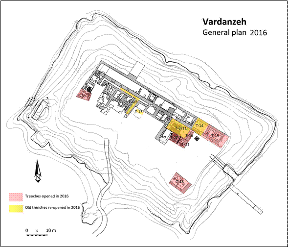
FIG. 1 Vardanzeh, general plan of the citadel and trenches excavated in 2016 (topography Mirzaachmedov on Cerasuolo genarl p
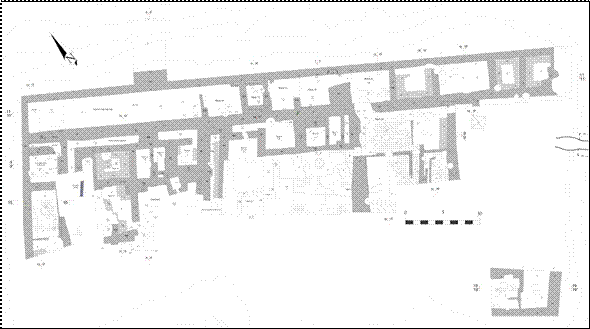
FIG. 2 Vardanzeh, general plan (topography Mirzaachmedov).
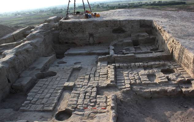
FIG. 3 Trenches 8-11-16-17-21, general view of room 31 (view from west).
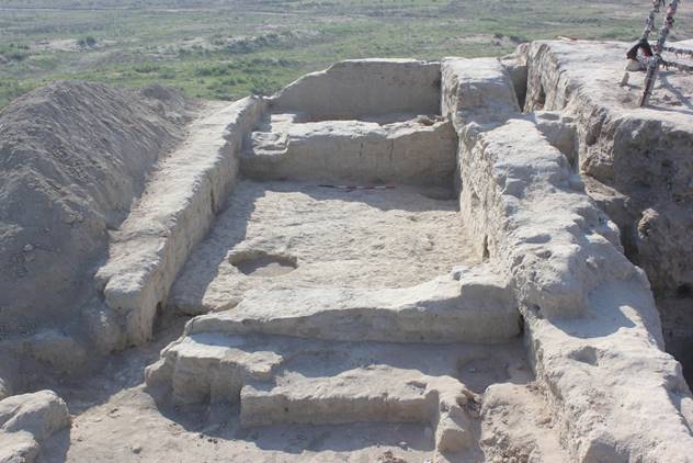
FIG. 4 Trenches 14-19: room 34 (view from west).
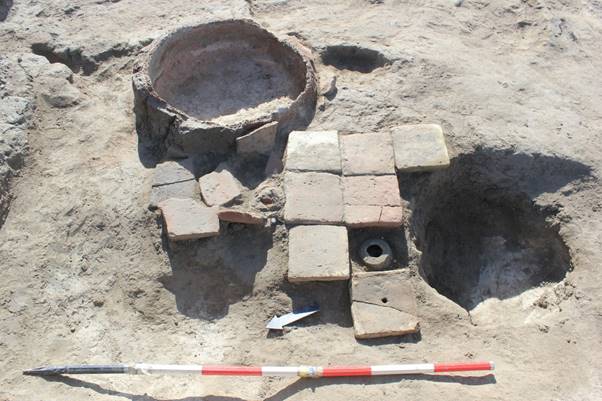
FIG. 5 Trench 18: fireplace SU 688 and floor 694 covering a drainage system (view from west).
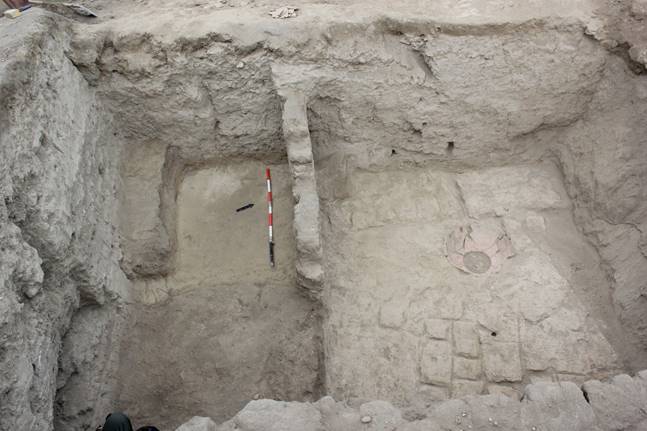
FIG. 6 Vardanzeh, western sector, Trench 20: early medieval phase (view from east).
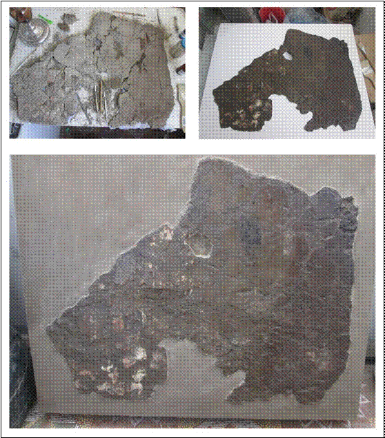
FIG. 7 Trench 8: consolidation and conservation of fragment SU 780 n. 1.
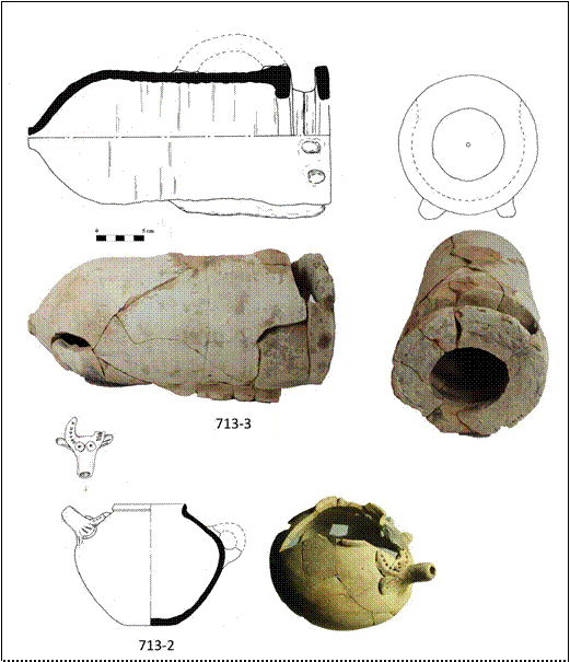
FIG. 8 Trench 16: mousetrap (713-3); pot/feeding bottle (713-2).
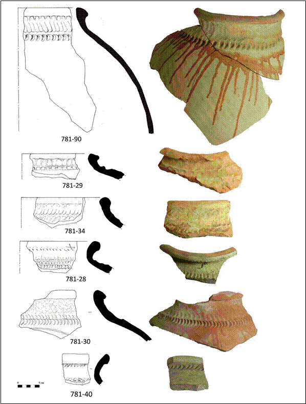
FIG. 9 Trench 19: rims of storage jars decorated with finger marks impressions (781-28, 781-29, 781-30, 781-
34, 781-40, 781-90).
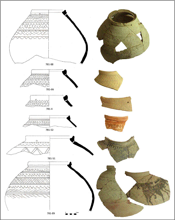
FIG. 10 Trench 19: globular jars decorated with incised motifs (781-4, 781-51, 781-52, 781-66, 781-88, 781-89).
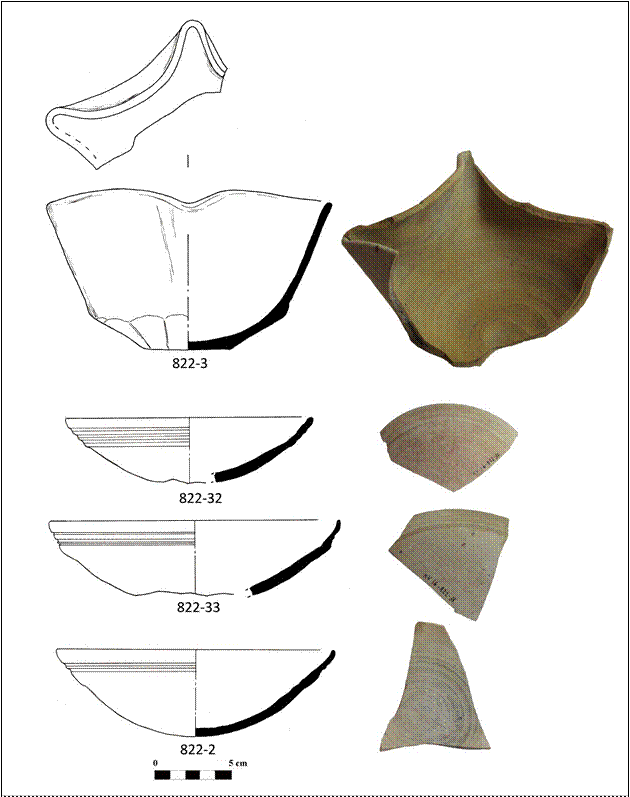
FIG. 11 Trench 19: bowl with festoon like rim (822-3); rims of bowls (822-32, 822-33); bowl with rounded base (822-2).
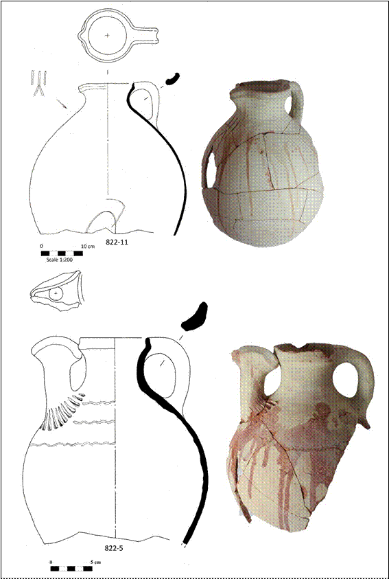
FIG. 12 Trench 19: jugs with moulded spouts (822-5, 822-11).
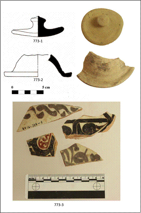
FIG. 13 Trench 19: lids (773-1, 773-2); fragments of glazed dishes (773-3).
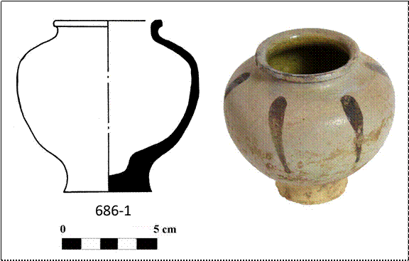
FIG. 14 Trench 18: glazed pot (686-1).
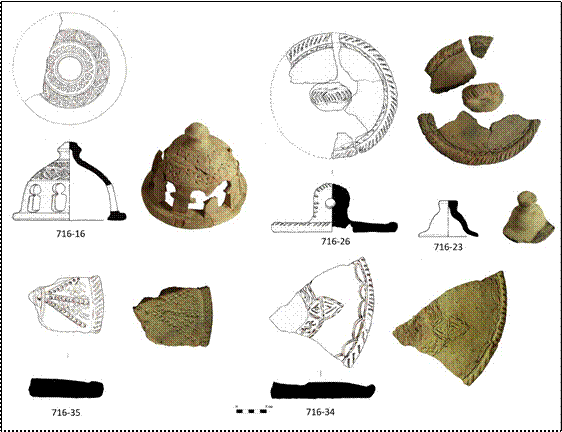
FIG. 15 Trench 18: lids 716-23, 716-26, 716-34, 716-35); pierced lid (716-16).
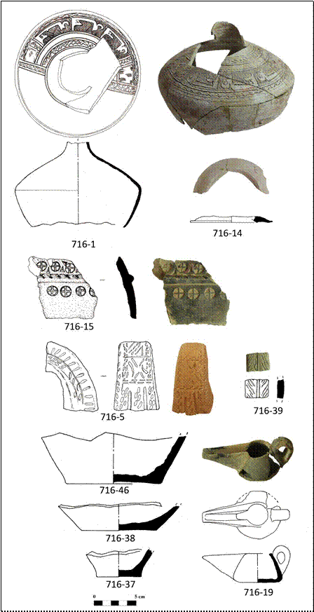
FIG. 16 Trench 18: pot decorated with calligraphic motifs (716-1); fragment of lid (716-14); fragment of pottery showing stamped motifs (716-15); handles (716-5, 716-39); base of jugs (716-37, 716-38, 716-46); oil lamp (716-19).
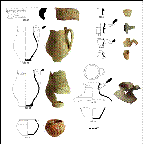
FIG. 17 Trench 18: rim of jar (716-47); rim of small jar (716-3); juglets (716-43, 716-
44), small pot (716-18); rims of jugs (716-6, 716-7, 716-30, 716-31); base of jug (716-
33).
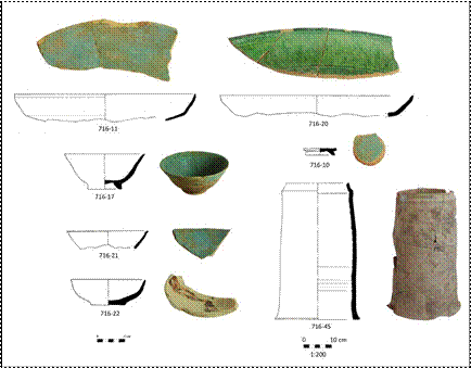
FIG. 18 Trench 18: glazed dishes (716-11, 716-20); glazed bowls (716-17, 716-21);
painted bowl (716-22); tubular pipeline (716-45).
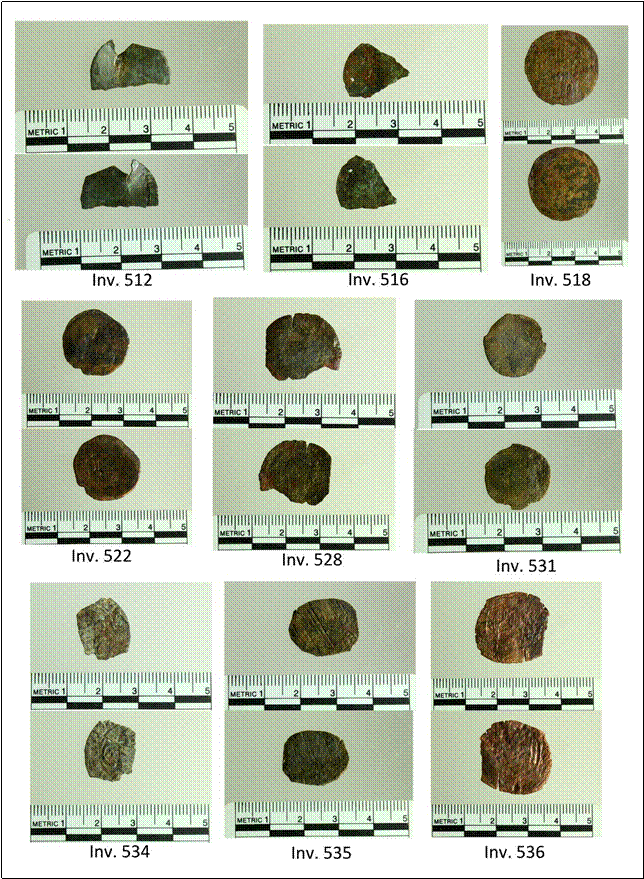
FIG. 19 Unidentified coins (inv. 512, 516, 531), Karakhanid coins (inv. 518, 522, 528, 534, 535), Timurid or Shaybanid
coin (inv. 536).
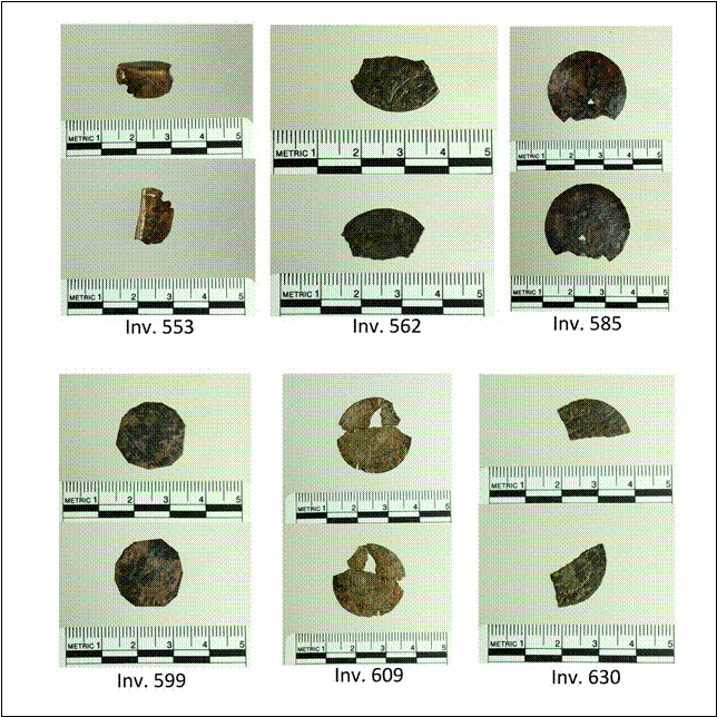
FIG. 20 Unidentified coins (inv. 553, 585, 630), Karakhanid coins (inv. 562, 599, 609).
FIG. 21 Iron artefacts: blames (inv. 539, 540, 557, 579, 582, 586, 590, 592, 603); shovel (581).
FIG. 22 Iron artefacts: horseshoe (inv. 577); tweezers (inv. 580); scissors (inv. 570); fragment of blade? (inv. 530); unknown fragments (inv. 523, 543, 552,
565, 597).
FIG. 23 Glass artefacts: concave bases of vessels (inv. 517, 617); flat bases of vessels (inv. 605, 606); cosmetic pots (inv. 515, 607, 626); handles of vessels
(inv. 567, 613); alambic spout (inv. 614); fragments of stem glass (inv. 604); necks of jugs (inv. 616).
FIG. 24 Glass artefacts: circular windows (inv. 615, 622).
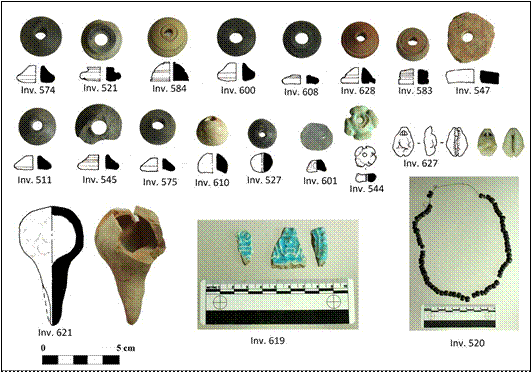
FIG. 25 Various artefacts: bone spindle whorls (inv. 721, 511, 545, 574, 575, 583, 584, 600, 608);
terracotta spindle whorls (inv. 547, 628); glass past beads (inv. 559, 624); bone bead (inv. 610); turquoise beads (inv. 544); terracotta bell (inv. 621), glazed terracotta plaque (inv. 619); lignite necklace (inv. 520); lignite bead (inv. 527); chalcedony gem (inv. 601); cowry shell bead (inv. 627).
|
|
|
PRELIMINARY REPORT
ON THE 2017 FIELD WORK AT VARDANZEH
Silvia Pozzi, Džamal K. Mirzaachmedov and Aisulu Iskanderova
The eighth archaeological excavation on the site of Vardanzeh (ancient Vardāna) was carried out between September 25 and October 28, 2017. The activities focused on the citadel and on the lower city (shahristan), where we investigated both new and already excavated trenches, for a total surface of 274 square meters (Figs. 1-2). The research staff was composed of three archaeologists: Silvia Pozzi, Džamal K. Mirzaachmedov and Aisulu Iskanderova. Architect Siroj Mirzaachmedov updated the topography of the site, while Munira Sultanova, architect as well, drew a selection of artefacts, for a total of 302 finds among pottery (274) and small finds (28). The conservator, Dilmurod Kholov, was in charge of the cleaning and the conservation of the artefacts, working also on-site for the removal of the mural paintings. Anvar Athakodjaev was in charge of the cleaning and the study of the coins found during the excavation.
Excavation
Trenches 8-11-12-16-17-21, already investigated in the previous years, are located in the eastern sector of the citadel. The excavation scheduled for this year aimed at first to clarify the layout of the first constructive phase of the so-called ‘early Medieval palace’, and secondly to reach the previous buildings phase (so-called ‘ancient phase’) buried under a deposit of pebble and sands three meters thick that clearly divides these two building phases. Some features dating to the medieval period were detected during the excavation of these trenches. The most important one is hole SU 332 (in NW corner of T-8), partially excavated in 2013. The hole yielded a large quantity of artifacts, mainly cooking vessels, storage vessels, glazed ware, glazed chirags, glass fragments and a bronze coin dating to the first third of the 11th cent. AD. As far as the early medieval phase is concerned, this year we completed the excavation of room 31, characterized by E-W oriented mud brick platforms. This large room was built on some previous rooms that represent the first building phase of the early medieval palace (rooms 32, 36, 37, 38) (Figs. 1-2). Room 32, partially investigated last year, had very probably a representative function, as suggested by the traces of mural paintings found on walls 29, 827 and this year also on walls 916 and 1022. Unfortunately, all the walls were preserved to a height of ca. 20-30 cm only, since in the 7th-8th cent. AD this area was reconverted into a storage area, and all the ancient walls were cut and covered by the mud brick platforms of room 31. For this reason, only the lower part of the walls and the related paintings were preserved, even though many fragments from the upper part of the walls were found also inside the filling of the room (SU 1009). The mural paintings started from the floor level and were realized on mud plaster 1-2 cm thick, on which a white coat layer of white color was laid. On this layer the proper painting was realized. In a second phase the layout of room 32 underwent some change, as attested by the presence of sufa on all the sides of the room. All the sufa covered the lower part of the mural paintings, even though at that time the upper part was still visible. We can assume that the entrance of the room was located at the southern side, possibly close to sufa 1021. Room 36 (4.40x9.20 m) is located to the south of room 37; it was partially excavated in 2015. At that time we detected only its western limit, constituted by wall 555, while this year we were able to detect the northern limit, represented by wall 911, and the eastern limit, represented by wall 916. A badly preserved floor (SU 910) was detected to the south of wall 911 at an altitude of -3.28 m. A hole (SU 912, alt. -3.15 m) that contained a complete large jar (khum) in situ was also discovered in the NW corner of the room, close to wall 911. The vessel, 1.10 m high, was decorated with an incised tamgha on the shoulder and presented finger marks impressions and red splashes typical of the 7th/8th cent. AD local pottery production. Room 37 (4.60x4.40 m) is coeval with room 32 and is located to the west of it. The eastern side of wall 555/74, delimiting the room to the W, was almost completely destroyed by the presence of a burial (SU 356) and of a medieval hole (389), excavated in the previous years. Remains of a N-S oriented sufa (SU 944) were detected against wall 555/74, under a later sufa (SU 367); both sufa were almost completely destroyed by the burial and the hole. The western part of wall 911, as well as the junction with wall 555/74, were destroyed by hole SU 389, already excavated in 2013. A rammed floor (917) was detected in this room at an altitude of -3.33 m. This floor was characterized by two large spots of red color, probably the remains of some fireplaces, whose traces were detected also on the northern side of wall 911.
Parts of trenches 12, 8 and 17, already excavated in the past years, were further investigated in a large probing trench labelled trench-12-a (4x6.5 m), laid in order to reach the ancient building structures belonging to the so-called ‘ancient phase’ of the citadel, buried beneath the deposit of pebbles and sand detected for the first time during the 2010-11 fieldwork. A platform made of pakhsa blocks and rammed clay (SU 552, alt. ca. -3.20 m) was found beneath the features related to room 36 in the western part of the trench. As shown by the sections of the trench, the thickness of this platform was not uniform, and this difference was probably due to the necessity of leveling the sloping created when the deposit of pebble and sand (SU 595) found under the platform was laid. The platform contained very few fragments of pottery, while the deposit of pebbles and sands yielded some pakhsa blocks of different sizes (45x25x15 cm; 35x25x11 cm). Three walls were detected during the excavation of the pebble and sand deposit. An E-W oriented wall (1015) and another perpendicular wall (1014) tied to the previous one were detected in the southern part of the trench at an altitude of ca. -4.60 m. These walls formed the NE corner of room 1, partially detected in 2011. A dome-shaped fireplace (SU 1025) was found in this room. The fireplace, realized into the brickwork of wall 1015, had an almost quadrangular shape (60x60 cm) and a dome-shaped roof 50 cm high. Immediately to the E of the fireplace, a rectangular deposit of ashes (SU 1026, 56x27 cm), almost 5 cm thick, was found on the rammed floor of the room (SU 1027), detected at an altitude of ca. -6.78 m. In the northern part of the trench another E-W oriented wall (1016) was found and only partially exposed since it continued beyond the northern limit of the trench. At an altitude of ca. 5.11/-5.26 m a N-S oriented compact deposit of clay (SU 1012) was found under the pebble and sand deposit SU 595. A large quantity of pottery, mainly fragments of jars and cooking vessels, was detected inside this layer. Two rammed floors (1031-1032) were detected at an altitude of ca -6.70 m. Floor 1031 was slightly lower than floor 1032, and they were separated by a vertical crack. It is possible that floor 1032 is a sort of basement, later used as floor, since the northern side continues downward quite vertically. A compact deposit of clay (SU 1035, alt. -6.67 m), similar to a rammed floor, was detected 20 cm down from floor 1031. This feature sloped eastward and covered a platform of mud bricks (SU 1036), sloping down eastward as well (Fig. 5). The platform is made of at least two layers of bricks of various dimensions, most of them N-S oriented. Most probably this platform covers one of the mud brick galleries identified during the excavation led in 2011, in particular the easternmost one.
Trench 18 was located in the SE corner of the citadel, and its investigation began last year. The investigation led this year aimed to clear up the whole layout of the SE corner of the perimeter corridor of the early medieval palace, and to clarify the underlying structures dating to the ancient phase of the citadel. Some features dating to the medieval period were also detected in the upper layers of this trench. We refer in particular to an E-W oriented floor (SU 907, alt. -1.69 m) (Fig. 6) made of two external rows of mud bricks and of a central filing of broken fired bricks of red and yellowish color. The southern side was damaged by a niche realized on the previous wall 698, while the northern part was cut by a circular hole (-SU 915) that partially extended beyond the northern limit of the excavation. Most probably this feature is related to the bath area SU 694 and to floor SU 693. As far as the early medieval structures are concerned, the southern perimeter corridor of the early medieval palace was detected in the western part of the trench under a sequence of underlying deposits of clay of different compactness (SSU 908, 910, 914, 918). The southern corridor, delimited by mud brick walls 701 and 909, was connected to the eastern perimeter corridor through a passage 1.20 m wide. Wall 909, E-W oriented, was well-preserved, while the northern side of perimeter wall 701 was extremely eroded and the original vertical profile was completely missing, without any traces of mud plaster. A rammed floor (873) was detected at an altitude of -3.10 m under SU 918, a deposit of friable silty sand of brown color that contained some fragments of jars (Fig. 107). In the eastern perimeter corridor we found the cut of a hole (-SU 905, alt. sup. -3.38 m) of circular shape that contained an archaeologically complete jar, (D: 0.38 m, H: 1.18 m), probably dating to the early medieval period as well (Fig. 7). The removal of the early medieval features cast light on the whole western side of wall 875 belonging to a previous building phase (ancient phase). This wall was buried under a deposit of pebbles and sand (SU 877) and turned westward into a perpendicular wall (906), identified in the southern part of the trench. Only the northern side of this wall was exposed, since wall 831, belonging to the early medieval palace, was built on top of platform SU 876 that covered wall 906. A N-S oriented wall (1037) tied to wall 906 and turning perpendicularly northward was also detected.
Trench 22 measured 4x3.80 m and was located to the north of T-17 (Figs. 1-2). An occupation of this area in the 12th century AD is inferred by the presence of a badly preserved mud brick structure and by some levels of occupation detected after the removal of a superficial layer of sandy clay (SU 945, alt. -1.55 m) that gently sloped from E to W. A large hole (SU 951) was detected in the SW corner of the trench; it yielded a large quantity of glazed and unglazed pottery, mostly dating to the 12th century AD, even though it is probable that this area was used as a rubbish dump also in the following centuries, as attested by fragments of glazed pottery dating to the 18th century AD found in the hole as well. As far as the early medieval phase is concerned, we investigated the continuation southward of room 33 (7th-8th cent. AD), partially exposed last year in T-17. The mud brick wall 768 (alt. -1.89 m), already detected last year in T-17, was found after the removal of SU 946 at an altitude of -1.89 m; it constituted the eastern limit of this room. A rammed floor (SU 954) related to this wall was detected in the northern part of the trench at an altitude of ca. -2.69 m under a soft deposit of sandy clay (SU 951). An iron medal was found on top of it. Another badly preserved rammed floor (SU 1002) was detected at an altitude of – 2.67 m in the SE corner of the trench. At almost the same altitude a fireplace (SU 953, alt. -2.73), locally known as achag, was also detected. This feature, characterized by a circular part and an elongated extension (D: 0.42, length 0.80, H: 30 cm), cut a very compact deposit of clay and mud bricks characterized by rough brickwork, probably the remains of wall (SU 1001, alt. -2.36 m). This feature, E-W oriented, was located in the central part of the trench and extended from wall SU 768 to the W limit of the trench. Another rammed floor was detected at an altitude of -2.74 and was cut by a circular fireplace (SU 1005, D: 0.28 m, H: 0.10 m). The removal of the features belonging to room 33 cast light on the southward continuation of room 31, largely exposed last year. The northern part of mud brick platform SU 779 was detected at an altitude of -2.77 along the northern limit of the trench, and another parallel mud brick platform (SU 1010, alt. -2.77 m) was detected to the south of SU 779, at the same altitude. The removal of these mud brick platforms cleared up part of another room, labelled room 38, coeval with rooms 32, 36, 37. This room (2.60x1.20 m) was located to the south of room 32 and to the east of room 36. To the north it was delimited by wall 1022, and to the west by wall 916, while the southern and the eastern limits are still unknown since they are located beyond the excavation area. As in the case of rooms 32, 36 and 37, the walls are preserved to a very low height only, ca. 30 cm. Both walls 916 and 1022 were decorated with mural paintings starting from the floor level (1030), detected at an altitude of ca. -3.18 m (Fig. 30). The room was filled with a compact deposit of clay (SU 1009, alt. -2.89 m) that contained several fragments of broken mud bricks as well as fragments of walls 916 and 1022, decorated with mural paintings (Fig. 31).
The excavation led in 2017 was localized in the eastern part of the shahristan, in correspondence with the trench opened in 2013. The new trench, labelled S-1, is the westward extension of the old trench; it measured 9 meters in length and 3 meters in width (Fig. 8). Due to the lack of time, the width of the trench was gradually narrowed to 1.5 meters, but the whole stratigraphy unearthed in this trench was visible in the southern section, which has been accurately drawn by Dr. A. Iskandervova. A sequence of superficial layers was found to the west of perimeter wall 921, extending for a depth of ca. 1 m from the crest of the perimeter wall of the shahristan (921). These deposits comprehended layers of destruction (SSU 922, 923, 925, 927), eolic layers (SU 928) and some deposits 10-40 cm thick (SSU 924, 929, 934) that contained cultural material, more specifically fragments of glazed and non-glazed pottery dating from the 16th to the 20th cent. AD. Under these deposits we found some layers of destruction and abandon (SSU 933, 935, 936, 937, 938), pits and hollows (SSU 932, 926). A wall (964) made of mud bricks was discovered against the western side of perimeter wall 921, at a depth of 1.20 meters from the crest of the wall. In accord with the stratigraphy visible in the S section of the trench, the wall was built using a mixed technique. Coeval mud brick masonries (SSU 961, 962, 963), covered by a deposit of gravel and small lumps of clay (SU 965) and by a filling of dense loamy clay (SU 957), were found to the west of wall 964. These masonries were laid on a deposit of loamy soil characterized by a small amount of gravel (SU 971). This deposit had a variable thickness (0.60 to 1.70 m) and was laid between the foundation of wall 921, labelled SU 976, and wall 958, another mud brick structure located to the west of masonries SSU 961-963. A vertical crack was visible in the central part of the masonry of wall 958. The orientation of the brickwork located to the west of the crack seemed to be slightly oblique. Possibly this was due to the pressure caused by the upper layers of destruction. Wall 958 was built on a deposit of loamy clay (SU 972), in which fragments of jars, jugs, bowls, pots and millstones were found. This deposit covered a structure consisting of two rows of mud bricks (SU 973). A small hole (SU 983) measuring 60x170 cm was found under SU 974 and SU 979. Deposit SU 979, spread all over the whole trench, was characterized by several lenses of clean gravel (SU 991) and contained potsherds made of red fabric, mortars and spindle whorls. Deposit SU 970 covered a deposit of loam and gravels (SU 986). In the eastern part of the trench a storage jar archaeologically complete was found buried in this layer. The base of the jar was set on another deposit of loam (SU 987) that covered a similar loamy layer (SU 988). The underlying deposit (SU 989), of yellowish color, consisted of a layer of loam mixed with gravels, without any trace of potsherds. The virgin soil (SU 990) was detected at an altitude of -9.50 m from the crest of perimeter wall 921.
The excavation led this year both in the citadel and in the shahristan allowed us to collect a total of 2,180 analyzed fragments, 1,766 un-diagnosed and 414 diagnosed. In the citadel alone the total amount of the pot sherds came to 1,391, with 285 of them diagnosed, while in the shahristan we collected a total of 789 pot sherds, 129 of them diagnosed. Descriptions, photos and drawings of the inventoried diagnosed potsherds were stored in the Diagnostic pottery database. The analysis of the functional classes within the diagnosed pottery unearthed this year revealed that the most frequent class is storage ware (46%), followed by glazed ware (22%) and cooking ware (17%). The large amount of glazed ware is due to the excavation of the two large medieval holes in the citadel and of the upper layers in S-1, very rich in pottery dating to the 18th-20th century AD. We also found a small quantity of unglazed table ware (12%), lamps (1%), storage pottery re-used as pipelines in drainage systems (less than 1%), some fragments of specific ceramic pipelines (less than 1 %), ritual pottery (less than 1 %) and pottery used for other purposes (less than 1 %).
Pottery found in the citadel comprehends a repertoire of pottery dating to the medieval period (10th-12th cent. AD), potsherds dating to the 7th-8th cent. AD, and a complex of earlier pottery (4th-5th cent. AD), found both in the first building phase of the early medieval palace and in the ancient phase, in particular in the deposits of filling in T-12-a. The dating of this last group is rather problematic since few specimens can be safely compared with pottery characterized by an already established chronology. Most probably we are in the presence of a local pottery production that developed its own characteristic traits, even though there are some shapes that can be considered as a ‘bridge’ between the general trends of the Bukhara oasis during the 4th-5th cent. AD and this local production. Pottery dating to the medieval period comprehends well-known shapes, both glazed and un-glazed, that belong to the categories of storage vessels, table vessels, cooking ware and pipelines (Figs. 9-11). Among the storage vessels there are basins, lids decorated with incisions, two fragments of a particular type of lid with a central hole, already detected in the same hole in 2013, pots decorated with red painted motifs, also typical of this period. Particularly interesting is a fragment of a bell-shaped lid decorated with a stamped impression showing a peacock under an arch (Fig. 11). The table vessels category comprehends thin walled jugs with narrow neck, specimens with larger neck and fragments of glazed dishes characterized by green and turquoise glazing or by painted vegetal motifs on yellowish background. The complex of medieval cooking ware comprehends all the attested shapes as well, e.g. the globular pots with globular rim or with pointed rim and inset for a lid, and the jugs used for boiling water. Pottery dating to the 7th-8th cent. AD includes fragments of jars decorated with finger marks impressions and red or brown splashes of slip, as well as a complete vessel of this type (Fig. 12) with a composite tamgha incised on its upper part. This sign, incised before the firing, is made up of two identical motifs: semicircular shapes containing semicircles whose ends are connected by a line. Pottery dating to the earlier period comprehends several examples of jars decorated with circular finger marks impressions, jugs, bowls and cooking vessels (Figs. 13, 14, 17). Among the storage vessels there are also globular jars decorated with incised motifs and holes on the neck, both in fine and in rougher ware. We have also exposed several examples of storage jugs with wide neck, characterized by different types of rim: everted rim with globular lip, vertical rim with triangular section, everted rims, carinated. Among the tableware we have found a fragment of a bowl of hemispheric shape and indistinct rim, and a bowl with more straight sides. There is also a fragment of a carinated bowl with reverted rim and everted lip that presents traces of brown slip, quite unusual in the later pottery production. An assemblage of various cooking ware was also found. All the specimens are modelled and characterized by a coarse fabric of red-brown color, with a high density of well-sorted stone inclusions, of white, gray and pink color. The pots are usually short-necked and present an everted rim, sometimes of globular section.
The pottery found in the shahristan includes a rich complex of pottery dating to the 16th-20th cent. AD (Figs. 18-20), found in the upper layers of trench S-1. Furthermore, there are a few specimens dating to the medieval period (12th-13th cent. AD), and potsherds dating to the beginning of the early medieval period, in particular to the 4th-5th cent. AD (Figs. 21-24). Pottery dating to the 12th-13th cent. AD is attested by fragments of dishes with turquoise glazing, jugs for boiling water and basins. Pottery dating to the 16th-17th cent. AD is represented by some fragments of glazed dishes decorated with grid-like motifs of blue color on white background. Pottery dating to the 17th cent. AD is represented by fragments of jugs characterized by gray fabric and decorated with stamped motifs (circles with central dots), and by some glazed dishes decorated with painted motifs in blue on white background. Pottery dating to the 17th-18th cent. AD comprehends fragments of a jar decorated with a ribbon-shaped relief, a fragment of an oven (tandyr), and two fragments of glazed ware, while ceramic finds dating to the 18th-19th cent. AD comprehend basins (tagora) in gray or red ware. The complex of pottery dating to the 19th-20th cent. AD can be divided into glazed dishes and bowls, glazed and unglazed basins (tagora), jars (khum), jugs (kuvshin) and vessels for storing oil. The manufacture of this last category of vessels is rough, the vessels are thick-walled and the inner part is glazed. We have also found a few specimens of glazed sanitary pots (tuvak), usually positioned under the cradles and used to collect the baby excrements. Pottery dating to the earlier periods includes several types of vessels: jars, jugs, bowls, dishes, cups and pans. As in the case of the pottery excavated in the lowest levels of the citadel, these finds also show specific traits not easily comparable with the production from other sites. An accurate study of this material will be realized in the near future on the base of the results of the C14 analysis. Jars with finger marks impressions can have a slightly everted rim, similar to the jars found in T-12-a, but also more vertical rims (similar to some types attested in Kizil Kir-Setalak and in Uch Kulakh). Storage jars without finger marks impressions and made of a more refined fabric are also attested. Several examples of storage jugs were also found, showing a variety of rims. The category of bowls includes several specimens, most of them characterized by a truck-conic shape. As far as the cooking ware is concerned, we have found several fragments of modelled pots made of the same coarse fabric used for cooking vessels found in the lower levels of the citadel (T-12-a). These vessels are usually characterized by a vertical or everted rim, sometimes marked by a globular extremity. The coarse ware used for cooking vessels was also used for the modelled incense burner found in this trench.
This year we unearthed metal finds, glass artefacts, terracotta artefacts, fragments of mural paintings, a single specimen of a bone find, and several examples of millstone - a total of 44 inventoried finds. 8 metal items have been found: 2 bronze coins, 5 iron finds and 1 bronze find. The first coin (Fig. 26, Inv. 631) is a fulus minted in Bukhara during the United Qarakhanid Kaganate, which can be dated to the first third of the11th cent. AD. The second coin (Fig. 26, Inv. 639), dating to the end of the 11th cent. AD, was also minted in Bukhara under Mahmud b. Sulayman (Western Qarakhanid Kaganate). The iron finds, which were all covered by rust, can be divided into weapons, tools and decorations (Fig. 28). The first category comprehends a single specimen, an arrowhead with tapered head (inv. 640), probably dating to the 12th cent. AD. Among the tools we have a folded nail or a hook (inv. 644), probably dating to the 12th cent. AD. Among the decorations there is a star-like medal (inv. 645). The remaining iron objects are of unknown use (Inv. 641, 643), even though we can hypothesize that the first one could have been attached to some wooden part, seen as the small hook on the backside. The only bronze find (Inv. 650) we unearthed this year is also of uncertain identification since it is merely a flat fragment, possibly part of a small vessel. The bulk of glass finds (Fig. 25) comprehends several fragments of glass vessels (Inv. 635-638, 642, 646) and fragments of a circular window of turquoise color (Inv. 634), all dating to the 12th cent. AD. Among the glass vessels there are two protruding bottom parts of (Inv. 636-638), both of light green color with a rim of light green color (Inv. 637), probably belonging to an open-shaped vessel, characterized by an irregular shape (oinochoe-like rim?). Two specimens of particular interest are a fragment of a stem of white-yellowish color, with a circular ring-like base (Inv. 635), and a small fragment of a spout of an alembic (Inv. 642). The terracotta finds unearthed this year (Fig. 27) comprehend two almost complete glazed oil lamps (chirags) (Inv. 632-633), a fragmented spout of an oil lamp (Inv. 647), a miniature vessel (Inv. 666), four spindle whorls (Inv. 649, 662, 664, 675), and a loom weight (Inv. 674). The miniature vessel, modelled, is pomegranate-shaped and characterized by a very short vertical rim and a flat base. The spindle whorls comprehend 3 specimens made for this specific purpose (Inv. 649, 662, 675), and one specimen recycled from a pottery sherd (Inv. 664). Two specimens are dome-shaped while one has a trunk-conic shape. Judging from their stratigraphic position and the related pottery, all the spindle whorls can be dated to the 4th-5th cent. AD. A loom weight dating to the 19th cent. AD (Inv. 674) has also been found. This specimen was obtained by re-using the ring-like base of a glazed bowl, with dark scratched motifs and greenish glazing. The base was cut and then pierced in the central part. The stone finds unearthed this year comprehend eight tools used for grinding wheat or other grains, all of them probably dating to the 4th-5th cent. AD (Fig. 29). Seven specimens were probably used as mortars (Inv. 667, 668, 669, 671, 672, 673), while one was used as pestle (Inv. 670). Many of them have been found in groups, suggesting the presence of a cooking area or a place where the rough material was processed. All the mortars had an irregular shape and some of them were probably broken. Usually they had a concave upper side where the grains were ground, and one or more carved sides, usually flat. The pestle had an elongated shape and smoothed sides.
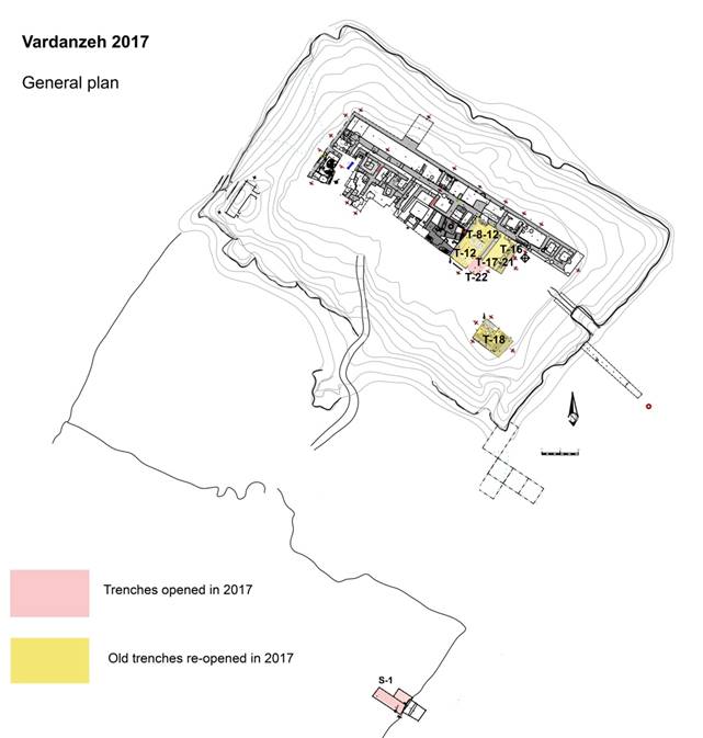
Fig. 1 Vardanzeh, general plan of the citadel and trenches excavated in 2017 (Topography Mirzaachmedov on Cerasuolo plan).
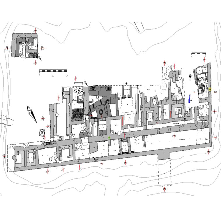
Fig. 2 Vardanzeh, general plan 2017 (Topography Mirzaachmedov on Cerasuolo plan).
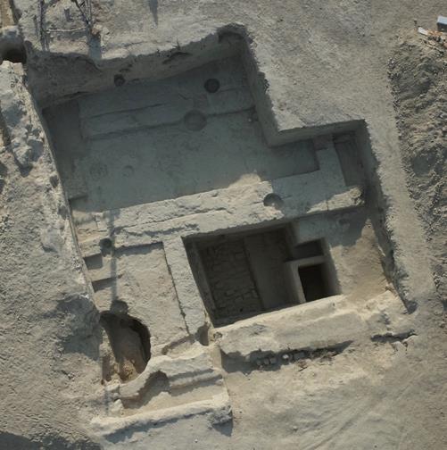
Fig. 3 Citadel, general picture of trenches 8/11/16/17/21/22 (shot with kite).
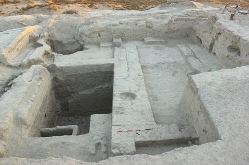
Fig. 4 Trenches 16/17/21: room 32 (right); T-12-a (left). (View from S.)
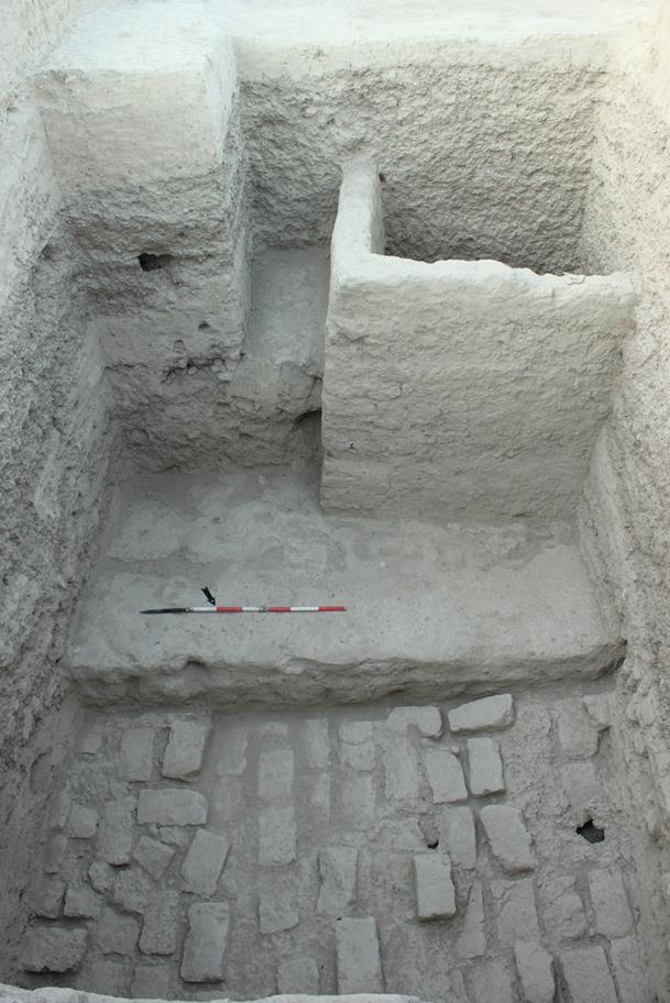
Fig. 5 Trench 12-a: mud brick platform SU 1036 (view from N).
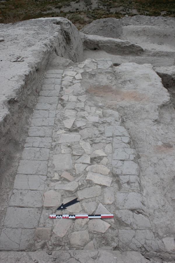
Fig. 6 Trench 18: platform made of fired bricks and mud bricks SU 907 (view from W).
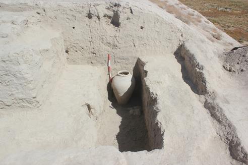
Fig. 7 Trench18: jar SU 905, completely exposed (view from S).
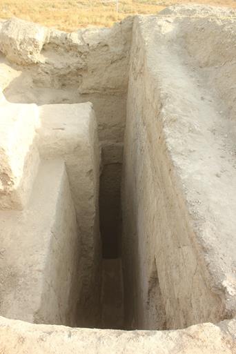
Fig. 8 Trench S-1: general view at the end of excavation (view from W).
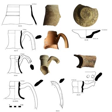
Fig. 9 Trenches 8/11: rims of thin walled jugs (332-70, 332-83, 332-87); rims of jugs for storage/boiling water (332-19, 332-49/54); handle of jug; concave lid (332-68).
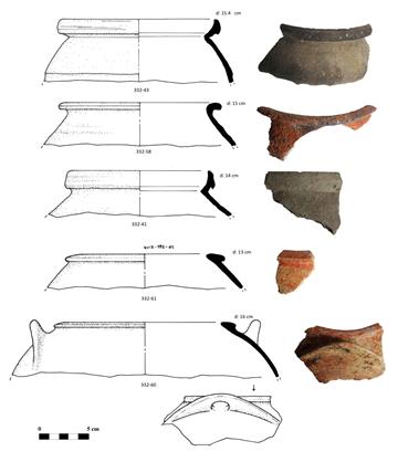
Fig. 10 Trenches 8/11: cooking pots with globular shape (332-41, 332-43, 332-58, 332-60/61).
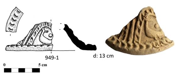
Fig. 11 Trench 22: bell-shaped lid with peacock-shaped impressed motif.
Fig. 12 Trenches 8/11: storage jar, complete (912-1).
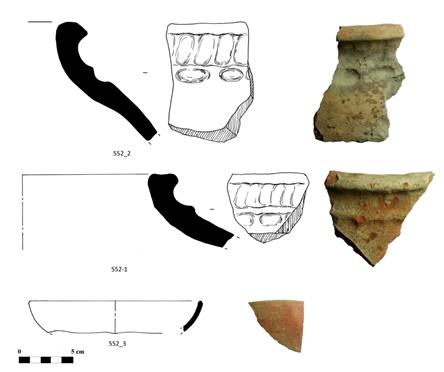
Fig. 13 Trench 12-a: rim of jars (552-1/2); rim of bowl (552-3).
Fig. 14 Trench 12-a: cooking vessels (1012-8, 4/2, 3/9); rim of storage jar (1012-6); spout of jug (1012-1).
Fig. 15 Trench18: rim of storage jar decorated with incised tamgha (873-1).
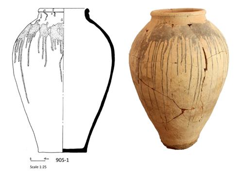
Fig. 16 Trench18: storage jar (905-1).
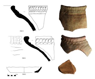
Fig. 17 Trench18: rims of storage jars (918-1, 918-3); base of jar (918-2).
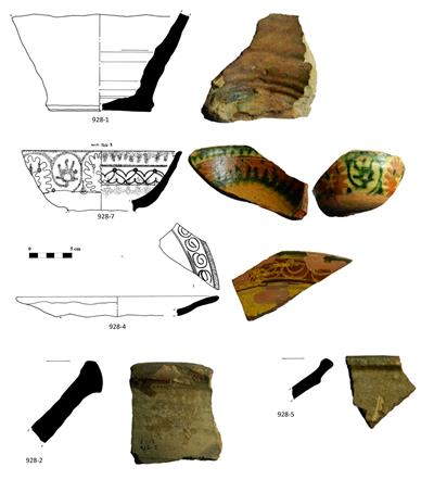
Fig. 18 Trench S-1: base of glazed jar for storing oil (928-1); glazed bowl (928-7); rim of glazed dish (928-4); rim of basin (928-2); rim of glazed basin (928-5).
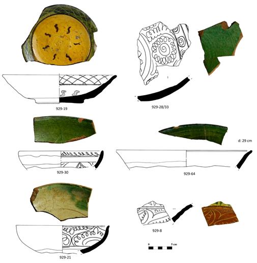
Fig. 19 Trench S-1: dishes (929-19; 929-28/33, 929-8, 929-64); bowls (929-30, 929-31).
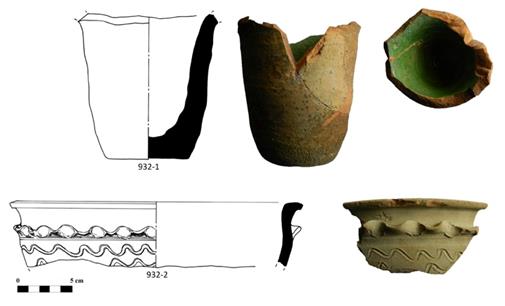
Fig. 20 Trench S-1: jar (929-32); sanitary pot (tuvak) (932-1).
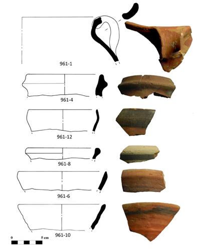
Fig. 21 Trench S-1: pot (961-1); rims of jugs? (961-4, 961-8); bowl (961-12); cups (961-6; 961-10).
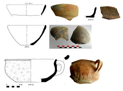
Fig. 22 Trench S-1: bowls (979-3, 979-5); pan (979-11); modelled cup (979-12).
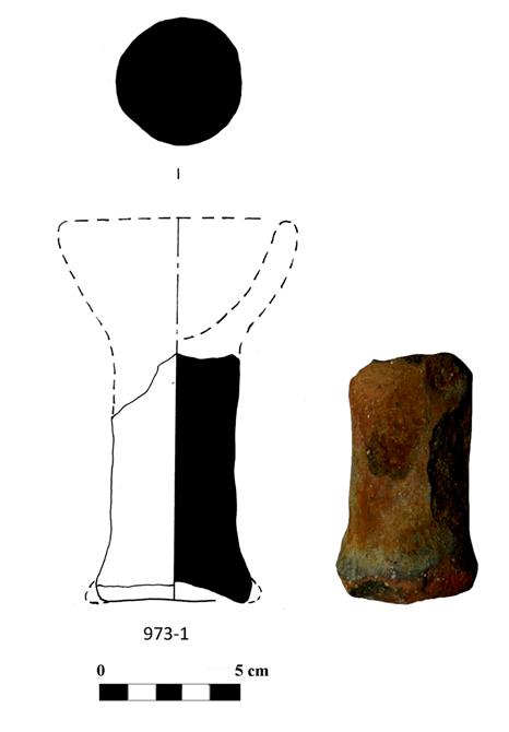
Fig. 23 Trench S-1: stem of a modelled incense burner (973-1).
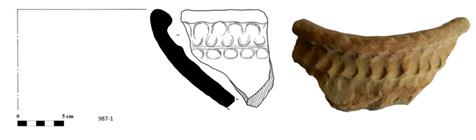
Fig. 24 Trench S-1: rim of jar (987-1).
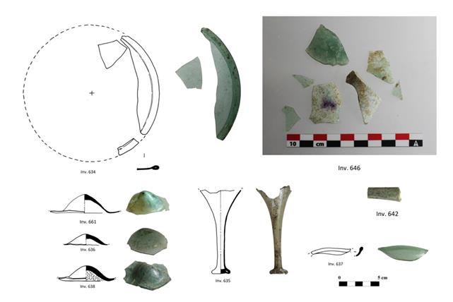
Fig. 25 Glass artefacts: circular window (Inv. 634); protruding bottom parts of glass vessels (Inv. 636, 638, 661); stem of glass vessel (Inv. 635); fragment of spout of alambic? (Inv. 642); rim of vessel (Inv. 637); various fragments (Inv. 646).
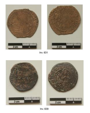
Fig. 26 Karakanid coins.
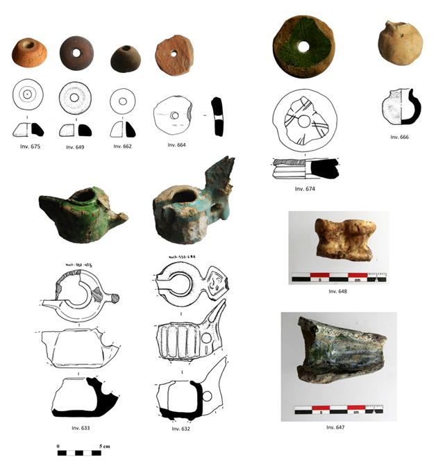
Fig. 27 Terracotta artefacts and bone finds: terracotta spindle whorls (Inv. 649, 662, 664, 675); loom weight (Inv. 674); miniature modelled vessel (Inv. 666); glazed oil lamps (chirags) (Inv. 632, 633); spout of glazed oil lamp (Inv. 647); atragal (bujul) (inv. 648).
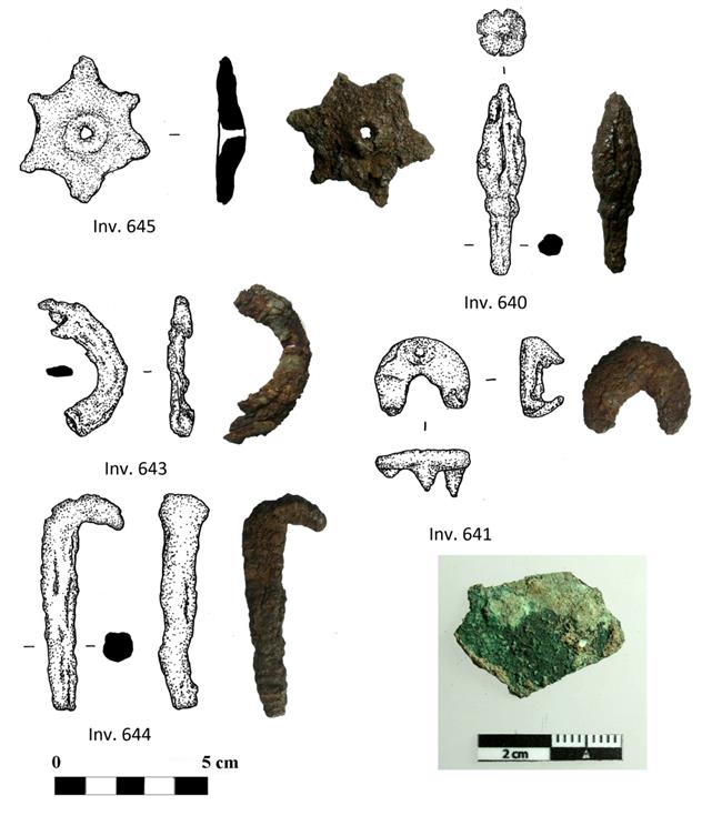
Fig. 28 Metal artefacts: iron decoration (Inv. 645); iron arrow head (Inv. 640); iron hook (Inv. 644); unknown iron objects (Inv. 641, 643); unknown bronze bject (Inv. 650).
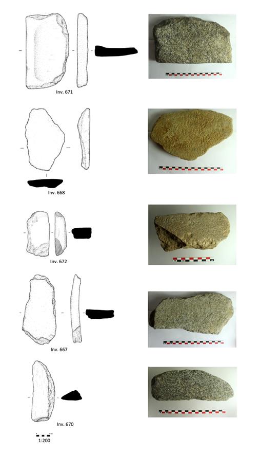
Fig. 29 Stone artefacts: mortars (Inv. 671, 668, 672, 667); pestle (Inv. 670).
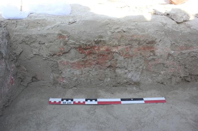
Fig. 30 Trench 22: walls 91022 with traces of mural paintings still in situ (view from S).
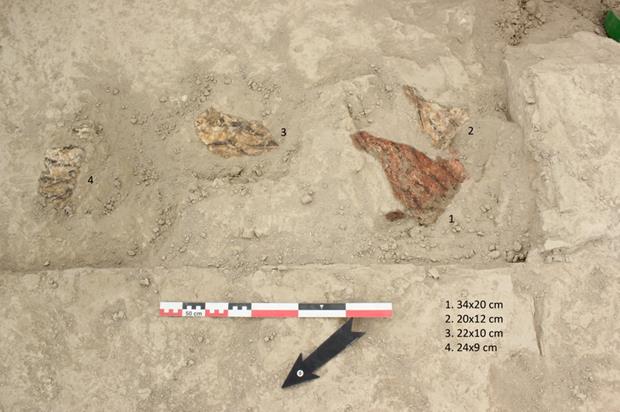
Fig. 31 Trench 22: fragments of mural paintings found inside the filling SU 1009, after the first coat of paraloid and acetone.
PRELIMINARY REPORT
ON THE 2018 FIELD WORK AT
VARDANZEH
The ninth archaeological excavation
on the site of Vardanzeh was realized between April 9 and May 12, 2018, plus
two days devoted to complete the documentation. The activities focused on the
citadel, where we investigated both new (T-23, T-24, T-25) and already
excavated trenches (T-8, T-11, T-12a, T-16, T-17), for a total surface of 203
m² (Figg. 1-3). The
research staff was composed of three archaeologists: Silvia Pozzi, Džamal K.
Mirzaachmedov and Aysulu Iskanderova. Siroj Mirzaachmedov, architect, updated
the topography of the site, while Munira Sultanova, architect as well, drew a
selection of artefacts, for a total of 445 finds among pottery (398) and small
finds (47). The conservator, Dilmurod Kholov, was in charge of the cleaning and
the conservation of the artefacts, while Anvar Athakodjaev was in charge of the
cleaning and the study of the coins found during the excavation.
The
excavation produced important results that improved our understanding of the
layout and of the chronological assessment of both the Early Medieval
structures and the ancient structures buried beneath the pebbles and sand deposits.
As far as the Early Medieval structures are concerned, we have new data both on
the internal part of the palace (in the eastern sector) and on the perimeter
corridors that encircled the palace itself. As to the internal area, the
excavation led in T-8/11/16 confirmed that in the first building phase this
area was used for representative purposes, as suggested by two large rooms (room
32 and room 43), one of which (room 32) is decorated with
mural paintings that started from the ground level (Figs. 4-6). During the first building phase both rooms
underwent some changes, which probably didn’t modify their original function,
unlike later modifications (VII-VIII cent. AD), when walls and the sufa were
razed and the space reconverted into a storage area. The major change
registered in rom 32 was the construction of a sufa that covered the
lower part of the painted walls. Room 43 was instead divided first into
two spaces (room 41 and room 42) by a small partition wall (998), and, at a
later stage, wall 998 was razed almost to the floor level, and a new wall (911)
was built, creating two new rooms (36 and 37). The excavation led in T-24
uncovered the ruins of another large room (room 38) located to the south
of room 32 (Fig. 9).
This first building phase can be assigned to the IV-VI cent. AD on the basis of
a C14 analysis realized on a sample of charcoal collected from the preparatory
phase of the palace itself, even though another sample, collected in the inner
part of the palace (T-24), would not exclude an even earlier date (III-V cent.
AD). As far as the perimeter corridor of surveillance is concerned, a new
square room (room 40) with a sufa on all four sides was detected in the
part of the E corridor exposed in T-25, suggesting that also this segment was
probably partitioned into several rooms, as already ascertained in the N
corridor (Fig. 11). The
pottery fragments would suggest a dating of this room to the VII-VIII cent. AD,
in line with the dating of the rooms unearthed northwards. On the contrary, the
S corridor of surveillance, exposed this year in T-24, did not yield any traces
of rooms and probably maintained its original layout (plain corridor) through
the whole period of use (Fig. 10).
Apart from the pit holes and the drainage system dating to the X-XII cent. AD,
the presence of potsherds dating from up to the XIX cent. AD would suggest that
the southern part of the Early Medieval palace was constantly used as a rubbish
dump. In this area (T-24) the southern perimeter wall was almost razed to the
ground level, except for the most eastern part, where also the external façade
was exposed.
With regard to the ancient structures
buried beneath the pebbles and sand deposits, an E-W oriented corridor (corridor
44), delimited by walls 81 and 1016, was found. A passage in wall 1016
connected the corridor with the area to the south of wall 1016. Based on the
C14 analysis this phase of occupation might be dated to the I-III cent. AD.
This date should refer to the very last phase of occupation of the corridor, as
another structure emerged from the floor level, suggesting that there was also
a previous phase of occupation of the corridor itself. It consisted of a
gallery (SSU 1151) built inside corridor 44 and sloping westward (Fig. 7). Part of the vault, made of
mud bricks, protruded from the floor and was thus visible when the floor was in
use. Traces of another gallery (SU 1163) that sloped eastward were found to the
S of wall 1016. We initially supposed that this gallery was the continuation of
gallery SU 3 detected in 2011, but its orientation is slightly different, so we
have to imagine that the gallery, which once reached the area of our trench,
turned slightly southward. In T-12a-1 the gallery should have been ‘channeled’
between walls 1016 and 1143, both continuing also downward. Like the previous
one, this gallery had a vault made of mud bricks, but it is preserved only for
a small part (Fig. 8). In
this gallery, very badly preserved, we didn’t reach the floor level.
A total of 3.326 pottery fragments
were unearthed and processed this year: 2.770 un-diagnostic (83%) and 556 (17%)
diagnostic potsherds. The majority consists of un-glazed ware (96%), and only
4% of glazed ware. The diagnosed potsherds were evaluated considering all the
single fragments of rims, bases, functional parts (also from the same broken
vessel), as well as the vessels found complete and the walls decorated with
previously unknown motifs or incised signs (tamga/nishan). After
counting all the fragments, the diagnosed and un-diagnosed potsherds that
belonged to the same vessels were glued and inventoried as single specimens in Diagnostic
pottery database, completed with descriptions, measurements, photos and
drawings. The glazed ware followed the same criteria of registration, but in
the case of SU that contained only un-diagnosed glazed potsherds, one specimen
of each type of glazing (different for color or decoration) was also
inventoried in the database, as proof of that type of pottery. The analysis of
the functional classes within the diagnostic pottery unearthed this year
evidenced, as usual, that the most common class is represented by storage ware
(59%), followed by cooking ware (18%) and table ware (17%), both glazed and
un-glazed. The storage ware re-used as pipelines represents 3%, while the
specific pipelines 1%. A small percentage (1%) consisted of glazed oil lamps
(1%), and of pottery used for specific purposes (flowerpots, trays, known as dastarkhan).
The ritual ware is less than 1%.
Pottery unearthed this year was
divided into 4 chronological periods (Figs.
12-22). Medieval pottery includes potsherds of various epochs (from
the IX to the XIX cent. AD), found mainly in T-23-24-25. Few potsherds,
unearthed in the lower levels of T-23-24 and in T-25, were dated to the
VII-VIII cent. AD. Potsherds possibly date to the IV-VI cent. AD were mainly
found in the first building phase of the Early Medieval palace and in the
deposits of pebbles and sand (T-8/11/16), while pottery supposedly dating to
the I-III cent. AD was found in T-8/11/12a/16, in correspondence with the
ancient structures found beneath the pebbles and sand. The dating of the
pre-Islamic pottery is still under discussion, especially as far as the two
most ancient groups are concerned. Pottery dating to the I-III cent. AD
includes storage vessels like jars and jugs, cooking vessels, table vessels and
ritual ware. Among the storage vessels we have fragments of un-necked jars
decorated with circular finger mark impressions, and stripes of dark slip
casually laid on the surface, similar to the Kizil Kir production. The most
remarkable specimen found this year in the lowest levels of the citadel was a
modeled incense burner made in medium-coarse fabric of red color (Fig. 13). The specimen has a flat
base decorated with finger mark impressions, and a cylindrical stem adorned
with a disk in its upper part. The cup proper is
conical in shape. The rim is not preserved. Traces of red slip are still
visible on the external surface, while the inner part of the cup shows black
traces of burning. Pottery dating to the IV-VI cent. AD includes storage ware,
cooking ware and tableware. Among the storage ware we have un-necked jars
decorated with finger mark impressions, necked jars decorated with an impressed
festoon-like motif on the rim and incised zig zag and wavy lines on the
shoulder, as well as a jar made of fine fabric, characterized by an everted and
flattened inset rim, with a rectangular section. The storage jugs are usually
made of fine material and have flared necks, characterized by different types
of rims: collared rims with a globular lip, central hollow and lower
carination; rims of triangular section; rims of circular section, with a deep
hollow and a marked carination. Of particular interest is the upper part of a
jug with flared neck and collared rim of rectangular section, marked externally
by a slight hollow.
The neck of the vessel is decorated
with lines evidently made by the potter’s wheel, and shows traces of black
strips that started from the rim. Cooking ware is represented by a fragment of
a pot with large mouth and handle, while table ware is
represented by a fragment of a hemispherical bowl with traces of red slip, by the rim of a carinated plate of conic shape, and a characteristic short
everted rim with a bulbous extremity and red slip on the internal and external
surfaces. Pottery dating to the VII-VIII cent. AD includes
principally storage vessels and table vessels. The jars, wheel-made, have
bulbous everted rims and necks and are decorated with circular and elongated
finger mark impressions. As far as the rich complex of jugs is concerned,
several specimens are well-known oinochoe-like vessels, characterized by a
small moulded spout. Medieval pottery includes both
un-glazed and glazed ware and can be subdivided into pottery dating to the IX-X
cent. AD, pottery dating to the X-XII cent. AD (with several sub-groups),
pottery dating to the XV-XVI cent. AD, pottery dating to the XVI-XVII cent. AD,
pottery dating to the XVII cent. AD, pottery dating to the XVII-XVIII cent. AD,
pottery dating to the XVIII cent. AD and few potsherds dating to the XIX cent.
AD. The largest group is represented by pottery dating to the X-XII cent. AD.
Large un-glazed storage vessels include jars,
different types of jugs, some of them re-used as pipelines, and basins (tagora).
We also have some examples of thin-walled storage vessels of smaller dimensions
and several types of lids. Among the cooking vessels there are globular pots
and ceramic ovens (tandyr). Among the un-common types of vessels we have
a fragment of a tray characterized by a modeled foot (dastarkhan), a
flowerpot decorated with a wavy line on the rim, and a ceramic lamp
characterized by its conical shape and flat base. Glazed pottery dating to the
X-XII cent. AD includes fragments of bowls and dishes, vessels decorated with
brown and red painted motifs (geometrical or floral motifs) on a white
background, vessels characterized by greenish glazing, and potsherds
characterized by turquoise color glazing. Pottery dating to the XV-XVI cent. AD
is represented by few glazed potsherds, mainly decorated with blue or light
blue motifs on a white background. Pottery dating to the XVI-XVII cent. AD
consists of two fragments of un-glazed vessels and some fragments of storage
jugs characterized by grey fabric and decorated with impressed and incised
motifs. Among the pottery dating to the XVII-XVIII cent. AD there are few
fragments of dishes characterized by greenish or dark turquoise glazing.
Potsherds dating to the XVIII cent. AD are mainly represented by bowls and
dishes decorated with brown zangir motifs on a light brown background,
by greenish dishes with scratched motifs or by plain glazed ware of light brown
color. Two fragments of pottery dating to the XIX cent. AD were also found.
Finds
This year we unearthed metal finds,
glass finds, beads made of glass paste, terracotta artefacts, bone finds,
shells, stone finds: a total of 67 inventoried finds. As to the metal finds, a total of 29 were discovered this year, among them 12 coins (two of them
very fragmented and therefore illegible), 5 bronze and 12 iron finds. All the
coins except one specimen came from T-25. Nine coins are dated to the
Kharakhanid period (XI-XII cent. AD); one coin (Inv. 703), almost illegible, dates
to the IX-XI cent. AD, while another one (Inv. 719), found inside a medieval tandir,
is an Asbar early imitation dating to the middle of the 4th to 3rd quarter of the V cent (Fig. 23).
AD. The majority of the iron finds were found in T-25. They include a fragment
of a blade, a leaf-shaped knife, two arrowhead tips, two hooks, a ring-shaped
object and five finds of unknown use (Fig.
24). Judging from their stratigraphic provenance, all these finds
can be dated to the XI-XII cent. AD. The bronze finds comprehend two fragments
of unknown objects, three small slags and a tubular object, hollow inside,
possibly a whistle, decorated in its central part with a row of ‘X’ motifs (Fig. 25). The glass finds unearthed this year can be divided into three categories: vessels, circular
windows, and ornaments made of paste glass beads. Among the glass vessels, we
have two vessels of light green color with protruding bottoms, the neck of a
small jug, also of light green color, the handle of a small vessel
characterized by its straight handle that is fixed at an angle of 90 degrees,
and a fragment of an unknown vessel (glass?) covered by white patina (Fig. 26). The terracotta finds (Fig. 28) include a token
or an unfinished spindle whorl made from the wall of a vessel, a rough spindle
whorl also made from the wall of a vessel, and two glazed oil lamps (chirag).
One of these, dated to the XVI-XVII cent. AD, has a circular oil tank opened in
the upper part (now destroyed) and dark turquoise glazing. The second oil lamp,
also broken, had a trunk-shaped conic oil tank and a multifaceted spout.
Bone and shell finds (Fig. 27)
include two cowry shells, a very small cowry shell, two buttons decorated with
incised motifs, and part of a comb characterized by teeth at both sides. The teeth
are of different thickness, only the thicker ones are preserved. Its central
part, used as handle, is decorated on both sides with nucleated circles. Both
the buttons and the comb can be dated to the XI-XII cent. AD. Some rough beads
of red color, probably made of coral, were also found. Among the stone finds (Fig. 28) unearthed this
year are a broken millstone, flat on one side, and 13 beads. A red chalcedony
bead, characterized by its shape made up of parallel pipes (six faces) was
found in T-25; it can probably be dated to the XI-XII cent. AD. The other 12
beads are all made of black lignite: 7 are of cylindrical shape (Inv.
690), and 5 of a double conic shape. A large bulk of glass paste beads (Fig. 29) was also found. The beads,
very eroded and fragile, are of different shapes and sizes.
Fig. 1 Vardanzeh, general plan of the citadel in 2018.
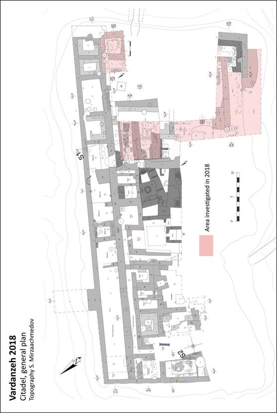 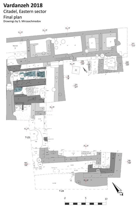
Fig. 2 Vardanzeh, plan of the
trenches excavated this year.
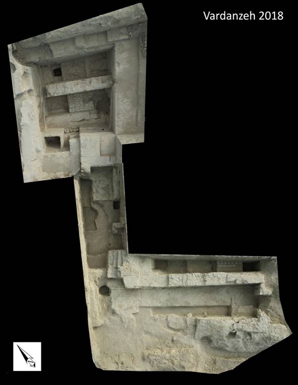
Fig. 3 Citadel, birds-eye view
of trenches T-8/11/12a/16/17, 22, 23, 24.
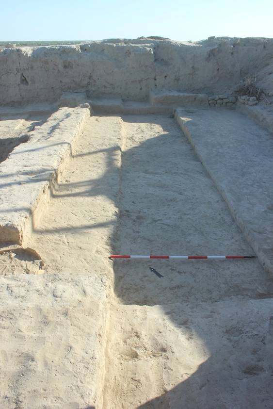
Fig. 4 Trenches T-16/17: room 32
(first phase), characterized by floor 839 (on left) going up to wall 916 (view
from S).
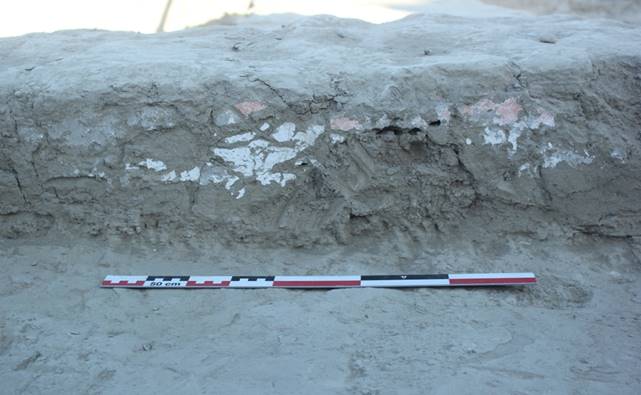
Fig.
5 Citadel,
trenches T-16/17: room 32 (second sub-phase), traces of mural paintings on the
E side of wall 916 (view from E).
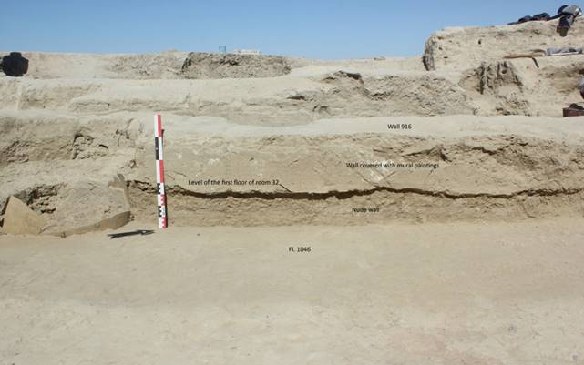
Fig. 6 T-16-17: mural paintings
on wall 916 and lower level of the wall, without mural paintings (view from E).
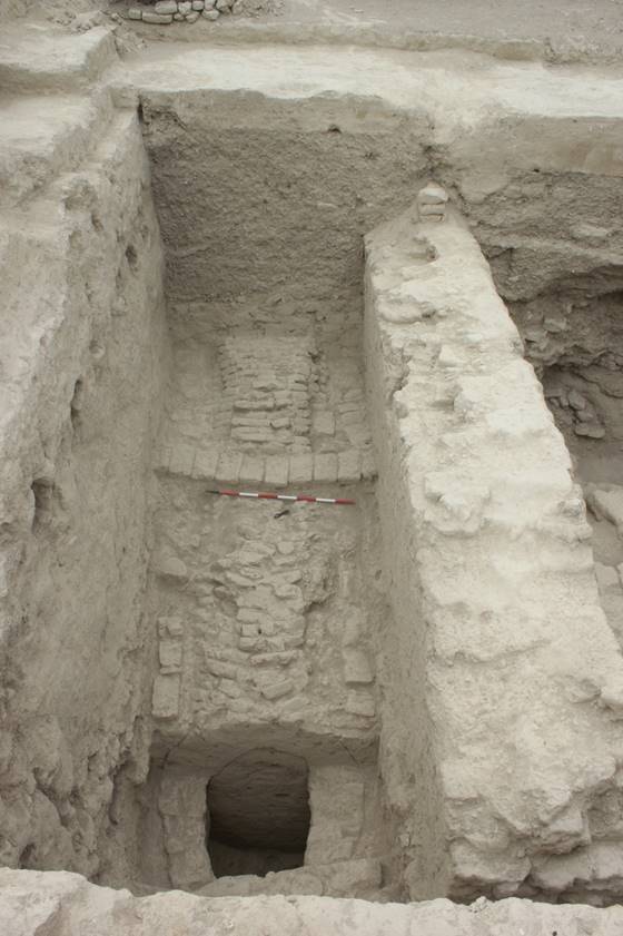
Fig. 7 Trenches 8-11 and probing
trench T-8-a : inner part of gallery SU 1151 (view from W).
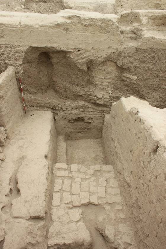
Fig. 8 Trenches 12-a, 12-a-1, 17:
general view at the end of the excavation (view from E).
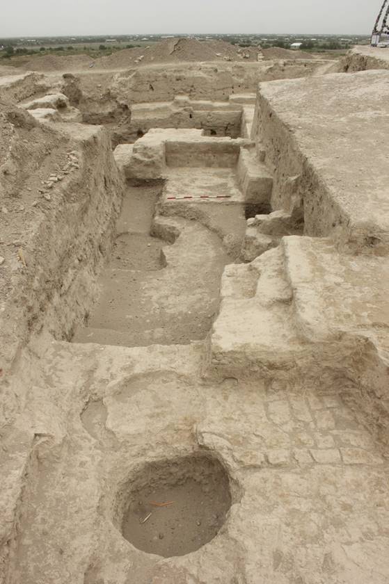
Fig. 9 Trench 23 and W part of T-24 (in
the foreground): general view at the end of the excavation (view from S).
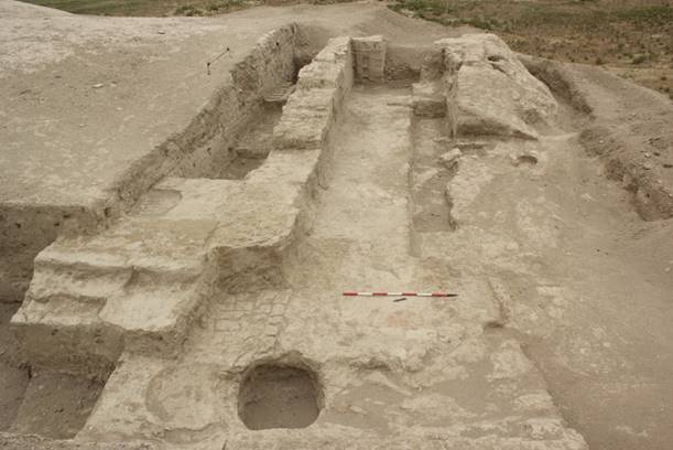
Fig. 10 Trench 24: general view at
the end of the excavation (view from W).
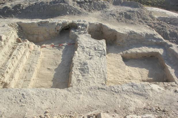
Fig. 11 Trenches 19-25: general
view at the end of the excavation (view from S).
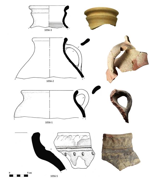
Fig. 12 Trenches 16-17: rims of
jugs (1056-2, 1056-3); rim and handle of modelled cooking pot (1056-1): rim of
storage jar (1056-5).
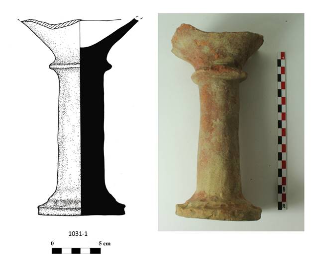
Fig. 13 Trenches 16-17: modelled
incense burner.
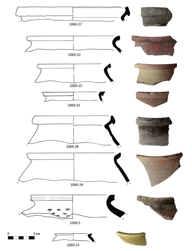
Fig. 14 Trench 23: rims of cooking
pots (1069-5, 1069-15, 1069-22, 1069-27, 1069-28); rims of thin-walled storage
pots (1069-24, 1069-25, 1069-31).
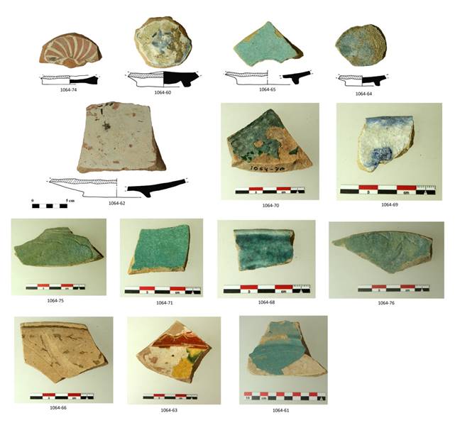
Fig. 15 Trench 23: bases of glazed
dishes (1064-60, 1064-62, 1064-64, 1064-65, 1064-74) rims of glazed dishes
(1064-68, 1064-69, 1064-66); walls of glazed ware (1064-61, 1064-63, 1064-70,
1064-71, 1064-75, 1064-76).
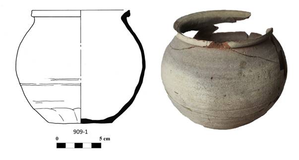
Fig. 16 Trench 24: storage pot
(909-1).
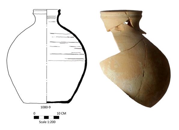
Fig. 17 Trench 24: storage jar.
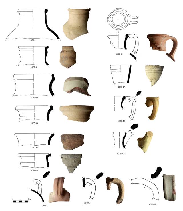
Fig. 18 Trench 24: rims of jugs
(1070-1, 1070-1-a, 1070-2, 1070-4, 1070-21, 1070-26, 1070-31, 1070-34, 1070-40,
1070-42); handles of jugs (1070-6, 1070-7, 1070-22).
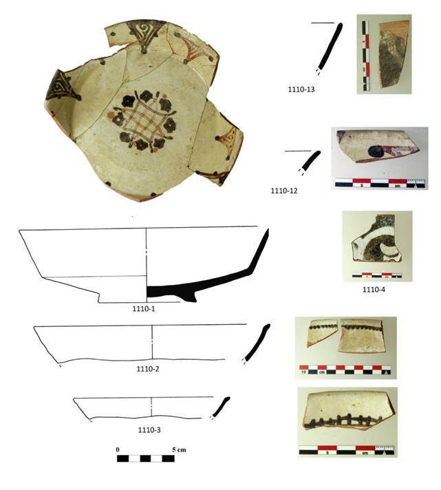
Fig. 19 Trenches 19-25: glazed
dishes.
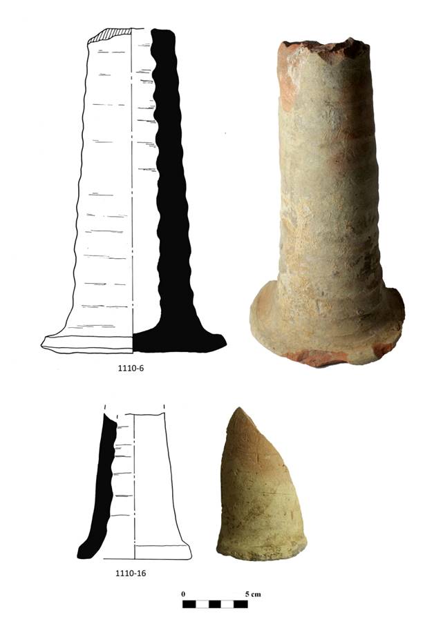
Fig. 20 Trenches 19-25: base of
lamp (1110-6); ceramic pipeline (1110-16).
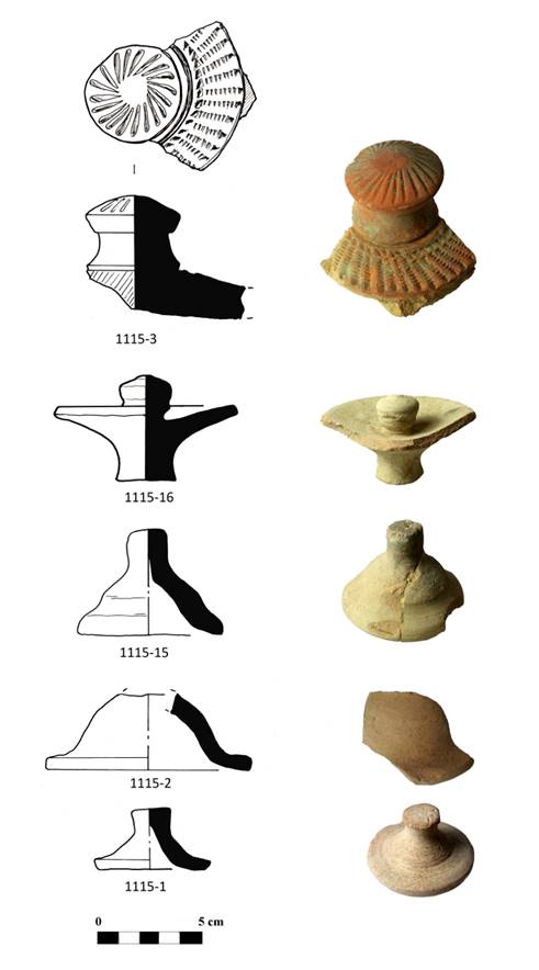
Fig. 21 Trenches 19-25: lids.
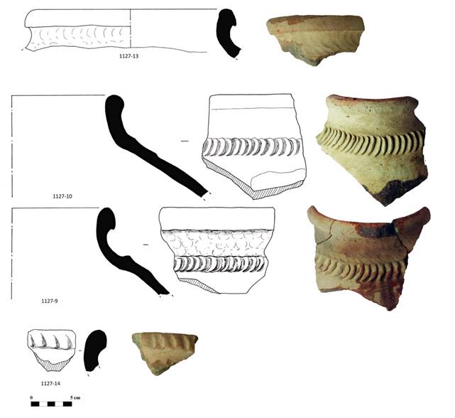
Fig. 22 Trenches 19-25: rims of
storage jars.
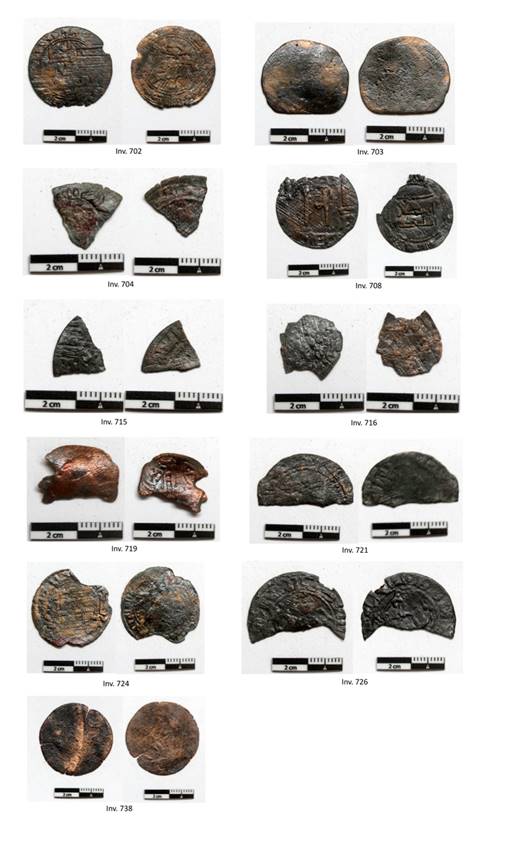
Fig. 23 Coins: Kharakamid coins
(Inv. 702, 704, 708, 715, 716, 721, 724, 726, 738); coin dated to the IX-XI
cent. AD (Inv. 703); Asbar coin (Inv. 719).
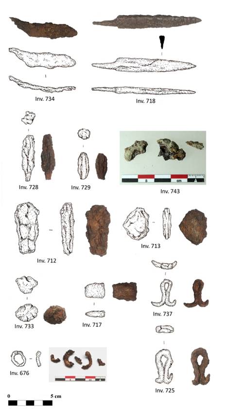
Fig. 24 Iron finds: blade (Inv.
734); knife (Inv. 718); arrowheads (Inv. 728-729); hooks (Inv. 725-737);
ring-shaped object (Inv. 676); unknown finds (Inv. 712, 713, 717, 733).
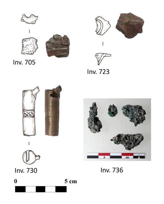
Fig. 25 Bronze finds: part of
small vessels? (Inv. 705. 723); whistle? (Inv. 730); slags (Inv. 736).
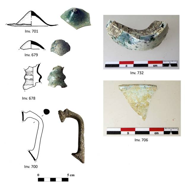
Fig. 26 Glass artefacts:
protruding parts of vessels (Inv. 679, 701); neck of small jug (Inv. 678);
handle of jug (Inv. 700); wall of vessel (Inv. 732); fragment of glass window
(Inv. 706).
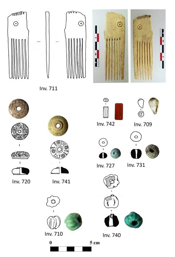
Fig. 27 Comb made of bone (Inv.
711); bone buttons (Inv. 720, 741); cowry shell (Inv. 709); glazed terracotta
beads (Inv. 710, 727, 731, 740); chalcedony bead (Inv. 742).
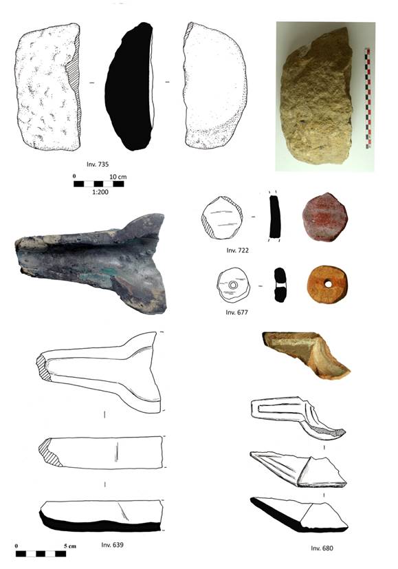
Fig. 28 Stone artefacts: mortar
(Inv. 735). Terracotta artefacts: glazed oil lamps (chirag) (Inv. 639,
680); spindle whorl (Inv. 677); token or unfinished spindle whorls (Inv. 722).
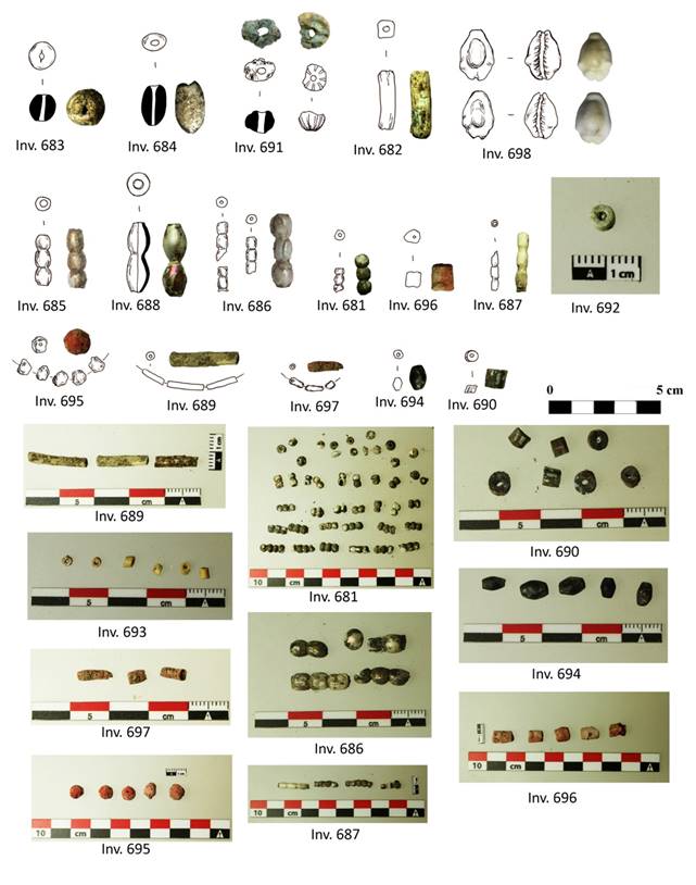
Fig. 29 Glass paste beads (Inv.
681, 682, 683, 684, 685, 686, 687, 688, 689, 690, 691, 692, 693); cowry shells
(Inv. 698); lignite beads (694); beads made of unknown red material, possibly
coral (Inv. 695, 696, 697).
| copyright by The Society for the Exploration
of EurAsia| E-mail
| Home
| 
|
|