| 2010 | 2011 | 2012 | 2013 | 2014 | 2015 | 2016 | 2017 | 2018 | 2019 | 2020 | 2021 | 2022 | 2023 | 2024 | 2025 | ||||||||||||||
Society for the Exploration of EurAsia
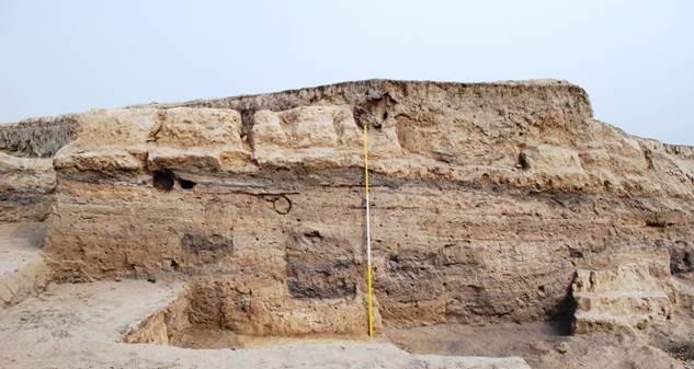
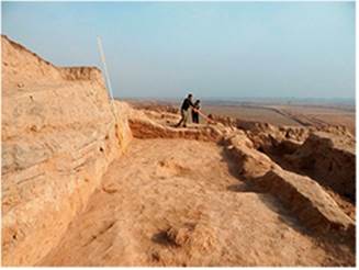
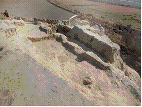
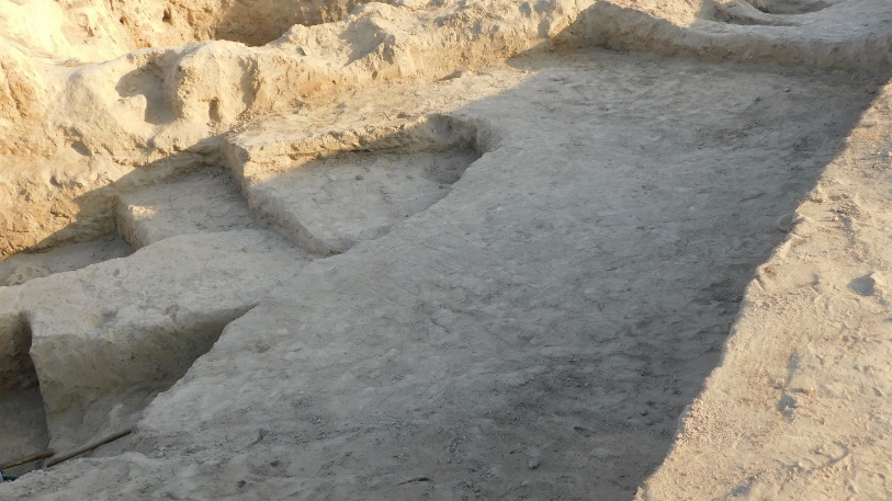
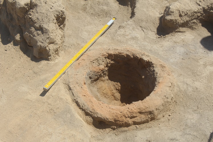
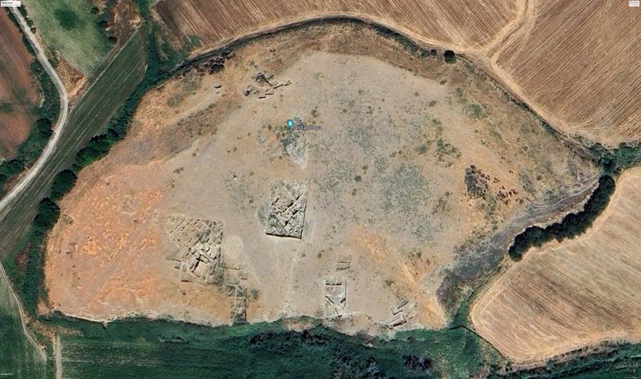
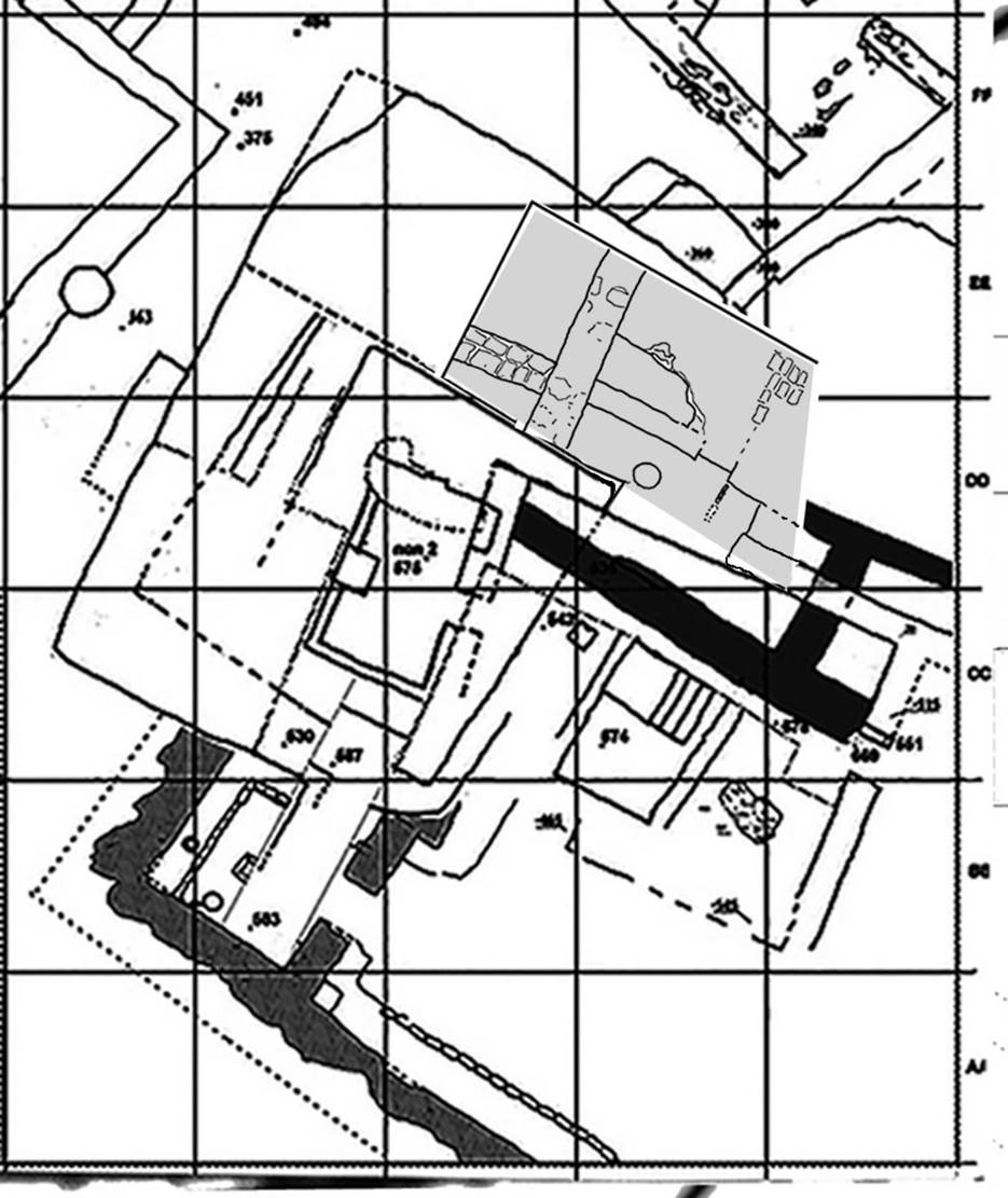
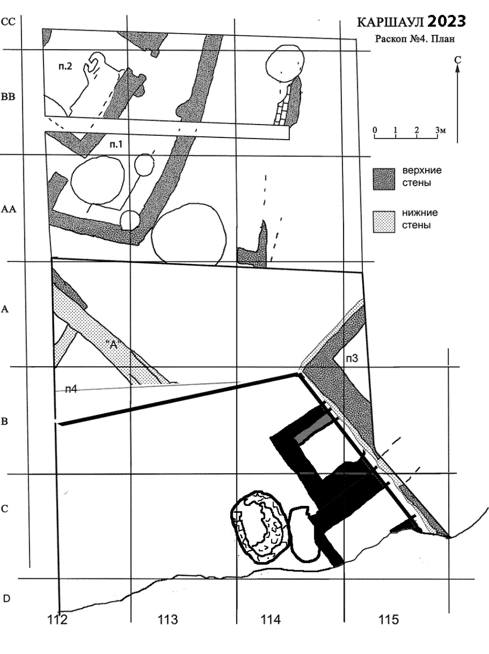
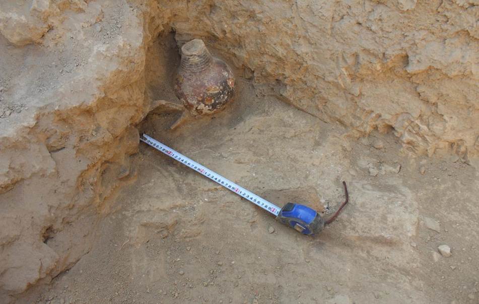
Archaeological investigations in 2019 K.A. Sheyko Tashkent 2020 In May-June 2019 the archeological excavations at the site of Qarshovultepa were continued. The monument is located to the southwest of Tashkent, in the settlement Dustlik of the Chinaz district of the Tashkent area, on the right northern terrace of the river Chirchik. Its co-ordinates are 40°58'24.03"N, 68°54'31.64" E (figs. 1-3).
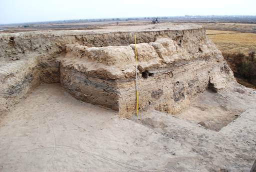
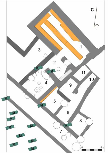
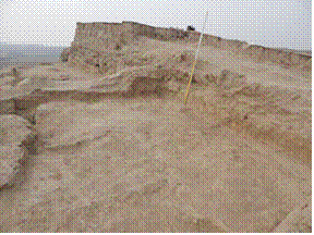
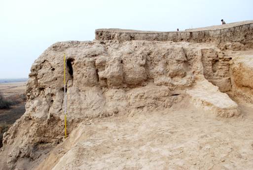
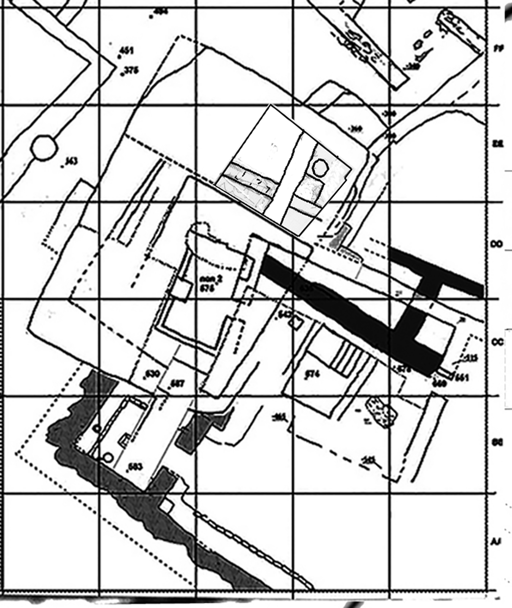
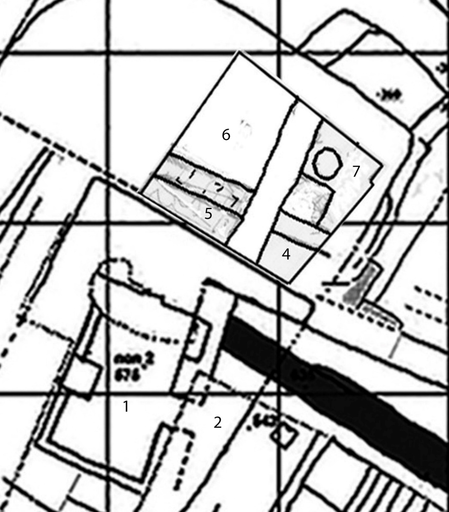
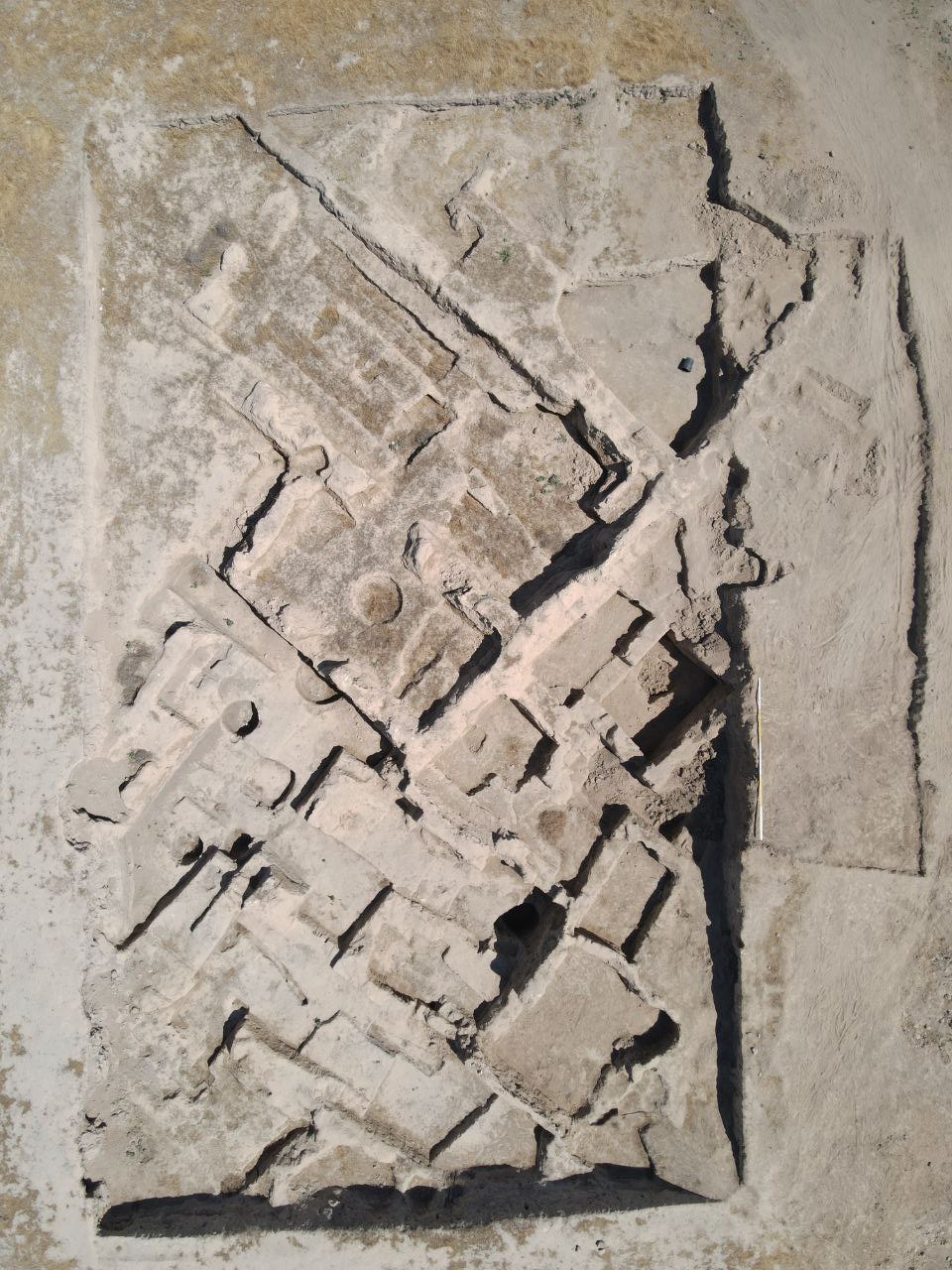
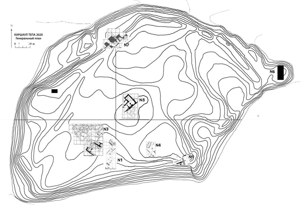
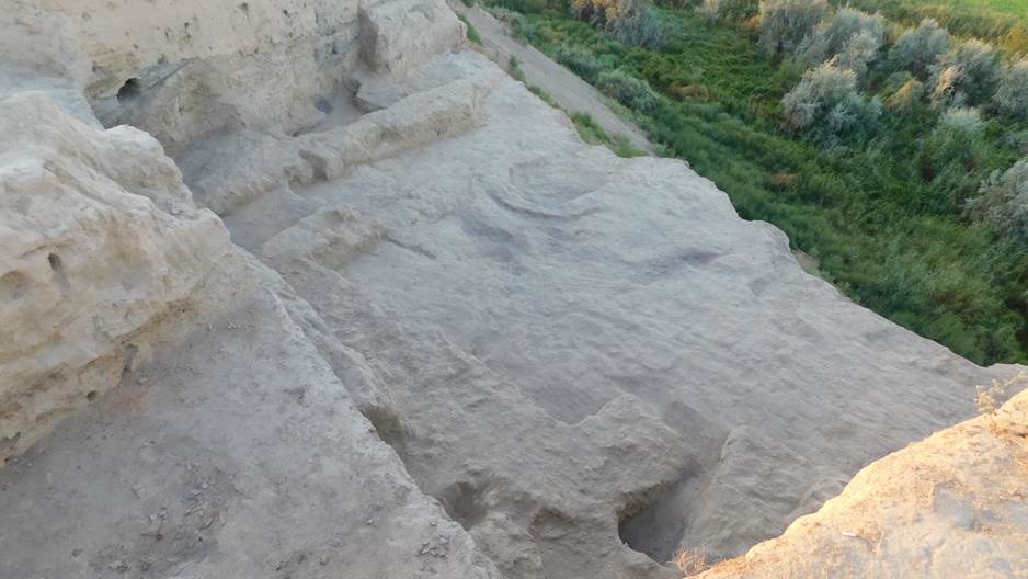
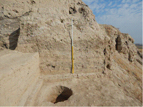
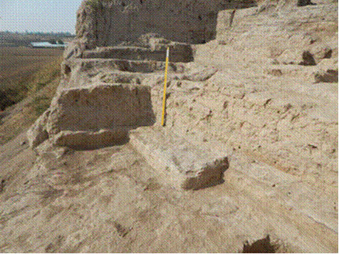
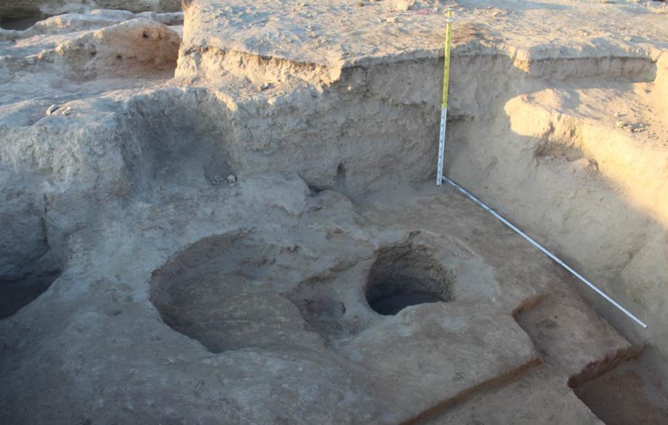
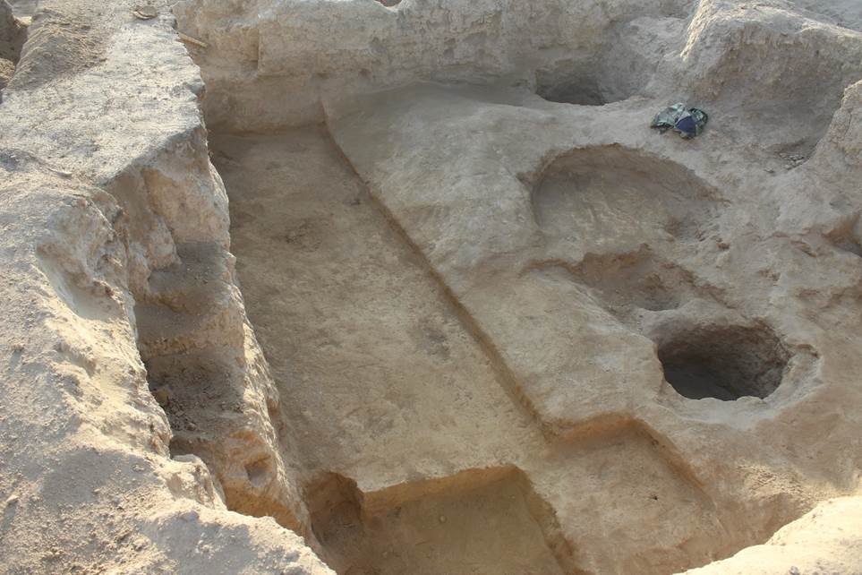
The excavation work focused on three sites: R-3 (the so-called platform); R-7 – a fortification sector in the northern part of the site; R-8 – a new excavation spot, located at the highest area of the site, to the northeast of R-3 (figs. 4, 5).
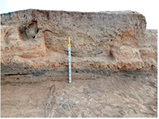
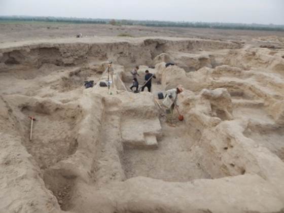
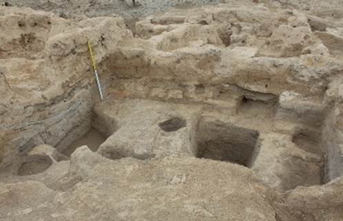
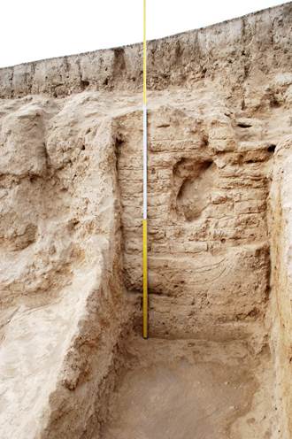
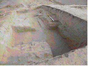
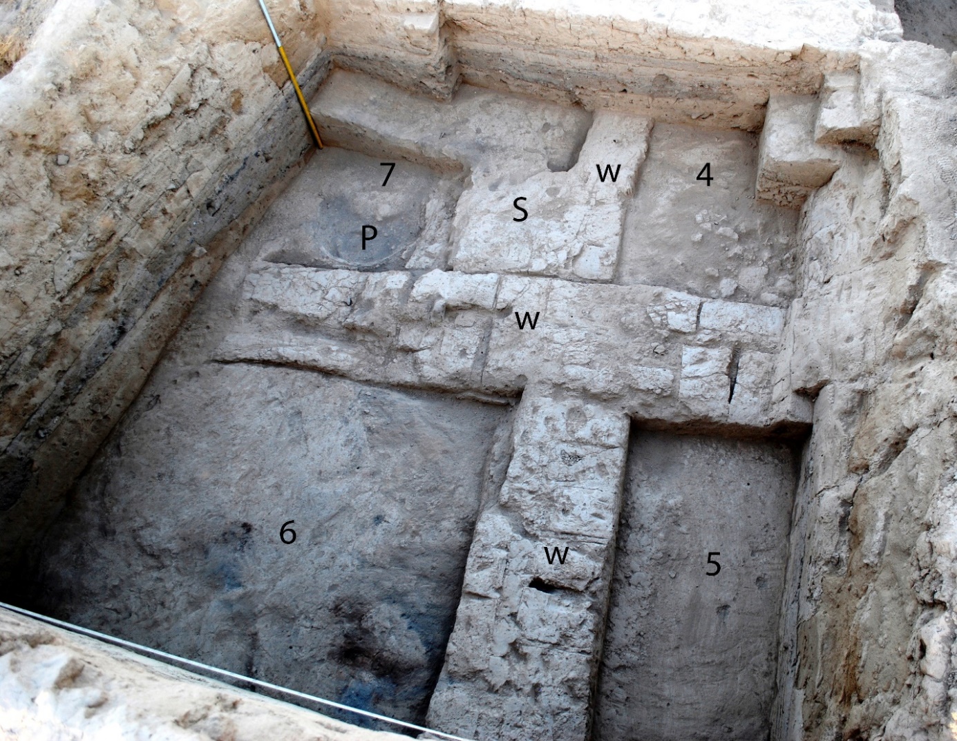
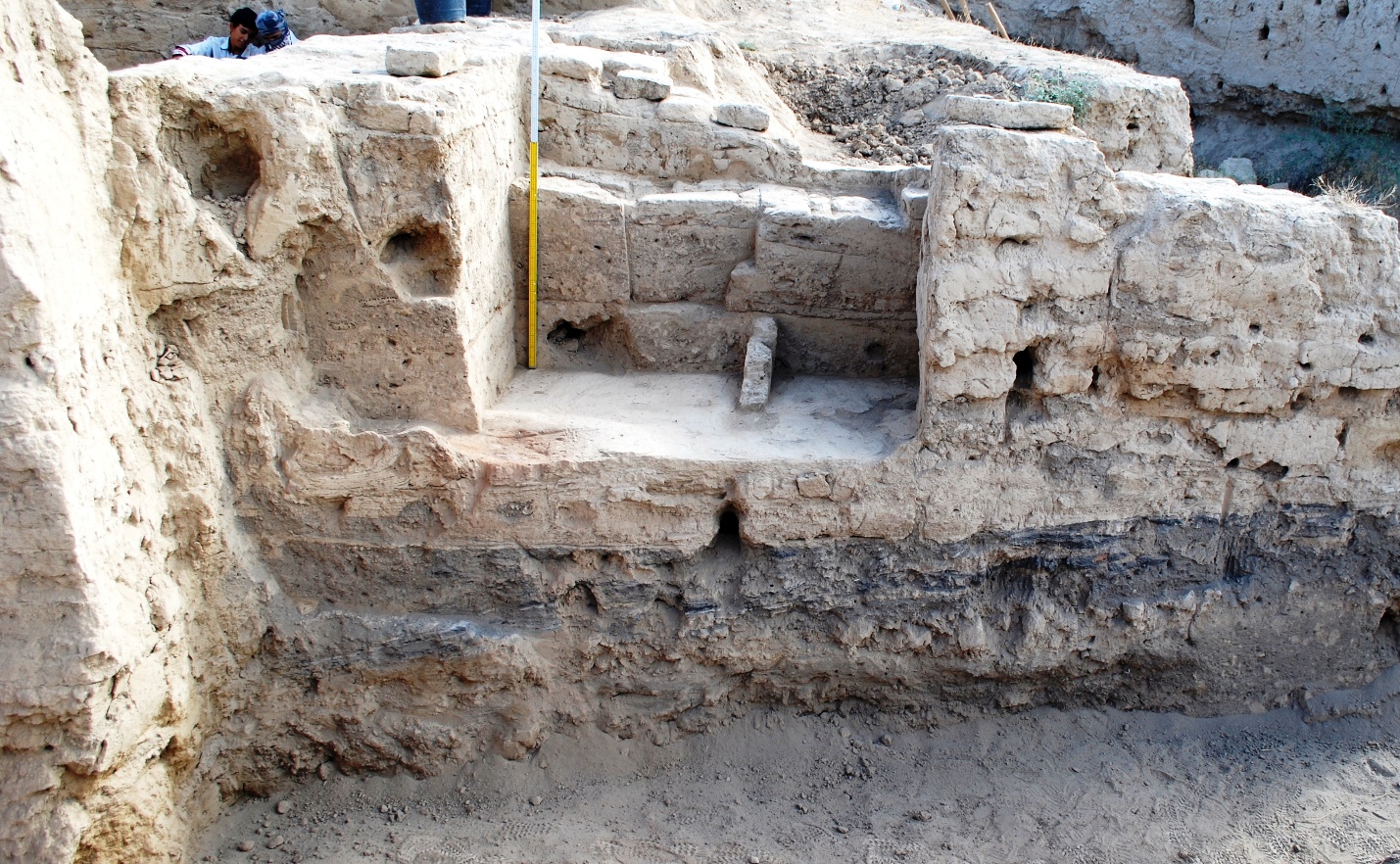
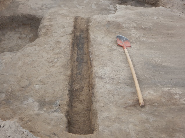
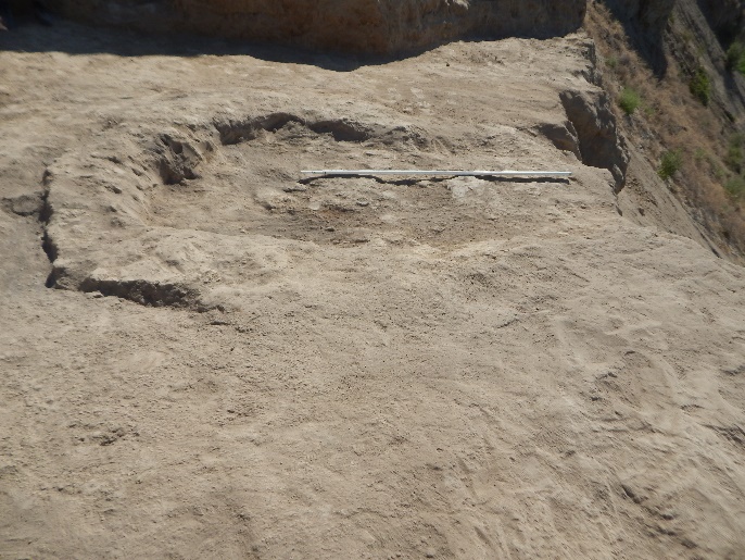
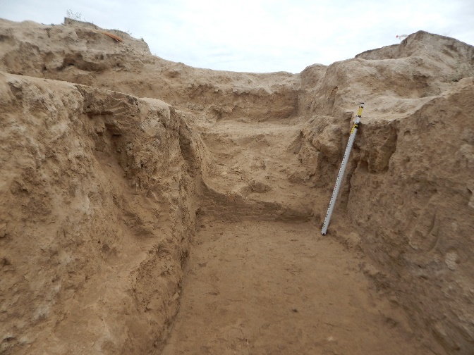
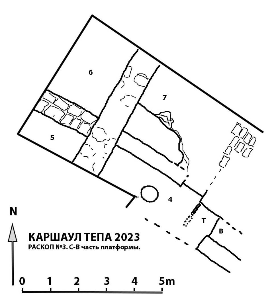
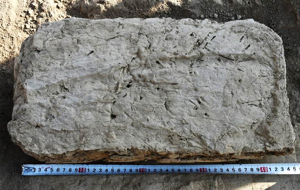
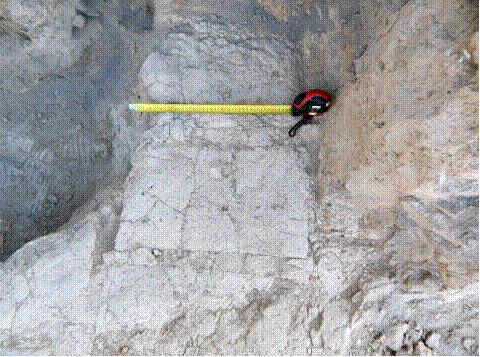
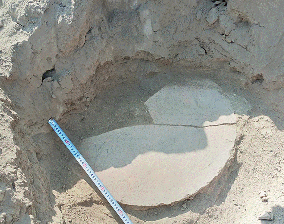
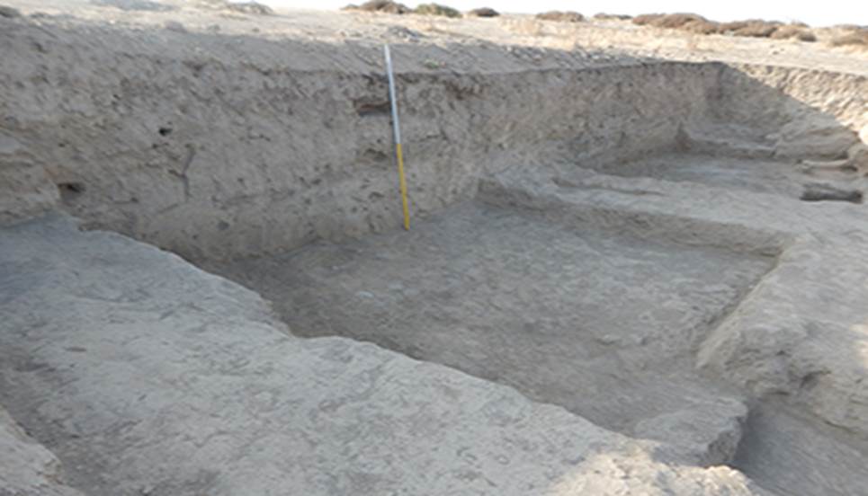
Excavation 3 (R-3). We continued our investigations of architectural remains of the 2nd building horizon which were hidden in the course of the construction of the monumental platform and rooms of the 1st building horizon (fig. 6). The work started with the clearing of the partially filled up rooms 1 ("throne-room") and 2 (to the east of room 1); the main excavation was conducted in the remains of room 3 located to the south of room 1. Parallel to that we cleared the western, northern and eastern boards of the cut-in made in the core of the platform to the north of room 1 during the previous seasons (figs. 7-10). The purpose of the clearance was the specification of the structure of the northern part of the platform which, judging by a joint revealed at the very beginning of the excavation on Р-3, was attached to the main massif of the platform.
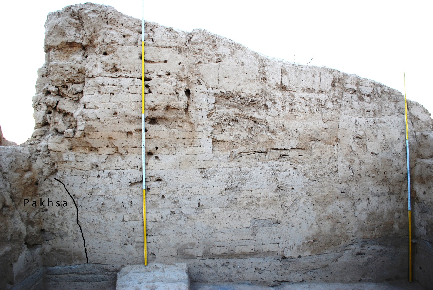
The sizes of the cut-in made into the platform were 2.30 m along the western, 2.40 m along the northern and 2.20 m along the eastern boards. The platform’s structure (along the western board and a part of the northern one) consists of mud bricks laid in one row, alternating with a 9 to 12 cm thick layer of clay. At a depth of 1.15 m from the highest point of preservation of the platform the combined masonry ends, above it lies a layer of pakhsa (adobe), up to 45 cm thick. The northeastern part of the platform was made of pakhsa only, its upper part at least. Therefore it is visible in the northern board of the cut-in that the combined part of the platform’s masonry is adjoined by a part made of pakhsa only (fig. 9). Similarly, the eastern board of the cut-in reveals only pakhsa masonry. Here the layers of pakhsa are up to 75 cm thick (fig. 10).
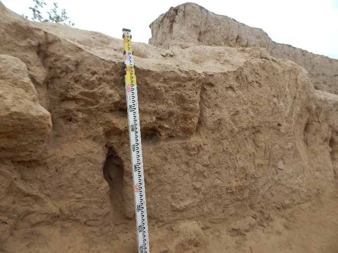
So the study of the platform revealed the following picture. The northern part of the platform was attached to its central part, which was primarily erected above room 1 and partially above the cut off rooms 2 and 3. Therefore there is no comparable even pakhsa field in the northern part of the platform like the one in the central part forming the basis for the combined masonry. It turns out that the basis of the combined layering in the northern part lies at a lower level. The northern part of the platform was also built in several stages: first its western part was erected from alternating rows of brick and clay layers, and only later was the eastern part, which consists of paksha, attached to it. The brickwork in the combined masonry of the northern part of the platform is laid as follows: one row of bricks in stretcher bond, with a layer of pakhsa 9-12 cm thick on top of it, filling in the joints, which are up to 17 cm wide, above it a row of bricks in header bond, and again a layer of pakhsa. The basic size of a mud brick is 50×26×10 cm. The vertical joints between the bricks vary between 6, 7, 7.5, 8, 11, 12.5 and 17 cm. The bricks were laid on the evened and dried up pakhsa surface without a solution, then covered with the next layer of clay (fig. 11). The clay used for this kind of building, judging by its uniform structure identical both in layers and in joints, was, most likely, in a well mixed up, semi-fluid condition.
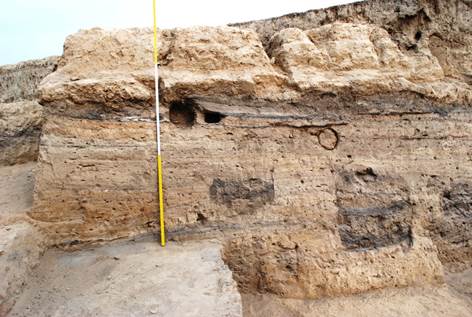
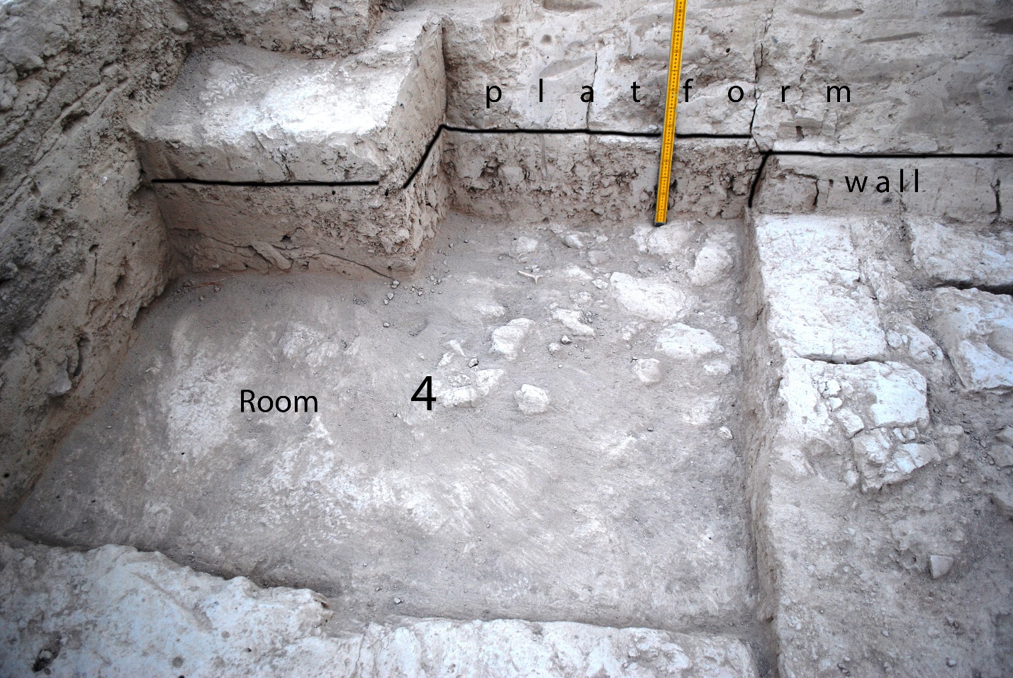
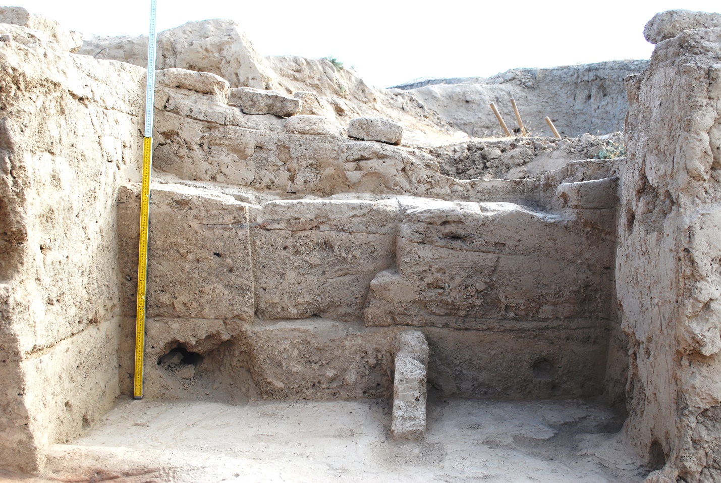
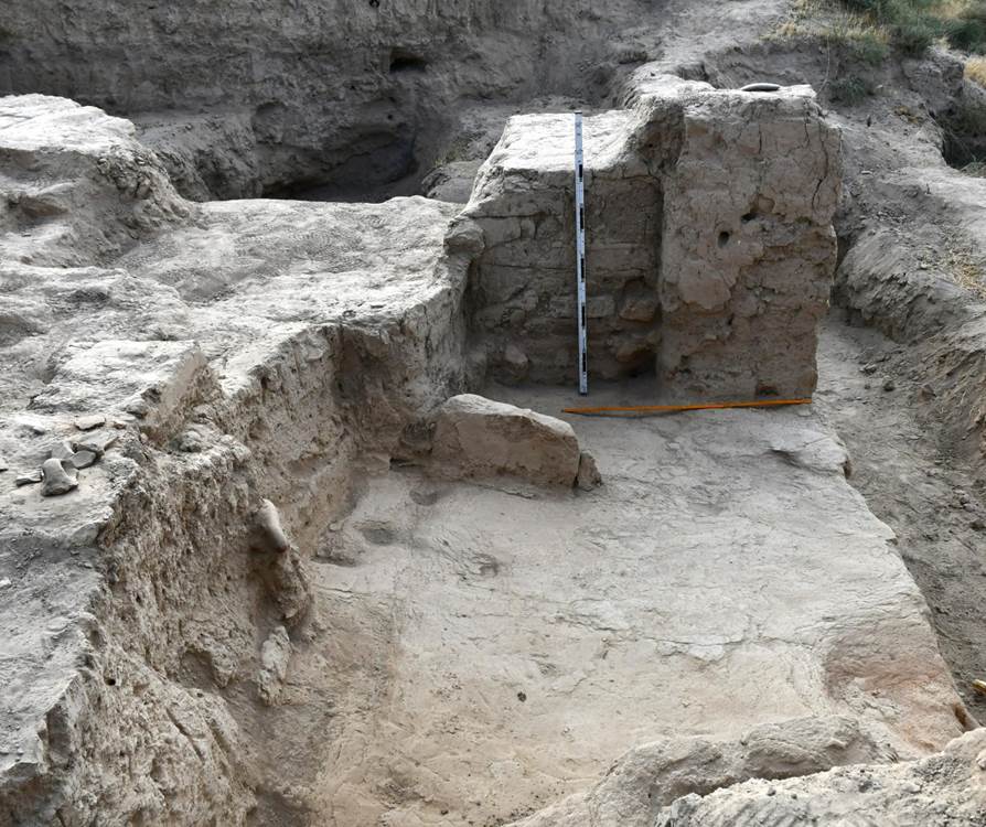
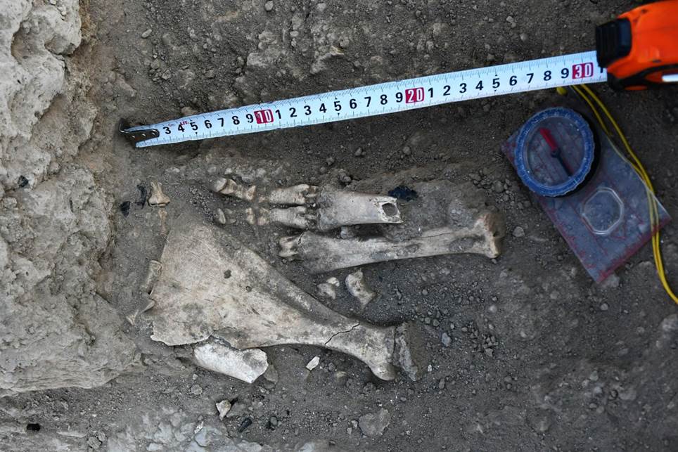
Room 3. Floor 1 in room 3, corresponding to floor 1 in the "throne-room" (room 1), has a calcinated, reddish surface (fig. 12). Similarly calcinated is the plastered southern edge of the northern wall of the room, which it shares with room 1. It testifies that an intensive fire burned in room 3. On the floor lies a layer of remains, ashes and pieces of charcoal; its thickness at the northern wall reaches 15-16 cm. The floor proceeds southwards, its surface is dense and of a dark colour, but it is not calcinated like in the northern part. Small ceramic fragments and small bones were revealed on the floor. Due to the preparations for the construction of the platform (first building horizon (I)) room 3, like room 2, was almost completely destroyed, therefore the information on it is incomplete. Thus, the southern wall was destroyed by the builders, and so were probably the eastern and western walls.
A layer of friable soil is preserved in rooms 1 and 2. It was used to fill these rooms up prior to their re-planning, which included the foundation of a passage between the rooms as well as the division of room 2 into two separate rooms 2a and 2b. The pakhsa backfill into room 3 started directly over the burnt layer lying on the floor. In room 1 the filling reached a height of 67-70 cm, in room 2 a height of 35-40 cm. In room 2 a wall was erected on top of this backfill, dividing the room into two probably isolated rooms 2a and 2b. The floors of these rooms were plastered. А solid pakhsa layer of the lower part of the platform was laid on top of this backfill at the beginning of the platform construction.
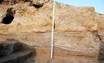
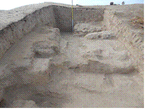
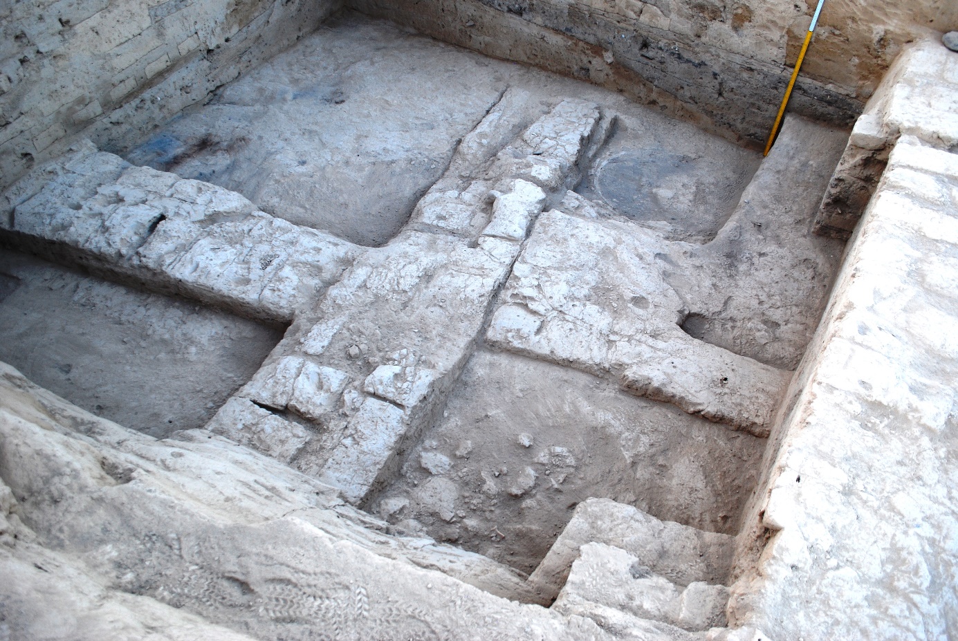
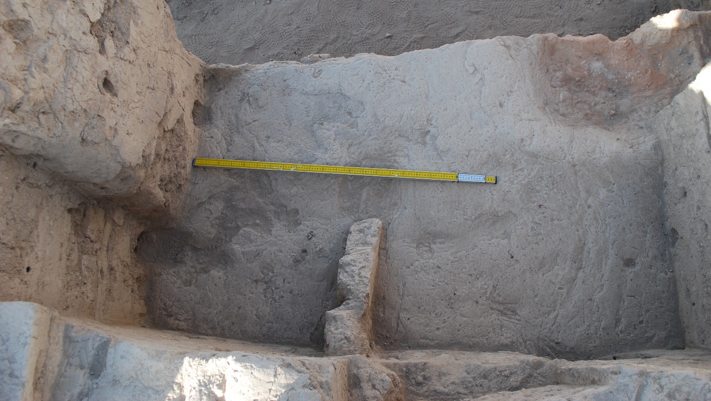
The western part of room 3 lies underneath the platform, the vertical clearance of which provides the chance to trace back its structure and construction (fig. 13). During the construction of the platform pakhsa was gradually laid on top of the layer of remains lying on floor 1. The thickness of the pakhsa basis, measured from its base up to a horizontal surface on which the erection of the upper part of the platform with the combined masonry started, reaches 1.90 m. This part of the platform protrudes 50-60 cm to the south in relation to the northern wall of room 3. Further to the south the height of the platform decreases to 1.30 m: either there was no continuation of the horizontal surface to the south, or the decrease is due to gradual washout. The massif of pakhsa existing today forms the edge of the platform, which in its upper part extends vertically for a length of 1 m from today’s surface. Below it the outer edge of the platform deviates for 70 cm to the south at an angle of about 70°, then slopes down for 60 cm at an angle of about 45°. After that the platform edge falls almost vertically down for 10-12 cm. The southern bottom edge of the platform is thus at a distance of 2.70 m from the southern edge of the northern wall of room 3, the one shared with room 1.
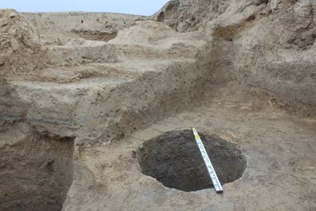
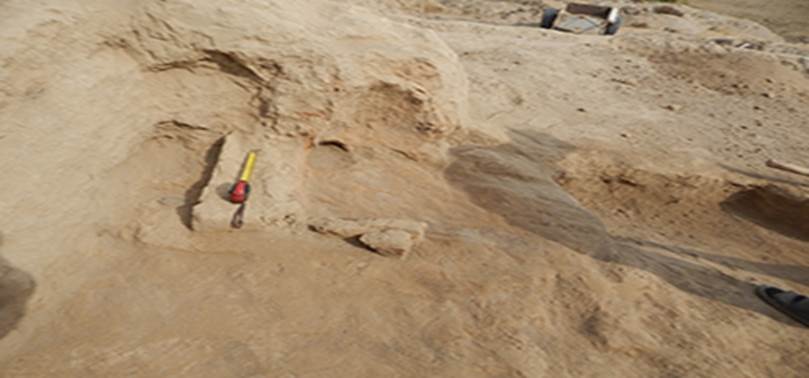
The southern edge of the platform is adjoined by layers of pakhsa, forming a levelling field. Several layers on this surface slope slightly southwards. They may be described as follows (from bottom to top): 1. Dark grey friable layer, 8-10 cm thick; At the level of layer 7 a pit cutting layer 6 (but not completely) is dug out. At its outfall its size reaches about 85 cm, at the bottom 60 cm, it is 35 cm deep (figs. 15, 16). The purpose of the pit is unclear, it is filled with a homogeneous friable lumpy soil of greyish colour. From above the pit is covered by the calcinated level of the floor on which the fireplace of room 6 was placed.
Thus, the observations within room 3 of the second building horizon (II) allowed us to specify the stratigraphy of this sector and to trace back the particularities of the construction of the platform.
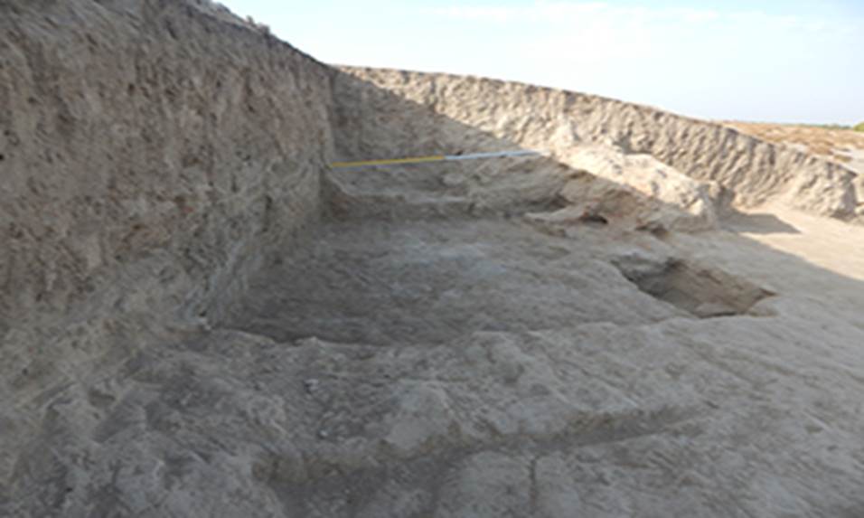
Excavation 7 (R-7 – gateway sector) During Excavation 7 we continued the clarification of the stratigraphy of the layers in the area of the city gate (figs. 17, 18). We specified its layout in the gate alignment at the floor level of 650-630 cm. Furthermore we can conclude from a section into the city wall as well as from the results gathered from the trial trenches to the north of towers № 1 and № 3 that below this floor, on the whole area of Excavation 7, the structure does not correspond to the one we have studied so far. We still have to find out whether there were defensive structures at this sector of the settlement prior to the 6th century. We cleared out a groove 35 cm wide and 15 cm deep in the floor along the northern facade of this extension up to the end face of the eastern site of the defensive wall (fig. 19). In its filling we found a lot of wood ashes. Most likely these are traces from the bottom part of the frame of a single wing gate. The gates opened to the outside; when closed, they rested against the protrusion in the end face of the fortification wall.
Fig. 17
To the north of tower № 1, in an area of 3×4 m, at a depth of 6.50 m from the surface (the level of the tower base) to 7.80 m no constructions were revealed. The soil in this sector is identical to the one opened last year in the trench. It is a friable loess with multiple layers of ashes and coal. Finds from these layers are dated to an earlier time (4-5th centuries) than the ones found in the layers in the adjoining defensive constructions. The sector between towers № 1 and № 2 appears to be the most promising for further excavation with the goal to detect defensive constructions of the early period of the city’s life and the earlier gates of the ancient settlement.
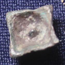
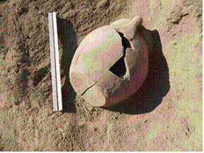
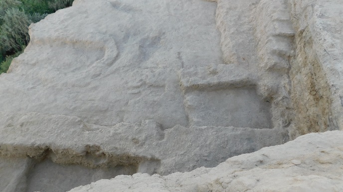
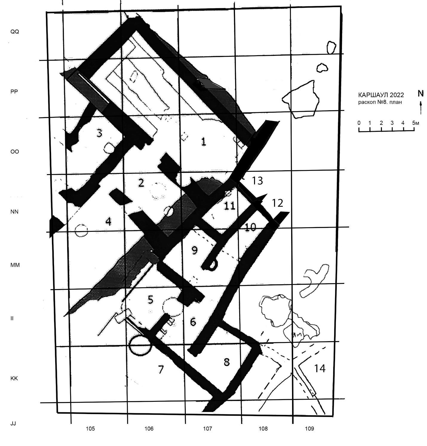
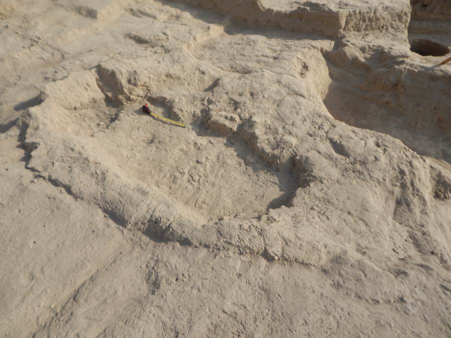
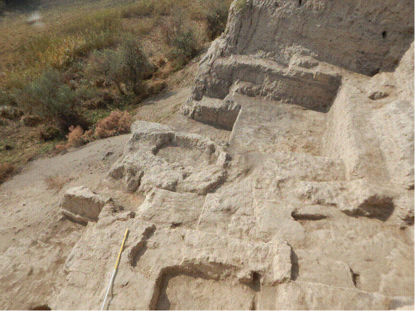
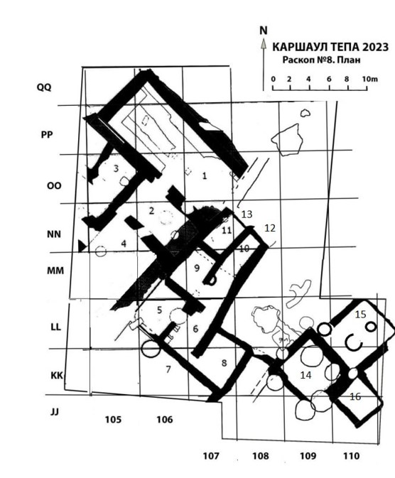
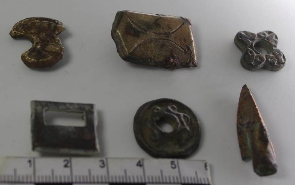
Excavation 8 (R-8) During excavation № 8 we proceeded with the opening of rooms located to the south of rooms 1, 2, 3 and 4 (figs. 21, 22). In the rooms excavated in 2018 we specified their layout and undertook additional clearings. After the excavations of 2018 we left a control balk in room 1, which has fallen because of heavy rains and winds. We were forced to remove its remains. During its demolition two coins were found, one of which, badly preserved, belongs to the period of the ruler Tarnavch. The second coin belongs to the type with the image of a ruler with his spouse (Tab. I, № 1, № 2). At the same place we also found fragments of walls of a big ceramic vessel (khum) with fire traces.
The demolition of the control balk in the northern part of the room revealed one more pass in the northwestern part, which was covered by this balk in 2018. This pass was likely made after a fire and is related to the re-planning of this room. In the southern part of this room, in an area of 4m2 we put a small stratigraphical trench in order to study the cultural layer underneath the first floor of this room. After the removal of the floor coating, which is up to 7 cm thick, a layer of soil mixed with ashes and sand emerged. It was probably used for backfill. It occasionally yielded animal bones and ceramic fragments. The thickness of this layer reached 25-30 cm. The second floor of the room, which extends underneath the eastern wall and sort of overlaps the southern wall in the southern part, is very well preserved under this layer. At this point the clearance and probing of this room were stopped, because we will be able to see the full picture only after the opening of the entire area of the room in the upcoming season (Fig. 23).
Fig. 23 At the clearance of the floor in room 3 four coins were found. A coin with a square hole was found in the northeast corner on the floor of the room, showing casting remains on both sides (Tab. I, № 3). Two other coins we found while clearing the floor at the southern wall, one of a lower, one of a slightly higher value. They show the image of a predator walking to the right with its head turned backwards. On the reverse is a fork-shaped tamga (Tab. I, № 4, № 5). The fourth coin from this room was found at the western wall, near the pass to room 4. It shows a predator walking to the left, with its head turned backwards (Tab. I, № 6). The probe laid in the southeast corner of room 4, just as in room 1, has revealed that the room layout was significantly different at an earlier time. Below the 20 cm thick floor coating a fillingsimilar to the filling in room 1 came up (fig. 24).
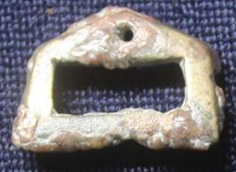
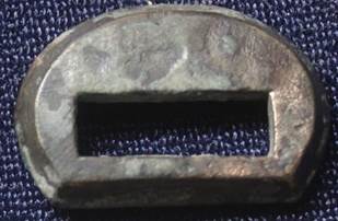
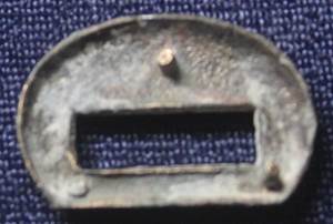
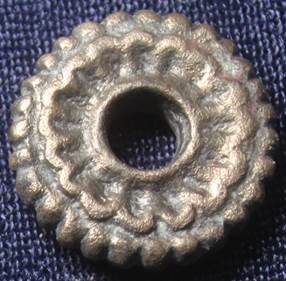
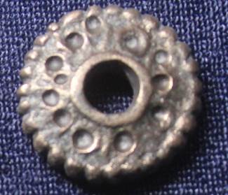
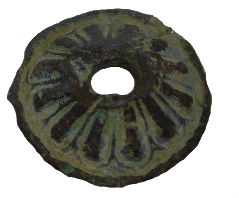
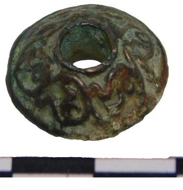
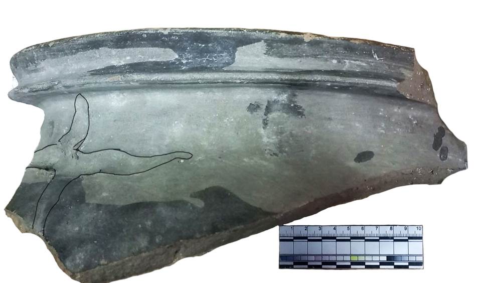
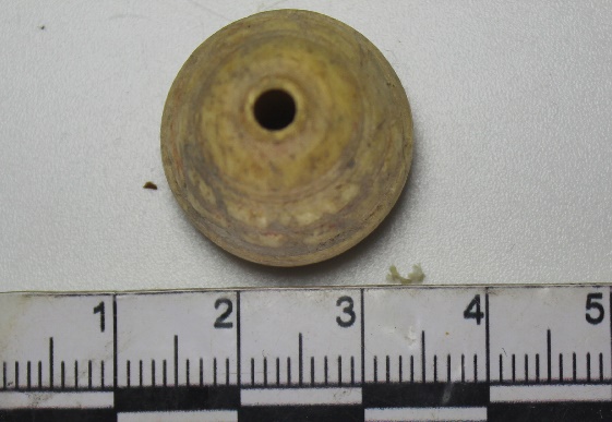
It is clearly visible here that the eastern wall is erected on top of the coating of floor № 1, and that it was absent when floor № 2 was in use, whereas the southern wall functioned synchronously with floor № 2. Two coins were found in the southeastern corner of room 4 underneath the first floor. One is of low value with an edge broken off; its obverse shows the image of a predator walking to the right with its head turned back, while the reverse has remains of a fork-shaped tamga inside a beaded circle. It is clearly visible how a part of the tamga image slipped to the side during the stamping (Tab I. №7). On the second coin there is a stylised image of a ruler en face, with the image of a cross to the left of his face. On the reverse a fork-shaped tamga can be recognized, part of which was not transferred to the coin. On the floor of room № 2, near the southern wall we found a flat round bronze object with a round hole in the center, decorated with a relief decor on both sides (fig. 25). Similar objects are considered to have been used both as buttons and as chips/counters serving as dividers in bundles of coins with square holes. Considering the fact that at Qarshovultepa we found coins with square openings, the second option seems more probable.
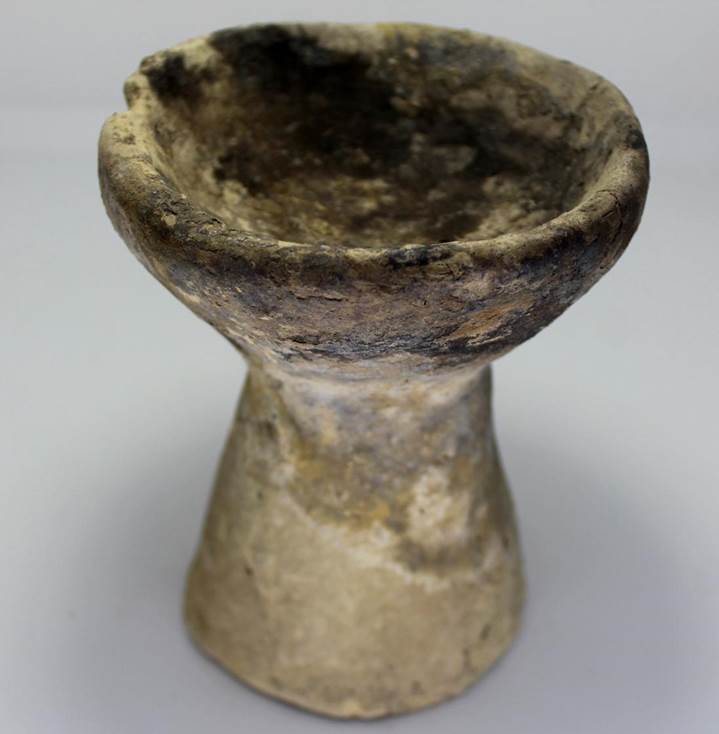
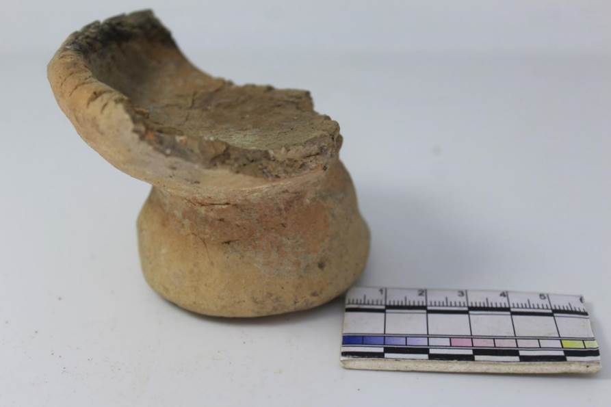
Fig. 25. A dividing token-chip for coins
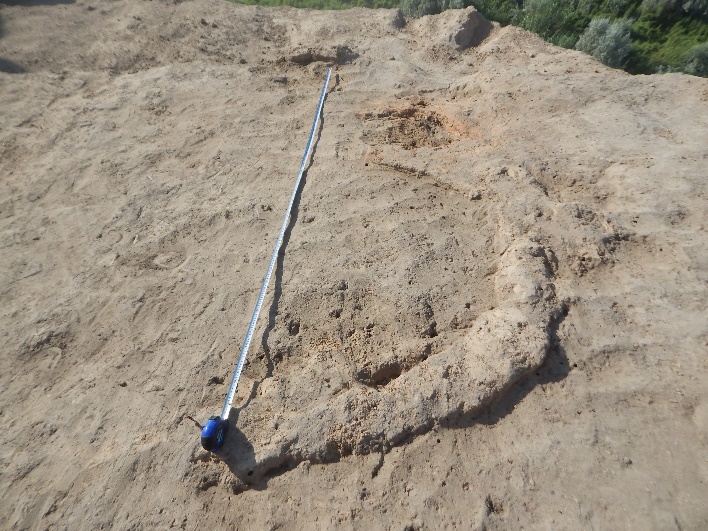
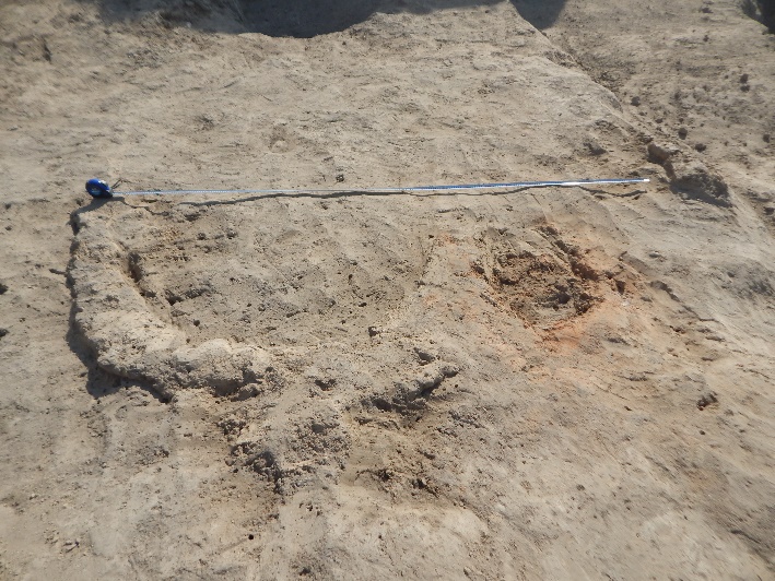
Room 5 It is located to the southern side of room № 4 and shares its northern wall with it (fig. 26). The wall is 5,50 m long. Along its perimeter a sufa is erected, the entire area of which has been covered with a clay floor in the last stage of the room’s functioning period. It is 1,05 m wide. The same picture is observed at the eastern side, where the eastern wall has been excavated. Its length is 4.40 m. The southern wall can be traced up to 5,20 m, in the southeastern corner a pit is punched, which has not touched upon the corner itself, whereas the southwestern corner of the room is completely destroyed by a later tomb. Floor № 1, as already specified, represents a 2-4 cm thick clay coating and slopes to the center of the room. It is fixed at a depth of 1.99-2.10 m from the benchmark of the entire excavation. In the filling of the room of this period we have found ceramic fragments, the majority of which come from small-sized pots, some of which have stylised handles.
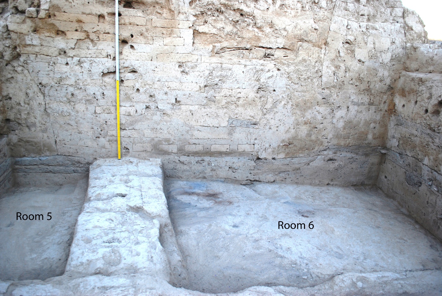
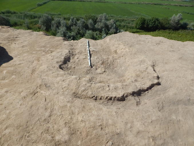
In the blockage from fallen walls on top of the floor of the room four coins were found, two of which show the image of the ruler with his spouse. The third coin belongs to the coinage of the ruler Tarnavch. It shows a predator walking to the right, with its tail lifted. On the fourth coin we see the image of a standing predator turned to the left, again with its tail lifted. On the reverse a fork-shaped tamga is represented (Tab. I № 9, № 10, № 11, № 12). Another four coins were found on the floor of the room. The first shows the image of a predator with an opened mouth and a lifted tail, walking to the right, surrounded by a beaded rim. It belongs to the coinage of the ruler Satavchar (Tab. I № 13). The coin was found at the northern wall, next to the sufa. The second coin was found near the eastern wall on the sufa, next to the southeastern pit. This coin depicts a ruler. It is strongly rubbed, therefore it is difficult to identify the headdress and other attributes of the protagonist. But judging by the lyre-shaped tamga on the reverse, we can assume that it belongs to variant 1 of the first type of group 7 (Tab. I № 14). The third coin was found at the western wall on the floor level; it shows a standing predator turned to the left with its mouth open and its right paw lifted. According to the classification of Shagalov/Kuznetsov[1] it is possible to ascribe this coin, as well as coin № 7, to the coinage of the ruler Satavchar, to variant 1 of type 6 (Tab. I № 15). The fourth coin was found in a pit in the southeastern corner of the room, on the 2.87 m mark. The coin is strongly erased, but on its reverse an Arabic inscription can be made out (Tab. I № 16). Room 6 (a corridor?) Placed between room № 2, located on the northern side, and room № 8, located in the south, it is limited by the wall of room № 5 towards the west. It is preserved only partially, due to five tombs of the 19th and early 20th centuries and four pits lowered from the level of the last floor, as recorded in this area. Further research into this sector will be continued in 2020. Ten coins were found in the area of the excavated corridor. Room 7 It is situated to the south of room № 5, sharing a wall with it. The northwestern part of that wall was destroyed by a pit dating to a late period and a burial pit of the 19th – early 20th centuries (fig. 27).
That wall is traced up to 4 m, the eastern wall up to 6.30 m. Its surface is damaged by holes. The southern wall of room № 7 lies completely under the southern balk. The width of the room is 3.40 m. The walls are built of rectangular raw bricks in the sizes of 47-49×23-24×9 cm and are 0.58-0.60 m thick. The revealed floor 1 (the last one from the time of the room’s functioning) is recorded on the 1.54 m mark from the general benchmark of excavation 7. It overlaps the walls of this room. A court yard probably functioned in the place of rooms № 7 and № 8 at the last habitation stage of that sector. This question should be further explored. Below floor 1 lies a filling directly related to the room’s functioning. At the eastern wall the floor dated to the last habitation period in this room could be recorded. It slopes westwards, but from the center of the room its level tends to rise. This can be explained by the fact that the masters generously applied clay solution next to the walls, but its thickness decreased to the middle of the room. In the habitation process the center of the room sort of sagged. In the blockage above this floor we have found nine coins at different spots; three more appeared in the dump from this room. The first coin is preserved to 70 percent and belongs to variant 1 of type 6 (Tab. I № 27). The second coin is of the same type, but of lower value (Tab. I № 28). On the third coin, found near the northern wall, we see the image of a ruler with his spouse: it can be identified with variant 4 of type 1 of group 5 (Tab. I № 29). In the top layers of the hole which is punched from the level of the last floor, we discovered a Muslim coin, which has not been classified yet (Tab. I № 30). Here next to the same hole two more coins were found, one belonging to type 1 of group 7, the other one is a coin of the Chinese type with a square hole (Tab. I № 31, № 32). Room 8 It is located at the eastern side of room № 7, sharing its western wall with it. It is traced to a length of 4 m. Its southwestern corner is destroyed by a late hole lowered from the level of the last floor, overlapping the remains of the fallen walls. Their remains are well visible in the section of the room shown in fig. 28.
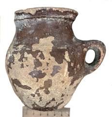
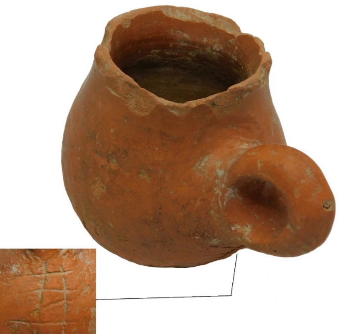
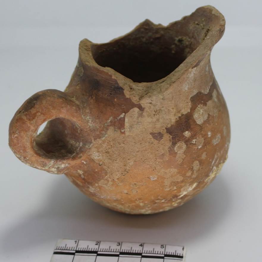
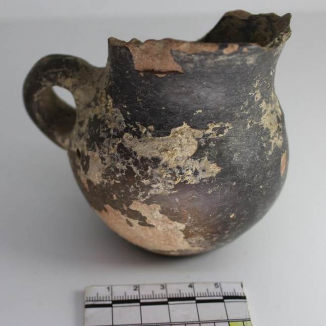
We found two jugs close to each other and turned upside down in the north-eastern corner of room 8 in a blockage above the fallen walls (fig. 29). Both vessels lack their corollas, handles and bottoms. Most likely they were thrown away at the time when the remains of the walls of this room were covered by the last floor. While clearing an area near the northern wall, we found two coins on the floor. The first one belongs to type 1 of group 5. It shows the image of a ruler with his spouse, and on the reverse a tamga in the shape of branched horns. On the second coin there is an image of a camel walking towards the left, and on its reverse a tamga in the form of two arches connected by two straight lines, which results in a rectangle at the center. It identifies with type 1 of group 8 (Tab. I № 33, № 34). The northern wall is 4 m long. Its northwestern part is damaged by a grave of the 19th – early 20th centuries. The northwestern corner of the room is nevertheless preserved. Above the floor we found two coins with a square opening (Tab. I № 35, № 36). The eastern wall is excavated to a length of 2.20 m; it was not possible to trace it further, since it leads underneath the eastern edge of the excavation (fig. 30). The southern wall is more difficult, as it is damaged by pits which were lowered from the last floor and largely destroyed it. However, in the cut of one of those pits - the one which is closer to the eastern edge - it was possible to record the thickness of the southern wall and to detect that it continues eastwards under the edge.
About 20 cm of its length are cleared, then it disappears under the balk where the southeastern corner of room № 8 is hidden. At this spot we discovered a coin with a square opening (Tab. I № 37). One more coin was found in the blockage above the floor during the clearance of the western wall (Tab. I № 38).
Thus, a one-month period of excavations carried out in the year 2019 has provided us with additional data on the history of Qarshovultepa.
Edited. 27.4.2020 JI [1] Shagalov V.D., Kuznetsov A.V. Catalogue of coins of Chach: III-VIII A.D. Tashkent, 2006, pp. 226-228.
------------------------------------------------------------------
Academy of Arts of Uzbekistan The
Ikuo Hirayama International Caravanserai of Culture REPORT on
archaeological excavations at
the Qarshovultepa site/settlement in
the Chinaz district of the Tashkent region in
2020 Authors:
K.A. Sheyko
Tashkent 2021 In July-August 2020 we continued archaeological excavations at the Qarshovultepa settlement. The monument is located to the south-west of Tashkent, in the village of Dustlik, Chinaz District, Tashkent Province, on the right upper terrace of the River Chirchik. Its coordinates are 40°58'24.03"N, 68°54'31.64"E. The work focused on four sectors: R-3 (the so-called platform); R-4 – excavation in the southern part of the site; R-8 – excavation located on the uppermost sector in the central part of the site; R-9 – new excavation intended for the study of the southern sector of the site’s fortification (Fig. 1).
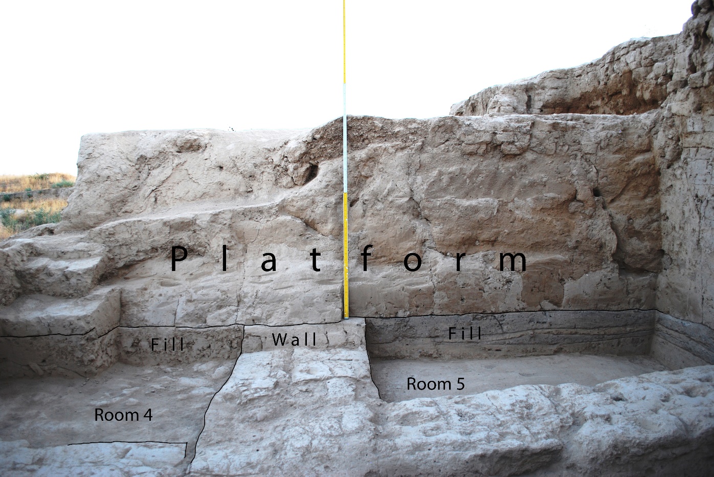
Excavation 3 (R-3) Excavation 3, intended for the study of the platform and the area that it was built on, is currently a stratigraphic one, which, with every opened layer, will enable us to study all the phases of life at Qarshovultepa.
It is important to emphasize that work on R-3 has its own specifics, because it is quite difficult to conduct planigraphic excavations of edifices of the second building horizon (II) in large squares. The reason for this is the massive platform that covers the central part of the building complex of the second building horizon (II). Firstly, its removal for the access to underlying layers requires a laborious process, and secondly, and more importantly, we are trying, as far as possible, to preserve this unique construction, the function of which is yet unclear to us.
Fig. 3. Character of the filling between Floors 3 and 4
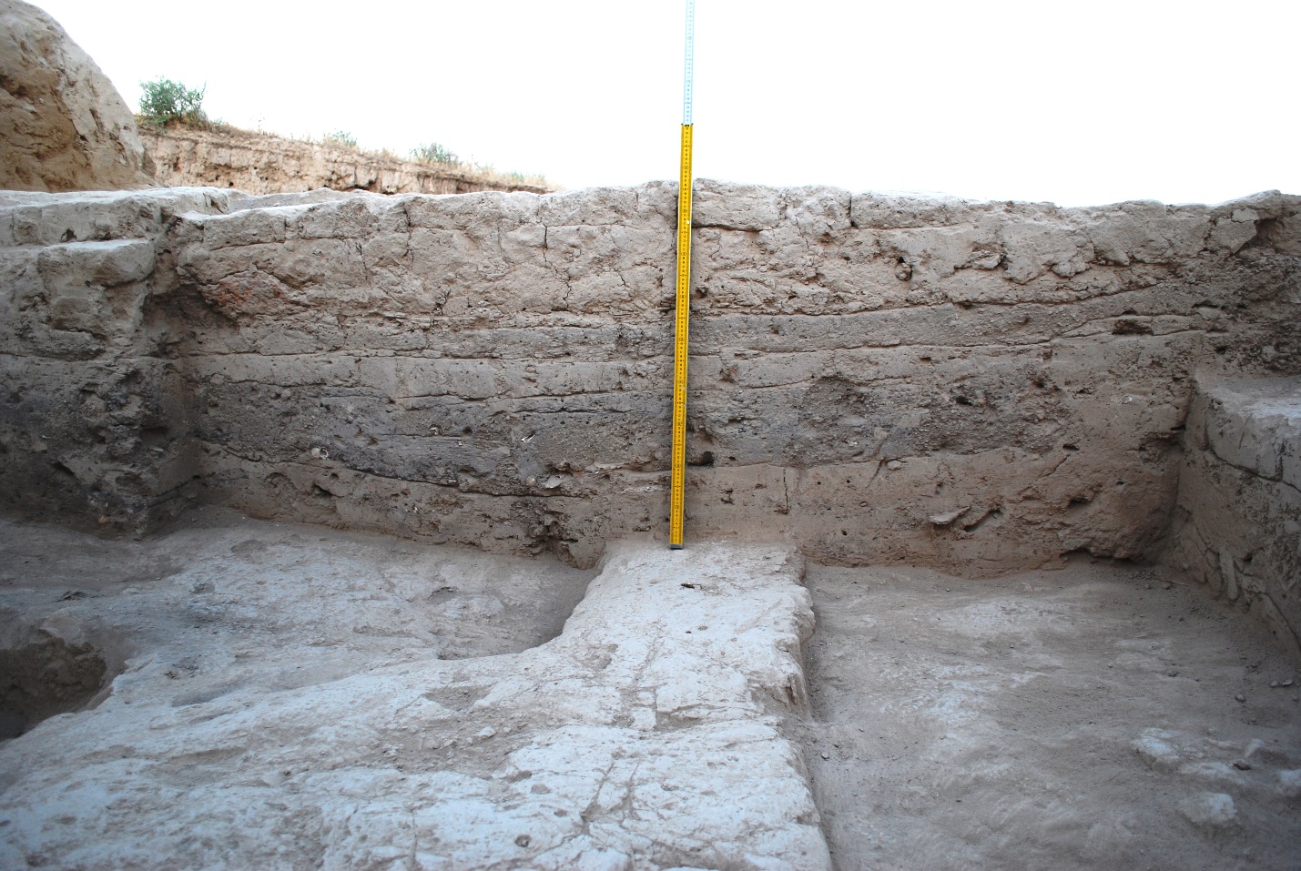
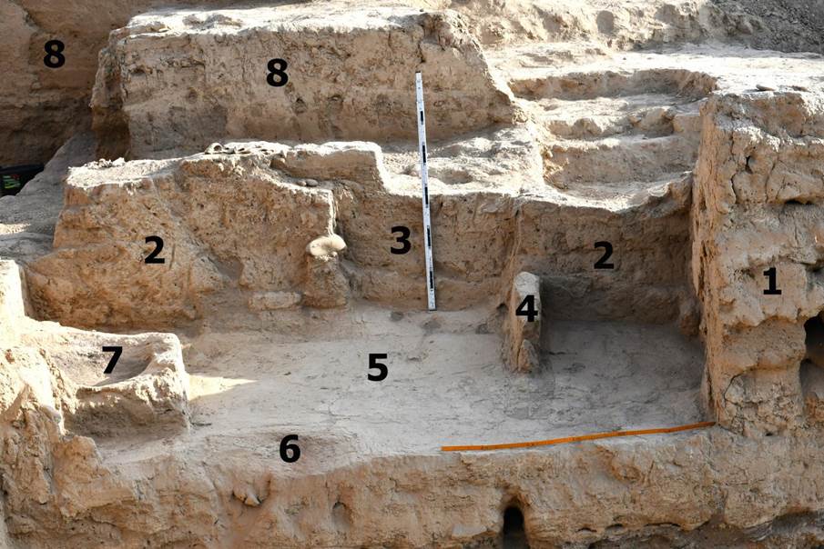
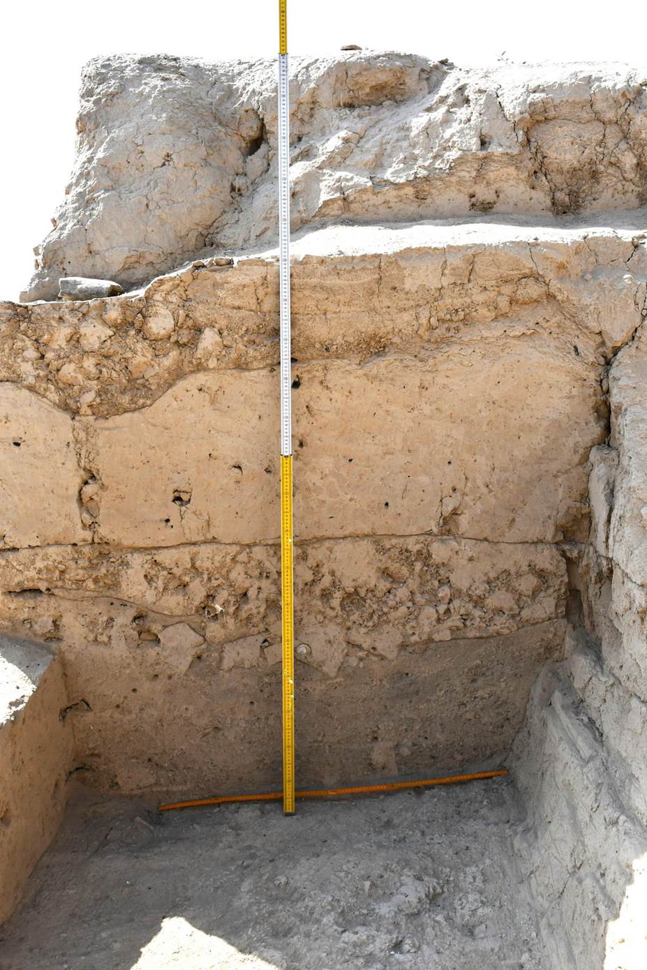
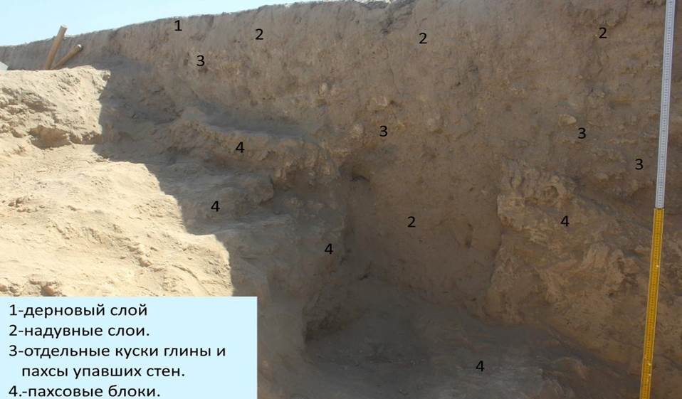
Floor 2 lies -575 cm under the benchmark, i.e. 55-58 cm lower than Floor 1. On this floor stands a wall made of raw mud bricks that served as the base for the western sufa in Room 1. The base of the eastern wall in Room 1, which incorporated the entrance into the “Throne Hall”, lies 45 cm lower than Floor 1 and 13-17 cm higher than Floor 2, i.e. it was erected during the formation of Room 1, but it is not related to Floor 2. Floor 3 lies on the -593-596 cm mark, i.e. 73-75 cm lower than Floor 1 and 15-20 cm lower than Floor 2. It consists of several layers of clay covering, its total thickness being 8-10 cm (Fig. 3). A characteristic feature of Floor 2 and Floor 3 is the occurrence of round fields heavily calcinated by fire, located above each other and extending underneath the eastern wall of Room 1 at the spot of a passage to Room 2 (Fig. 4). This testifies to the fact that braziers (fire altars?) had been placed here (in the centre of the rooms?) in the functioning periods of Floors 2 and 3. Floor 4 lies at -636-640 cm under the benchmark, i.e. 40-47 cm lower than Floor 3. The layer between Floor 3 and Floor 4 consists of a loose mass of grey colour, nurtured with ash, with streaks of burned earth, soot and small coals as well as with ceramic fragments and animal bones (Fig. 3). Inside Floor 4, at a distance of 130 cm from the southern wall and 85-86 cm from the eastern wall, there is a pit with a diameter of 12-13 cm, probably to keep the coals. In the loose layer, before the spreading of Floor 3, a lens-shaped recess was dug out, which was filled with dense homogenous clay (Fig. 6). The northern border of this clay lens lies at a distance of 2,35 m from the edge of a sufa, built in the last phase of the functioning of Room 1 along the southern wall. Before the clay dried, two small round pits and a groove were dug out of it. They are located along the north-south axis (Figs. 5, 7). The first round pit is 21-22 cm in diameter, with a preserved depth of 6,5 cm. The pit cut into raw clay has fireproof walls — first, a layer of clay covered by small stones, then a layer of pure clay on top. The walls of the pit are calcined to red, the thickness of the calcined layer is 2 to 5-6 cm. At a distance of 40 cm to the south are the remains of another round pit, 22 cm in diameter. Its walls are likewise covered with clay, and calcined. On its ground lies the bottom part of a modeled vessel with walls 1 cm thick. 13 cm to the south of the second pit a north-south orientated groove was cut out of the clay, (Fig. 8). The distance between the groove and the edge of the sufa is about 90 cm. The groove is trapezoidal in cross section, its ground and walls are smoothed out. Its preserved length is ca. 60 cm, its width 5-7 cm. Judging by traces of high temperature, the walls of the pits were exposed to high degrees of heat. Such temperatures can be achieved through the usage of charcoal and the blowing of fire with the help of bellows. A procedure like this is required, for example, to melt a small amount of metal. That is, we are dealing with traces of a small-sized workshop (of jewellery?). After some time the pits and the groove were hidden under Floor 3. In this filling layer, 15-18 cm underneath Floor 3 (minus 606-611 cm under the benchmark), we found an intact ceramic lid with a loop-shaped handle and a cut-out decor (Figs. 12, 13).
We noted several times that the northern part of the excavated sector was significantly damaged by a looting pit. That pit also cut through Floor 4. Next to the pit can be seen the outline of a round calcined spot, trace of a mobile hearth used to heat the room (Fig. 9). In the northern wall of the room — the single wall that existed throughout the entire functioning period of all floors unearthed at this point, from Floor 1 to 4 — we detected a round hearth-fireplace, located closer to the north-eastern corner of Room 1 (Figs. 10, 11). In the same wall there is a narrow, low opening, relating to Floor 2 or Floor 3 as a doorway. Because the looting pit cut the surface of the northern wall, too, it seems impossible to determine which of the floors this doorway exactly related to. In
the filling between Floor 3 and 4 we found animal bones and fragments
of ceramics that can be divided into kitchen ware, tare ware and
table/banquet ware. The kitchen ware consists of fragments of hand
modeled pots for cooking and boiling water, whose surface is covered
with soot. Two of them have vertical handles of flattened oval shapes
in cross section. The upper part of the handle is connected to the
collar, and the lower is fixed to the shoulder of the vessel. The
shoulder carries a horizontal stuck stripe decorated with dents; to
the left of the handle base a knobble was stuck onto the vessel’s
body (Fig. 15). There are also a fragment of a hand modeled
bottle-shaped vessel and a moulded pot decorated with a wavy ornament
incised prior to the firing (Figs. 14, 15). In
the filling we also found a fragment of a ceramic support with a
stylized depiction of a ram’s head (Fig. 17).
Both ends of such supports had the shape of an animal, often of a
ram; they probably had a cultic function. Very
interesting is a vessel, the fragments of which were found in
different parts of the room and in different depths in the floor
(Fig. 18). While the first find was discovered immediately under the
spreading of Floor 3, on the surface of the sooty filling, the other
fragment was found inside the sooty filling, 5 cm above Floor
4. It is a modeled vessel, a round bottom bowl decorated with a ring
surrounded by triangles, which were drawn on its outer side prior to
the firing. Inside the ring and the triangles there are incisions. On
the outer bottom part of the bowl an S-shaped sign was cut in,
likewise prior to the firing. Unfortunately, the sign is not fully preserved. It is likely a tamga, the earliest among
those found at Qarshovultepa to this date. The surface of the vessel
is brightened. This object does not belong to household wares and
obviously had a specific function. Noteworthy
are two ceramic finds from Floor 4. They are miniature objects,
probably children’s toys. One of them recalls flasks of the Kaunchi
culture, with one flat side, 3,7×3,2 cm in size (Fig. 19). It was
found 2,95 m from the southern sufa and 1,20 m from the eastern wall.
It could also have been used as a whistle. The second find is a
footring of a miniature vessel (Fig. 20), spotted at 2,85 m from the
southern sufa and 1,75 m from the eastern wall, 2,54×1,6 cm in size. Two interesting objects were recovered from the filling between Floors 3 and 4: a stone polisher 9,3×7,6 cm (Fig. 21), and an astragalus bone (knucklebone), 3×2,2×1,7 cm, with a hole drilled into it (Fig. 22). The latter was found near the northern wall, 1 m from its north-eastern corner. Until recently astragalus bones were used by the population of Central Asia for gambling, and the holes were used to fill them with lead in order to add weight for more effective throws. The
continuation of work on P-3 will make it possible to study the
settlement’s stratigraphy and to differentiate the material
(ceramic and, hopefully, numismatic), which characterizes the
transition from the late phase of the Kaunchi culture (Kaunchi III –
second half of the 4th – first half of the 6th centuries CE) to the
Turkic period. Excavation 4 (R-4) We resumed work with excavation № 4 on the southern edge of the central part of the settlement, next to the steep slope. The excavation there was started in 2011 by the orientalist A. Savchenko. During the same season the excavation was interrupted for lack of perspectives. As the excavations of the current season have shown, the reasons for this interruption were the underestimation of the importance of this area of the monument, and the significant damage of the layers in this area requiring an excavator of higher qualification. The plan composed after the 2011 excavation reveals how complicated and unintelligible the situation at the selected area was. Fig.
23. Plan of Р-4
after the 2011 excavations The decision to resume work on R-4 was based on the assumption that the territory on which it was started possibly contained the citadel of Qarshovultepa. This hypothesis was set up after the study of satellite photographs. Comparing the shots taken at different times of the day we could detect that the central part of the south of the settlement might have been separated from the main territory of the site by massive fortification walls (Fig. 24). Fig.
24. Relief of the settlement’s walls Work started with the cleaning of the old sector and its inclusion into the grid of five-metre squares systematizing the entire settlement. On its edge we installed a temporary benchmark for the measurement of depths in relation to the general zero benchmark. Its mark is -170 cm. Hence, this is the approximate measure that the entire square around the excavation lies lower than the highest point of the settlement. Initially, throughout the area of the old excavation, we cleaned off the floors on the level of minus 260-280 cm and clarified the directions of the remaining walls. Afterwards we expanded the area of the excavation southwards to the steep slope and 5 m to the north and east respectively (Fig. 25). Fig. 25. Plan of R-4 after the 2020 excavations Thus, the overall square of R-4 has reached 360 sq.m. (24×15 m). The top of the entire excavated area presents a more or less homogenous picture. A turfy layer of 5-10 cm was followed by a very loose salted and entirely destructed ground. The thickness of this layer varies. In the northern and southern parts of the excavation it as about 20 cm thick, in the centre up to 40 cm. It is noteworthy that this kind of layers occurs at all excavations on the site, with the exception of the areas above the “platform” at P-3 and above the fortification walls and towers on excavation R-7. This layer was even thicker at excavation P-5 (necropolis), where no traces of burial pits were visible up to a depth of one metre. This is possibly related to the destructive impact of tree roots during a millennium, which are significantly more present in a soft ground. We traced a relatively loose layer with fractions of adobe walls under the amorphous layer described above, practically on the entire area of the excavation down to the floor level -260 cm (90 cm from the present-day surface). Next to the wall fragments preserved in this layer the rubble was denser. This layer was particularly loose in the central part of the excavation (squares AA-113, A-113 and the north-eastern corner of square B112) due to a large amount of pits. They were so numerous that, except for one pit located at the very centre of square AA-113, we could not define their edges. In
squares A-114 and AA-114 the picture is different. Fig. 26. R-4. Eastern part. The destroyed wall and the clay consisting of its fragments. View from the south There
we detected remains of a north-south oriented adobe wall. Traces of
it are preserved over a length of 15 m, but only a small sector
(slightly over a meter long and 110 cm thick) inside square BB-114 is
preserved with both its facades up to a height of 90 cm from the
floor level of -260 cm. In the southern part we managed to trace 4,5
metres of its western façade, 20-30 cm in height above the floor on
the -260 cm level. A clay вал,
about 80 cm wide and slightly above 1,5 m long, adjoined this facade
approximately at its middle. The height of the вал did not exceed 15 cm above the floor at its highest point. It is
highly probable that these are the remains of a wall directed
westwards. Fig.
27. R-4.
Square АА-114.
Remains of a wall directed westwards The central part of the south-east wall described above is preserved as well. The edge of the remaining wall is slightly higher, reaching 30 cm. This remaining part and the floor to the east of the wall are covered with a layer of dense dried clay, with small pits dug up in many spots. This layer cannot be a simple remnant of the wall. Most likely the wall was intentionally destroyed for the preparation of clay. In the north-western corner of the excavation we opened two rooms, the walls of which rose above the floor (-260 cm) to a height of 40-60 cm. Room
1. Its southern part was partially opened in 2011. Then, the
excavators did not reach the floor of the room, but missed it - by a
few centimetres only. The trapeziform room stretches from south to
north with a slight deviation to the east. At the south the width of
the room measures 3,75 m, 6 m further north it narrows to 2,5 m, but
because of oval protrusions built onto the eastern and western walls
the width of the north entrance into the room is 1,55 m. Fig.
28. R-4.
Room № 1. View from the south, and its entrance from the north The three remaining walls are built from pahsa. They are 80 cm thick. The eastern wall of the room curves slightly to the east. It is badly preserved. Its eastern facade is heavily damaged by precipitation, like the southern wall. Its northern (i.e. inner) facade is preserved much better than the southern one. This circumstance probably attests to the fact that the space to the east and south of Room 1 was not roofed. From the north-western side the room is limited by better preserved walls. We opened a passage 120 cm wide to the north-west beginning at a spot 170 cm to the north-east from the western corner of the room. From the north the passage is limited by the outer southern corner of Room 2. In the southern part of Room 1 we cleaned off two floors. The upper one on the level of -250 cm was well tamped. The filling of the room above this floor is quite loose, homogenous, and was formed through the gradual breakdown of the walls in small pieces (abandonment). The lower floor (on the level -265 cm in the southern part and -275 near the northern passage into the room) was also easy to clean off. It has clear traces of habitation. It is partly burned and there are a lot of coals and soot in the filling between the floors. Particularly many of them were found next to the northern passage. To the north of Room 1 we opened part of a corridor (?) narrowing to the north. Under the northern edge of the excavation its width measures only 180 cm. Its walls are continuations of the walls of Room 1. They are preserved to a height of 30 cm. Fig. 29. R-4. Corridor and passage into Room 2. View from the south
Room
2. Not completely opened. The north-western part of the room was left
beyond the excavation area. It shares its south-eastern wall, 80 cm
thick, with Room 1. The width of Room 2 is 5 m. Extra
niches were made in the wall ends aligned with the passage for the
frame of the doors. One meter from this passage on the floor in the
corridor we
found a granite thrust bearing with two holes for the installation of
doors (Fig. 30). Hence, the passage to Room 2 may have been closed
with double doors.
Along the south-eastern and south-western walls sufas, rising 20 cm from the floor, were arranged. The south-eastern sufa is 130 cm wide, the south-western one 80 cm. In the corner between them there is an unfilled space of 30×30 cm, possibly the spot of a wooden column. An
oval hearth (140 ×70 cm) was inserted in the northern corner of the
south-eastern sufa (Fig. 31). The borders of the sufa and the hearth
were simultaneously decorated with flat raw bricks lying on their
edges. The hearth is moved towards the passage, and the distance
between it and the north-eastern wall reaches 1 m. The fact that the
hearth was located near the passage presupposes that it did not
fulfill household needs, but cultic purposes. Fig. 31. R-4. Room 2. Sufa and hearth The cleaning by fire of persons entering a room was widespread among Central Asian peoples in the pre-Islamic period. Such a ritual cleaning arrangement was already discovered in 2017 at room 20, Excavation R-3. The smoothly finished floor of Room 4 was cleared off at a depth of -175 cm. Above it there is a massive burnt fire layer, covered at -150 cm with a surface on top of which we found only traces of abandonment. To the south of the southern wall of Room 1, 3 m away from it, we found an ill-preserved pakhsa wall inside squares А-112 and В-113 (Fig. 32). Its northern part was already discovered in 2011. This year we expanded the excavation and opened the southern end of this wall in the south-western corner of square B113. The overall length of the wall reached 15 m, but its north-western part lies beyond the excavation area. To the east of it, on a small area, on the floor at level -160 cm we detected lenses of humus. To the south-east of that wall, beyond the southern edge of the control partition, we opened a wall that formed its continuation, stretching from the centre of square B-113 to the cliff at the centre of square C-114: quite a complex construction. Its lower part consisting of a single row of bricks follows the principle of placing whole bricks longitudinally on the edges, with a filling of fractions and clay between them (Fig. 33).
With the bricks being heavily crushed, we were unfortunately unable to measure their sizes; in any case they were large rectangular bricks, 10 cm thick or more. The wall is 90 cm thick. At the -260 cm level, the bricks of the wall lie on the cut pakhsa wall, the edge of which protrudes westwards from the line of bricks for 20-30 cm. On the farthest edge of the excavation, above the cliff fall, we detected a piece of a pakhsa wall standing on top of the brick wall. It is possible that the bricks standing in one row only served as the foundation of the pakhsa wall, which is not preserved. To the west of the walls described above, in squares С-112 and 114, the surface of the territory is so heavily changed by pits dug out at a later time that the preserved wall fragments do not give us a clear picture of the layout on the excavated level. At the crossing of squares А-114,115 and В-114,155 we opened a corner of well-preserved pahsa walls extending under the eastern border of the excavation (Fig. 34).
Fig.
34. Р-4.
Wall in squares В-114,115 The corner is directed westwards. The walls are preserved to a height of 60 cm above the floor level, defined at a depth of -260 cm, but they had been built at an earlier period. Through the work conducted at P-4 during the season under review we opened new areas concerning the last phase of habitation and the period when the settlement was being abandoned. Unfortunately, the layout of that period was heavily damaged when the walls were disassembled to obtain construction material. However, as the walls were not taken apart below the -270 cm level, work on that sector is promising. The position of the building with large rooms inside an area of the settlement that was possibly a citadel gives us hope for more interesting material on the urban planning structure and city architecture in pre-Islamic Chach.
Excavation 8 (R-8) In 2020 work was conducted in rooms 4, 8, 9, 10 and 11 (Fig. 41).
Room 4 In field season 2019 we excavated Room 4 along the horizon of the first building period. It is 6,80 m long and 6 m wide. Its north-western wall is badly preserved. Its northern part, near the passage into Room 3, is destroyed by a 20th century burial. An identical burial was detected at the north-eastern wall during the 2018 field season. The south-eastern wall is shared with Rooms 1, 2 and 4. The north-eastern wall of the first building period stands on a levelling clay layer, the surface of which served as a floor in the last habitation phase of this complex. It is noteworthy that a large amount of household (utilitarian) pits, set from different levels at different periods of habitation significantly obstructed the study of Room 4 (Fig. 42). Fig. 42. Household pits in Room 4. View from the west The north-eastern wall of Room 4 is better preserved in its northern part. In 2019 we detected a household pit at a distance of 80 cm from the north-western wall near the doorway. The opening of this room started from the -174 cm mark, i.e. from the surface of Floor 1 of the first building period. The upper surface of the 35-40 cm thick coating became Floor 1. Right underneath this finely dispersed clay coating is a filling consisting of an ash-cinder layer including charcoals mixed with soil. The floor on which these layers lie was fixed at the -234 cm mark. It belongs to the second building period when the room had different dimensions. Its length is as yet unidentifiable because the north-western wall of Room 4 most likely lies under the floor of Room 3, but its width is known — 4,60 m. A pit is lowered near the entrance from Floor 1 of the first building period; it partly destroyed the north-western wall of the second building period. During field season 2019 we found the second pit of the first building period near the eastern corner of the north-western wall. The south-eastern and north-western walls are of equal length — 6,90 m. The south-western wall was 4,60 m long in the first building period. Between the first and second floor of the first building period lies a layer of filling, consisting of soil with a large amount of cinder-ashy incisions with some coals. Inside that filling we found large numbers of decayed pieces of reed mats, which possibly served as cover material for roofing the room. That layer yielded ceramic fragments as well as two coins. On the obverse of the first coin a predator walking to the right is depicted, on the reverse is a tamga shaped like a pitchfork. The second coin belongs to the group of coins with the representation of the ruler and his wife. Noteworthy are several fragments of walls of a large vessel — a cooking pot with a series of ornaments: short oblique line strokes under its mouth, below them short segments and another ornament in the form of herringbones. In that layer we found numerous walls of cauldrons and khums as well as ewers and plates. On
this particular layer the north-western and the south-western walls
were erected. The south-eastern wall continues beyond this layer and,
evidently, there is another more ancient wall behind it, to which new
walls were continuously attached, changing the layout of the rooms.
This was fixed in the process of its excavation in Rooms 2 and 3 in
2019. An analogous situation is to be found in Room 4, which is
attached to the south-eastern wall. There, at the -267 cm mark, we
detected masonry of raw bricks in the sizes of 50-48×30-23×8-10 cm.
In the south corner of the room the western part of the wall is now
absent, because here, most likely, was a door passage leading south,
where Room 5 is located. At the level of the top of this masonry the
floor was coated throughout the entire area of the room. At the level
of this floor we found 3 pits dug into Floor 2 of the first building
period. Two further pits were located under this floor; they were
lowered from the second floor of the second horizon. Pit 6 is located
under the south-western wall, covered by Floor 3 of the first building period, which is clearly visible in
cross section (Fig.
43). It is halfway cleared off.
Inside we found a coin with the portrait of a ruler in three-quarter
view turning to the right, enclosed by a ring.
The reverse of the coin is heavily abraded, but one can identify a
tamga consisting of two bows connected by two parallel lines. Pit 7 was discovered in the eastern side of the room next to the north-western wall of the first building period; it extends to the area of Room 3 (Fig. 45). Like Pit 6, it was lowered from the level of Floor 3 of the first building horizon, i.e. functioned earlier than Pits 3 and 4. In the work process we noted that the floor coatings of different building horizons significantly differ from each other. While Floor 1 was perfectly leveled in Rooms 1, 2, 3, 4 (season 2018), Floors 2 and 3 were carried out as if applied in haste, without sparing material. It is clear that Floors 2 and 3 of the second building period were used only temporarily during renovation. The utilitarian pits we found in these layers suggest that they were most likely used to contain the clay needed for covering the floors. Room 8 This room offered the opportunity to clarify the length of the north-eastern and south-eastern walls. The first one is 4,00 m long, the second one 4,75 m. Fig. 46. Section of Room 8 from north-east to south-west The eastern corner of the room is destroyed by a household pit. The north-western wall was excavated in 2019, it was 4,00 m long. Its western part is destroyed by a 20th century burial situated at a door passage leading out of this room into a corridor (Room 6). The clearing showed that across the entire area of this residential complex destroyed premises were swamped and this filling was covered with a clay layer, which served as the base for new walls. Thus, the surface of the clay coating became the floor of the upper building horizon. The last floor of the room yielded two coins: one, found near the south-eastern wall, with a female portrait and, on its reverse, a lyre-shaped tamga, the second one of small denomination with a square hole, of ill preservation. Room 9. Located to the north-east of Room 5, it shares a wall with it - the north-eastern wall for Room 5, the south-western one for Room 9. It is built of bricks 50-49х24х9-10 cm, 4,40 m long and 80-87 cm thick. When the floors were laid out in the second building horizon, a sufa 35-42 cm wide was attached to it. The north-western wall is shared with Rooms 5 and 11 from the north-western side and with Rooms 1, 2 and 4 from the south-eastern side. The north-eastern wall is 4,20 m long. The south-eastern wall is 3,45 m long and heavily destroyed by pits at its centre and southern corner. The entrance was probably located in the southern corner of the south-eastern wall. Inside the room we cleared off three levels of floors, which belonged to different periods of the first building horizon. In the room we found several wall pieces of large vessels and rims of ewers and khums. On the first floor of the first building horizon we detected a coin that can be related to Group 7, Type 1, Variant 5. It shows a ruler portrait in three-quarter view to the left encircled in a dotted ring. The ruler wears a bashlyk-shaped headdress. Another coin was found in the layers under Floor 2 of the same horizon. Judging by its preserved features we can assign it to Group 5, Type 1, Variant 3. It shows a paired portrait of a ruler and his spouse, and, on the reverse, an image composed of a symmetrical tamga with a cross in its upper part. The coin is heavily abraded with edges broken off. Room 10 Behind the north-eastern wall of Room 9 follows the area that is taken up by squares ОО108, 109 and NN107,108,109. Within these squares we did not identify any architectural structures, including pakhsa and brick walls, down to the -1,85 m mark. Therefore, back in 2019 we made the assumption that this sector was used as a utility yard in the last functioning phase of Qarshovultepa. That is why we decided to lay a 5×2 m sized digging, which eventually turned into an excavation. The floor on this sector is uneven, closer to the eastern edge and in the southern direction there were formless piles of clay, which, in our view, were prepared for renovation works. From the north-western side the floor of this sector is connected to the south-eastern wall of Rooms 1 and 2, which lie behind that wall. The thickness of the floor coating of the first building horizon reached 38-40 cm. Underneath lies a 40-45 cm thick layer, which consists of layers of small charcoals and cinder, mixed with earth and pieces of pahsa. In the southern part it is three times as thick as in the northern part. Fig. 47. Section of Rooms 10 and 11 on the А – А1 line This
layer lies on Floor 2, which belongs to the second building horizon.
At the
level of the floor, in the northern part, we detected the upper row
of a brick wall masonry, matching with this floor. At a particular
time a reconstruction was undertaken in this area, this wall was
destroyed, and the room filled up. On top of this filling the surface is leveled with a thick layer of clay, serving as the last floor in this area. As a result of this work, the area of this sector expanded, and its function changed. We determined that a corridor functioned in the first building period in the area described. It led from Room 8 to the north-east. Under Floor 3 of the first building period lies a layer of earth with a large amount of raw brick fragments, which probably originated from the north-western wall of the corridor and were used as filling material for this sector after the levelling of this wall. Floor 2 of the first building horizon was fixed at a -3,52 m mark. In this layer we found a red-slip mug as well as fragments of a large tare vessel – a khum – and walls of a cauldron pot. Floor 4 was fixed in the corridor at the -3,87 m mark. Compared to the other floors – 1, 2 and 3 – it is perfectly even and easy to clear off. Occasionally, there are some pieces of chalk, which suggests that it was covered with whitewash. From this floor, 30 cm from the north-eastern wall, in its centre part, a pit 1,26 m deep was lowered. It is 1,30 m in diameter. The north-western wall is preserved up to a height of 0,95-1,00 m. It is built of raw bricks sized 46-49×23×9-10 cm. In its lower part the south-eastern wall is build identically to the northern one, but starting from a height of 50 cm from the floor line, its masonry starts including different-sized bricks and pakhsa blocks. In the western part it extends under the control edge. During the clearing of this floor we found great amounts of ceramics, among which we will mention a fragment of a round-foot plate, made of high quality clay, covered with a light-brown slip with a polished finish. Here, we also found fragments of a cauldron, with handles under tits rim, most likely decorative ones. Near the southern corner in the north-eastern wall, at a height of 0,86 m from the level of the last floor, there is a niche 0,60 m wide, 0,70 m high, and 0,60 m deep. We found a coin on the floor next to a utilitarian pit, heavily abraded, but one can still see a paired portrait of a ruler with his spouse, and, on the reverse, a composed tamga in the shape of horns. Room 11. Located to the north-west of Room 10, sharing a wall with it, which for Room 11 is the south-eastern one, and for Room 10 the north-western one. It is excavated partially, because the south-western and north-eastern walls extend under the north-western wall of the first building period. The length of the excavated south-western wall is 1,90 m, its remaining part lies underneath the north-western wall of Room 2 of the first building horizon. It is composed of raw bricks 45-46×23-25×9-10 cm in size. The south-eastern wall is built of identical bricks, 4,05 m long, with a preserved height of 0,7-0,8 m. The north-eastern wall was excavated up to a length of 1,50 m, and just as the south-western one it proceeds under the wall, but towards Room 1. In the excavation process we fixed two horizons in this room, the floors of which belong to the first building period. On the first floor of the first building period lies a layer of rubble made of raw bricks which were found in this room’s wall masonry. Possibly, when the floor of the first building period was spread, the walls of this room were torn down first, and only afterwards was the above-mentioned floor laid on top of them. Among the finds in this room is a ceramic mug with a broken handle, covered with red slip, its walls partially burned black. We also found two coins. One of them was lying in the centre of the room in the rubble above the first floor of the second building period. It depicts a predator; on the reverse is a pitchfork-shaped tamga. The second coin was found on Floor 2 of the first horizon. It shows a paired portrait analogous to the portrait on the coin from Room 10. Further excavations opened the corridor (Room 6) in the western direction. The stratigraphy of this area does not differ significantly from that of Room 10. The corridor measures 10,65 m starting from the control edge in Room 10 up to the outer wall of Room 7. Its width varies between 2 m in the north-eastern part and 3 m in the south-west. At a distance of 4,55 m from the control edge in Room 10 in the south-western direction there are separating “wings”, building a passage and nominally dividing the corridor into two parts. Two hearths were built with vertically set raw bricks 49×24×9 cm in the south-western part of the corridor in the north-western wall at the level of Floor 2 of the first building horizon. Around the hearths were dispersed large amounts of animal bones, scraps of cinder and ashes. Near one of them we found a coin of a small denomination with a ruler portrait and a lyre-shaped tamga on the reverse. In the south-western corner of the corridor is a door way leading into Room 8; it was partly destroyed by a 20th century burial. As in the other areas we are faced here with floors from different times that belong to one and the same building period. The area of the corridor is not fully excavated yet. Further excavations at R-8 will provide important information on the building structure and the layout of this sector located at the highest point of the settlement.
Fig.
50. R-8. Oil lamp Fig. 51.
R-8. Bowl with tamga Excavation 9 (R-9) As
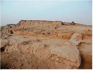
has been continuously pointed out in our reports and publications, in
ancient times the river Chirchik was flowing in close proximity to
Qarshovultepa. On the one hand it provided security for the access
routes to the city walls from the south. On the other hand at some
point the river started washing away these walls. At the present
time, the southern edge of the highest point of the monument looks
like a steep cliff, 15 m high. Every year the collaborators of the
excavation examine this cliff in order to find new details in the
layers of the monument or dropped out artifacts. 2020 was no
exception. During the examination of the farthest eastern part of the
cliff we found a massive pakhsa wall directed perpendicularly to the
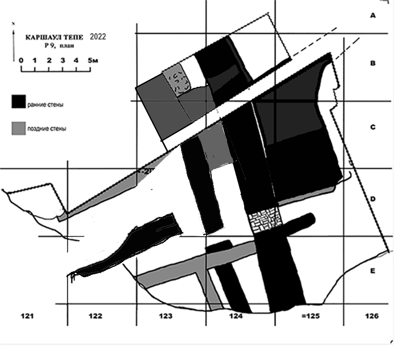
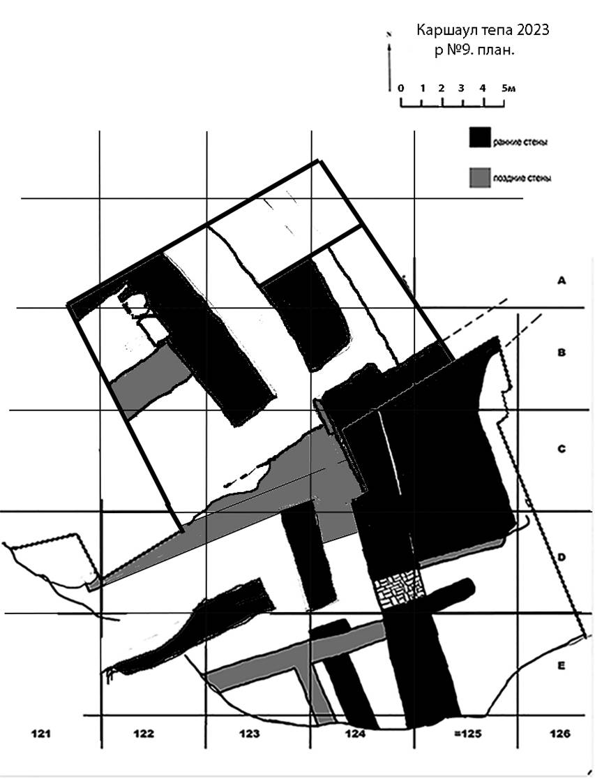
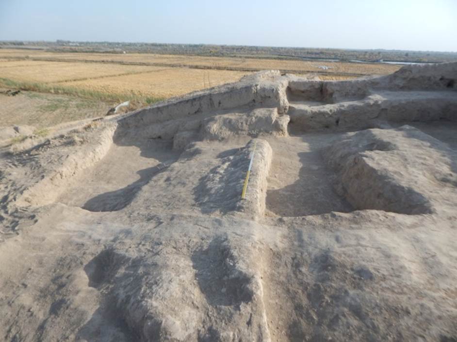
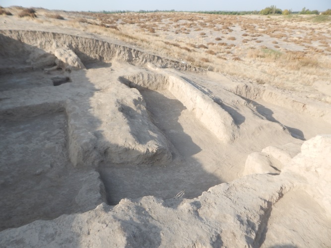
bank of the southern fortification wall of the shahristan at the junction with the citadel. Fig. 52. R-9, plan After a slight cleaning it was clear that this area is undoubtedly of interest for the study of the city’s fortification. Hence, we decided to start working on it. The excavation received the ordinal number 9 (Fig. 52). The sector was connected to the settlement’s systematizing grid of squares. At the junction of squares C-122,123 and D-122,123 we installed a temporary benchmark. It is 285 cm lower than the universal zero mark of the monument. Since the pahsa wall was built perpendicularly to the city’s fortification wall, the object was identified as a tower. The
excavations started from the cleaning of the eastern facade of the
wall discovered in the cliff. Afterwards we opened the layers to the
west of it. The overall area of the excavation works conducted at P-9
exceeded 150 m2. The area of the excavated sector has
a deviation/skew from -285 cm in the north-west to -450 cm and -800
cm in the south-east. The turf layer is the same as at the rest of
the settlement – 5-15 cm. The
outer eastern wall of the tower is built on the north-northwest –
south-southeast line, perpendicularly to the southern city wall
(Figs. 53, 54). In the season under review we followed it up to a
length of 12,5 m from the cliff edge, but did not manage to reach the
spot where it joined the wall. Under the turf layer above the wall
lies a terrain of medium density, 30-50 cm thick, containing pahsa
lumps from a destroyed wall. On the remaining excavation area we
found friable ground. The upper part of the wall was discovered at
the -450 cm level in the northern part and at -500 cm in the southern
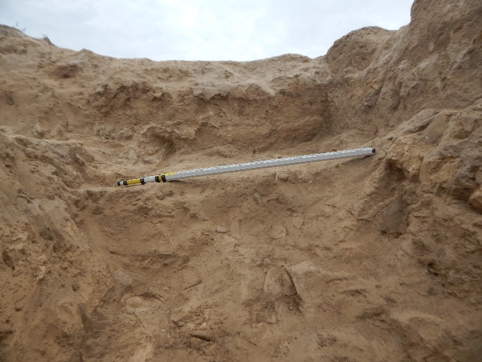
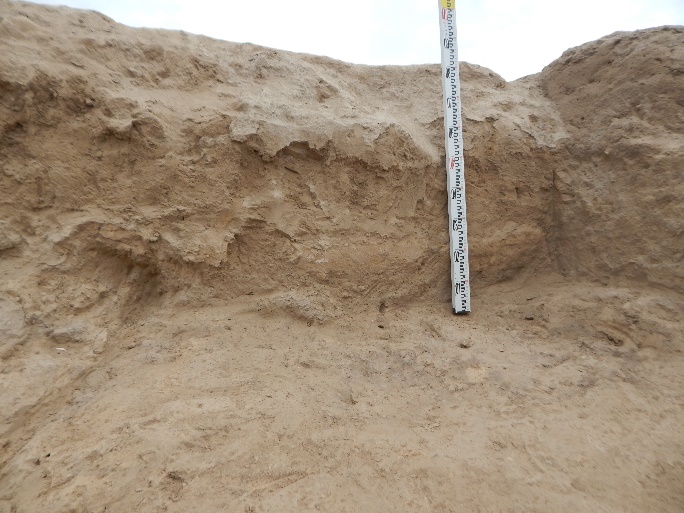
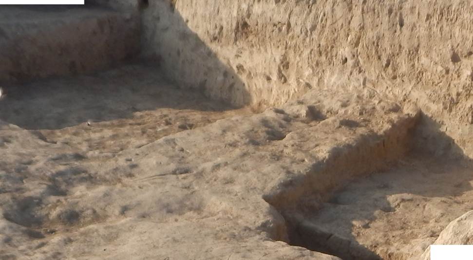
one. The wall is 250 cm thick at the top. To the east of it the relief falls heavily, but under the loose layer along the wall we found large pieces of pakhsa (up to 1,5 m) that slipped from it during destruction. In square С-125, a stepped ramp (possibly initially a staircase) led from the top of the wall eastwards to the -550 cm level (Fig. 55). We could not yet measure the width of the ramp, because its northern edge lies beyond the excavation limits. The length of the ramp is 4 m, it rises from an adobe platform built into the wall. The platform protrudes 4 meters from the wall eastwards, from the northern edge of the excavation, along the wall, 5 metres in length. The same layer of rubble consisting of large wall pieces continues lower than the platform down to a surface level of -800 cm. No excavations were conducted into greater depth at that part, but it is visible in the cliff that the wall is built from the -945 cm level. Hence, its preserved height is about 5 meters. At 130 cm to the south of the platform, a pylon 220 cm long and 90 cm wide was attached to the wall. Its top was obviously cut off. Its preserved height is 50 cm near the wall, 20 cm at the opposite end. This led us to the idea that there was an entrance into the tower between the platform and the pylon, which was subsequently walled up (Fig. 56). It was confirmed after we cleared off the western (inner) facade of the eastern tower wall, where this entrance has actually been found (Fig. 58). To the west of the fortification wall the excavations were conducted in squares D-124 and Е-123,124 (Fig. 57). On this territory the layers significantly differed from the ones we detected in the eastern part of the excavation. First of all, there were no large fractions of pakhsa along the fortification wall. A row of 40 cm thick fragments lies under the surface at the -500 cm level. This surface was cleared off across the entire excavation area. Above it was a relatively even, loose layer with some seals in the northern part of square Е-123. If
any buildings existed above that surface, they were not preserved. At
a greater depth than the -500 cm surface the facade of the
fortification wall was more articulate and easy to open. Under the
layer of pahsa fractions up to the -610 cm surface level we found a
loose layer with lenses of cinder and ash. In this layer we opened
two pakhsa walls. One adjoins the inner front of the eastern tower
wall with its end (approximately on the line of the pylon, attached
to the fortification wall from the east), and extends for 9 m to the
cliff. Another wall was attached to this wall from the south. It runs
parallel to the eastern wall of the tower, 3,5 m to the west of it.
These walls are 80 cm thick. Under the -610 cm mark down to the -675
cm level, work was conducted within a space limited by the northern
edge of the
excavation. At the eastern wall of the tower we cleaned the upper
part of an arched passage built with large rectangular bricks,
52-53×26-27×10-11 cm in size (Fig. 58). The width of the passage at
the foot level of the brick masonry is 175 cm, the preserved height
of the masonry is 90 cm. The upper part of the passage arch as well
as the top of the masonry are washed away. Under the brick masonry is
a layer of thickened ground, about 30 cm thick, into which a ceramic
pipe (a kubur in the Central Asian archaeological terminology) is buried. Its diameter is 30 cm. It is
the first part of the pipeline which was intended to withdraw the
water from inside the tower, after the passage was built The passage is
so far cleared off up to a height of 120-130 cm, its width measures
180 cm in the lower part.
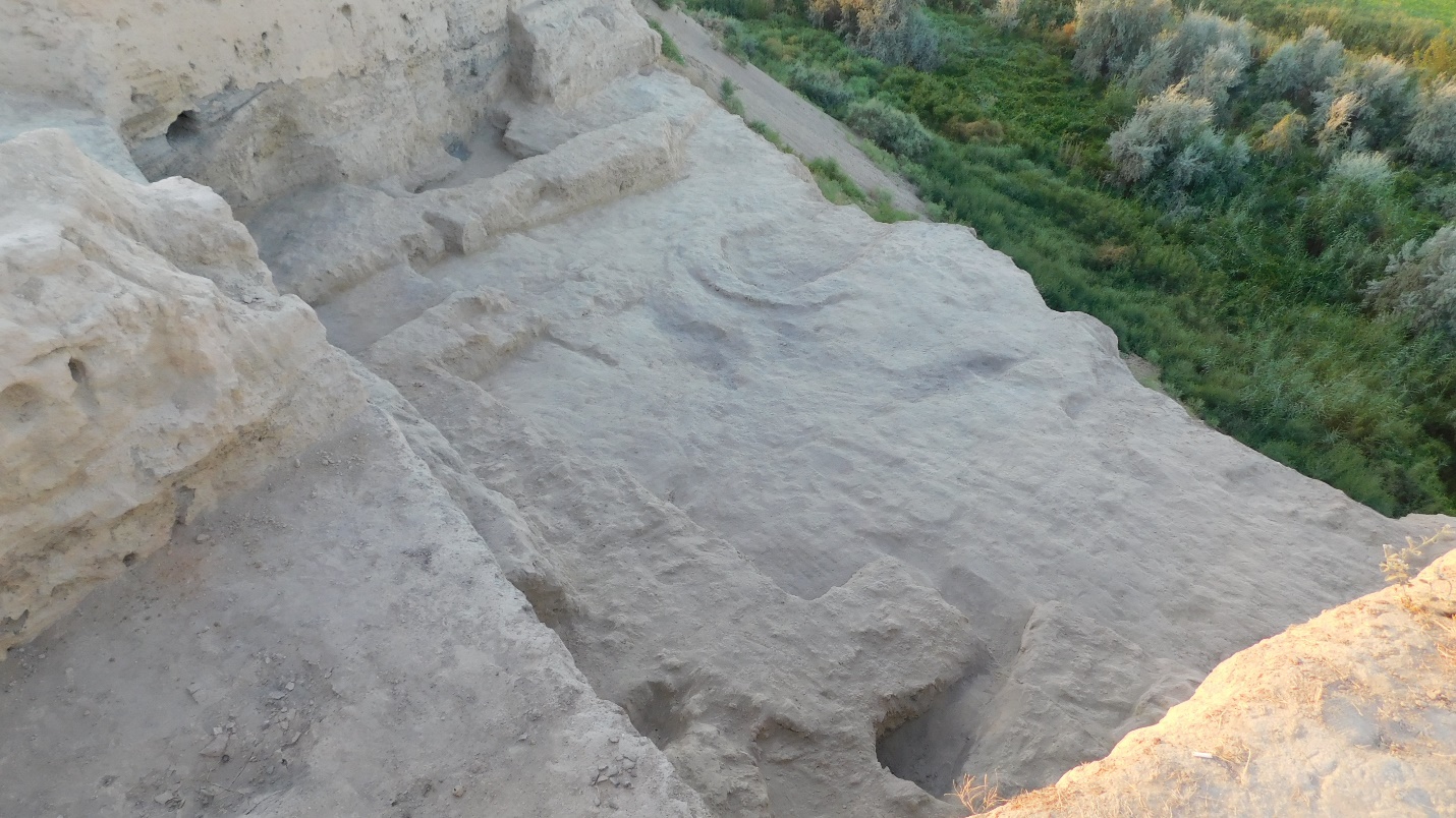
Two walls relate to the lower layer of the tower, identified in the course of the excavation (Fig. 59). The first one stretches along the eastern wall of the tower, 1,5 m to the west of it. It starts from the line of the southern side of the passage and follows southwards to the cliff. The second one stretches along the east-northeast – west-southwest line, i.e. almost parallel to the southern fortification wall of the city. Its eastern end is located at a 1,5 m distance from the eastern tower wall, it proceeds westwards, continuing the line of the northern side of the passage up to the cliff in the western part. In this wall, 1,2 m from its eastern end, we cleared off a passage to the north 80 cm wide. The distance between two perpendicular walls is 1,5 m. The filling at the lower excavation level is loose earth blackened by charcoal and cinder. No excavations were conducted below the -675 cm level during this season under review. The materials gathered in the course of the excavation at R-9 in 2020 are of high value, not only as sources for the history of the fortification of Qarshovultepa, but also for the little studied history of fortifications in early medieval Chach more generally. We intend to continue our efforts at R-9 in the upcoming season.
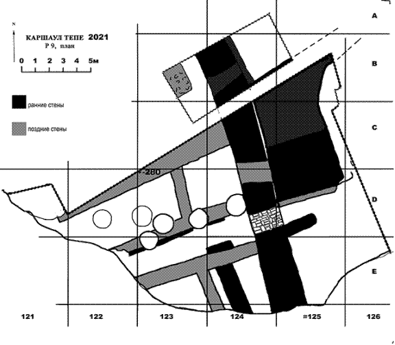
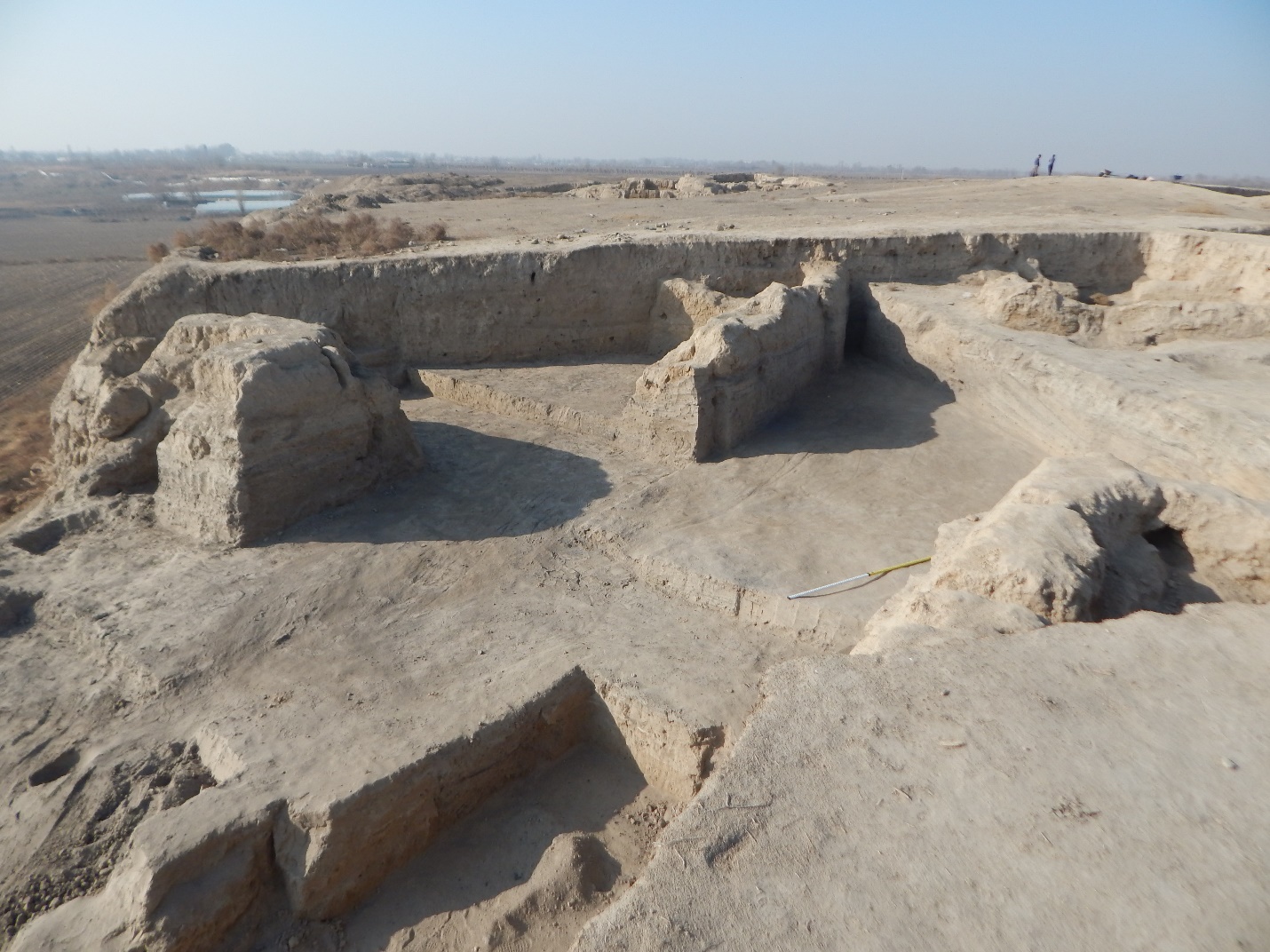
------------------------------------------------------------------ Academy of Arts of Uzbekistan REPORT Authors:K.A. Sheyko, Tashkent 2022 In October-November 2021 we continued archaeological excavations at the Qarshovul Tepa settlement. The monument is located to the south-west from Tashkent, near Dustlik village in the Chinaz district of the Tashkent Province, on the right upper terrace of the Chirchik River, its coordinates are 40°58'24.03"N, 68°54'31.64"E (Fig. 1).
The works were focused on three sectors: R-4 – excavation in the southern part of the site; R-8 – excavation located on the uppermost sector in the central part of the site; R-9 – excavation intended for the study of the southern sector of the site’s fortification (Fig. 2). Excavation R-4
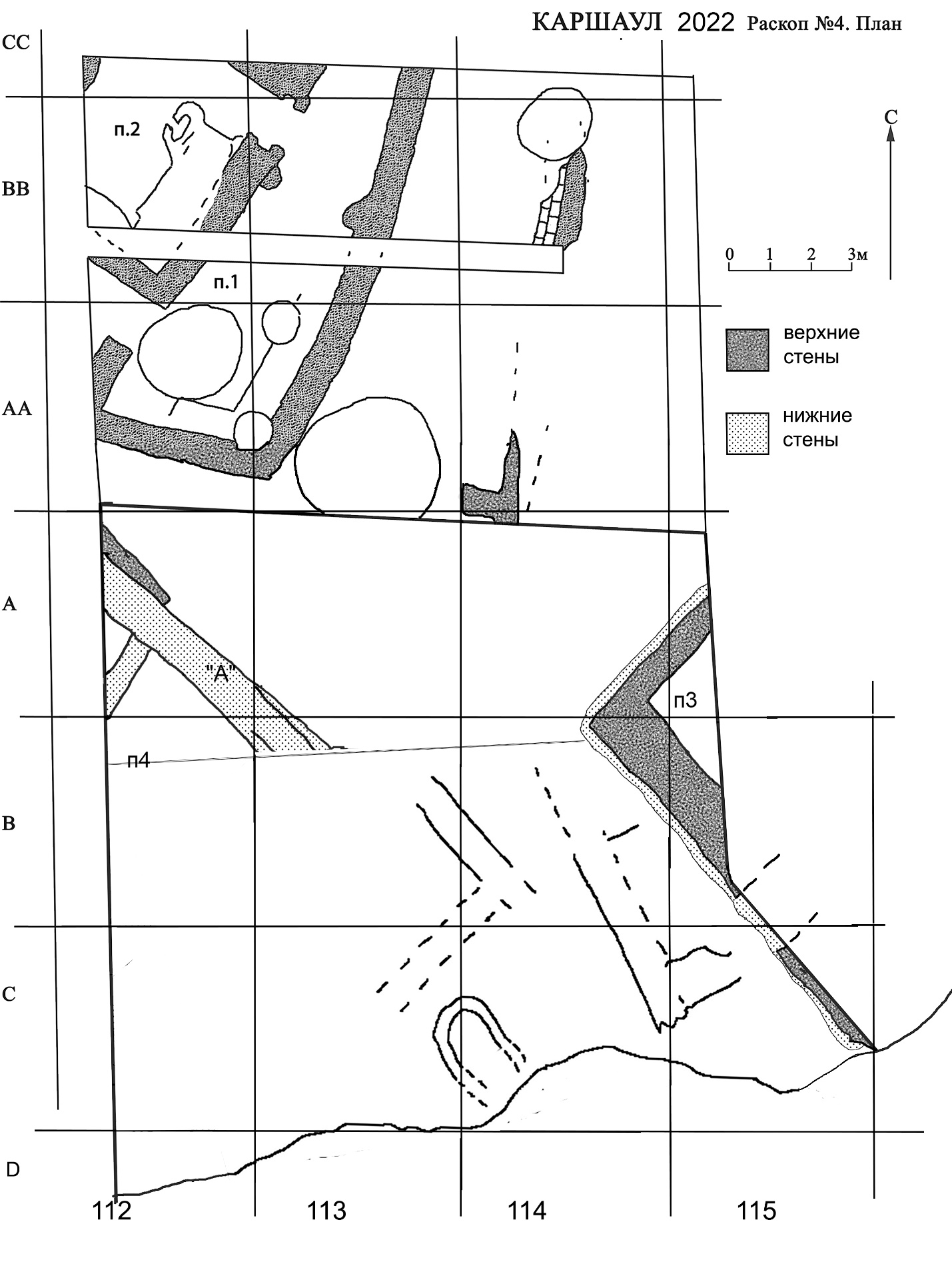
The southern part of the site was excavated with an area of 200 sq. m in order to clarify the structure of this part of the settlement, as many questions about the layout remained unclear after last season's work due to the strong destruction of the walls by later pits (Fig. 3). In addition, according to the long-term program of studying the stratigraphy of the settlement, it was necessary to study the lower layers in this area.
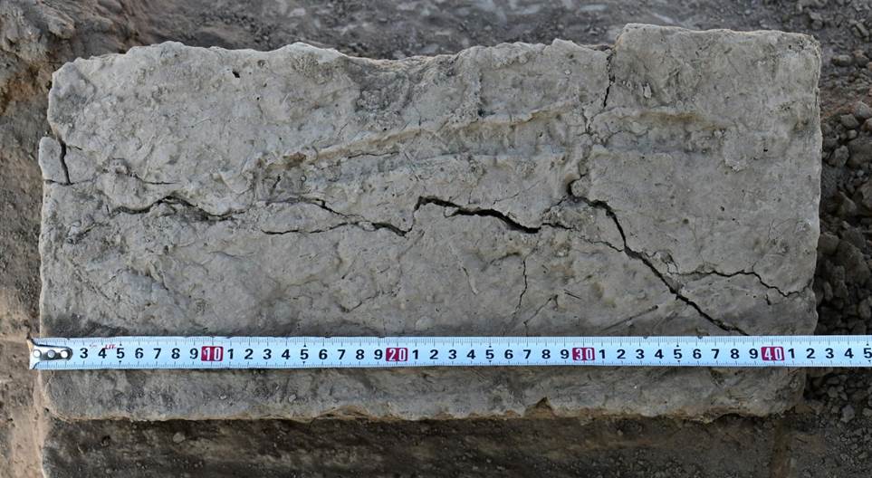
The layers here were as follows: at a depth of 10-15 cm from the surface was fixed turf layer. Below was a layer of saline and loose soil. Its thickness in the eastern part was 40 cm and in the western part 20 cm. Under this layer up to the floor at a depth of -2.60 m from the Zero reference point, there was a layer of broken pakhsa walls. It was denser in the western part. Part of the wall “A” was almost completely destroyed by the late Pit 1 at this location. This pit in the square B-113 is 2 m in diameter, began at the level of -2.10 m and continued till the bottom of wall “A” which is at a depth of -3.30 m from the Zero point (Fig. 5). Its filling did not differ from the ground next to it. In the section of the wall, which was formed as a result of destruction during the digging of the hole, we were able to establish the method of its construction. At this point it was built in two parts: eastern part of 70 cm thick and western of 50 cm thick (Fig. 6). At the same time, at the southern end of this wall at the edge of the cliff no such picture is observed. Here the wall is monolithic (Fig. 7).
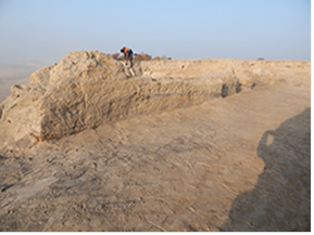 Fig. 7. Southern part of the wall “A” This year's work was carried out in the southern part of the excavation, in an area of 15×14 m. Under the floor at a depth of -2.60-2.70 m, loose soil with large amounts of ashes was detected. The next floor, named floor -2.90, in the eastern part of the excavation (east of wall "A") was easily penetrated by any tool and was fixed only by a very thin layer of clay interlayers, which differed from the upper and lower layers in color and density. The depth of occurrence of this floor is not the same in different parts of the excavation: from -2.70 m in the northwest corner of the site to 3.00 m in the southeast corner. To the west of wall "A" a different picture was observed. The fill was denser and the floor at a stable level of -3.00 m was well compacted and dense. While clearing this floor it was possible to fix the bases of the walls of several rooms. At this level they were less destroyed by the late pits.
The filling between the floors was quite dense, but they could easily be cleared. The northern corner of the room was excavated in square A-112 and the main part in square B-112. A 3.20 m long section of wall "A" served as the eastern (actually, north-eastern) wall of the room. The thickness of its main part at the bottom at the depth of -3.40 m was 80 cm, but at the level of -2.90 m a thin 25-cm-wide repair wall was added to its eastern façade (Fig. 10).
The same wall was also attached to the west façade at -3.00 m depth, but it is only preserved in the southern part of the room (Fig. 11). The maximum preserved height of this section of wall “A” is 90 cm. The northern wall of Room 4 is opened to the length of 1.80 m (Fig. 12). Its south-western part remained under the western edge of the excavation. The wall was built of pakhsa together with the main part of wall "A". Its foundation in the east part is at -3.35 m depth and at -3.45 m depth in the west part. The wall is 60 cm thick at the bottom.
The southern (actually, south-eastern) wall of Room 4 separated it from Room 5 (Fig. 13). Its facades are very poorly preserved, but the fact that there was a wall separating rooms 4 and 5 in this place is beyond doubt. It was traced at 6 m from wall "A" to the western edge of the excavation. The base of the wall was at a depth of -3.45 m. The remains of the wall were up to 60 cm high, and it was about 80 cm thick at the bottom. The size of the room was at least 6.00×3.20 m. It remains unclear what side the entrance was on. It is possible that it was on the north or west side, as the entire west wall and part of the north wall remained uncovered under the western edge of the excavation. It is also possible, however, that the entrance was in the badly damaged middle part of the southern wall between rooms 4 and 5. At the depth of -3.35-3.40 m layers of ash, up to 20 cm thick, were observed under the floor of the room, and in many places between them we could see interlayers of tamped floors/surfaces.
Room 5, stretched along the line NE-SW, excavated to the south of the Room 4 (Fig. 14, 15). Its northern wall is shared with Room 4. The dimensions of Room 5 are 6.60×2.80 m. The eastern wall of the room was a section of wall "A", destroyed by pit No.1 (see description above). The western wall closed the space of the room from the south-western side. The wall is made of pakhsa and collapsed heavily in the southern part.
The interior facade in the northwest corner of the room is well preserved. The thickness of the wall is about 60 cm. Its base is at the level of the lower floor of the room (-3.45 m), the preserved height is about 80 cm. There are two floor levels at the depth of -3.35 m and -3.45 m in the room. In between there is dense layer of a destroyed wall. The southern wall of the room 5 was built of pakhsa from the floor level of -3.35 m. Its western part with a length of 4.50 m was preserved, and its eastern part was destroyed by the two overlapping pits 2 and 3 each 1.50 m in diameter. It is characteristic that the filling of the pits differed little from the filling of the premises. Consequently, they were not specifically dug out for garbage; instead, they remained empty and were filled in the natural way by fragments of walls and dust brought by winds. There was no clear passage into the room. It could be either in the place of collapse of the northern wall common with the Room 4 or in the southern wall in the area destroyed by pits Nos. 2 and 3. Below the lower floor (-3.45 m), the room was excavated to the level of -4.50 m. Throughout the entire area of the room and under the wall separating it from Room 4, the same layers were observed as under the floor of Room 4. Numerous layers of earth with ashes, from 5 to 20 cm thick, separated from each other by relative soft earth surfaces (floors?).
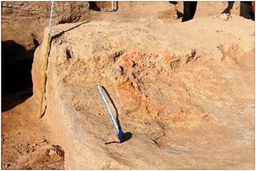
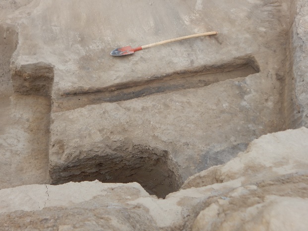
At the level of -4.35 m, at one of such “islands” of the floor, the remains of a brazier which have been dug into the floor was cleared out (Fig. 18). Its eastern part is not preserved because of digging activity of the later period. The preserved length of the structure is 80 cm. The width of the groove is 20 cm, it is 15 cm deep. The inner walls of the structure are strongly calcinated. The whole internal space was filled up with burnt earth with charcoal and ashes. To the east remains of an arch-shaped ceramic object made of fireclay and ornamented with circular grooves were also found here. The preserved height of the arch is 20 cm. The width at the base is 18 cm, the thickness is 6 cm. The surface of the object is burnt and smoked on the ornamented side. Similar objects are known as a kind of damper, placed on one of the ends of the brazier (Fig. 19).
To the east of wall "A," excavations were conducted in squares A–112-114, B–114 and C–114, 115 in the space bounded on the southwest side by wall "A", on the east side by the southwest wall of Room 3 and on the north side by the south wall of Room 1. In square C–115 in the eastern edge of the excavation we continued the cleaning of the south-western wall of Room 3 as well as the layers under this wall (fig. 20). So, the length of this wall is 4.80 m from the northern corner of the room to the south. Further, we found a 1.80 m wide passage in this wall (Fig. 21). Whether it was a corridor between two rooms or a wide entrance into Room 3 needs to be investigated.
There is a layer of dense clay under the wall and the passage with a thickness of 20-30 cm. It is assumed that it was a kind of expanded foundation for stability of walls standing on very loose soil (Fig. 21).
Below the floor which is in the depth of -3.00 m, excavations were carried out to a level of -5.40 m. No architectural remains were recorded in the excavated area (Fig. 22). The filling is exactly the same as under Rooms 4-6. We still need to find out why in such a large area we detect only ashes and ash interlayers (Fig. 23). Moreover, a similar picture is presented by other excavations on Qarshovul Tepa. As a working hypothesis, an opinion is put forward that at some stage people lived in tents and yurts in the area of the settlement.
From the mark of -1.15 m in the southwestern part and from the mark of -1.09 m in the northwestern part throughout the excavated area is a layer of destroyed bricks and pakhsa. At the -1.25 m mark, the upper part of the wall running northwest, parallel to the southwest wall of Room 8, was fixed. The absence of any partitions and doorways for 17 meters allowed us to assume it was a street. Its continuation in the northwest direction goes under the western edge of R-8, and the southeastern end goes under the southern edges of the excavated area. The width of the street in different parts varies from 2.95 m to 3.30 m. Rooms 4, 5, 8 and the southern end of the Room 6 (corridor) adjoin the street from the east. Excavations of the street revealed 2 levels, which refer to the 1 construction period. The first level is fixed at -1,98-2,00 m from the general Zero point of Qarshovul Tepa. It is covered with a dense layer of clay over the entire excavated area. This clay cover smoothly passes to the walls that are limiting the street.
In the layer lying on this floor, fragments of pottery were found, mainly the walls of jugs, and a large amount of animal bones. We should especially note a fragment of the wall of a large storage jar – khum or khumcha – on which there are two scratched marks. The first mark in the form of a vertical stick and the second in the form of a half oval with a “foot” attached at the bottom.
A fragment of a red-engobed polished mug with a loop-shaped handle was found in the same layer (Fig. 28). Under the handle there was a tamgha-sign scratched before firing, of which only the upper part in the shape of an arch was preserved.
The second floor was found on a depth of -2.45 m and just like the floor 1 has a good clay covering. The filling between the first floor and the second floor is different. There are no large pieces of pakhsa and mud-bricks on the second floor, in contrast to the fill over floor 1. That indicates that there was no destruction of walls during this period. Area was just leveled and raised on 40-45 cm.
Thus, we got the following picture. Walls bordering the street are built from the level of -2.50 m. Under them is an ash layer of 20-30 cm thickness, which was made for the leveling of the site for the construction of walls. At the -2.80 m depth another horizon was cleaned out, where the backfill on which the street walls were built has been started. It was well paved and perfectly leveled, unlike the two levels above it. At this level, two coins were found near the ditch, one of which depicts a ruler sitting cross-legged on a throne (Attachment I: 4). The second coin was found to the south, at a distance of 40 cm from the first coin, and 1 meter from the southeast wall. The coin is defaced, but the obverse of the coin shows a portrait of the ruler enface. On the reverse side we see a badly visible forked tamgha. There is a runner preserved on the edge of coin (Attachment I: 5).
In 2019, a digging was laid at the northeast wall of Room 4 in order to trace the stratigraphy of cultural strata beneath the floor. It turned out that all of the floors were associated with the walls of building period I. In 2020, the floors of this room, which belonged to the building period II, were excavated. At the depth -2.67 m the southwestern wall of Room 4, i.e. northeastern border wall of the street, were cut through. As a result, a profile of the street wall was obtained, in which all the elements of its construction are perfectly visible (Fig. 34).
The layer on which all the walls of room 4 are standing was a dense tamped ashen layer with soil additives. In turn, this layer lies on the clay floor, which was cleaned up on the entire area of the excavated room. There are no walls standing on this level, i.e. this layer goes under all the walls of the Room 4.
Another pit was found at this level, which is located on the southwest side of the room and is 0.75 m deep and 0.84 m in diameter. The pit is filled with loose soil, which has a large amount of ashes. At the bottom of the pit a miniature ceramic vessel was found (Fig. 36), as well as spindle whorl made from a ceramic fragment (Fig. 37) and a large ceramic bead (Fig. 38).
Back in 2018 and 2019, three pits were excavated, dug up from levels of the 1st building horizon. They were cut through the floors and levels of the underlying layers. In 2021, 8 pits were recorded throughout the area and were excavated (Fig. 39). They were filled with ashes (Fig. 40). At the depth -2.71 m on the whole area of the room a level of clay coating was opened. Its thickness is 1.5-5 cm, in the eastern direction it goes 10-15 cm deeper. In the western part of room a hearth spot measuring 70×50 cm was cleaned up.
The second horizontal level of the сoating was fixed at -3.12 m from the Zero point of Qarshovul Tepe. It is not perfect in its preservation, as in some places the plaster was not preserved. From this floor level, in the northwestern part of the room, another pit was dug out, which is connected by a small groove with a small hearth that is 0.45 m to the north of it. It was used to collect ashes and burnt material from the hearth while cleaning.
The fourth level was fixed at the -3.60 m depth, and the works were stopped there. Two more pits were found on the floor of this building horizon. One is on the west side, and the second next to the square pit. The first one was completely filled with ashes.
Two metal objects were found next to the pit. One is a lyre-shaped bronze buckle (Fig. 43). The size of the buckle is 2.1×3.0 cm. And the second item is a four-petal belt ornament or button (Fig. 44). The size is 1.1×1.2 cm.
In Room 5, the northwestern wall with an attached sufa was cut and the room itself was excavated to a depth -3.0 m to obtain information about the stratigraphy of the layers under the floor of the room and the construction of the northwestern wall. Under the sufa, at a depth of 45 cm from its surface and -2.50 m from the Zero point, there are remains of a destroyed furnace which was used probably for some kind of production, maybe for metal melting (Fig. 45). It stands on the floor, which is fixed at a -3.03 m depth. Two smaller stoves are situated to the east of furnace. They were destroyed during the construction of the sufa along the northwestern wall of Room 5.
The continuation of works on R-8 would allow us to understand the plan and stratigraphy of the central part of Qarshovul Tepa, its place in the urban structure and the history of the town. Excavation R-9
The excavation area was expanded to the north by squares B-123, 124, C-123, 124, D-121-123 in order to clarify the layout in this area. The total area of the excavation reached 320 sq.m. All depth measurements were taken from a temporary benchmark established in 2020. Its level is -2.80 m from the highest point of the settlement. The excavation was divided by the 1 m wide control line into two unequal parts – the southern basic part along the edge of the hill fort and the northern part with the area of 40 sq.m considering further extension of the northern part to the north and west. The level of the dividing control terrace was lowered along the slope of the settlement's surface from the -2.40 m mark in the D-121 quarter to the -5.90 m mark in the B-125 quarter. In the southern part of the excavation the main work was carried out to the west of the defensive wall which is perpendicular to the southern defensive wall of the city. In this part, layers were excavated from the surface of the settlement till the floor at -4.80-4.90 m depth. The upper turf layer is 10-15 cm thick. Below, as practically on all excavated sites of the settlement, there was a loose saline layer without any architectural remains. The thickness of the layer was not the same in different parts of the excavation. In the western part, near the edge of the precipice, it was about 1 m, and only 20-35 cm thick in the east, above the defensive wall. A rather loose layer was also unearthed below this one, but it contained pieces of pakhsa and fragments of adobe bricks. In this layer, along the dividing control edge, the front of the pakhsa wall was cleared all the way from the western edge of the cliff to the defensive wall with the passage to which it adjoined (Figs. 47, 48).
The wall stood on the surface at -4.10 m depth. The preserved height of the wall is not the same in different sections. In the western part, its height is only 20 cm. In the central part, at the depth -2.80 m, its preserved height reaches 80 cm. At the eastern end, at the junction with the defensive wall, it is 25-30 cm high. We were unable to establish the exact thickness of the wall, as its northern facade is covered by the control border. The surface at -4.10 m depth on which the given pakhsa wall was built is not very dense. In many places it was destroyed by later pits. But the layers above and below this surface differed significantly by the presence of a large number of interlayers with ashes in the layers below the given surface. This lower layer was traced to the floor level at a depth of -4.80- 4.90 m from the Zero reference point. It was possible to fix the walls of two rooms at the level of this floor. The wall of the eastern room was the outer eastern defensive wall of the whole excavated area of excavation R-9.
There is a 1.60 m wide passage in the eastern wall at the level of the room floor which goes beyond the city limits (Fig. 50). The established dimensions of the room are 4.90×3.40 m. The north wall was not opened. It remained under the upper wall along the control line. The southern wall of the room, 4.90 m long and about 1 m thick, was very poorly preserved, up to 40 cm high in the western part. In the eastern and western corners of the room, this wall has been completely destroyed by pits which are up to 1.60 m in diameter. The western wall, also made of pakhsa, was 3.50 m long, and has completely collapsed at its northern end, which was under the upper wall. Its thickness was 80 cm, and its height was 40 cm on the south and 95 cm on the northern side. On the floor of the room, approximately in the center of it, a 30 cm high ceramic vessel with a wide mouth and a loop-shaped handle was found (Fig. 51).
The exact dimensions of the western room could not be established, as the northern wall was left under the upper wall, and we were only able to record traces of the western wall on the floor (Fig. 52). The presumed dimensions were 6.00×3.50 m. The floor, just like in the eastern room, was excavated to a depth of -4.80 m. In many places it was punctured by later pits.
The pass was closed with bricks measuring 48×24-25×8-10 cm, ?×27×8 cm. The bottom of the passage is at the level of the bottom of the second layer of the pakhsa wall (-7.85 m), i.e. one meter above the bottom of the wall itself. The preserved height is 1.80 m. The arch itself, which was apparently made of brick on the outside as well as on the inside, is not preserved. The collapsed part was covered with a strip of pakhsa. Careful clearing of the surface of the wall next to the passageway revealed the system by which it had been created. A 2.90-3.00 m wide gap was left in this area during the construction of the wall. To the north and south of both ends of the wall, there were perpendicular walls that protruded 2.20 m to the east of the wall. In the body of the wall at a height of 1.50 m from the bottom of the passage, a brick arch was supported on these walls, leaving between them a passage width of 1.30 m and a height of at least 1.80 m. The pylon top was gradually lowered down to the east to a height of 40 cm from the floor surface, rising between pylons from -8.20 to bottom of the passage at -7.85 m.
In the northern part of the excavation R-9 in the squares B-123, 124 excavations were carried out on an area of 40 sq.m. They reached to the level of -5,70 m in the western part and level -6,50 m in eastern part of R-9.
Here, under the turf and amorphous layers (described above) at the level of -4.90 m we were able to find the continuation of the eastern wall of so called tower, with a thickness of 2.80 m. This wall was traced for 4 meters and poorly preserved, but clearly a visible passage of 1.60 m in width was detected in it. The bottom of the passage was at a depth of -5.70 m, which is not significantly different from the bottom of the upper passage in the same wall in the southern part of the excavation. Perpendicular to this wall the inner facade of the southern defensive wall of the city was cleaned. It is 3.50 m long and goes eastwards. Consequently, originally there was a defensive wall in the direction North – South here. In this case it could not be a tower wall, but rather a defensive wall of the citadel. Its purpose is still to be clarified. The results of the 2021 work on R-9 confirmed the importance of studying this part of the site in order to clarify the history of construction and development of the city.
------------------------------------------------------------------
Academy of Arts of Uzbekistan
The Ikuo Hirayama International Caravanserai
of Culture
REPORT
on archaeological excavations
at the Qarshovultepa site
in the Chinaz district of the Tashkent region
in 2022
Tashkent 2022
In June-July 2022,
archaeological excavations continued at the Qarshovultepa (Karshaultepa) site. The monument is located
south-west of Tashkent, in Dustlik village of Chinaz district of Tashkent region, on the right-bank terrace
of the Chirchik river, its coordinates are
40°58'24.03 "N, 68°54'31.64 "E (Fig. 1).
The works were
concentrated at four sites: R-3 (so-called platform); R-4 – excavation in the
southern part of the settlement; R-8 – excavation located at the highest site
in the central part of the settlement; R-9 – new excavation aimed at study of
the southern section of the fortification of the settlement (Fig. 1).
Fig. 1. Qarshovultepa-2023. Plan and excavations
Excavation 3 (R-3)
Excavation 3, aims to
study the platform and the area on which it is built; it is now a stratigraphic
excavation that will allow, by layer-by-layer uncovering, the study of all stages
of Qarshovultepa history (Fig. 2).
Fig. 2. R-3, platform
and surrounding
The layout of
construction horizon II continued to be clarified. As has been clarified in
previous years, the rooms of this horizon, including the so called "throne
room", were partly cut down during the construction of the monumental
platform and partly concealed under it.
Fig. 3. R-3. Premises of the
construction horizon II (No. 1 – «throne room»)
This made it impossible
to trace the layout of the rooms adjacent to the "throne room", or,
more precisely, to reveal the layout of the entire complex, somehow connected
either with the religious or social life of the town's inhabitants.
Fig. 4. R-3. Construction horizon II, view from west.
4-7 – room numbers,
W – walls, S – sufa/bench, P
– pit
Fig. 5. R-3. Construction horizon II,
rooms 4-7. View from south
The dimensions of the
opened parts of the rooms are as follows: Room 4 – 1.60 (west-east) × 1.30 m;
Room 5 – 2.30 (west-east) × 1.10 m; Room 6 – 2.25 (west-east) × 2.70-3.10 m;
Room 7 – 1.70 (west-east) × 2.25 m. The wall separating rooms 4 and 5, and
rooms 6 and 7 in the meridional direction is made of mud bricks (52×32×? cm,
56×26×? cm), 90 cm thick, laying is one and a half rows (one row lengthwise and
one row across), with a 14 cm joint between rows. This wall was traced to the
north for 4.25 m from the southern edge of the excavation, it was cut down
further, or there was a passage that connected Rooms 6 and 7. This wall is
probably a continuation of the eastern wall of Room 1 (the "throne
room").
The wall separating
Rooms 5 and 6 is 80 cm thick, made of mud bricks with dimensions of 46×29×11
cm, 46×23×? cm, 44×23×? cm, etc., also one-and-a-half rows, with a 12-15 cm
joint. As we can see, bricks sometimes deviated from the standardized ratio of
2:1 that had spread throughout Central Asia in the early Middle Ages (6th-8th
centuries). Their most typical size can be recognised as 52×26×10 cm.
In Room 5, the floor
level (Floor 1) has been cleared and is located at a depth of -5.10 m from the
zero point of the settlement. This is very close to the floor level of Room 1
("throne room"), which is at -5.18-5.22 m. Room 6 also shows a burnt
floor level at -5.22 m.
Room 7, or more
precisely its south-west corner, which fell into the excavation, had a podium
or sufa measuring 1.10×1.10 m. It was adjoined by a circular pit to the north, the
walls of which were coated with clay (Figs. 4, 5, 9). The clay coating is preserved
in the western half of the pit. The walls of the pit are not burnt; it is
filled with loose ashy soil.
The walls of the
building horizon II were cut down evenly and carefully during the construction
of the platform. The premises were filled to the same level as the upper plane
of cut down walls to form an even surface, on which either pakhsa or platform’s brickwork
was laid (Figs. 6, 7).
As we have mentioned,
the ramming of the premises varies. Thus, in the north-west part of the Room 4,
which fell into the excavation, the infill consists of rubble from the
(intentional) destruction of the walls. These are small and large pieces of
bricks mixed with soil (Fig. 7). In the adjacent Room 5, located to the west,
the fill consists of loose bulk soil, which was filled in several stages,
interspersed with a clay coat. The uppermost layer, which lies immediately
below the platform’s bottom, has an even greyish colour due to its saturation with ash (Fig. 6). Room 1 ("throne room") was
filled with the same soil.
In Room 6, on Floor 1,
there is dense, uniform fill, 35 cm thick at the southern wall, 50 cm in the
northwest corner of the excavation (Fig. 8), with a gradual reduction to 35 cm
at the northern end of the eastern wall (Fig. 9). Above that lies loose ashy filling,
with pottery and bones, from 14 cm thick in the north-west corner of the
excavation to 42 cm in Room 7 (Fig. 9). This layer is overlain by a 3-5 cm
thick clay coat; it is covered in places with a thin layer (3-6 cm) of loose
backfill, and pakhsa,
of which the northern end of the platform is constructed entirely, is laid on
top.
To
the east, our excavation is bounded by mud brick (50×25×10 cm) masonry, laid in
two rows (Fig. 10). This masonry is 1.60 m from the eastern wall of Room 5 and
is unrelated to the building of the construction horizon II. The masonry is up
to 2.20 m wide; it served to level the platform edge site and limit it.
To the east, there is
another masonry wall, which probably covered the eastern half of room 4 (Fig.
10). It was once separated from the Room 2 to the south by a brick wall, which
collapsed last year due to loose ash layers and
precipitation (Fig. 12). At the same time its filling was preserved and this
season it was possible to clear a part of this room. Judging by the location of
the wall separating Rooms 4 and 7 within the excavation, Room 4 was rather
narrow, corridor-like. It was entered from the east. The Floor 1 in Room 4 was
at a depth of -5.50 m, which was lower than the Floor 1 in the "throne
room" (-5.18-5.22 m), but higher than the Floor 2 (-5.76 m). Clearing it
revealed that there was a hearth on the floor close to the collapsed wall (Fig.
13). A loose loess-coloured layer 28-30 cm thick lies
on Floor 1. A similar layer of greyish colour with
inclusions of mud brick pieces and charcoal lies on it, it is about 30 cm thick
(Fig. 14). In this layer, near the south-eastern corner, a gambling astragalus
was found, grinded and polished. In the same layer, 50 cm above Floor 1, a jug
with a chipped rim was found (Fig. 15).
The fill layers are laid
with brickwork, which served as the basis for the construction of the platform.
The bricks measure 48x21x10cm, 49x25x10cm. On their underside there are
indentations made on the damp clay with four fingers of the left hand. Some
scholars see these marks as magic and symbolic signs. It is more likely,
however, that they were made to make bricks stick better to the mortar.
A clear indication of
the stages of platform construction is given by the western face of the
excavation (Fig. 16). Here the platform had the best
preserved height of approximately 3.50 m from the footings. The footings is at -4.75 m from the zero point. The section shows
that the northern part of the platform, consisting of combined masonry (a row
of mud bricks, a thick layer of clay fill), was attached to the pakhsa massif
which formed the base of the platform. We can clearly see that in this part the
mortar layer and bricks were placed on the cut surface of the walls and the
levelling layer of the backfill, rather than pakhsa. A cavity with a rather
loose filling was found in the thickness of the platform (Fig. 16), and if this
is not a grouting between two vertical sections of masonry then we may be
dealing with a saving of building materials. Pakhsa was again used for the
northern end of the platform.
Thus, the works of the
year 2022 have provided new data on the layout of building horizon II, the
unusual nature of which unambiguously indicates the presence of a miniature
"throne room". In the next season the task will be to continue these
works to reveal the layout and also to open the joint between Room 1 and Room
5 and to understand to what period the passage in the northern wall of the
"throne room" belongs. In addition, we intend to continue the
stratigraphic study of the site, which will allow us to differentiate the
material (ceramic and, hopefully, numismatic) characterizing the transition
from the late stage of the Kaunchi culture (Kaunchi-III – the second half of 4th – the first half of 6th
century AD) to the Turkic period.
Excavation 4 (R-4)
Excavations on R-4
continued and, due to the development of the site, became more and more of a
stratigraphic study. Excavations were carried out in the southern part of R-4
along the whole width of the excavation, covering the area up to 7-8 m from the
edge of the cliff (Figs. 17, 18). According to the coordinate system of the
settlement, these are squares A112-114, B112-114 and C112-115.
The whole site was
levelled to a level of -5 m from the zero point and the layers were then
cleared in layers to a level of -6.90 m. Up to the -5.95 m level, layers of
soil with large amounts of ash were observed (i.e. the same layers as those we
uncovered under the upper buildings last year). The space between the layers is
5-10 cm. The ashy layers were separated from one another by thin layers of clay
damp. These 2-3 cm thick layers were layered, quite dense and were similar to
temporary floors. The layers above them were easily separated. In many places
these layers were disturbed by pits lowered from the higher levels. As a
consequence, it was never possible to clear a continuous surface across the
entire site.
While levelling the
selected area for stratigraphic works, on one level of clay interlayers at the
depth of -4.80 m from zero reference point in the square B-113, a ditch (or
rather its part, as its southern part was destroyed by the late pit while the
northern one is beyond limits of excavated area) with 25 cm width and 29 cm
depth was excavated, extending in line NW-SE. The length of the open area is
2.35 m (Fig. 19). Similar ditches were previously found on R-8.
Fig. 19. R-4. Square В-113. Ditch at the level -4.80 m, view on south-west (left)
and north-west (right)
At a depth of -5.30 m
from the zero reference point, while clearing one of
the many surfaces of suspected floors in square C-113, the remains of mud
bricks heavily melted due to precipitation were discovered (Fig. 20). The
dimensions of the bricks could not be ascertained. The remains of these bricks
were laid out in a single row above the -5.45 m surface and outlined an oval
area at least 2.50 m wide. The full area outlined with bricks could not be
established, as its southern part at the edge of the monument is remaining for
the 2.60 m only. In the western part, inside the area enclosed by the brick
rampart, there was a shallow circular hole 40 cm in diameter enclosed by melted
adobe bricks. The bottom of the pit and the edges of the lining were strongly
heated. There was a lot of ash inside.
This structure is
probably the remains of a light dwelling made of poles or reeds covered in
clay. The bottom of the walls may have been reinforced with mud bricks for
greater stability.
From a level of -5.45 m
to a level of -6.50 m, the layers on the site did not open evenly horizontally
across the site. From west to east, approximately to the middle of the site,
the upper level of light, medium-density clay, with many lumps of dense mass of
building material and lenses of ash gradually descended. In the eastern part
below the -6.00 m level from the zero reference point,
layers of ash did not cover the entire surface. From this level, the upper
parts of the earthen buildings and their ruins began to be cleared.
In Area C-114, at -6.50 m,
the upper part of a brick lining of a dwelling such as the one described above
was excavated (Fig. 21). The 40-50 cm wide lining was made of large fragments
of adobe bricks and framed an oval space up to 1.5 meters wide. It was
impossible to ascertain the length of the dwelling. The southern edge of the
dwelling is ruined and goes down into the cliff. The maximum length of the
cleared part is 2.5 meters. The dwelling stretches in a NW-SE direction. There
was a floor at -6.50 m to the outside of the dwelling. Inside the dwelling, the
floor was at -6.70 m from the zero point level.
Section of another wall laying
1.10 m west from the first, 2.50 m long and 80 cm thick, was recorded in
B-113,114 (Figs. 22, 23). The wall was earthen, rising 55 cm above the floor at
-6.50 m. Also, like the first, it was oriented in a NW-SE line. But with a more
deviation to the NW. Below the -6.50 m level, no work was carried out on the
site this season.
Thus, as in the last
season, layers of considerable thickness were revealed on R-4, which did not
contain regular architectural remains. Apparently, for quite a long period of
time there were separate dwellings of the type of light huts or yurts. However,
after further excavation and clearing of the remains of two walls and changes
in the structure of the layers, it became clear that we should reach the lower
layers with earlier permanent buildings, provided that we continue the work.
Excavation 8 (R-8)
During three field
seasons of works on R-8 it was possible to present in general outline the
course of building on this site (Fig. 25, 26). It is established that in the
last stages of its life the central object of this site was room 1. Other rooms
– 2, 3, 4, 5, 6 and 8 played a secondary role. Room 1 played the role of a
large refectory, which is primarily indicated by the sufas located not only along the
three walls, but also in the middle of the room.
The main objective in
2023 and beyond is to extend the R-8 excavation to the east, west and south. To
the east, some sort of wall running south is visible in the topography. It
would be interesting to trace how it relates to our excavation and what kind of
space it encloses. Widening to the west would allow a connection to the R-3
excavation. This would provide important data for the planigraphic study of Qarshovultepa.
In 2022 the works were conducted
in the eastern part of the excavation, in squares PP-107, 108 and 109, HO-108
and 109, NN-108, 109, 110, MM-108 and 109, 110, LL-108,109, 110, KK-108, 109,
110. In the course of works, it was once again confirmed that squares OO-109
and partly 108, NN-108, 109 and partly 107, MM-107, 108, 109 had no
architectural development, and ash deposits were accumulated in this area
(yard). At the last stage of life on the site, when Room 1 was already in
operation, this area was covered with a thick clay coat, which was recorded at
-1.65 m from the zero point. It was up to 0.45 m thick. In the northern part,
this grout came to the wall which was the common southern wall for rooms 1, 2
and 4. When we continued to clear the wall to the eastern direction, it turned
slightly to the north-east. A pit with a diameter of 1.40 m was detected at a
distance of 0.4 m from this wall and a second pit at a distance of 0.8 m to the
east, with a diameter of 2.30 m. The very first level in which these pits were dug
up was at -1.65-1.68 m from the Qarshovultepa zero point.
On this area, in the south-eastern corner of the excavation, the remains of pakhsa wall,
which was raised from this level and has a height of no more than 32-40 cm,
were recorded. It should be noted that the remains of this wall have been
heavily destructed and, due to erosion, completely collapsed in some places. To
the south, the area is bounded by this wall, which has a slightly curved plan.
This entire area
(approximately 40 square meters) was excavated to a mark of -1.64 m, i.e. to
the level of the first blotting. Here, in square MM-110, at a depth of 0.6 m, a
fragment of an earring made of yellow metal and a bronze object ornamented on
both sides, which is called both a coin divider (?), or a button (Fig. 27),
were found.
Here, on the first coat
level, which is related to the time when the above-mentioned premises were
built, the largest number of coins was found, which are related both to the
life of the town during its functioning and to the period when it was
abandoned, but the ruins were visited for some reasons. For example, 3 coins
belonging to the Umayyad dynasty were found under the turf layer at a depth of
0.20 m in square QQ-108. The fourth similar coin was found in the square NN-109
at the depth of 0.50 m (see Table of coin finds, Nos. 1-4). A silver coin
belonging to the Bukharhudat mint was found in the
square NN-110 at the depth of 0.25 m, other two similar coins were found in the
square PP-109 at the depth of 0.32 m and in the square OO-110 at the depth of
0.15 m (Table of coin findings, Nos. 5-7).
A second layer of clay coat
was found at -1.98 m depth. It is separated from the first (upper) coat by a
small layer of a fill. A little deeper, at -2.23 m, there is a third layer of coat.
Apparently, underlain by loose fill in the form of ash layers, the floor levels
had subsided and heavy clay grouting was supposed to reinforce and level the
dwelling surfaces.
In the eastern part of
the excavation, two rooms numbered 10 and 11 were uncovered in 2020 under the
aforementioned coat levels. In the reporting field season, the R-8 excavation
was extended eastwards by 10 m, allowing two more rooms, numbered 12 and 13, to
be partially excavated. As with rooms 10 and 11, they extend from southwest to
northeast. Because of the lack of time, only the western part of them was
partially delineated.
Let us give them a brief
description. Room 12 is to the north-east of Room 10 and has a common wall.
This one is 2.55 m long and its preserved height is 1.10 m. The southeast wall,
which was common to rooms 10, 6 and 8, was only traced in Room 12 for 1.09 m,
which was then reduced by a pit with clearly identifiable facets.
During the cleaning of
the pit, the area adjacent to the pit on the south side was examined and a
ceramic lamp of a specific shape was found (Fig. 29). It was made in the form
of a wide-necked jug, the mouth of which is sealed tightly with a saucer with a
small round hole for a wick. The lamp is 12.9 cm high with a diameter of 4.5 cm
at the bottom and a diameter of the opening of 1.3 cm. The vessel is made of
well-drained reddish-brown clay, evenly fired. The entire vessel is covered
with dark red engobe and glossing. Vessels of similar shape and purpose were
repeatedly found at Qarshovultepa, but the quality of
clay and processing may be simpler (Fig. 29, left).
Next to the lamp at a
depth of 3.02 m, another special ceramic object was found. It is a rounded
rattle with a small hole (0.5 cm) near the handle (Fig. 30). The body is 7.9 cm
in diameter and the handle is beaten off. The rattle could serve as a child's
toy and as a musical instrument.
The north-west wall is
poorly preserved, surviving to a height of 0.60 m; the north-east wall appears
to have been destroyed during the levelling of the site and laying of clay
layers.
Fig. 32. R-8. Mug with tamgha under handle
Four coins were also
found here in the filling of room 12. The first and the second were found
closer to the southwest wall. The first one was a coin of the Turgesh dynasty rulers (see the Table of coin findings, no.
8). The second belongs to the coins of the Chach ruler Tarnavch (Table, no. 9). The third coin was
found near the south-eastern wall, closer to the west corner (Table No. 10).
The fourth coin is found at the northwest wall in the rubble (Table No. 11).
We must note the
discovery in room 12 of a copper or bronze seal found in the middle of the room
in the rubble from the collapsed wall. It is round and has a diameter of 1.5
cm. On the front side, there is an in-depth image of a deer (Fig. 33). On the
reverse is an eyelet for threading a lace. The animal is shown running, with
its legs and body showing the dynamics of the movement.
Fig. 33. R-8. Bronze seal with a stag
image and sealing
Room 13 is to the north
of room 12 and is not fully excavated also, as most of it goes under the common
southern wall of rooms 1, 2 and the north-eastern edge of the excavation. The
south-west wall was excavated to a distance of 1.20 m. The south-east wall
was 2.90 m long. The filling of the room was similar to that in Room 12.
Of the finds, we note
the handmade mug (Fig. 34). It is 14 cm high and the rim has a diameter of 10
cm. The bottom is missing. The dough is coarse, with sand and chamotte added.
The outside of the mug is heavily smoked from direct exposure to fire,
apparently it was used to heat water and other liquids.
Fig. 34. R-8. Vessel from the Room 13
A terracotta figurine depicting
a dog was found next to the mug (Fig. 35). The animal is rendered very
schematically, without detail, with the front and hind legs as a solid column.
One ear is broken, the other ear and the tail stick out upwards.
Fig. 35. R-8. Dog image, terracotta
Of other finds, we note
two coins found in the upper rubble of this room (Table, nos. 12, 13), as well
as a copper heart-shaped belt buckle (Fig. 39: 3).
Room 14. It was situated
in south-eastern corner of R-8 and its south-western wall was found at -1.64 m
from the zero mark. It is built of pakhsa and clad in bricks measuring 41-42×23-24×10 cm. It is
traced for 3.4 m to the north-west, where it turns to the north-east. The wall
is 0.65 m thick. The southern part of the adobe lining has collapsed and pakhsa blocks
masonry is clearly visible here. The room has been partially excavated and its
eastern and southern parts are under the berms. The room was filled in with
large pakhsa blocks and fragments of adobe bricks from the collapsed walls. A wind-blown
layer had already accumulated in the middle of the room after it had collapsed.
Fig. 36. R-8. View on the south-western part
of the Room 14
Two coins were found in
the upper layer. One was in the south-eastern corner of the excavation at a
depth of 1.80 m from the zero point (Table, no. 14). The second coin was found
near the south-west wall at the location of a collapse of the brick lining (Table,
no. 15).
Fig. 38. R-8. Fill
of Room 14: А – turf and
inflatable layer; В – layer
of ash with bones and charcoal; С – collapsed
walls
A bronze button (or divider
chip for coins) and a belt tip, also of bronze, were also found here. The
bronze chip/button has a cut conical shape with a height of 0.6 cm and a
diameter of 2.3 cm (Fig. 39: 1). There is a 0.5 cm round hole in the middle of
the chip. The weight is 10.12 gr. The face of the chip has an ornament in the
form of plant shoots, into which are fantastic figures resembling animals. The
tip of the strap has a wavy outline, with a longitudinal projection in the
middle (Fig. 39: 2).
Below
this layer a large fragment from a ceramic dastarkhan (table) was found (Fig. 40).
Fig.
40. R-8. Fragment of a dastarkhan
Below was a level, which
we can attribute to the last floor of this room. Four coins were found in the
middle of the excavated room. The first of these, like the one found above, can
be classified as Group 5 (Table, no. 16). The second coin was found at a
distance of 0.40 m closer to the eastern edge (Table, no. 17). The third and
fourth coins belong to the coinage of ruler Satachari/Sochak/Satuk, similar to the coin
from room 12 (Table, nos. 18, 19).
A round hearth/tandoor
with powerful calcined walls, excavated in the floor, was excavated in the
southeast corner of R-8, to the southwest of Room 14, at -1.96-2.03 m from the zero
point (Fig. 41).
It is 0.6 m from the
southern edge of excavation and 1.30 m from the eastern edge. The diameter of
the tandoor's rim is 0.71 m, the preserved height is 8-9 cm. To the north of
the tandoor runs the southern wall of Room 8.
During excavations in
this area, there were fragments of ceramic vessels, mainly of domestic use:
cauldrons, khumcha (storage jar), jugs, a few fragments of a small pan. Part of a rounded-bottom
plate, archaeologically intact, found (Fig. 42: 1).There is an embossed rosette at the bottom of the plate. On the outside, a tamgha, of which
two short lines remain, carved before firing on the bottom. The plate is 15 cm
in diameter and 5 cm high. From this layer, we could mention two fragments of
rims from a cauldron (Fig. 42: 2), a fragment of ornamented lid and the upper
part of an oil lamp of the type mentioned above (Fig. 42: 3).
A coin depicting two
characters found near the hearth (Table, no. 20). The other two coins found
near the southern wall of the room 8, closer to the tandoor, but below its
level. The first coin worn heavily, on the front side a portrait of a bearded
male ruler in frontal view (Table, no. 21). The second coin found to the east
of the tandoor at the south-west wall of room 14, on the outer side of the wall
(Table No. 22).
A copper/bronze ring found
at the southern edge opposite the tandoor, at a depth of 0.73 m from the day
surface. Judging by its size, it was woman/child ring. There is an image of a
cross with an arc connecting its two ends on the shield (Fig. 43).
Thus, works at R-8 yield
the greatest number of coins, ceramics and other artefacts of interest for
studying and understanding the material, economic and cultural life of the
town's inhabitants. Extension of this excavation would allow better
understanding of the structure of the town's residential quarters, its layout
and building features.
Excavation 9 (R-9)
The main aim of this
excavation is to study the town's fortification (Fig. 44). Therefore, the northern
area of the excavation widened by 2.5 m to the south-west and to a depth of
-5.20 m from the zero reference point. From this
level, large clay lumps up to 30 cm in diameter found as a fill of newly
excavated area. In addition, on the northern section in the square B-124 the
facades of the southern defensive wall of the settlement and the eastern wall
of the "citadel" were partially uncovered.
The east wall of the
citadel was demolished in its final stages, and a one-meter wide pathway can be
traced on top of what remains of it, leading from the town into the citadel.
This wall was built to the corner between the south wall of the city and the
east wall of the tower. It is about three meter thick on this level, while the outer wall of the citadel is only two meter thick. The
above-mentioned lumpy clay deposit found to the west of the corner between the
eastern tower wall and the southern town wall was also recorded to the south of
the dividing edge between the northern and southern parts of the excavation.
The 1.29 m wide corridor
was laid 2.5 m south of the dividing edge to the laid passage in the eastern
wall of the tower (Fig. 45).
The corridor was filled
with 29×20×10 cm of adobe bricks. The same brick was used for the passage (Fig.
46). The 90 cm wide passage was cut in the eastern wall of the tower from a
level of -5.75 m and led to the surface of the original annex on the outer
corner between the southern defensive wall of the town and the eastern wall of
the tower.
Several floor levels
were found in the corridor – a lower one at -6.50 m, then at -6.20 m, higher at
-5.75 m and upper at -5.20 m. At the same heights, stages of rebuilding of the
western wall of the corridor were recorded also. It was 1.10 m thick at the
lower stage, 1 m thick at the middle stage and 80 cm thick at the upper stage.
To the west of the west
wall of the corridor, work was carried out up to the floor at a depth of -5.75 m.
Only one 1 m thick wall was excavated at this level, extending perpendicular to
the west wall of the corridor from square D-123 to square C-122. It is 8 m long
along the southern façade to the cliff. The northern façade, especially its
western part, is poorly preserved. The southern façade of the wall continued
the line of the southern end of the western wall of the corridor. Continuing
that line eastwards, a right angle is formed between them. However, between the
western wall of the corridor and the end face of this wall, a 1 m wide passage
was cleared.
We have not yet reached
the virgin soil in any part of the excavation. Consequently, complete data on
the stages of fortification construction at this site may be obtained by
further excavation of this unit of the Early Medieval town defense.
------------------------------------------------------------------
Academy of Arts of Uzbekistan REPORT Authors: K.A. Sheyko,
In September-October 2023, archaeological excavations continued at the settlement of Qarshovul Tepa (Qarshaul Tepa) . The monument is located southwest of Tashkent, in Dustlik settlement, Chinaz district, Tashkent province, on the right supra-floodplain terrace of the Chirchik River, its coordinates are 40°58'24.03 "N, 68°54'31.64 "E (Fig. 1).
The works, as in several previous seasons, were concentrated on four sites: R-3 in the southwestern half of the town (the so-called platform); R-4 - an excavation in the southern part of the ancient settlement; R-8 - an excavation located on the highest site in the central part of the settlement; R-9 - an excavation aimed at studying the southern section of the fortification of the settlement (Figs. 1, 2).
Excavation 3 (R-3)
The entrance to room 4 was from the east. Its width is 75 cm. The eastern wall of the room is actually a corner pylon framing the entrance from the south. The northern cheek of the entrance is the continuation of the northern wall in the eastern direction (Fig. 5-7).
If we consider that the length of the vestibule wall was one and a half bricks, i.e. about 75 cm, then between it and the corner of the pylon there was a narrow passage only 55 cm wide. In this case, the entrant was almost against the southern wall of room 4, which was 70 cm from the edge of the vestibule wall. In the western part of room 4, a circular or oval-shaped pit was excavated from the floor level, which we were unable to clear due to time constraints. The western edge of the pit fits the western wall and the southern part goes under the platform. The eastern edge of the pit is 1.50 m from the western wall, and the northern edge is 35-40 cm from the northern wall. We hope to clear the pit and clarify its purpose in the 2024 season. About in the middle of the room, closer to the southern wall and the hearth, a shallow round hole 70 cm in diameter was found in the loose fill. Its bottom, covered with soot and white powdery substance, was at a depth of -5.42 m (Figure 9: 5). The edges of the pit were 2.15 m from the eastern wall and 1.65 m from the western wall; 70 cm to the northern wall and 40 cm to the southern wall. The bottom is 19-20 cm above the floor. A bottomless hum, possibly used for heating or cooking during the construction of the platform, was at one time inserted with the mouth facing upwards. Fragments of the broken khum (big storage jar) began immediately below the bottom of the pakhsa platform (-4.82 m). It was probably crushed during its construction (Figs. 10 and 11).
The fragments of the khum have a dark gray color, probably as a result of over-firing or from the effects of fire during secondary use. It was abundantly decorated with dark brown engobe sweat on the outside, and it has a mark under the corolla in the form of a long horizontal stripe crossed in the middle by a short vertical stripe. The mark was made on raw clay, probably with a finger (Fig. 12). The western part of the room was filled with loose soil, its surface was leveled, then a denser layer consisting of large and small fragments of bricks was laid on top. Afterwards whole area was filled with homogeneous clay, thus creating a dense pakhsa part of the platform (Fig. 13).
The north wall of room 4 had been partially cut down during manipulations associated with the construction of the platform, making it difficult to clear the room to the north of it (Room 7). Thus, a hole was let into the thickness of this wall in which the bones of a young lamb/goat were placed. Since this hole was dug right at the eastern edge of the platform, it is possible that we are dealing with the remains of a sacrifice related to the consecration of the platform being built (Fig. 16).
Fig. 16. Bones buried near the edge of the platform inside the northern wall of the room 4 Thus, additional data on the history of the construction and operation of the so-called platform was obtained in 2023.
Excavation 4 (R-4)
Fig. 17. View of the southern part of excavation R-4 at the beginning of works in 2023
As already mentioned in last year's report, the layers to the east and west of the semi-dwelling below the -6.50 m level are not identical. To the west of it up to the virgin soil at the level of -9.50 m thin layers 15-25 cm thick with a lot of ash and with clay smears between them continued to alternate. In the eastern part of the site up to the depth of -7.00 m we observed dense layers of crude wall ruins and the remains of the walls of partially opened rooms in squares B-114 and C-114, 115.
After removal of the sod layer (minus 1.20 m from the general reference point), the whole area of the excavation was covered with a loose salted layer of soil of light brown color, in which first small and then large pieces of clay and pakhsa began to occur. Among them, fragments of pottery, both tare and kitchen utensils, covered with white salty coating began to occur in large quantities (Figs. 49, 51, 52). Several fragments from a ceramic frying pan were found. The thickness of this layer was 0.45-0.55 m.
Excavation of the remaining area of this room on the eastern side began with the removal of the sod layer, followed by a layer, in which, at a depth of 40-50 cm, first small and then large pieces of clay and pakhsa began to be found. Among them there were fragments of ceramics. They were mostly fragments from cauldrons and khums (Fig. 44). Several pieces from a frying pan with a low rim were found. At minus 1.60 m from the common reference point, the level was cleared. It is possible that this is the floor of a courtyard that was built after the end of the functioning of the premises in this area. In the excavated area 5 pits were recorded, which are dug up from this level. Naturally, they caused damage to the walls of the rooms we excavated.
No architectural remains were recorded in squares II-107, 108, 109, and 110. Two levels of clay daubing were recorded in this square, which served as floors of these areas after the abandonment of the rooms. The daubs over rooms 14, 15 and 16 coincide with these levels. Having passed through the whole area of this level, where no architectural remains were recorded, we began to go lower and at the mark -1.80-1.90 m we recorded the tops of the walls of rooms 15 and 16. In the upper layers of the room, consisting of loose earth of light brown color, there were large pieces of pakhsa clay and fragments of mud bricks. Cattle bones were also found here in large quantities. Along with this, the layer contained ceramics, mostly kitchen crockery: fragments of pots, jugs, cauldrons, fryers and khumchas (Figs. 46, 47, 50: 1, 2, 4).
A bone button or spindle-whorl in the form of a truncated cone (Fig. 30), and a small copper pendant in the form of some kind of fruit, possibly a pomegranate or apple (Fig. 31), were found in the filling of the room, consisting of wall rubble.
A bronze or copper belt buckle was also found here (Fig. 32). It belongs to the type of buckle with a movable tongue. The tongue is not preserved on our buckle.
The tops of the walls were heavily destructed, the room was also damaged by pits that came down from above. 5 pits heavily destroyed the walls, in the center of the room there were two pits, one of which enters the other.
The northwest wall is 6 m long and 0.8 m thick. The northeast wall is 4.65 m long with a thickness of 0.75 m. The south-east wall is 5.90 m long and the south-west wall is 4.50 m. At a depth of -1.50 m from the reference point, a floor was recorded, which probably dates to the last period of the room's occupation. Fragments of kitchen and table pottery were found on it and in the layer above it. Two fragments from vessels in shape close to the open-type kettle, i.e. there is a wide corolla, and below it a compressed drain, which can be called the spout of the vessel. A mug with a loop-shaped handle on the body was found near these fragments (Fig. 37, 50: 3). The mug is covered with orange-red engobe.
A bronze arrowhead was found in the pit during clearing (Fig. 26, 38). The tip is socketed, with a three-edged striker and three lowered stingers. By type, it belongs to the Saka period arrowheads, which preceded the layer in which we found it by more than 1000 years. Apparently, the inhabitants of Qarshovultepa looted some ancient burial in a nearby burial mound. Whether they could have reused such ammunition or whether it was a kind of souvenir is difficult to say. A large number of fragments from ceramic cauldrons were found in the southwest corner of room 15. Room 16 is located to the south of rooms 14 and 15 having a common wall with them (Figs. 25 and 39). It is rectangular in plan. The north-west wall is well preserved, it is 3.18 m long and 0.45 m thick. It has a 0.95 m wide sufa attached to it. The northeastern wall is worse preserved, 3.70 m long and 0.5 m thick. The southeast wall is 3.15 m long and 0.55 m thick. It contains a doorway, which is located in the southeast corner. The southwest wall is 3.20 m long and 0.60 m thick.
The room was excavated to the level -2.95 m and had a fill in the form of soil with small pieces of pakhsa and interlayers of clay, in which fragments of pottery, mainly table and kitchen ceramics, were recorded (Fig. 44: 2, 4, 5, Fig. 45, 48). A mug covered with dark brown engobe was also found (Fig. 40). From other finds we should mention another ceramic incense burner, its foot is much lower and the diameter of the reservoir is smaller (Fig. 41, Fig. 43, 2). Its height is 6.5 cm, diameter of rim 8.3 cm, foot diameter 5.9 cm. It differs from the above described burner not only in its size but also in the presence of modest ornamentation. The burnerr from Room 16 has incisions on the rim, made before burning. A total of 18 coins were found during the 2023 field season, which are still being processed and cleaned. But we can assume already that on the site R-8 money circulation was more active than on the others. Perhaps this is due to the fact that more commercial activity was in this part of the town.
Excavation 9 (R-9) Fig. 53. Excavation R-9
In addition, after detailed stripping it became clear that the thickness of the wall was not 2 m, as it was imagined after last season's work. On the eastern side at a depth of -6.50 m the line of the façade was traced to the east. Thus, although the facade itself was not excavated below, the total thickness of the eastern wall was about 3 meters below, taking into account the discovered ledge. The western façade of this wall was traced to the floor at -6.10 meters. 1.75 m west of the east wall, on average from the level of -5.75 m, a western pakhsa wall was discovered, which repeated the arc-shaped line of the east wall. It was 2 m thick and opened to a length of 7.35 m in the excavation area. Between the southern end of the western wall and the wall separating the northern part of the excavation from the southern part, a passage 1.8 m wide was cleared. The dimensions of the eastern and western pakhsa walls leave no doubt that in this area there is a corner between the defensive wall of the city and the eastern defensive walls of the citadel. To the west of these walls, two rooms with floor level at a depth of -6.40 m were partially uncovered. They were separated by a 1.40 m thick wall made of 50×30×10 cm mud bricks (Fig. 56).
The uncovered area of the northern room formed by a common wall with the southern one, the western pakhsa wall and the as yet unexplored plastered brick wall in the north is 2.7×2.75 meters. The floor is well tamped. In places calcined and covered with ash. In the NE corner of the north room, the remains of a heavily demolished manufacturing furnace with a pit in front of it were uncovered. The area of the furnace firebox was 50×40 cm, height at least 40 cm.
So, judging by all the collected facts, at this level the walls of the citadel had already lost their defensive functions. The population of the city passed to the territory of the citadel through the passages punched in them and cleared by us. It is possible that the citadel also lost its administrative functions.
Bibliography
|
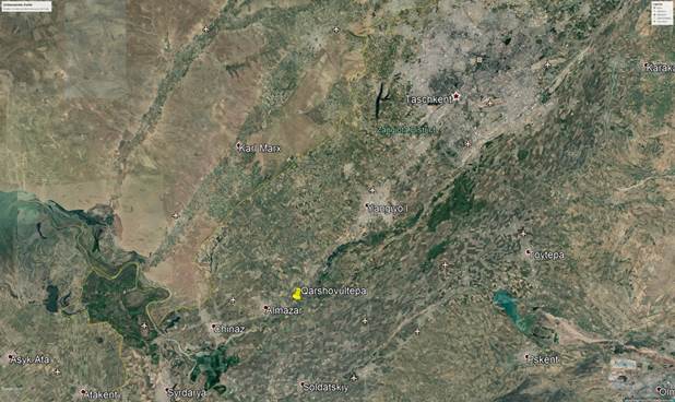
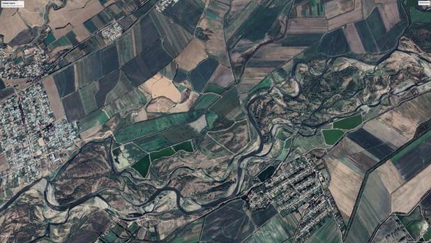
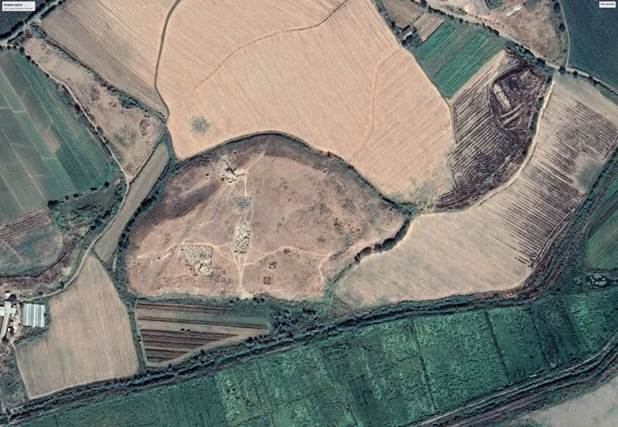
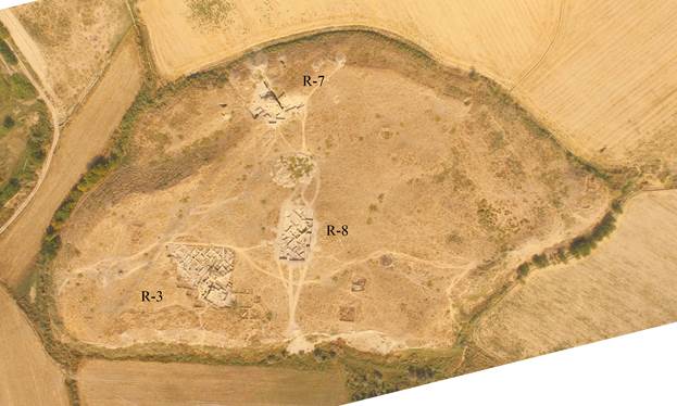
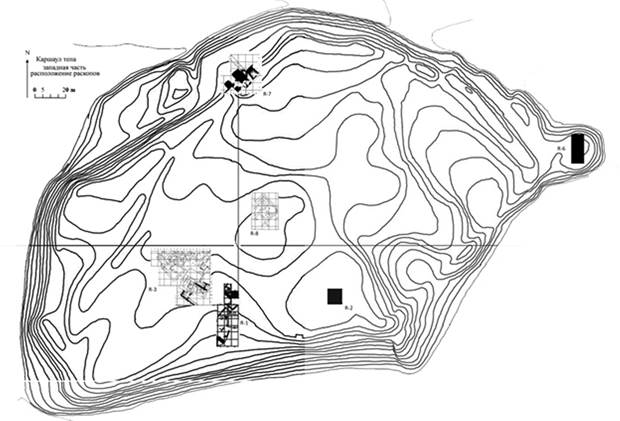
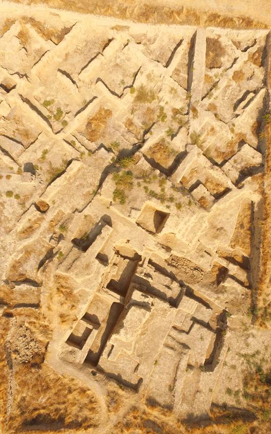
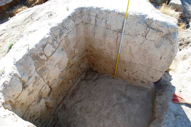
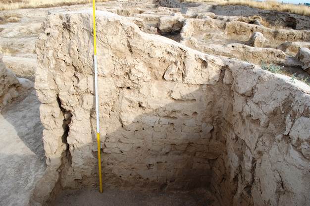
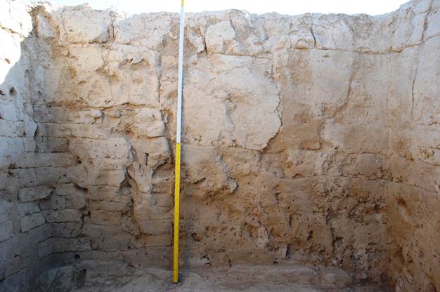
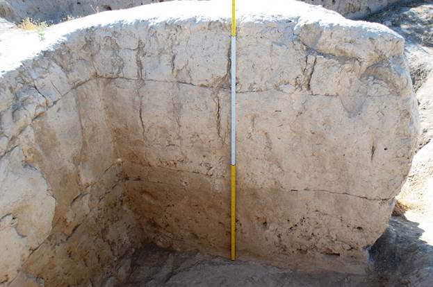
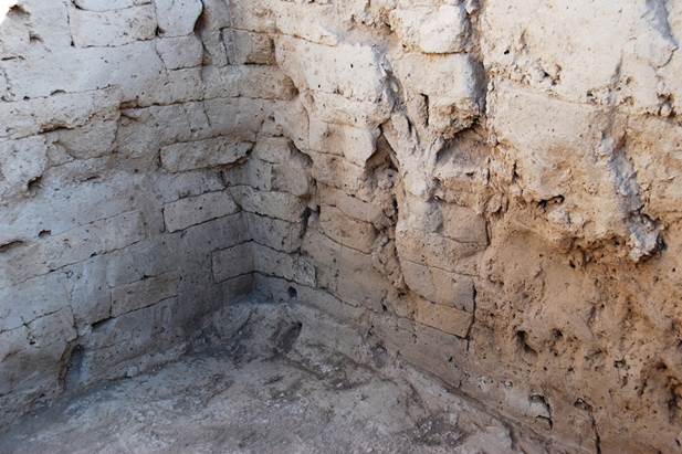
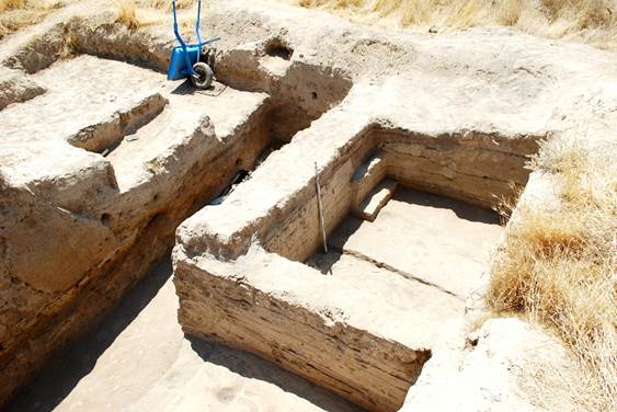
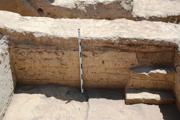
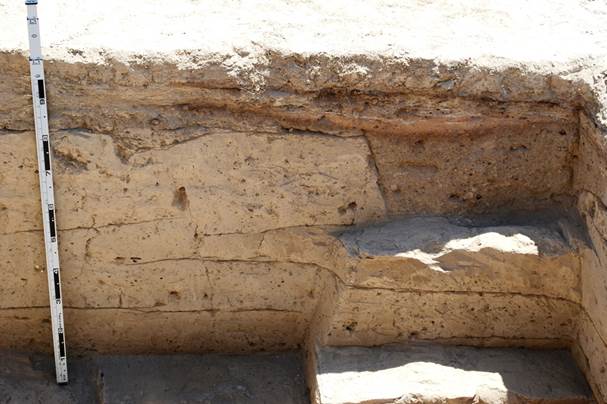
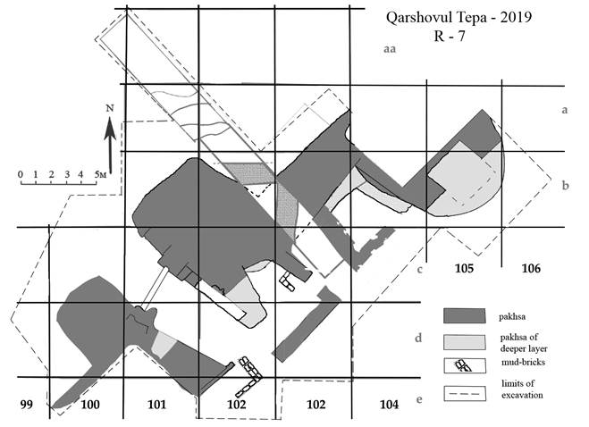
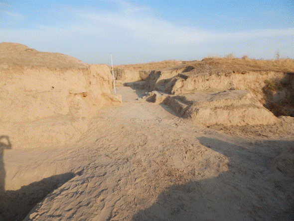
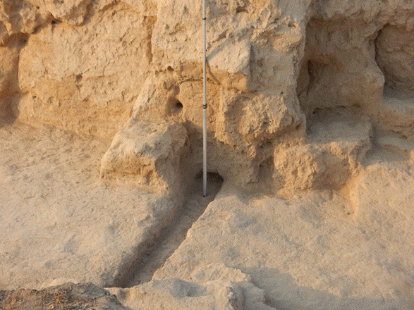
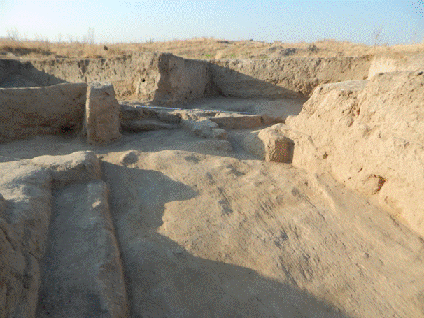
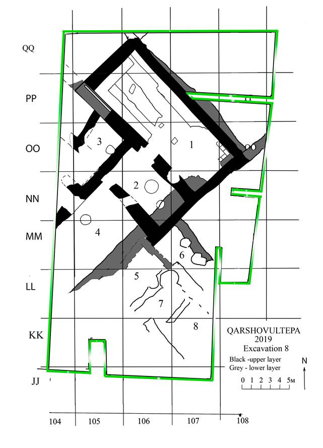
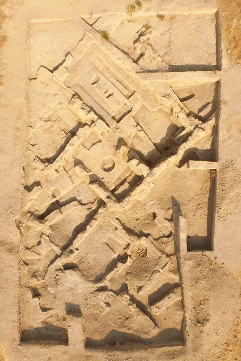
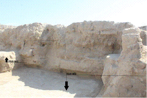
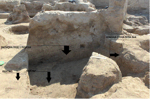
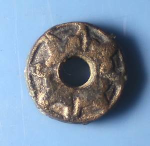
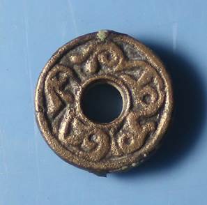
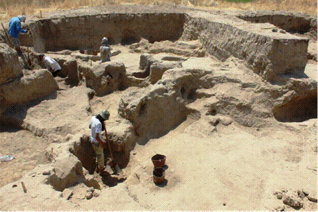
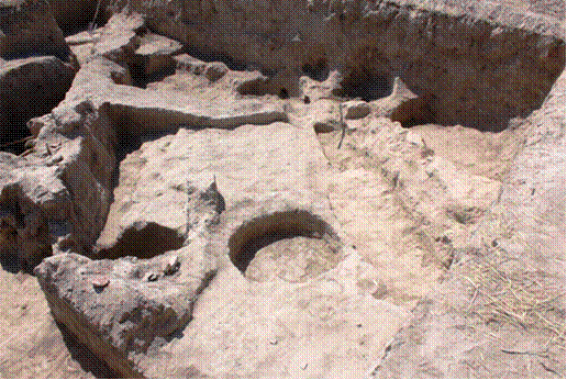
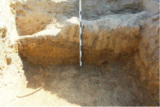
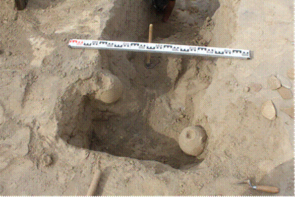
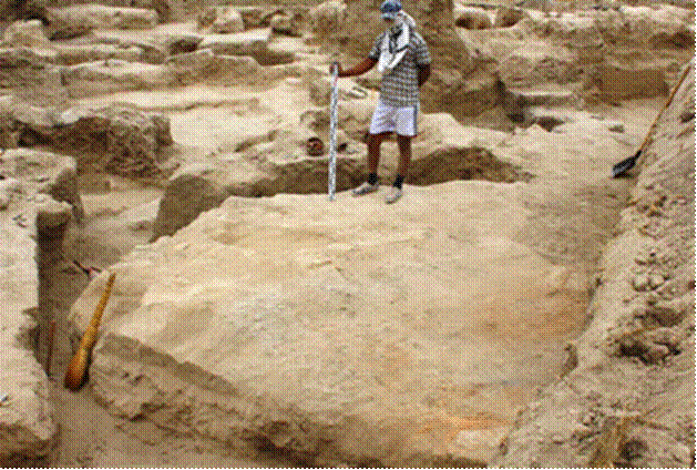
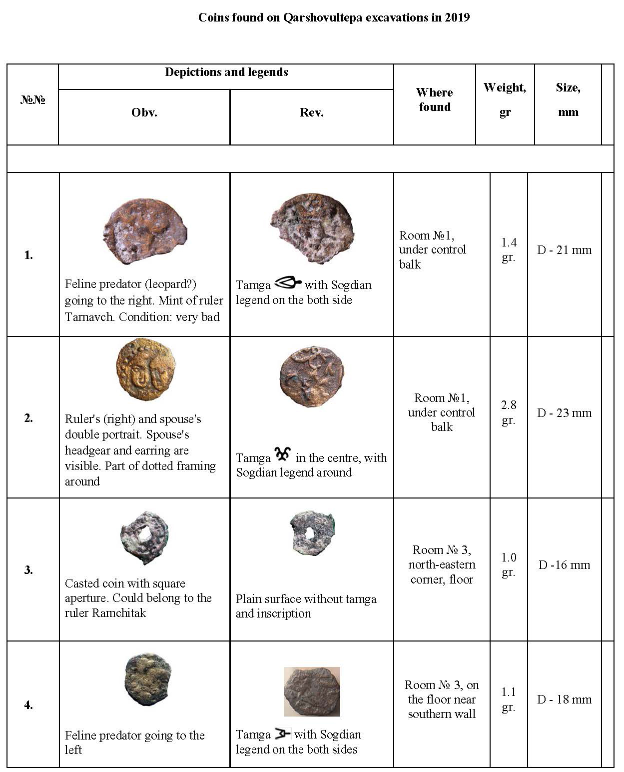
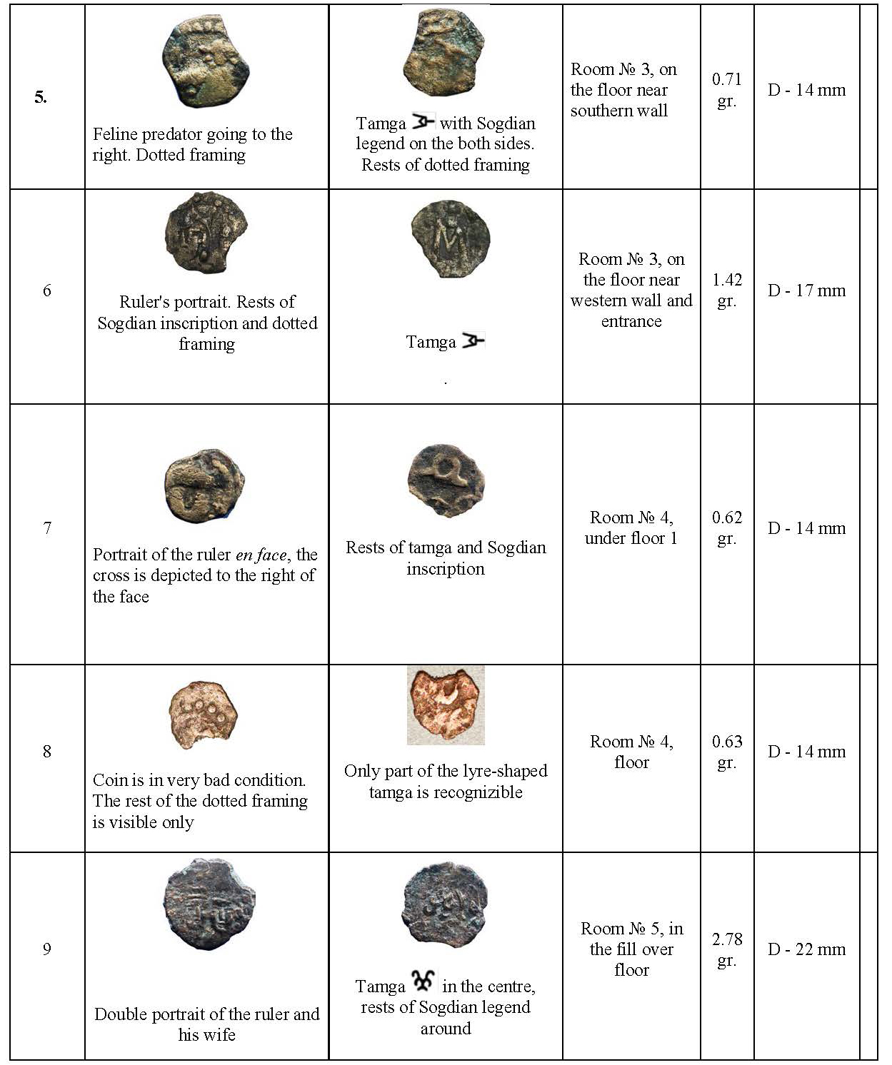
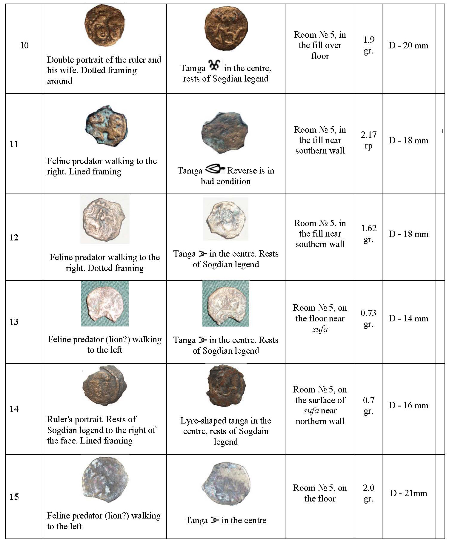
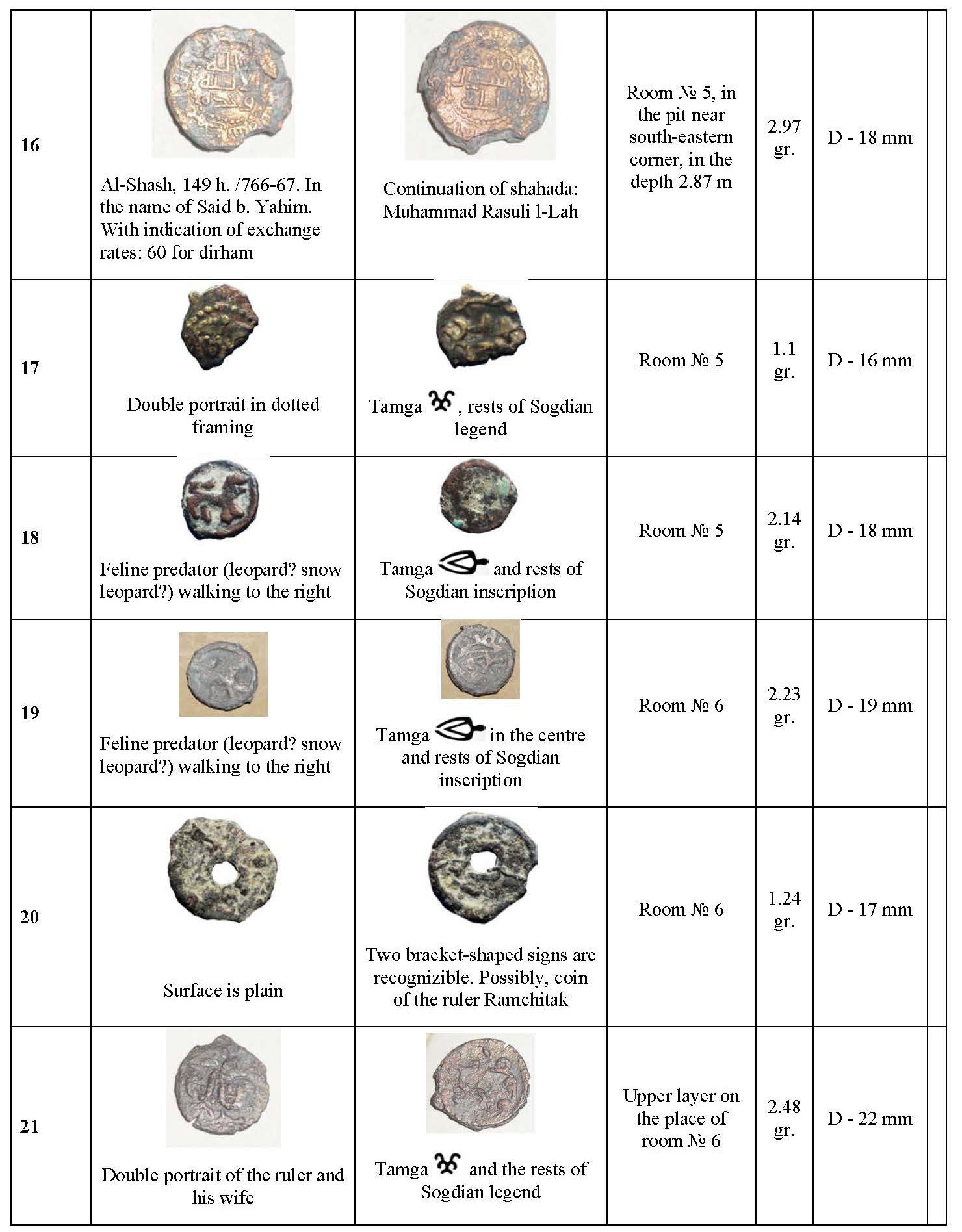
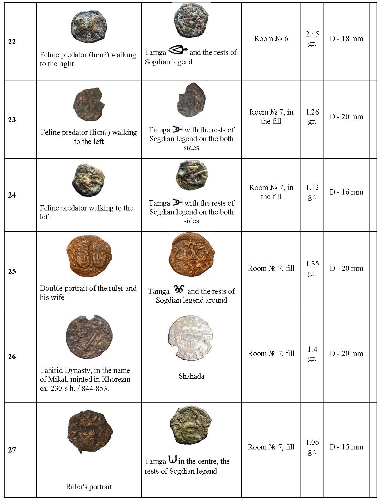
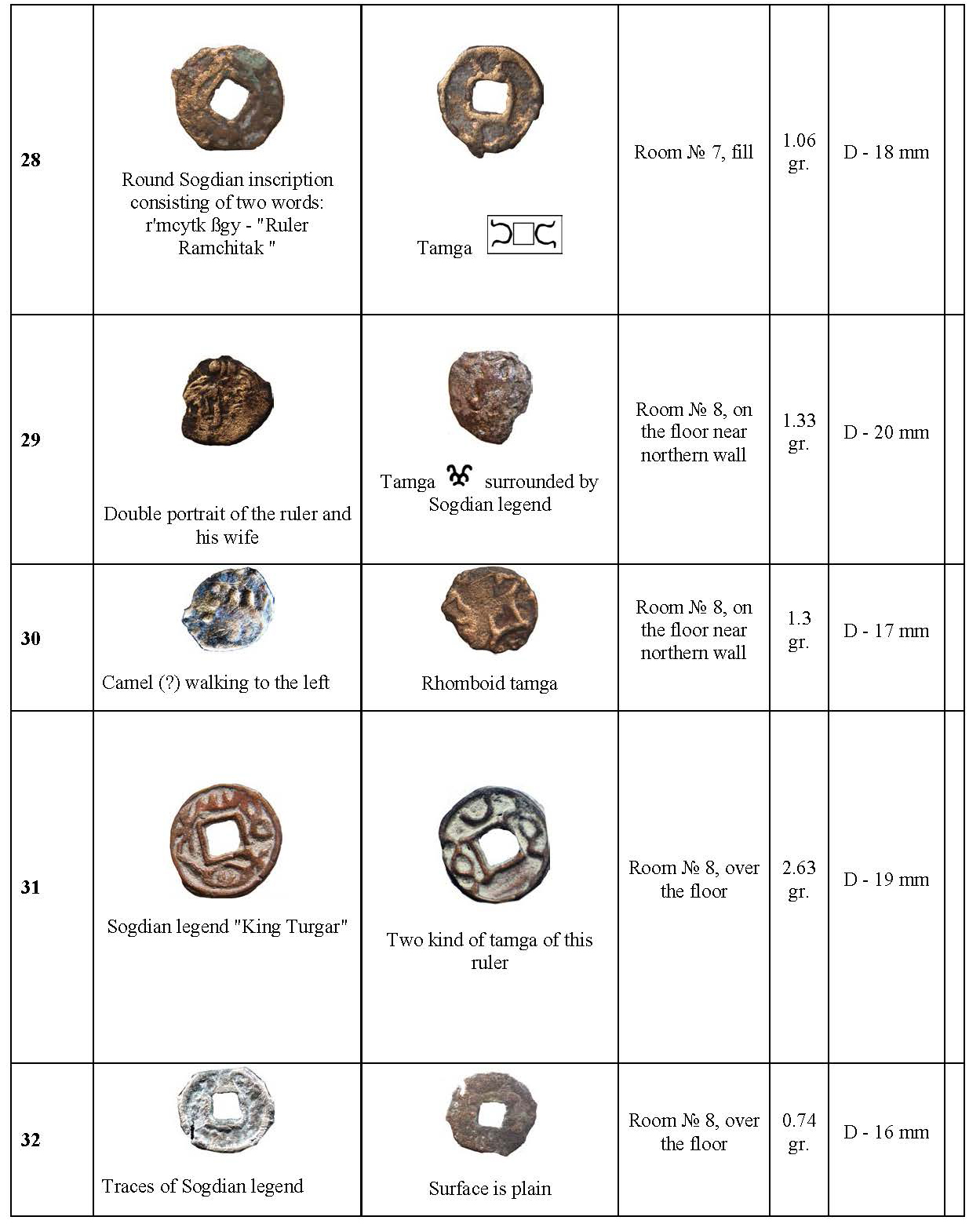
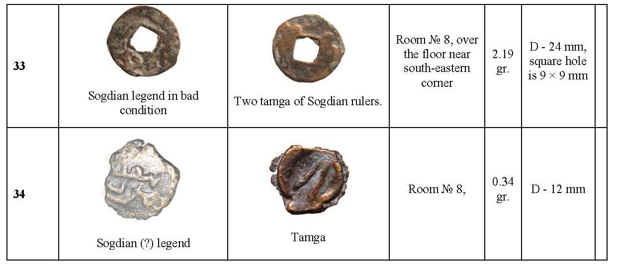

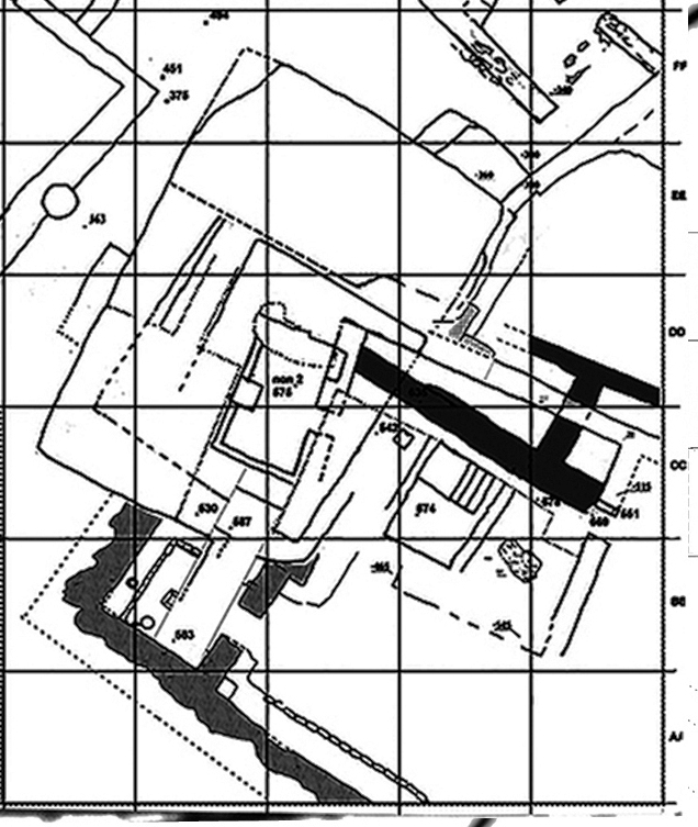
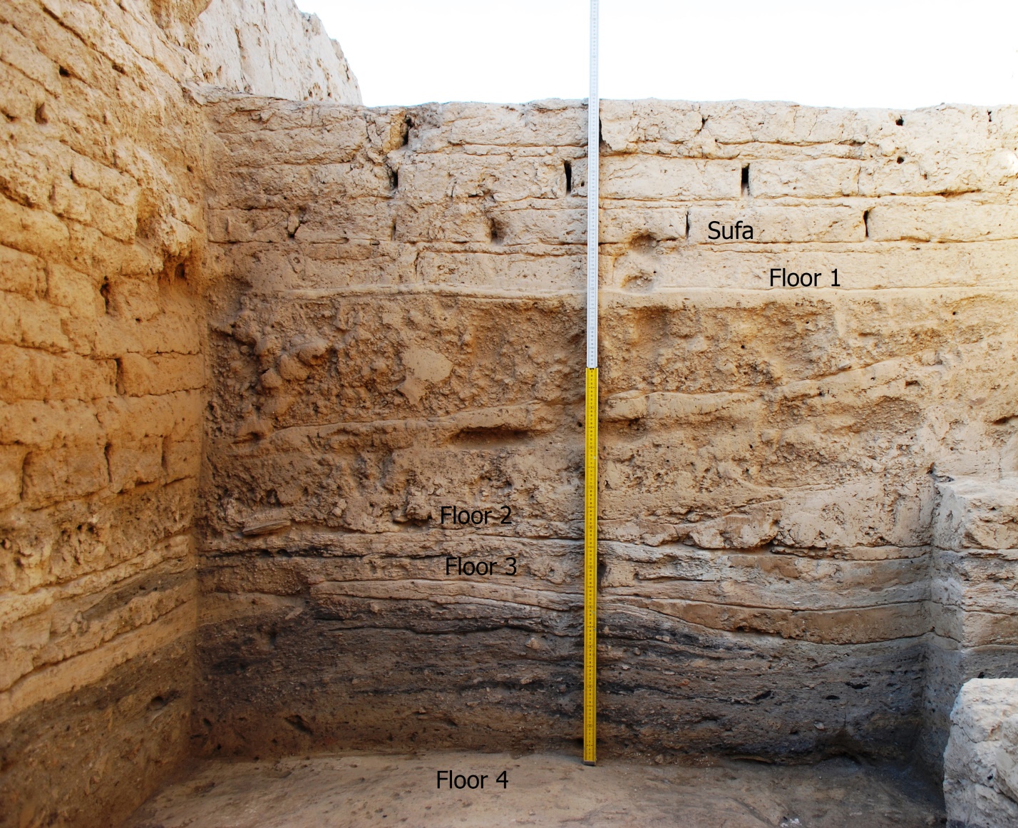
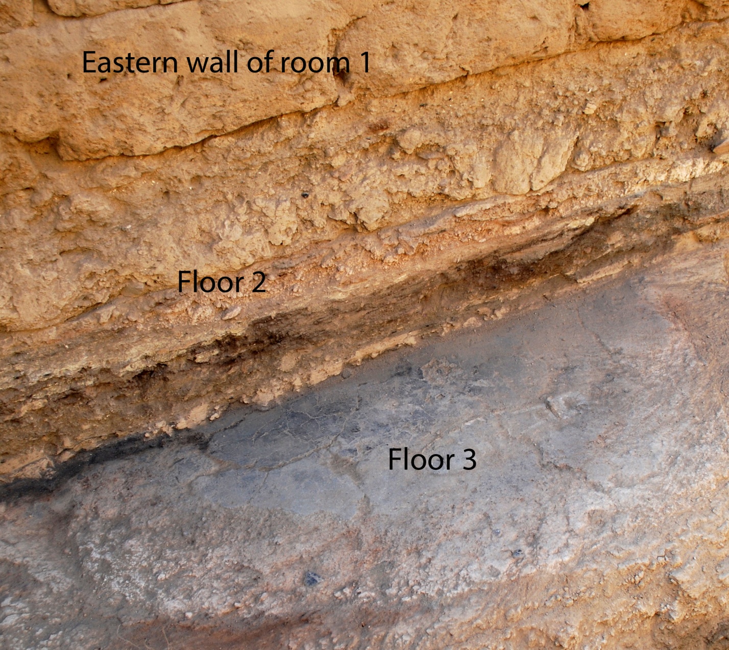
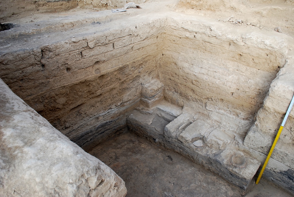
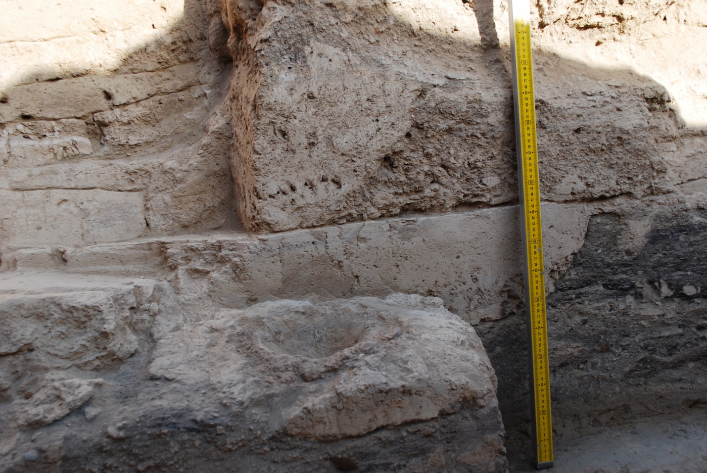
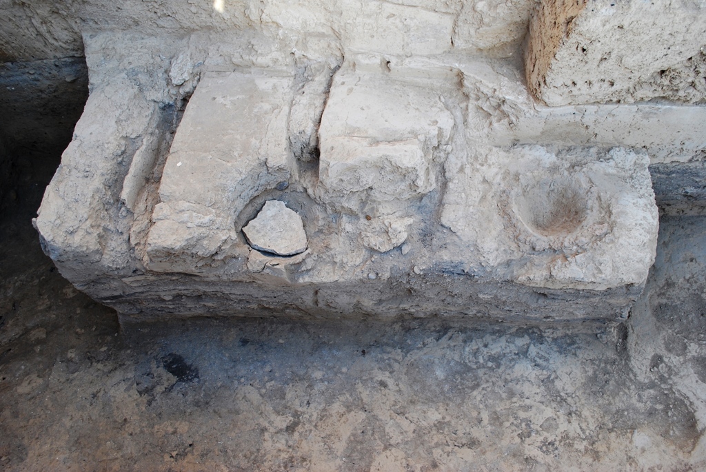
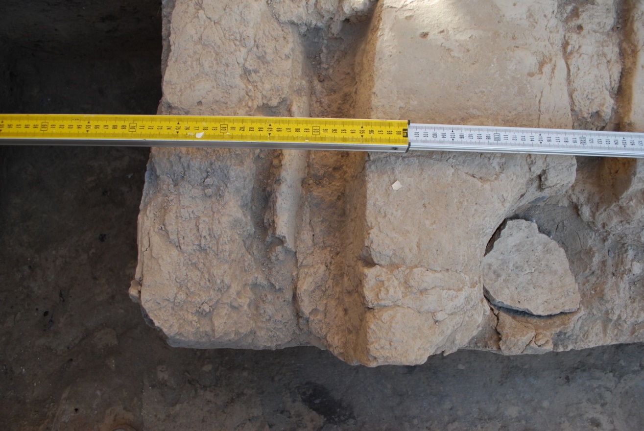
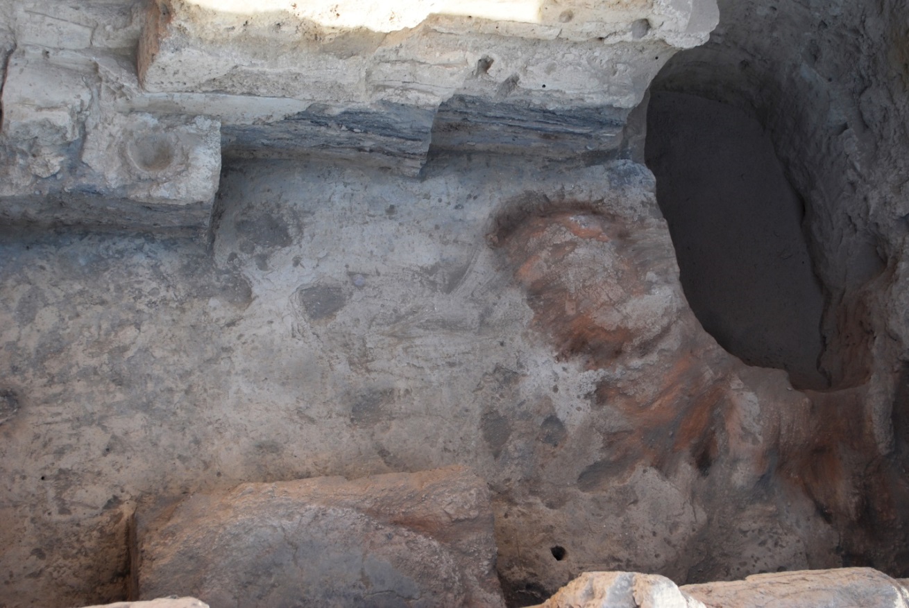
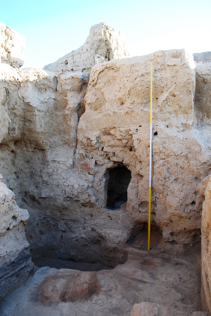
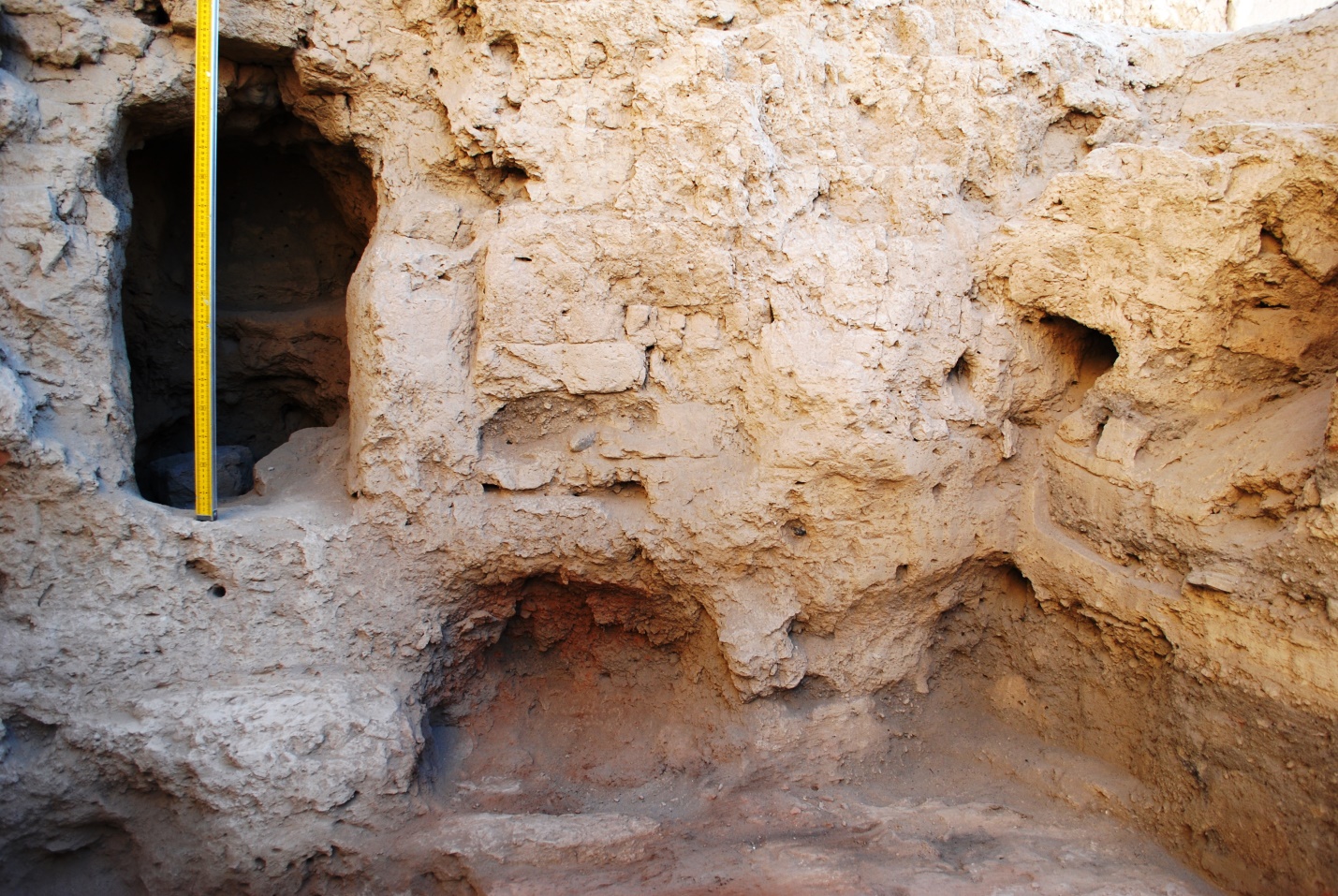
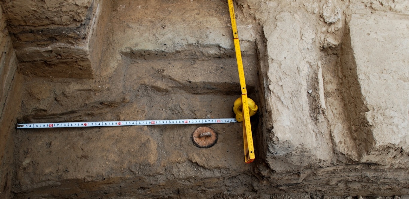
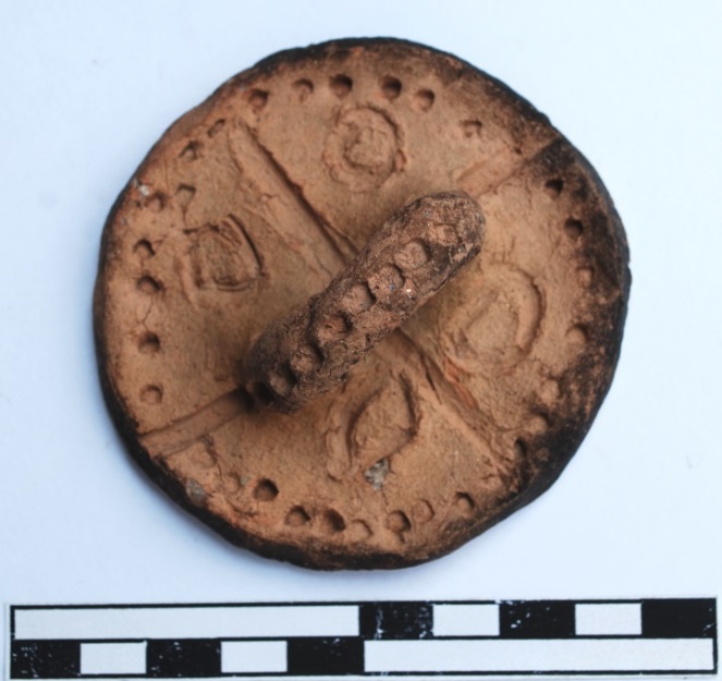
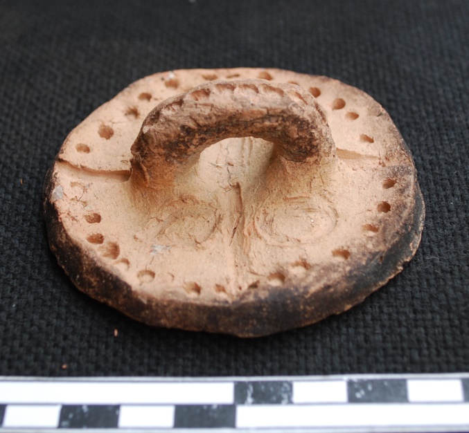
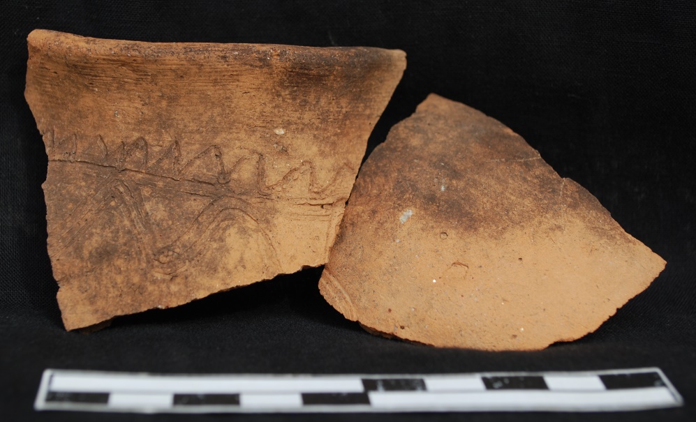
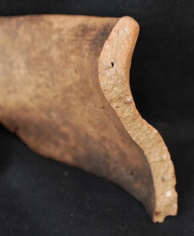
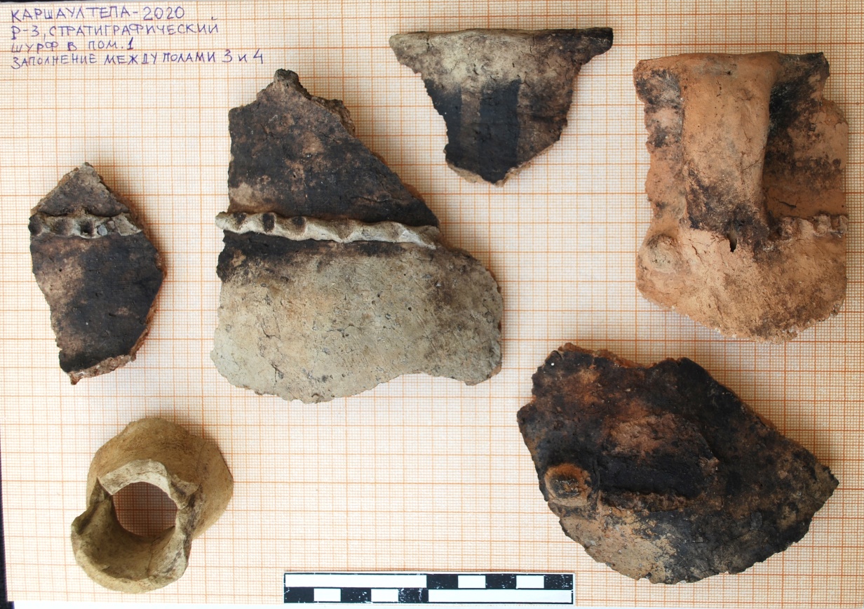
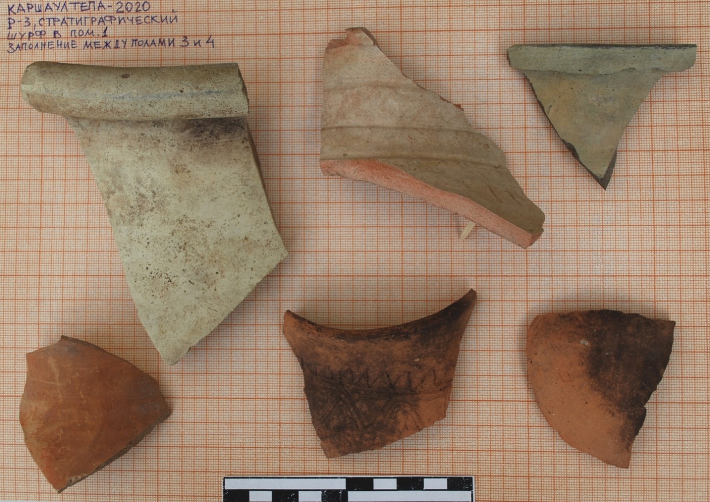
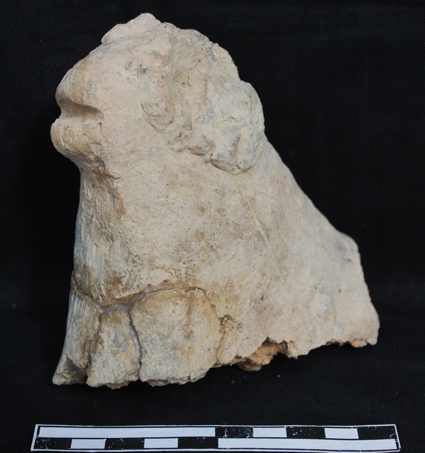
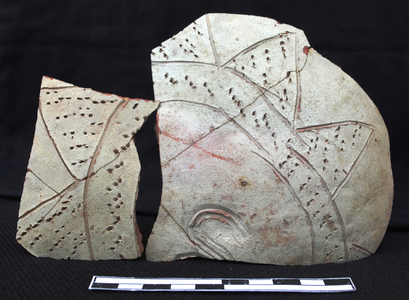
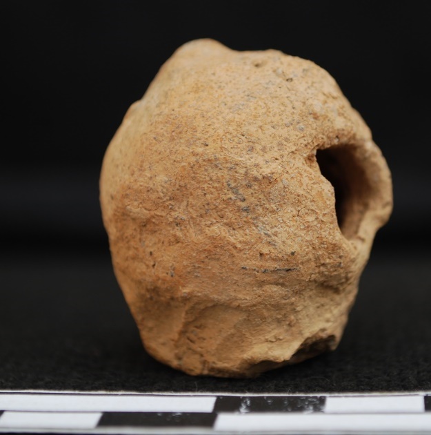
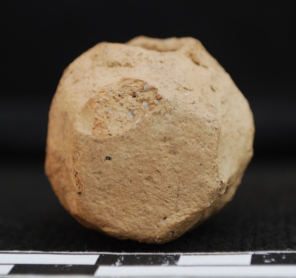
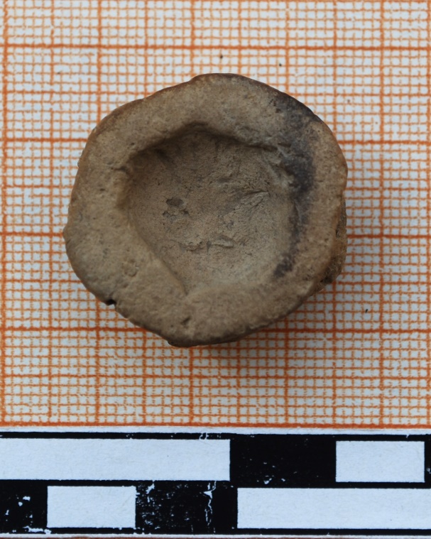
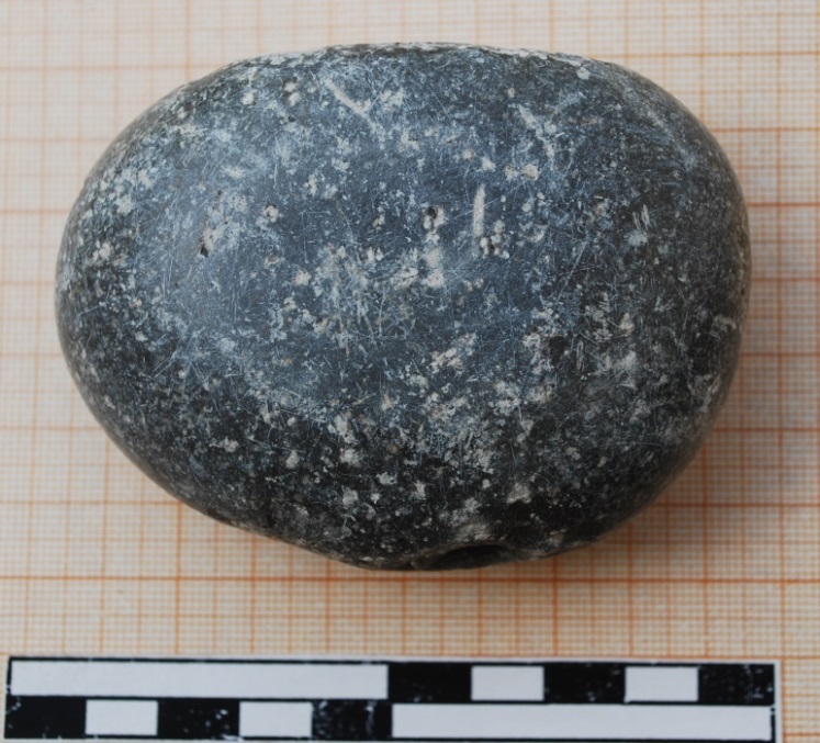
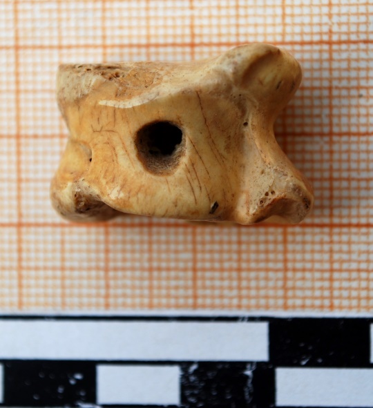
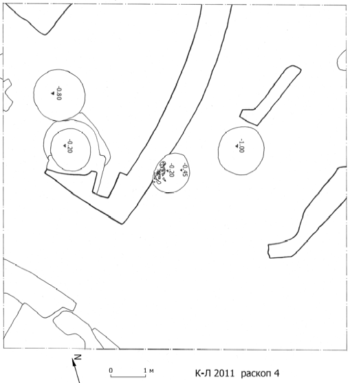
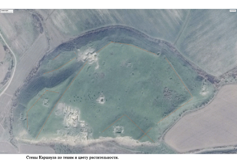
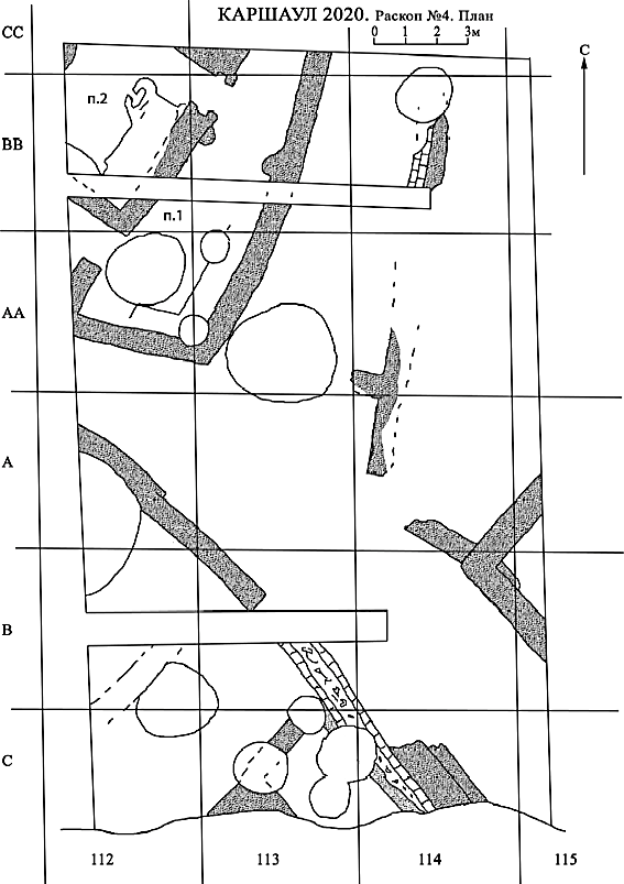
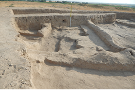
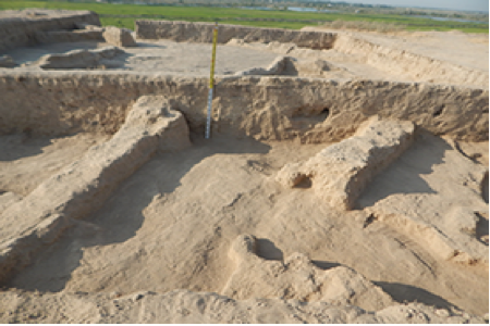
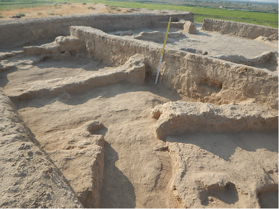
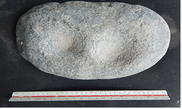
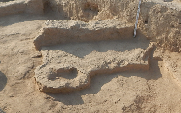
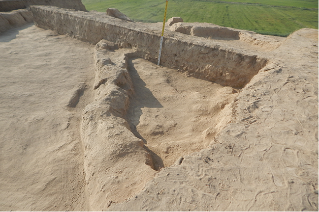
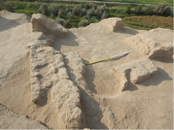
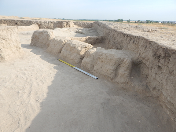
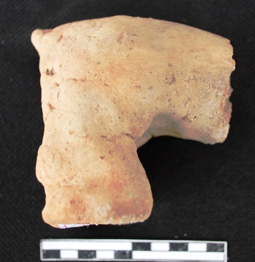
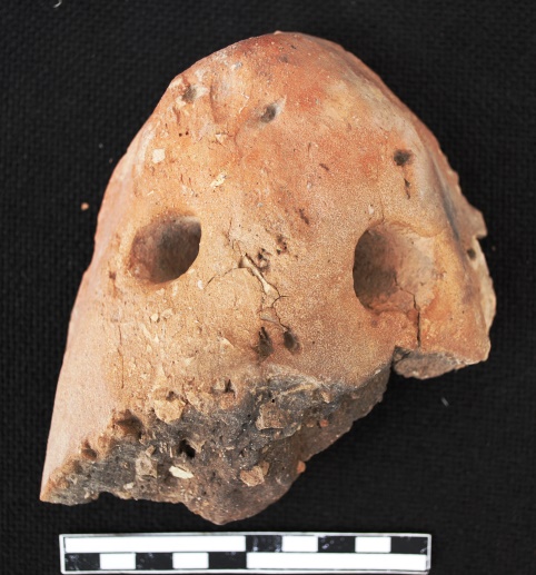
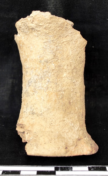
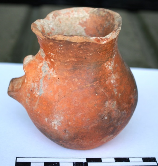
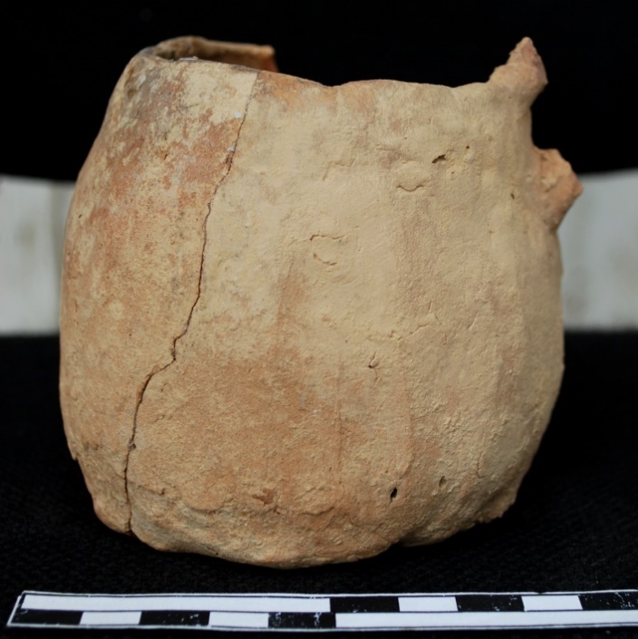
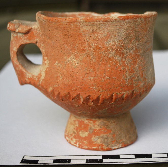
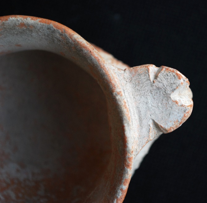
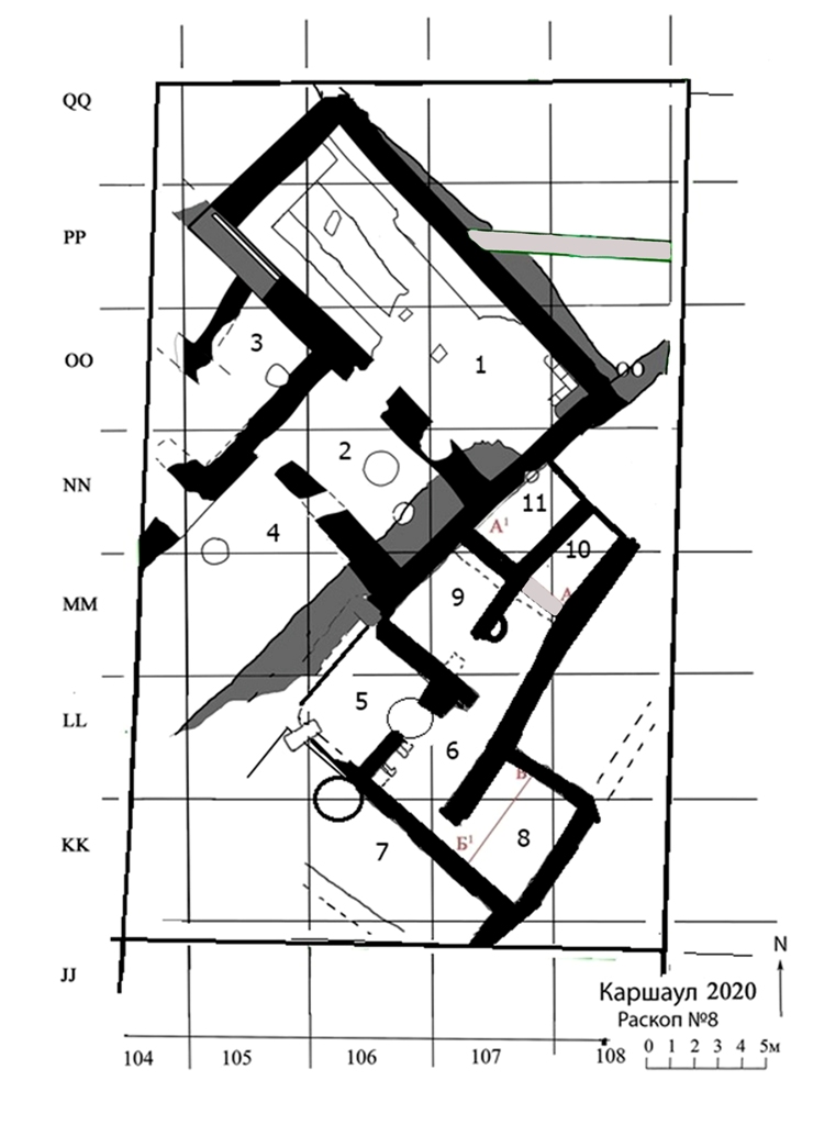
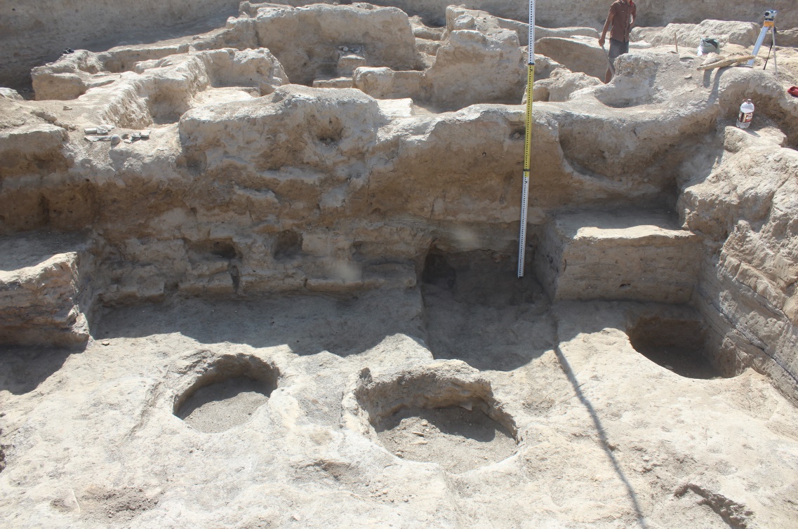
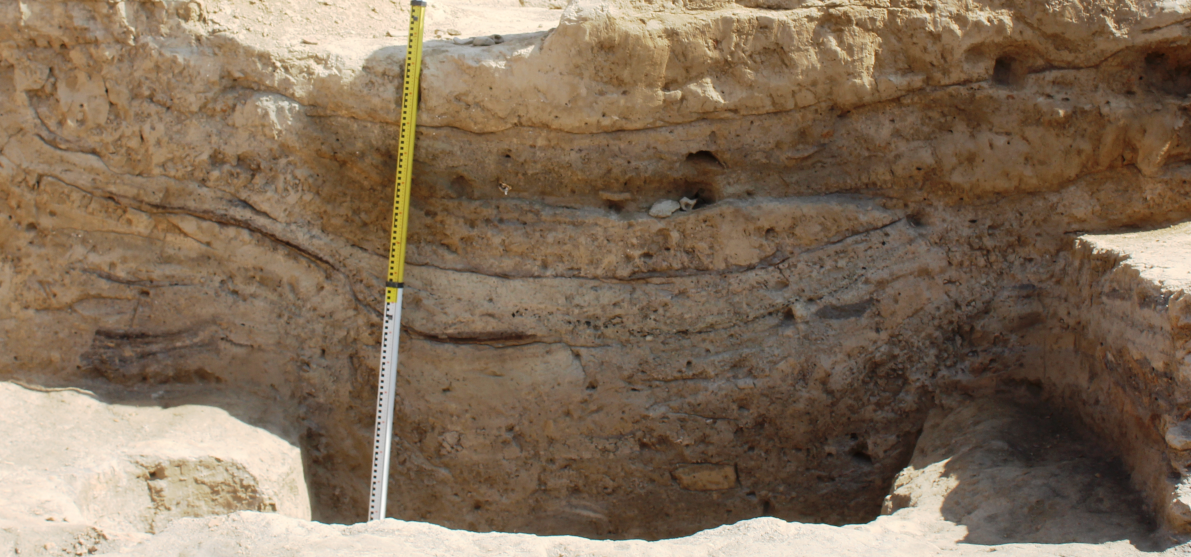
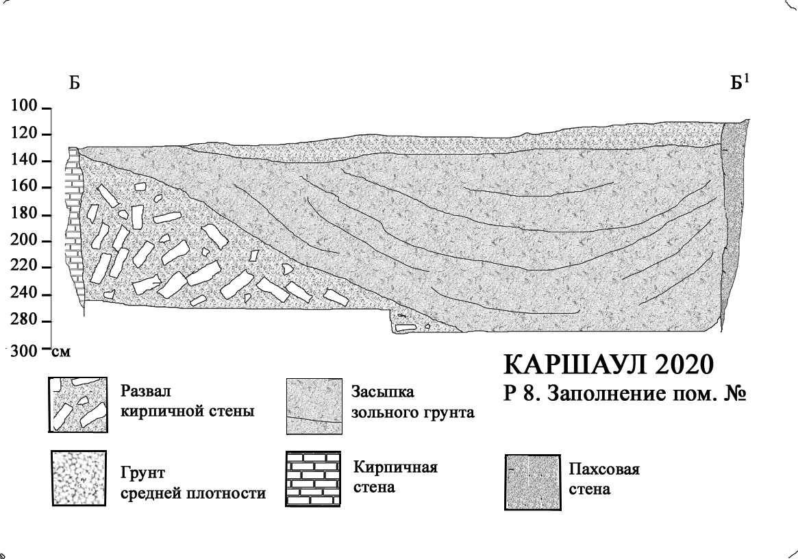
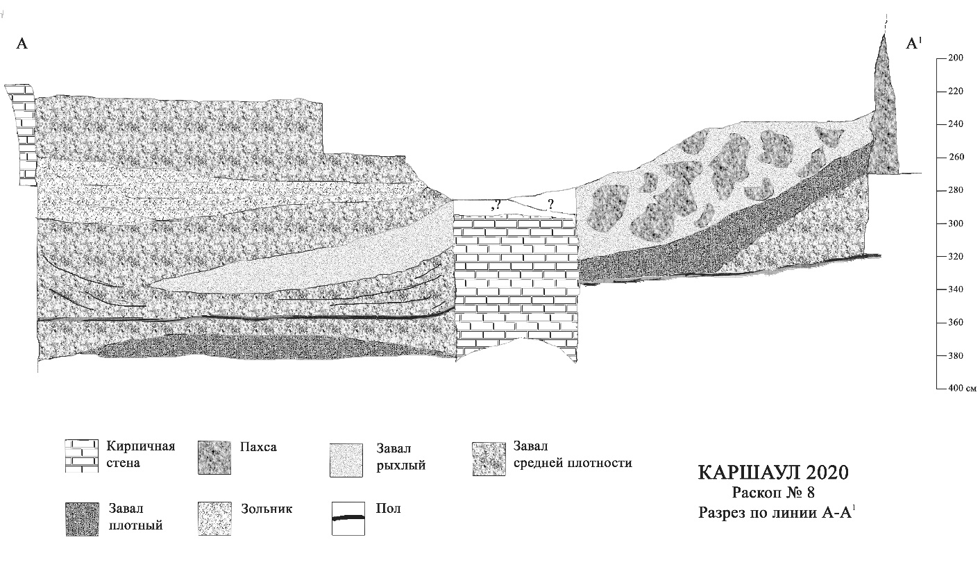
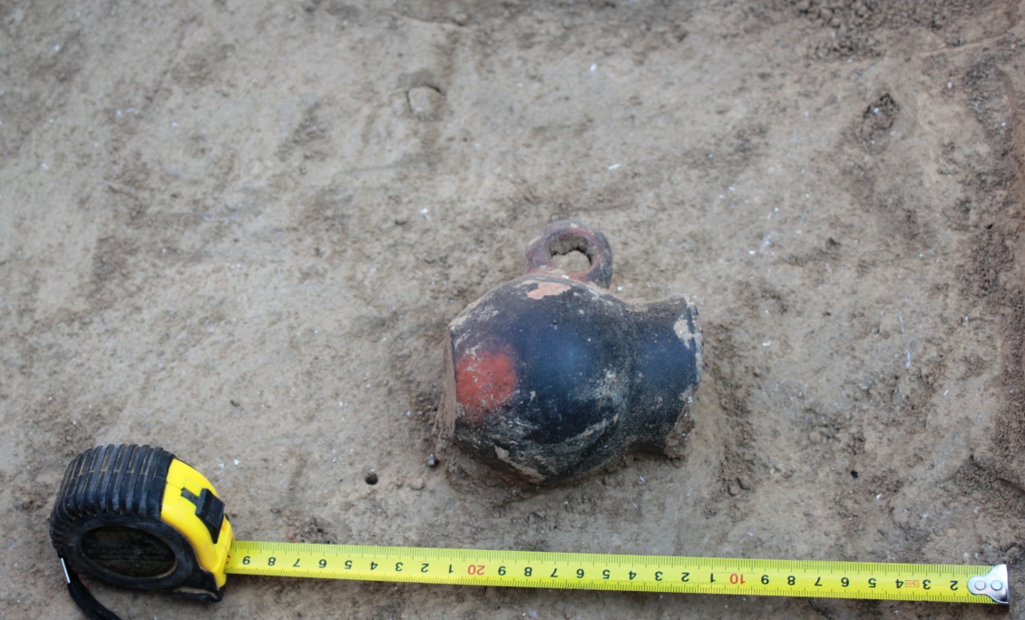
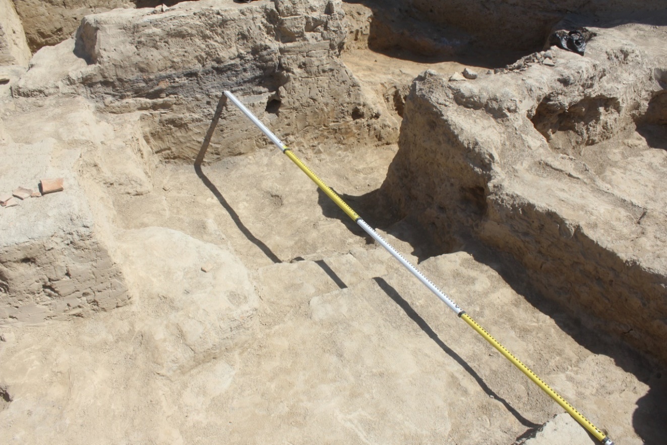
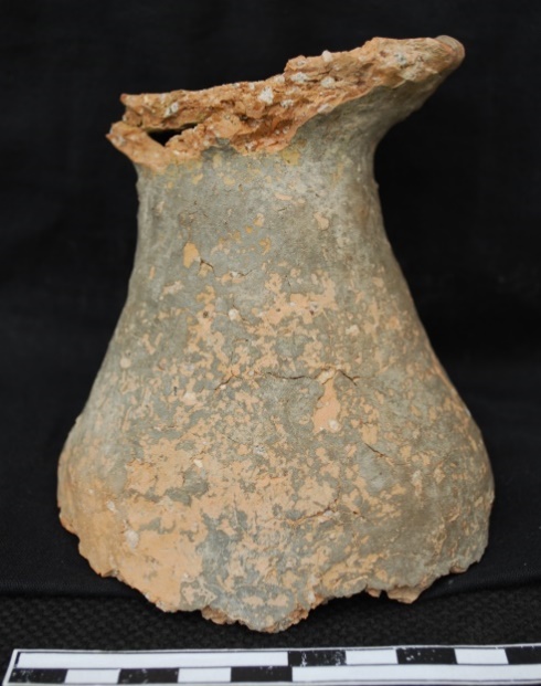
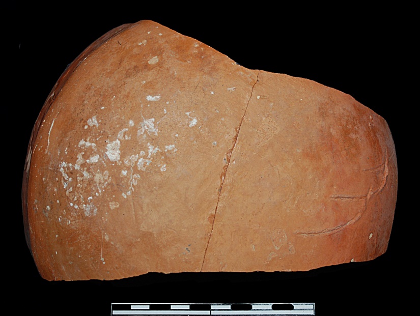
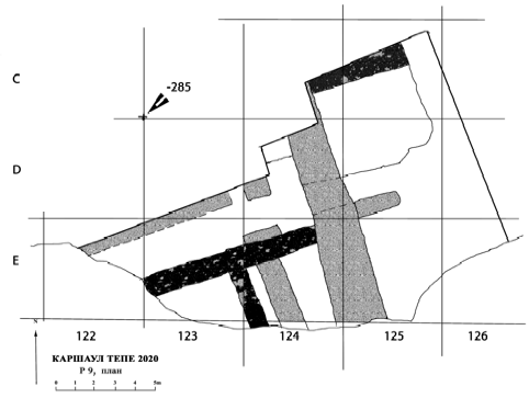
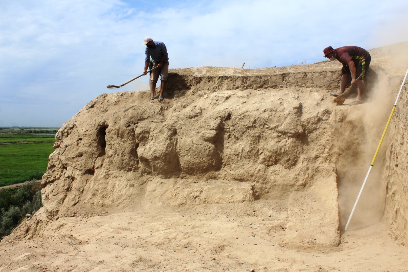
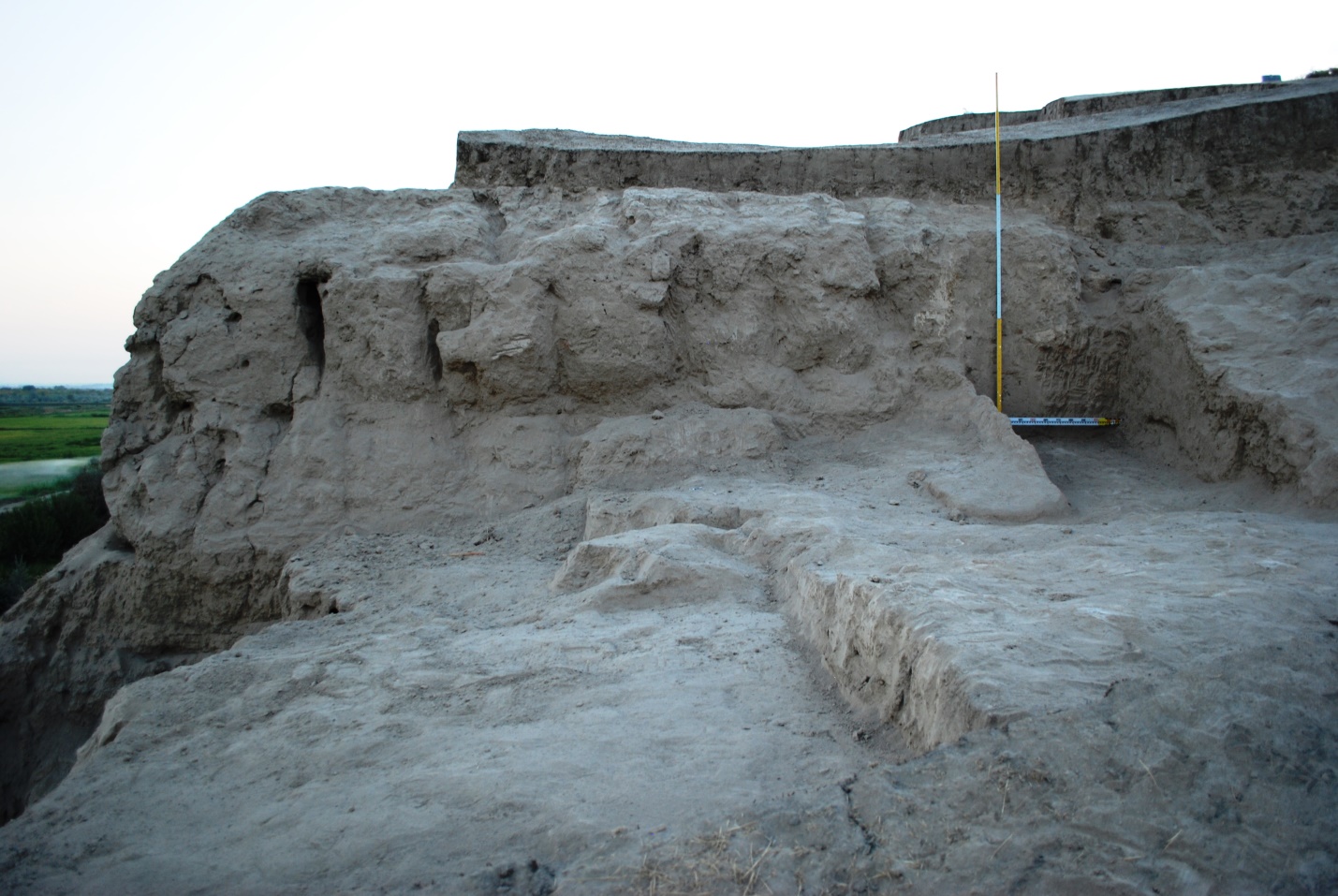
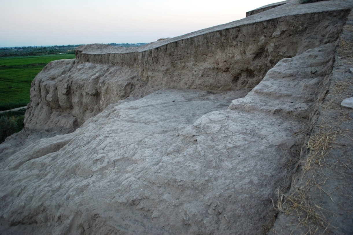
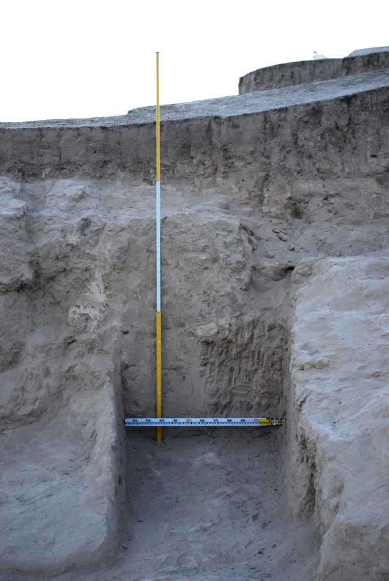
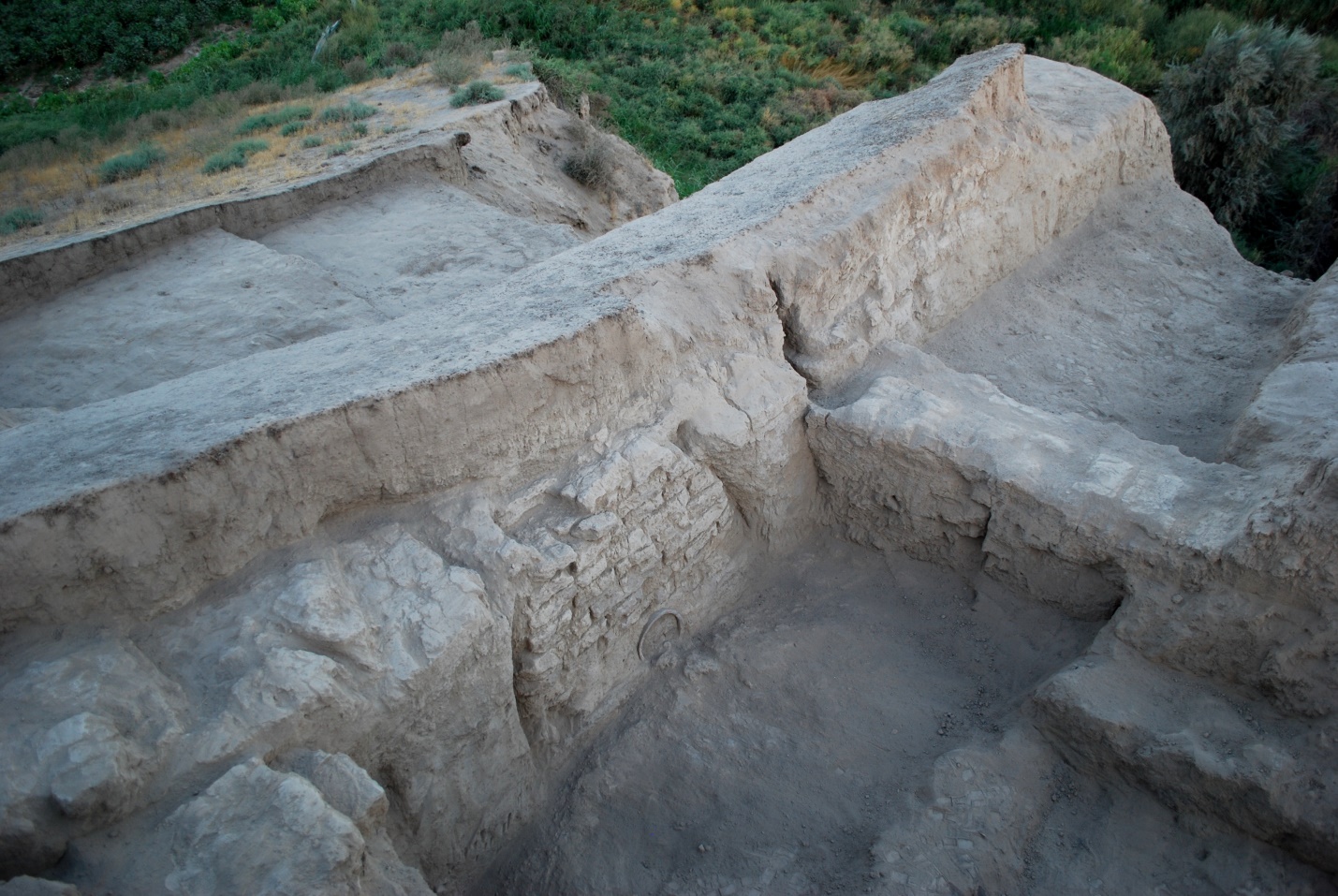
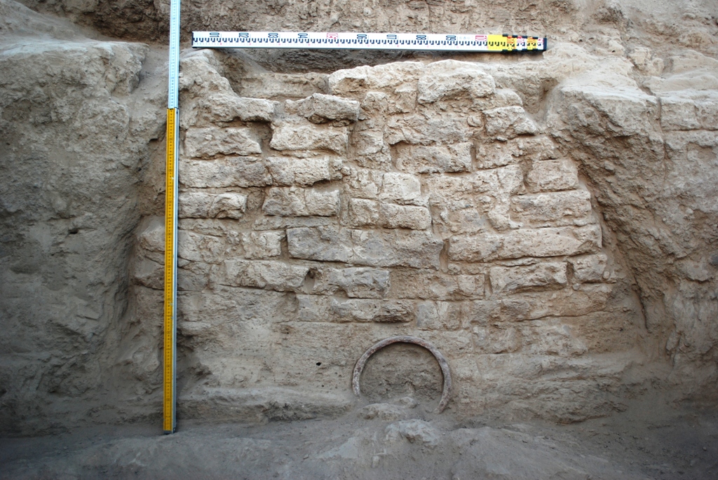
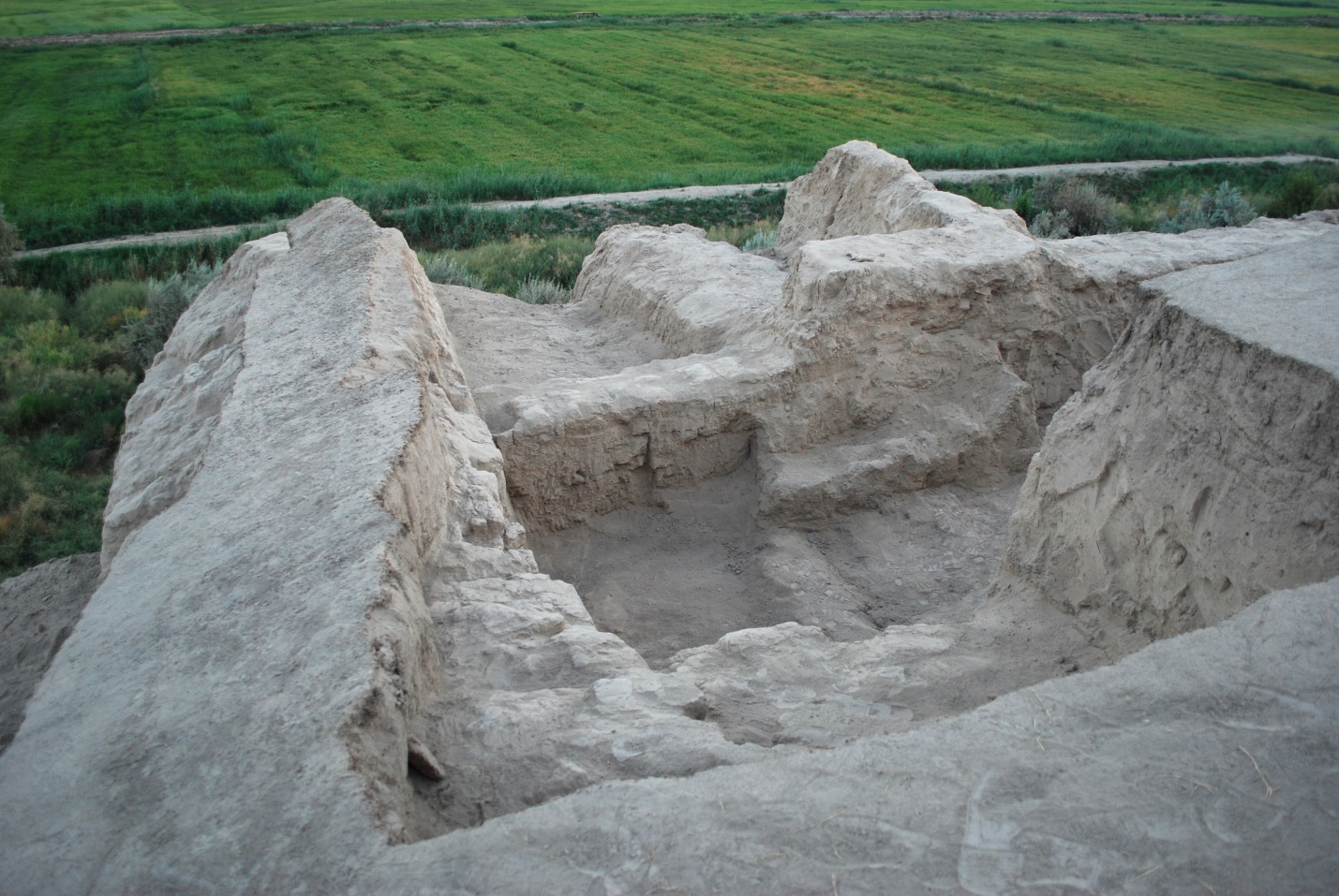
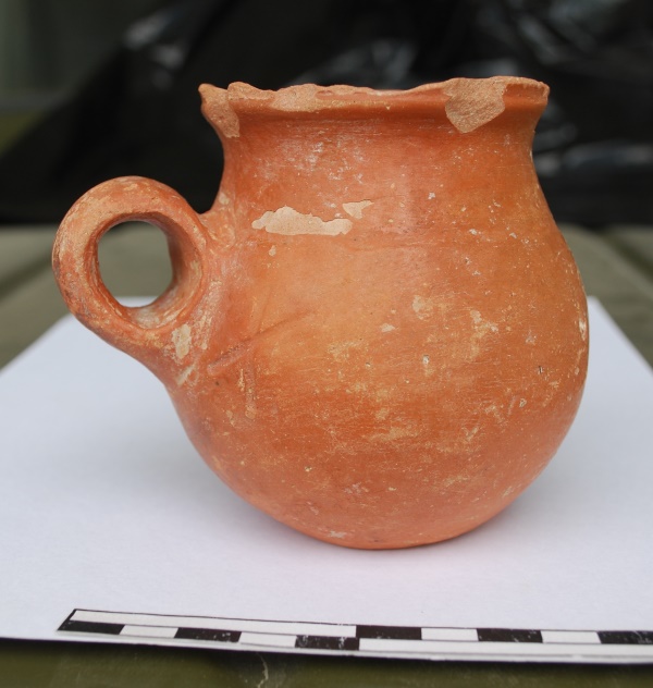
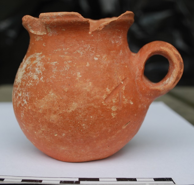
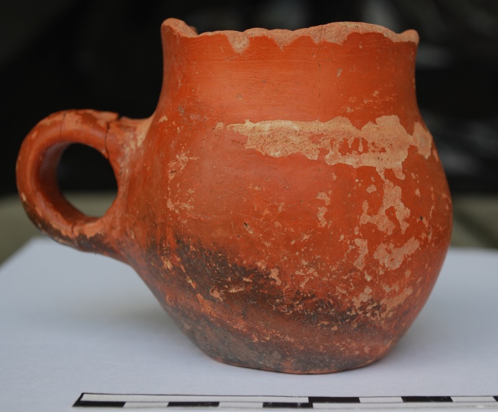
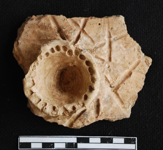
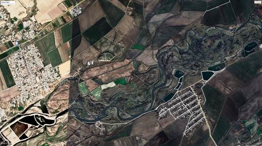
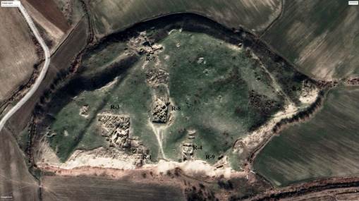
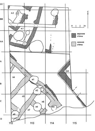
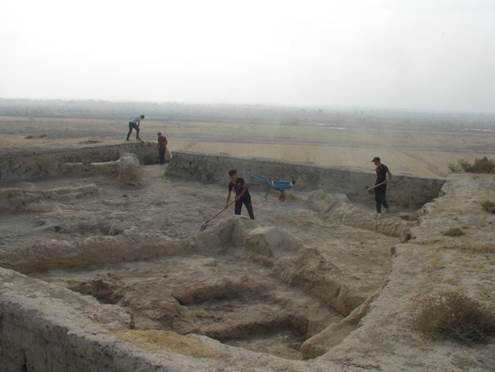
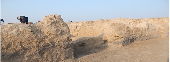
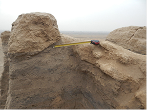
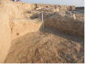 Fig. 8. Northern corner of room 3
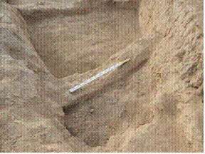
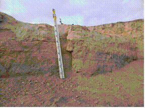
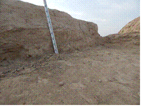
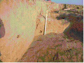
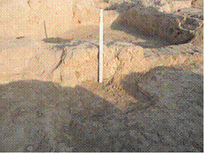
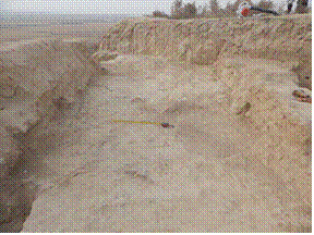
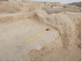
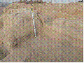
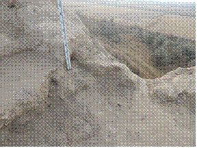
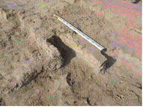
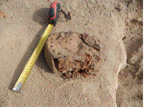 Fig. 19. Fragment of oven-door