Yeddi Tepe
| 2023 | 2024 | 2025 |
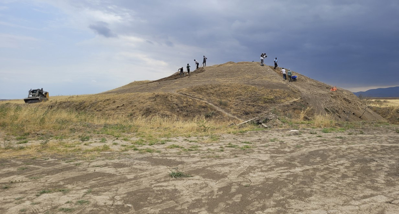
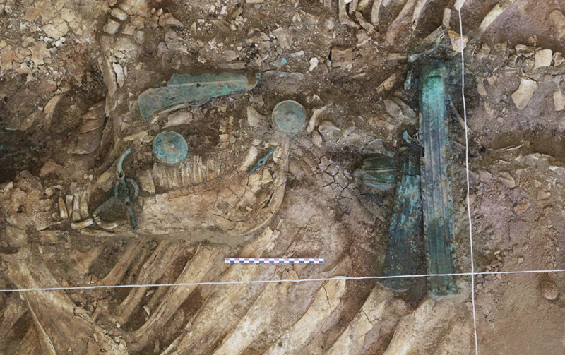
The Yeddi-Tepe kurgans, situated in western Azerbaijan, offer a unique window into the burial practices and daily life of the Early Iron Age. This archaeological site, consisting of 19 distinct burial mounds aligned along a natural hill ridge, forms a crucial cemetery revealing insights into ancient traditions and societal structures. In 2022 and 2023, an excavation of the largest mound uncovered a burial chamber of remarkable preservation. This chamber, at a depth of 4 meters with an oval-shaped top measuring 8 by 7 meters, and a rectangular floor plan of 7.6 by 4.5 meters, was originally covered with wooden beams. These beams, now broken and slanted inward under the weight of the mound, suggest complex funerary rituals and construction techniques involving lime, clay, and wood. Inside the chamber, an isolated human skull, animal bone fragments, and eight wooden poles along the walls were found. Additionally, a wooden chariot, drawn by two oxen and accompanied by a diverse range of artifacts including iron spearheads, bronze bells, horse tack, pendants, and bracelets, will form the basis for future comparative studies and natural science analyses. The east side of the chamber held tightly stacked skeletons of domestic animals. Six horses, adorned with bridles and bells, were discovered flanking the chariot, emphasizing their ceremonial importance. The discovery of thousands of beads, including Kauri shells from the Indian Ocean, within the chamber suggests extensive trade networks and the diverse material culture of the time. Over the coming years, the work at Yeddi-Tepe will shed light on the subsistence strategies of this ancient community, offering a glimpse into their diet and agricultural and pastoral practices. The Yeddi-Tepe kurgans stand as a testament to the complex social and cultural dynamics of Early Iron Age Azerbaijan, providing invaluable insights into a rarely researched era.
Goals:
1. Chronological and Cultural Contextualization: Determine the age of the burial mounds and establish the cultural context of the artifacts found within the burial chamber through radiocarbon dating and contextualization within the archaeology of the southern Caucasus.
2. Dietary and Subsistence Analysis: Analyze the contents of the ceramic vessels and animal remains to reconstruct the dietary practices and subsistence strategies of the population. This includes the study of plant residues and micro-faunal remains from the dry screening of vessel contents as well as zooarchaeological analysis of the sacrificed animals, offering new insights into agricultural and animal husbandry practices.
3. Social and Ritual Practices: Investigate the burial customs and social stratification evidenced by the grave goods and burial structure. This goal focuses on understanding the significance of the artifacts, such as the chariot, weapons, and jewelry, and their arrangement within the chamber as well as larger geographical connections to the northern Black Sea region and the Eurasian steppe.
Partners:
Dr. Gino Caspari, Max Planck Institute of Geoanthropology / University of Bern
Dr. Zaur Hasanov, Azerbaijani Academy of Sciences
Literature:
Ricci, A., Jalilov, B., Fiori, S., Erkul, E., Kneisel, J., Fischer, S., ... & Rabbel, W. (2024). Kurgan Phenomenon in the Southern Caucasus: Results of an Interdisciplinary Multi‐Method Remote Sensing Survey Along the Kurekçay Valley (Goranboy Province, Western Azerbaijan). Archaeological Prospection.
Agalarzade, A. (2022). Grave Monuments in South-Eastern End of the South Caucasus: Late Bronze Age – Early Iron Age Kurgans. Поволжская археология, (1 (39)), 130-144.
Lau, H., Proctor, L., Gopnik, H., & Bakhshaliyev, V. (2020). Agropastoralism in middle bronze through early iron age Naxçıvan: Zooarchaeological and paleoethnobotanical data from Qızqala. Journal of archaeological science: Reports, 33, 102535.
Guliyev, F., & Lyonnet, B. (2014). ARCHAEOLOGICAL COMPLEXES OF THE CENTRAL WESTERN PART OF AZERBAIJAN IN CONTEXT OF ARCHAEOLOGICAL CULTURES OF THE CAUCASUS. PROBLEMS OF EARLY METAL AGE ARCHAEOLOGY OF CAUCASUS AND ANATOLIA, 25.
Sagona, A. (2018). The archaeology of the Caucasus: from earliest settlements to the Iron Age. Cambridge University Press.
------------------------------------------------------------------
Kurgan No. 4 Excavation at the Yedditepe Burial Ground
Preliminary Report for the Society for the Exploration of EurAsia
1. Introduction
The Yedditepe-Fizuli burial ground in the Eastern Lesser Caucasus has been identified as a significant archaeological site potentially linked to the early Scythian period. The extensive burial ground presents a unique opportunity to study kurgan funerary practices in Azerbaijan during the Iron Age (8th–5th centuries BCE). Previous studies have highlighted limited research on such burial sites in the region, and the lack of radiocarbon dating has left chronological interpretations inconsistent. In 2023 and 2024, the Azerbaijani-Korean-Swiss joint archaeological expedition focused on Kurgan No. 4, which exhibits architectural and cultural elements suggestive of Scythian burial practices. This report details the preliminary findings of the campaign including excavation methodologies, stratigraphy, findings, and their interpretations to contribute to understanding the Scythian presence in the region.
2. Site Description
The Yedditepe-Fizuli burial ground comprises 19 kurgans distributed in three rows along a north-south axis, situated on a natural hill. Agricultural activities have damaged several kurgans, including Kurgan No. 4, reducing its height and altering its original shape. A reason why the expedition focused on Kurgan No. 4 was that the mound was almost completely flattened by ploughing – likely during the Soviet period. This allowed for an almost immediate start of excavation works in relation to the burial without significant soil volumes having to be moved. Of course, it is regrettable that the stratigraphy of the mound itself cannot be studied in detail anymore, as this is an important part in determining the specificities of the funerary ritual.
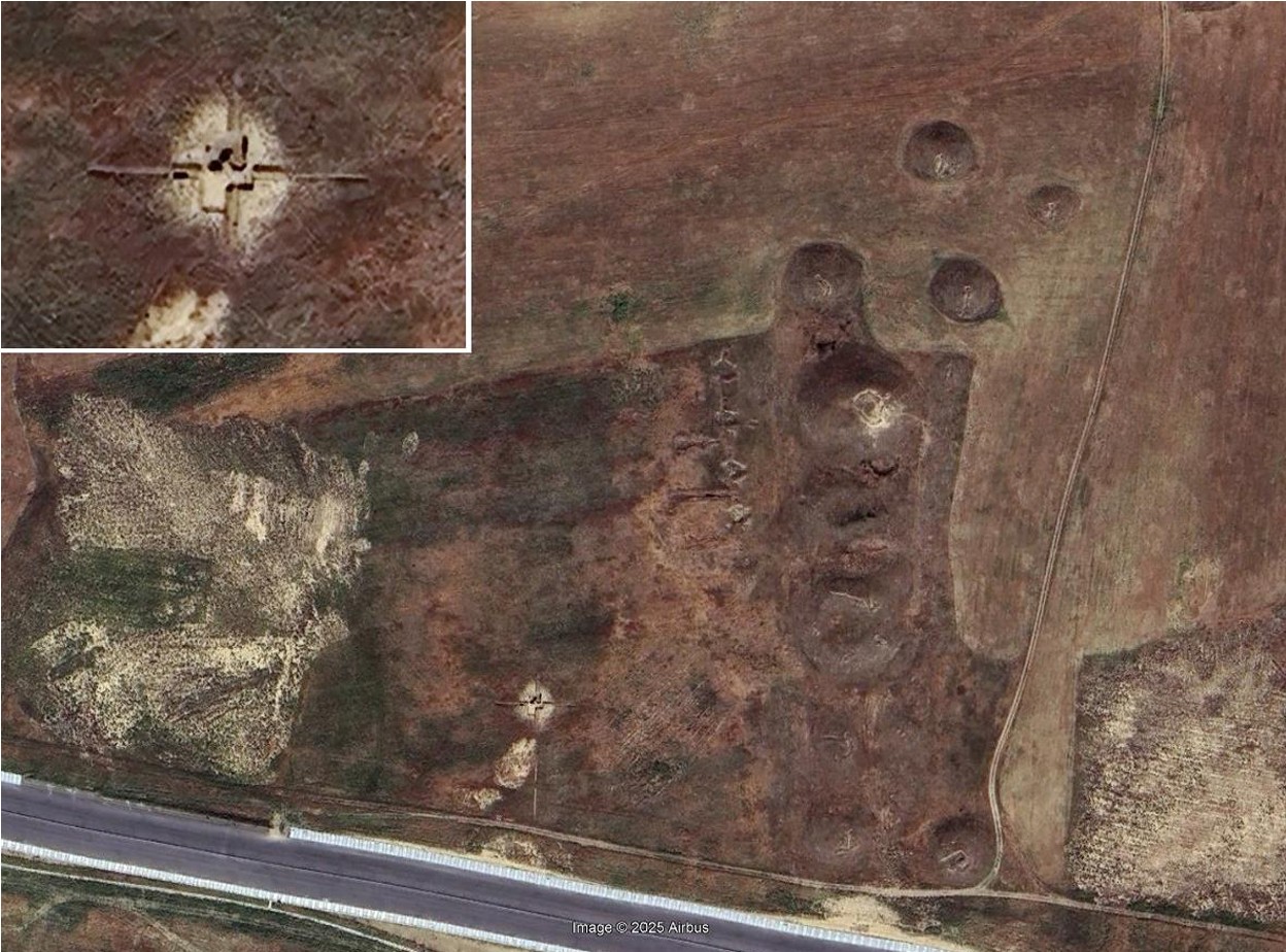
Figure 1: Since the high-resolution Google Earth data has been updated, Kurgan No. 4 is now visible in the imagery due to the excavation activity. Before, it was hardly detectable from above.
3. Excavation
Strategy and Methodology Initial identification relied on a topographic survey using GPS and GNSS, which mapped out the eroded contours of the mound concealed beneath dense grass cover. This initial survey confirmed the mound's location on the westernmost row of the burial ground, with significant degradation attributed to heavy agricultural machinery. In most places the mound was not higher than ca. 0.5-1.2m.
Ground-truthing efforts involved visual inspections supplemented by remote sensing tools to validate the topographic data. These methods ensured accurate delineation of the mound despite its altered state, particularly in areas where the original shape had been entirely flattened by past land use practices.
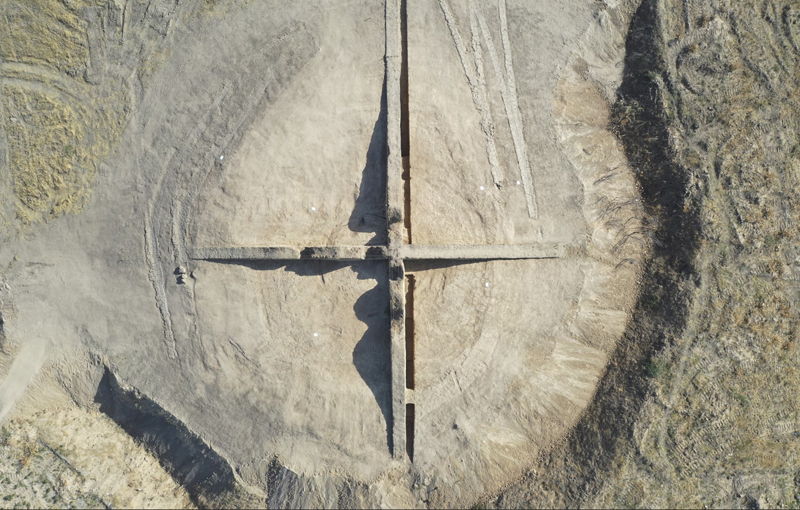
The excavation team implemented a quadrant-based strategy to ensure comprehensive analysis of the mound. Strings and stakes were used to divide the mound into four clearly demarcated sectors, with walls aligned along the cardinal directions to create a precise north-south and east-west orientation. Within each quadrant, stratigraphic layers were carefully excavated, providing a detailed record of both vertical and horizontal contexts.
In addition, a grid-based recording system was utilized to map artifact locations accurately within the stratigraphic context. This system ensured that all artifacts, soil samples, and features were cataloged systematically, providing a robust framework for analysis.
To ensure precise documentation and analysis, the team generated orthophotos and 3D models tied to ground control points which were measured with a Leica Total Station and drone-mounted cameras, which provided high-resolution visual data. Additionally, a 5 m pole camera was used for preliminary assessments of the catacombs, offering visual access before physical excavation commenced. These tools significantly enhanced the team’s ability to capture structural details and contextual relationships.
Given the instability of the catacomb walls and ceilings, excavation proceeded cautiously from the top down. This approach minimized the risk of collapse while preserving the structural integrity of the site. By avoiding lateral excavation, the team ensured the safety of both personnel and the fragile archaeological features.
4. Results
4.1 The Mound
While the upper parts of the mound were fully destroyed, we identified the outline of the kurgan below the current ground level. A key discovery was a yellow soil layer, identified at a depth of 0.3-0.4m. This layer exhibited extensive disturbance caused by historical agricultural activities. However, this is very likely the soil resulting from the excavation of the chambers below. Sediment analysis revealed compaction and the inclusion of non native materials, further confirming mechanical alteration of the site.
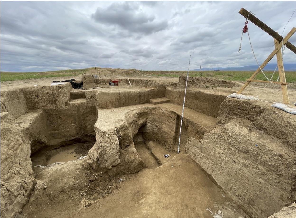
Figure 2: Excavation site during the 2024 campaign. The front show the entrance shaft of the tomb. In the back, the two catacomb chambers are visible at a depth of more than 4m from current ground level.
4.2 Entrance
Chamber and Catacombs
Within Sector A, the excavation revealed the entrance chamber and two associated catacombs.
Catacomb 1:
This was identified in the southeastern portion of the sector. The chamber’s ceiling had collapsed, and the soil was heavily disturbed. Careful excavation from the top allowed for safe exploration and documentation of the catacomb's interior features.
Catacomb 2:
Situated in the southwestern part of the sector, this catacomb’s entrance was partially looted, leaving scattered remains of mud bricks. Despite the looting, niches were discovered along the entrance chamber walls.
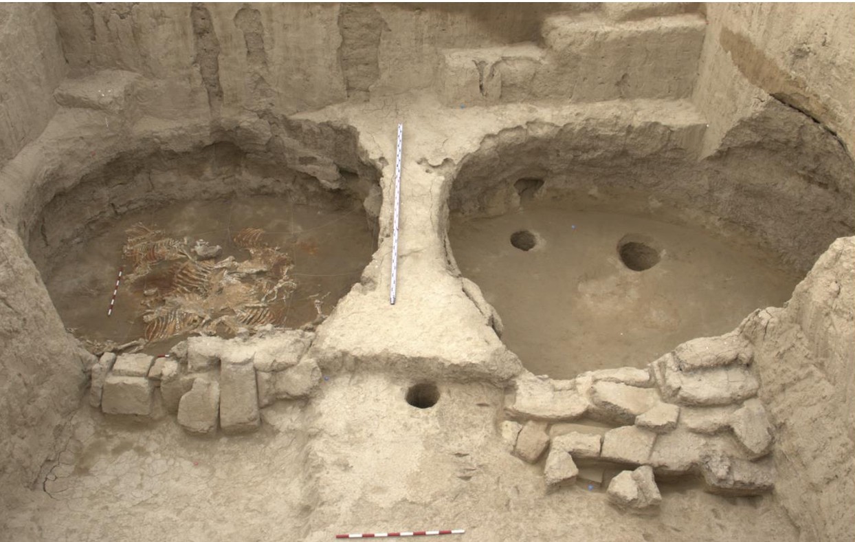
Figure 3: The shaft in the front and the remains of mudbricks which originally covered the entrances to the two catacombs separated by a thin wall of natural soil. Left: chamber 1 Right: chamber 2.
The entrances to Catacomb 1 and Catacomb 2 showcased meticulous construction using mud bricks measuring approximately 65x35x10 cm. These bricks reflect a deliberate architectural approach. Tool marks identified on the walls and floors of the catacombs provide further evidence of the techniques employed during construction. These marks, characterized by their depth and pattern, point to the use of specific implements designed for precision excavation and shaping of the chambers. Detailed analysis of these tool marks could shed light on the technological capabilities and resources available to the builders. Additionally, their presence aids in reconstructing the sequence of construction activities. Several niches were found and very carefully excavated because these often contain the most valuable artifacts.
4.3 Artifacts
The excavation of Kurgan No. 4 yielded an array of significant artifacts that shed light on the cultural and ritual practices associated with Scythian funerary traditions. In Catacomb 1, notable discoveries included Scythian-style horse harness elements, which reflect the high status of the individuals buried within. These elements, intricately designed and preserved, suggest the symbolic importance of horses in the burial rites. Animal bones were also found within Catacomb 1, including those of horses and sheep, likely indicative of sacrificial offerings. Gold plaques adorned with decorative patterns were among the most striking finds, showcasing advanced metalworking skills and the significance of ornamental artistry in burial rituals.
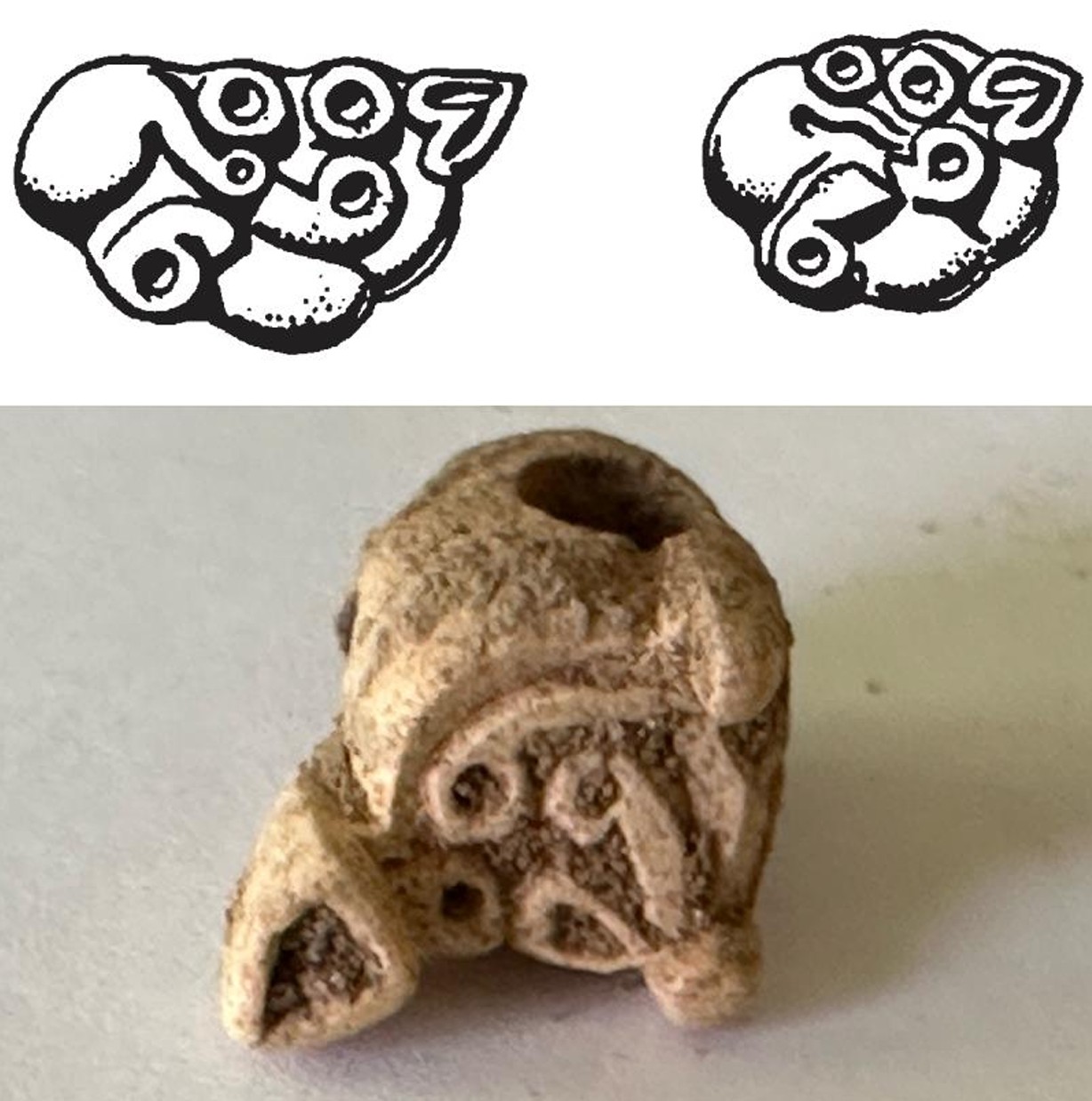
Figure 4: Evidence for Scythian material culture in the form of Scythian animal style artifacts, here in the form of a coiled feline typical for the earlier phases of Scythian material culture.
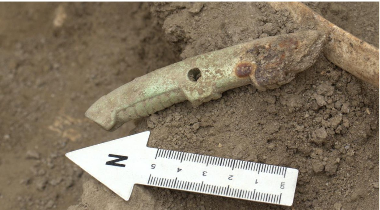
Figure 5: Horse harness pieces, an important part of the Scythian triad, supports the hypothesis that this is a burial ground with significant influence of Scythian material culture.
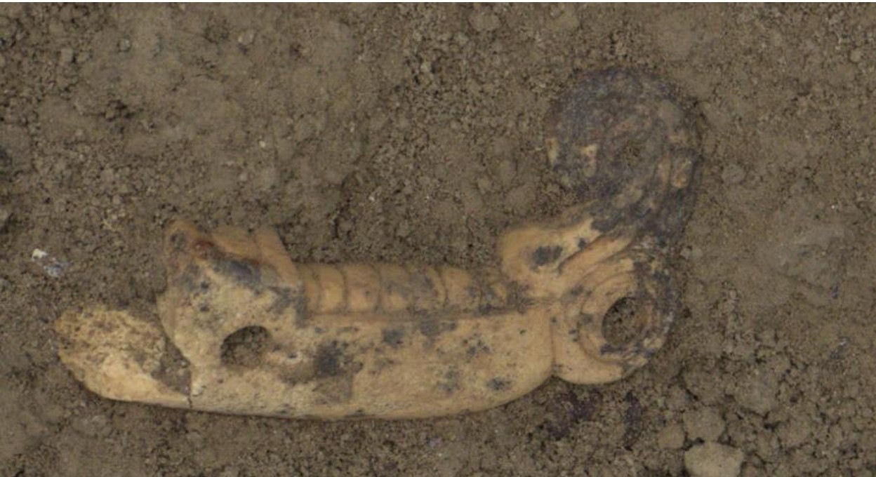
Figure 6: Horse harness piece with a griffin head, a key iconographic element of Scythian material culture.
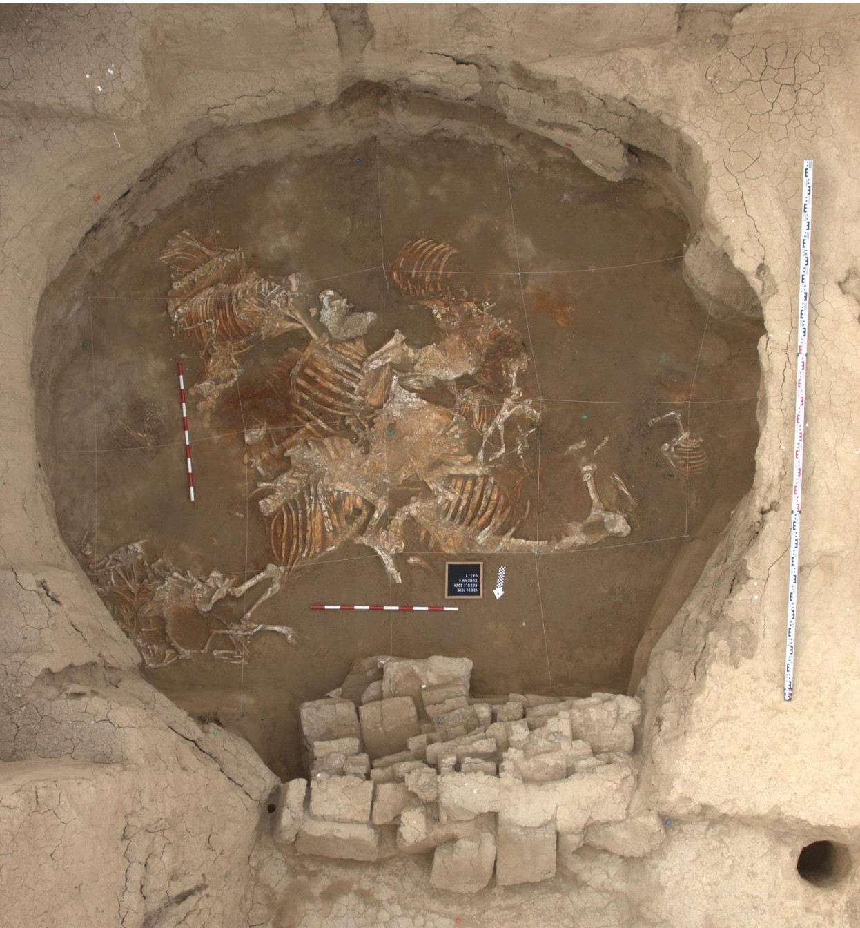
Figure 7: Complete view of Catacomb 1 with several animal sacrifices deposited in its middle. Clearly visible are the mud bricks closing the entrance to the chamber.
In Catacomb 2, the range of artifacts was equally compelling. Thousands of beads crafted from various materials, including faience, bone, mother of pearl, agate, and carnelian were sieved from the sediments. These beads were primarily concentrated in the western and southwestern portions of the catacomb. Most of the beads were likely 9 sewn onto textiles of which none remain. Cowrie shells were also uncovered alongside Scythian-type arrowheads. The reason these finds could not be documented in situ is that the layer they were found in was thoroughly disturbed, likely by tomb raiders who entered the catacomb in antiquity. However, the tomb was so rich, that a lot of items were forgotten by the looters and plenty of artifactual evidence remains that we can work with in the future.
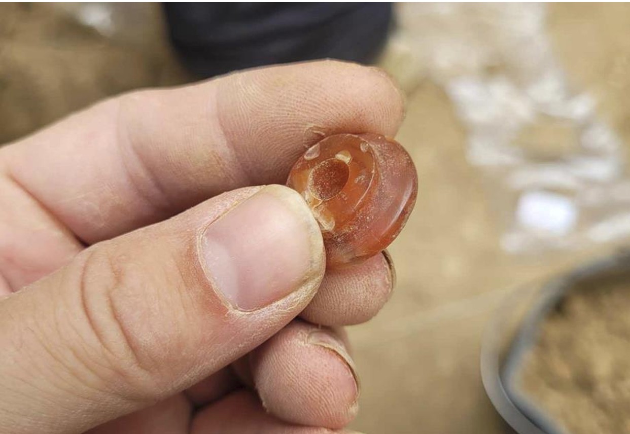
Figure 8: The carnelian pommel of a small knife found in Catacomb 2.
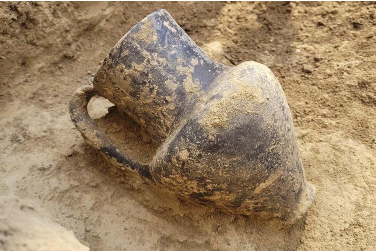
Figure 9: A complete vessel in the style of an oinochoe, recovered from Catacomb 2.
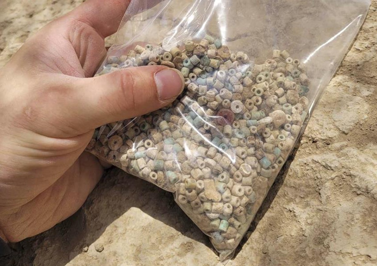
Figure 10: An enormous number of beads was recovered from Catacomb 2. They have yet to be counted. A rough estimate is >10’000. To illustrate the frequency of beads in this catacomb: the bag shown above was collected within 30 minutes on excavation.
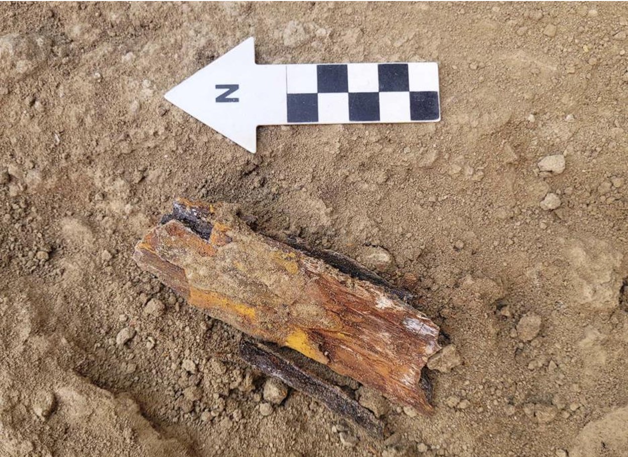
Figure 11: The remains of an iron sword were left by the looters.
5. Discussion
5.1 Chronology and Interpretation
The artifacts discovered within Kurgan No. 4 provide compelling evidence for dating the site to the 7th to 6th centuries BCE, a critical period associated with early Scythian cultural expansion. The feline predator motif carved in bone finds parallels and dates to no later than the 7th century BC. Similarly, cheek-pieces with griffin heads have exact analogies and are confined to the same period. The bronze beak of a bird of prey has comparable examples and only exists until the early 6th century BC. Ceramics show parallels in a small unpublished kurgan in Azerbaijan and are attributed to the late 7th century BC, with evidence suggesting their continued use into the first half of the 6th century BC. Bone buttons from the gorytos, with parallels in the North Caucasus, are also confined to the 7th century BC.
Bronze bells have similar examples from Kelermess and Azerbaijani kurgans, with additional parallels in Kurgan no. 3 at Yedditepe, though their chronological range requires further verification Items such as zoomorphic harness elements and Scythian-style arrowheads reflect the material culture of the Scythians during this era. These artifacts align with known typologies from similar sites across the North Caucasus and Central Asia, reinforcing the kurgan’s temporal and cultural placement. Furthermore, ritual practices identified in the excavation, including the deliberate placement of animal remains and the use of niches for offerings, resonate strongly with funerary customs observed in the Kelermes kurgans of the North Caucasus. These parallels validate the Scythian attribution.
5.2 Cultural Insights
The integration of distinct Scythian elements with local architectural features, such as the use of large mud-brick construction for the catacomb entrances, highlights a fascinating cultural synthesis. This blending suggests a dynamic exchange between the Scythians and indigenous populations of the Lesser Caucasus. While the mud-brick construction is a locally distinctive feature, the inclusion of Scythian-style artifacts, such as arrowheads and horse harnesses, demonstrates the cultural permeation and adaptation that occurred during this period. Such integration also underscores the strategic and cultural importance of the region as a nexus between northern and southern cultural spheres during the Iron Age.
5.3 Looting Evidence
Traces of looting, including broken mud bricks, mixed layers, and displaced sediments, provide critical insights into the post-depositional history of the site. The evidence suggests multiple episodes of intrusion, likely aimed at retrieving valuable artifacts. Despite this, some hidden niches within the catacombs remained undisturbed, preserving key cultural and ritual items. This preservation offers a unique opportunity to study artifacts in situ, providing a clearer picture of the original burial practices and the symbolic 14 meaning ascribed to these objects. The looters’ activity, while destructive, inadvertently created stratigraphic anomalies that assist in reconstructing the sequence of disturbances and the kurgan’s broader history.
6. Conclusion
The excavation of Kurgan No. 4 at the Yedditepe burial ground has provided crucial insights into the funerary practices and cultural exchanges of the early Scythian period. The combination of Scythian-style artifacts with unique local architectural features and ceramics highlights the region's role as a cultural crossroads during the 7th to 6th centuries BCE. The findings emphasize the high status of the individuals buried within, as evidenced by the sophisticated equestrian items, richly ornamented clothings, and sacrificed animals. Furthermore, the meticulous construction of the catacombs using mud bricks points to advanced architectural planning and a fusion of local and Scythian influences.
This site’s significance extends beyond its immediate context, offering valuable data for understanding the cultural and trade networks that connected the North Caucasus, Central Asia, and the Lesser Caucasus during the Iron Age as well as their connections to the Ancient Near East. The preservation of key artifacts, despite evidence of looting, has allowed for a nuanced interpretation of the burial practices and symbolic meanings encoded within the kurgan. These findings not only enrich our understanding of Scythian cultural exchange but also underscore the unique contributions of local traditions to the broader archaeological landscape.
Future radiocarbon dating of key samples will refine the chronological framework, while comparative studies with other kurgan sites in the North Caucasus and Ukraine will contextualize the architectural and cultural elements discovered at Yedditepe. Such endeavors promise to further illuminate the complexities of Scythian influence and local adaptation in this pivotal region of the Iron Age world.
| copyright by The Society for the Exploration
of EurAsia| E-mail
| Home
| 
